Newly-launched JPSS-2 satellite to help forecast climate change, track extreme weather
The Joint Polar Satellite System-2 (JPSS-2) launched aboard a United Launch Alliance (ULA) Atlas V rocket from the Vandenberg Space Force Base in California early Thursday morning.

Overview of NOAA's Joint Polar Satellite System (JPSS)
NOAA’s Joint Polar Satellite System-2 (JPSS-2) mission will lift off from the Vandenberg Space Force Base in California on a United Launch Alliance (ULA) Atlas V rocket. Here's what it plans to do. (Video courtesy of NASA)
A new satellite made to help forecasters better predict extreme weather and monitor climate change is headed to space.
The Joint Polar Satellite System-2 (JPSS-2) launched aboard a United Launch Alliance (ULA) Atlas V rocket from the Vandenberg Space Force Base in California early Thursday morning.
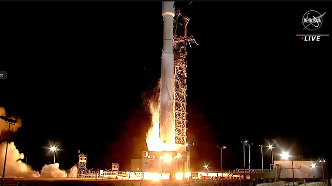
![JPSS-2 Launch]() Image 1 of 11
Image 1 of 11The JPSS-2 Rocket launches from California. ( )
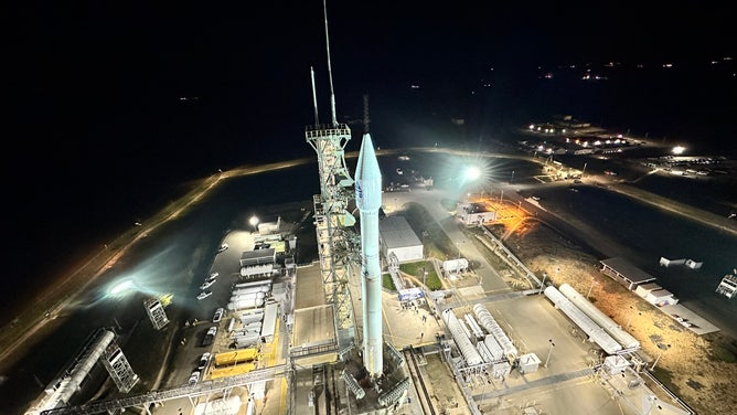
![ULA Launch JPSS-2]() Image 2 of 11
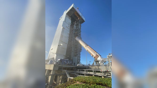
Image 2 of 11The Mobile Service Tower at Space Launch Complex-3 has been retracted and secured in the launch position, revealing the United Launch Alliance Atlas V rocket to launch JPSS-2 and LOFTID, ULA says. (Twitter:@ulalaunch)
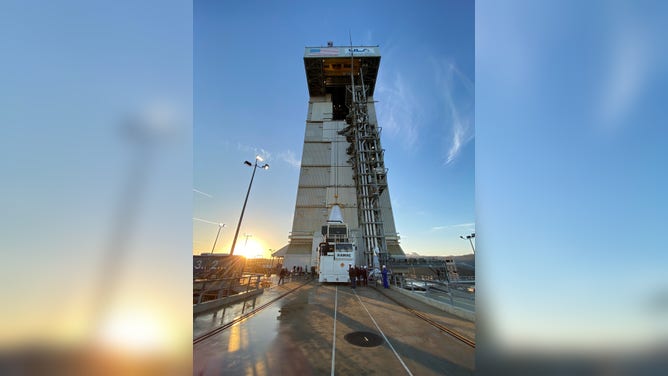
![]() Image 3 of 11
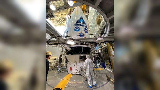
Image 3 of 11The JPSS-2 weather observatory for NOAA and NASA is mounted atop its ride to space, the United Launch Alliance (ULA) Atlas V rocket, in preparation for launch at Space Launch Complex-3 (SLC-3) at Vandenberg Space Force Base, California. Photo Credit: United Launch Alliance ( )
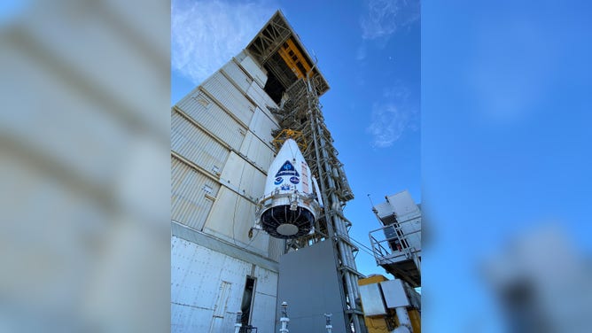
![]() Image 4 of 11
Image 4 of 11The JPSS-2 weather observatory for NOAA and NASA is mounted atop its ride to space, the United Launch Alliance (ULA) Atlas V rocket, in preparation for launch at Space Launch Complex-3 (SLC-3) at Vandenberg Space Force Base, California. Photo Credit: United Launch Alliance ( )
![]() Image 5 of 11
Image 5 of 11The JPSS-2 weather observatory for NOAA and NASA is mounted atop its ride to space, the United Launch Alliance (ULA) Atlas V rocket, in preparation for launch at Space Launch Complex-3 (SLC-3) at Vandenberg Space Force Base, California. Photo Credit: United Launch Alliance ( )
![]() Image 6 of 11
Image 6 of 11The JPSS-2 weather observatory for NOAA and NASA is mounted atop its ride to space, the United Launch Alliance (ULA) Atlas V rocket, in preparation for launch at Space Launch Complex-3 (SLC-3) at Vandenberg Space Force Base, California. Photo Credit: United Launch Alliance ( )
![]() Image 7 of 11
Image 7 of 11The JPSS-2 weather observatory for NOAA and NASA is mounted atop its ride to space, the United Launch Alliance (ULA) Atlas V rocket, in preparation for launch at Space Launch Complex-3 (SLC-3) at Vandenberg Space Force Base, California. Photo Credit: United Launch Alliance ( )
![]() Image 8 of 11
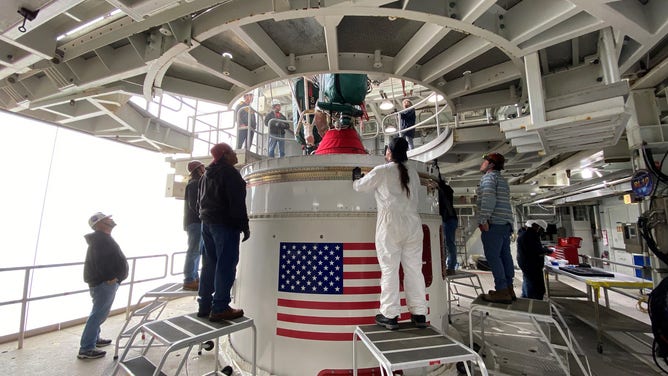
Image 8 of 11United Launch Alliance (ULA) hoists its Centaur upper stage atop the Atlas V rocket that will launch the JPSS-2 mission for NOAA and NASA. Photo credit: United Launch Alliance ( )
![]() Image 9 of 11
Image 9 of 11United Launch Alliance (ULA) hoists its Centaur upper stage atop the Atlas V rocket that will launch the JPSS-2 mission for NOAA and NASA. Photo credit: United Launch Alliance ( )
![]() Image 10 of 11
Image 10 of 11The United Launch Alliance (ULA) Atlas V first stage was raised vertically by the overhead MST crane and maneuvered it onto the Fixed Launch Platform (FLP) for the upcoming Atlas V JPSS-2 mission for NASA. Photo by United Launch Alliance ( )
![JPSS-2]() Image 11 of 11
Image 11 of 11At Vandenberg Space Force Base in California, teams hoist the United Launch Alliance Atlas V rocket for the National Oceanic and Atmospheric Administration and NASA’s Joint Polar Satellite System-2 (JPSS-2) mission into a vertical position in preparation for a move into the Vertical Integration Facility (VIF) on Sept. 28, 2022. (USSF 30th Space Wing/Steve Gerlich)


JPSS-2 will head into a low-Earth orbit and scan the globe from the North to the South Pole, crossing the equator 14 times a day. The satellite will capture data from 512 miles above Earth that inform weather forecasts, extreme weather events and climate change.
The JPSS-2 satellite will provide data for weather models used by meteorologists and weather apps. Measurements of temperatures, moisture and clouds will be taken to better improve forecasts.
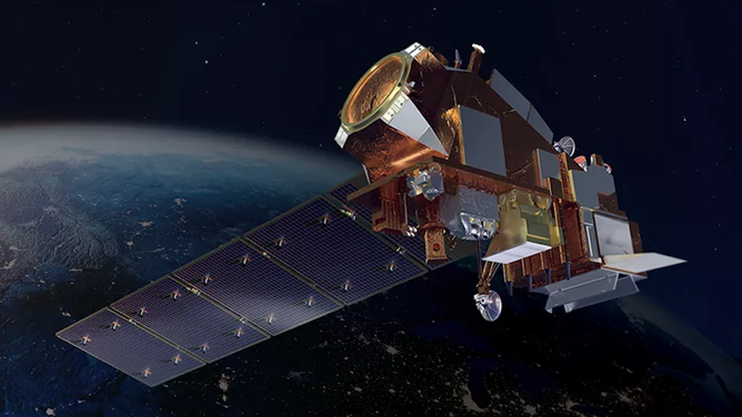
Artist’s rendition of the JPSS-2 satellite in space.
(Lamont W. Harvey)
The 5,500-pound satellite has four main instruments to measure weather and climate:
- Advanced Technology Microwave Sounder (ATMS) – Inspects inside of clouds and storms and can view the structure of the atmosphere.
- Visible Infrared Imaging Radiometer Suite (VIIRS) – Scans images of hurricanes, floods, dust storms, cloud patterns, and ocean color. It also helps locate and map wildfires.
- Cross-track Infrared Sounder (CrIS) – Works to take detailed measurements of the atmospheric conditions needed to generate extreme weather forecasts days in advance.
- Ozone Mapping and Profiler Suite (OMPS) – Tracks ozone concentration in the atmosphere and measures aerosols emitted from volcanoes and particulates from wildfires.
JPSS-2 is the third satellite in the Joint Polar Satellite System series and will be renamed NOAA-21 after reaching orbit. JPSS-2 will continue the work of its predecessors, NOAA-20 (formerly JPSS-1) and the NOAA-NASA Suomi National Polar-orbiting Partnership (Suomi-NPP).
This was a special mission for scientists as the mission from Vandenberg was the last for Atlas V as the pad will soon be modified to support the ULA's new Vulcan rocket.