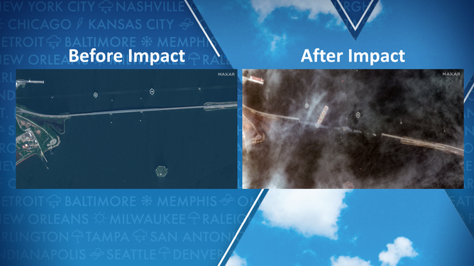
See it: Satellite images show Baltimore bridge before and after collapse
Maxar satellite images show the Francis Scott Key Bridge above the Patapsco River taken before the devastating crash. Photos taken around noon on Tuesday show the container ship under parts of the collapsed bridge and the search efforts underway around the crash site.
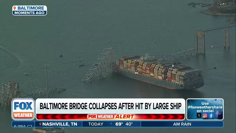
Baltimore bridge collapses after hit by large shipping container vessel
Multiple vehicles were sent into the frigid water Tuesday morning in Baltimore after a shipping container vessel collided with the Francis Scott Key Bridge, causing a portion of it to collapse.
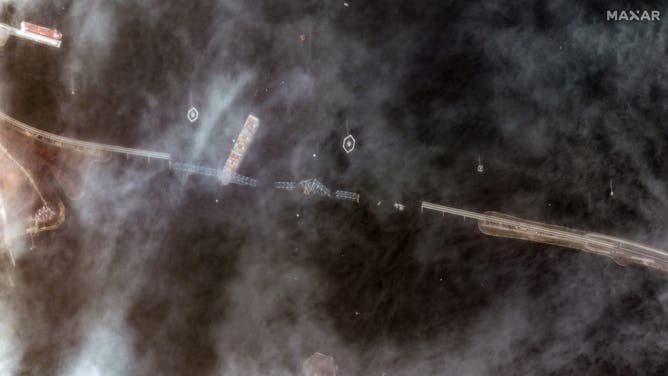
BALTIMORE – Satellite imagery taken after a cargo ship crashed into Baltimore's Francis Scott Key Bridge on Tuesday shows the wreckage left in the waters of the Patapsco River.
Photos obtained by Maxar Technologies taken before noon on Tuesday show the Dali container ship underneath a section of the bridge in the river.
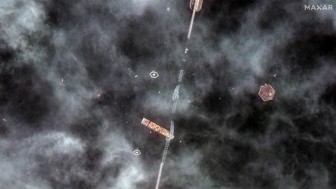
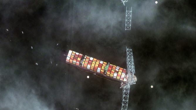
A MAXAR satellite image shows the Dali containership after crashing into the Francis Scott Key Bridge in Baltimore, Maryland on March 26, 2024.
(Satellite image ©2024 Maxar Technologies.)
According to the U.S. Coast Guard, the 948-foot containership collided with the four-lane bridge along Interstate 695 at 1:27 a.m. EDT. Maryland Gov. Wes Moore said the ship lost power and called for help before colliding with the major Baltimore bridge.
BALTIMORE BRIDGE COLLAPSE RECOVERY EFFORTS LIKELY TO BE IMPACTED BY EAST COAST STORM
Maxar satellite images show what the 1.6-mile Francis Scott Key Bridge looked like before the devastating crash.
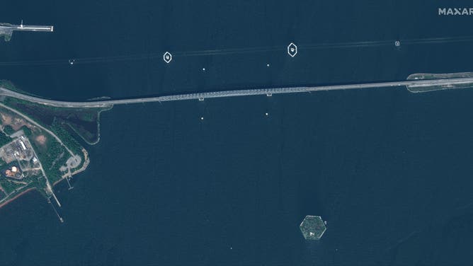
A MAXAR satellite image shows the Francis Scott Key Bridge in Baltimore, Maryland before the collapse on March 26, 2024.
(Satellite image ©2024 Maxar Technologies)
Photos taken around 11:36 and 11:59 a.m. EDT on Tuesday show the container ship under parts of the collapsed bridge and the search efforts underway around the crash site.
A MAXAR satellite image shows the Dali containership after crashing into the Francis Scott Key Bridge in Baltimore, Maryland on March 26, 2024.
About 3,300 feet of the bridge fell into the river when the Dali container ship hit the bridge. Large chunks of the bridge structure can be seen under the water in the Maxar images.
Search crews continue to look for at least six missing people on the bridge at the time of the collapse. However, how many vehicles were on the bridge at the time of the collapse is unknown.
![MAXAR satellite imagery before and after the collision with the Francis Scott Key Bridge in Baltimore, Maryland on March 26, 2024.]() Image 1 of 5
Image 1 of 5MAXAR satellite imagery before and after the collision with the Francis Scott Key Bridge in Baltimore, Maryland on March 26, 2024. (Satellite image ©2024 Maxar Technologies)
![A MAXAR satellite image shows the Dali containership after crashing into the Francis Scott Key Bridge in Baltimore, Maryland on March 26, 2024.]() Image 2 of 5
Image 2 of 5A MAXAR satellite image shows the Dali containership after crashing into the Francis Scott Key Bridge in Baltimore, Maryland on March 26, 2024. (Satellite image ©2024 Maxar Technologies)
![]() Image 3 of 5
Image 3 of 5A MAXAR satellite image shows the Francis Scott Key Bridge in Baltimore, Maryland before the collapse on March 26, 2024. (Satellite image ©2024 Maxar Technologies)
![A MAXAR satellite image shows the Dali containership after crashing into the Francis Scott Key Bridge in Baltimore, Maryland on March 26, 2024.]() Image 4 of 5
Image 4 of 5A MAXAR satellite image shows the Dali containership after crashing into the Francis Scott Key Bridge in Baltimore, Maryland on March 26, 2024. ( )
![A MAXAR satellite image shows the Dali containership after crashing into the Francis Scott Key Bridge in Baltimore, Maryland on March 26, 2024.]() Image 5 of 5
Image 5 of 5A MAXAR satellite image shows the Dali containership after crashing into the Francis Scott Key Bridge in Baltimore, Maryland on March 26, 2024. (Satellite image ©2024 Maxar Technologies.)