SpaceX, NASA target Tuesday to launch NOAA's next powerful GOES weather satellite
A two-hour launch window opens at 5:16 p.m. ET on Tuesday. SpaceX's Falcon Heavy rocket will lift off from Launchpad 39A at NASA's Kennedy Space Center, sending NOAA's GOES-U into orbit 22,000 miles above Earth.
Final GOES-R weather satellite arrives at Kennedy Space Center
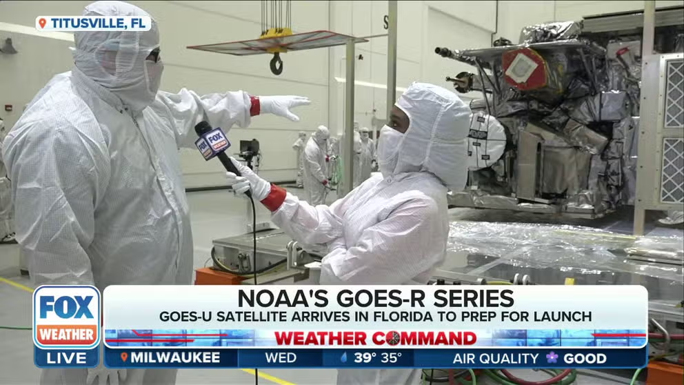
NOAA's next weather satellite, and the last of the GOES-R series, arrived in Florida ahead of the April liftoff. FOX Weather's Brandy Campbell is just outside the Astrotech cleanroom where the GOES-U satellite is being prepared to launch.
KENNEDY SPACE CENTER, Fla. – A SpaceX Falcon Heavy rocket is ready to carry NOAA's next powerful GOES weather satellite into orbit, providing critical forecasting data to the meteorologists who issue weather warnings.
SpaceX's triple-booster Falcon Heavy rocket will lift off from Launchpad 39A at NASA's Kennedy Space Center, sending NOAA's Geostationary Operational Environmental Satellite U (GOES-U) into orbit. The two-hour launch window opens at 5:16 p.m. ET on Tuesday.
NOAA’S NEWEST GOES SATELLITE LAUNCHING DURING BUSY SEVERE WEATHER SEASON, SPACE WEATHER
The new spacecraft will join NOAA's small fleet of satellites orbiting more than 22,000 miles above Earth's Equator and is the last in NOAA's GOES-R series of satellites. The previous GOES launch happened with GOES-18 in 2022.

Crews transport NOAA’s (National Oceanic and Atmospheric Administration) Geostationary Operational Environmental Satellite (GOES-U) from the Astrotech Space Operations facility to the SpaceX hangar at Launch Complex 39A at NASA’s Kennedy Space Center in Florida beginning on Friday, June 14, 2024.
(NASA/Ben Smegelsky)
Launch forecast includes possible showers
Showers and thunderstorms driven by sea breezes around Florida will affect Tuesday and Wednesday's backup launch day. SpaceX must thread the needle to get the Falcon Heavy and its payload off the ground.
The U.S. Space Force's 45th Weather Squadron forecasts a 30% chance of favorable launch weather for Tuesday's two-hour window. The primary weather concerns are cloud cover and lightning.

(FOX Weather)
What will GOES-U do in space?
Data from NOAA's GOES satellites is intertwined with nearly every forecast Americans read daily.
While GOES-U won't be operational in time for the 2024 hurricane season, its predecessor satellite has been busy tracking the tropics, including the first named system of the season, Tropical Storm Alberto, in the Gulf of Mexico.
All GOES-R satellites have the Advanced Baseline Imager (ABI), which provides detailed imagery of hurricanes and other weather, helping the NWS issue severe weather alerts. The Geostationary Lightning Mapper (GLM) can help forecasters with NOAA's National Weather Service issue advanced warnings of severe thunderstorms or even tornadoes.
"The GOES series of satellites consistently provides imagery of weather features in the Western Hemisphere for us. The GOES-R series creates a full disk of the Earth every 10 minutes," National Weather Service Director Ken Graham said. "We can get imagery as up to 30 seconds, which is absolutely useful for our warning capability."
ABI data can help NWS forecasters notify local emergency responders within minutes of detecting a wildfire.
GOES-R Program Chief Scientist Dan Lindsey said the ABI is powerful enough to detect small barn fires from space.
All of the GOES-R series spacecraft built by Lockheed Martin were designed to be functionally the same, but lessons learned from the previous satellites helped NOAA make some changes to GOES-U.
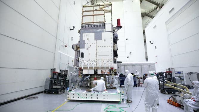
Technicians monitor movement and guide NOAA’s Geostationary Operation Environmental Satellite-U (GOES-U) as a crane hoists it on to a spacecraft dolly in a high bay at the Astrotech Space Operations Facility near the agency’s Kennedy Space Center in Florida. (Credit: NASA/Ben Smegelsky)
(NASA)
MESMERIZING TIME-LAPSE VIDEOS SHOW NORTHERN LIGHTS DAZZLING SKYGAZERS AROUND THE WORLD
The most significant change with GOES-U is the addition of the compact chronograph to improve space weather forecasting. This chronograph will continuously monitor the Sun's outer atmosphere, known as the corona, allowing NOAA forecasters to see where extreme space weather like solar flares and coronal mass ejections originate.
"For the first time, we will have continuous observations of the Sun's fainter outer atmosphere, creating the equivalent of a total solar eclipse every 30 minutes. In doing so, this powerful solar telescope will also observe the corona, which is the region where extreme space weather events originate," NOAA’s Office of Space Weather Observations Director Elsayed Talaat said.
The timing of this new capability happens as the Sun approaches the most active period in its 11-year cycle, known as the solar maximum. In May, activity from sunspot regions produced the most extreme solar storm in 20 years, producing the Aurora Borealis as far south as Florida.
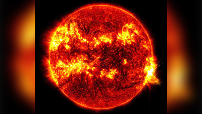
This image shows a massive solar flare exploding from the Sun on Tuesday, May 14, 2024.
(@NASASun/X / NASA)
GOES satellites continue helping after forecasting role ends
Once in orbit, GOES-U will become GOES-19, acting as NOAA's GOES-East satellite, watching over North and South America and the surrounding oceans.
Once GOES-19 becomes GOES-East, the current satellite in that orbit, GOES-16, will be moved to an orbit over Colorado, acting as a backup satellite.
GOES satellites are designed with an operational lifespan of about 10 years, but many have exceeded their lifespans, according to Charles Webb, NASA's Joint Agency Satellite Division deputy director.
"The longest serving GOES, actually, lasted for 40 years. Admittedly, not doing all of the things that it had been designed to do, but serving as a communication relay, essentially, for scientists that were in Antarctica," Webb said. "The inclination of the orbit changed, it became visible from Antarctica and served as that important communication relay for those folks in that very remote region."
Webb said GOES-13 and GOES-15 were transferred to the U.S. Space Force for operations over the Indian Ocean.
NOAA is developing the sixth generation of GOES satellites, which will begin launching in the early 2030s.
Once in space, the satellite will take a few weeks to reach its final orbit. When fully operational in orbit, GOES-U will produce between 1 and 3 terabytes of weather data daily.