Watch: Drone video shows Kentucky highway underwater amid historic flooding
In the western part of the state, the Nolin River reached a peak of nearly 30 feet Sunday evening in White Mills.
Watch: Drone video shows Kentucky highway submerged as flooding sweeps across region
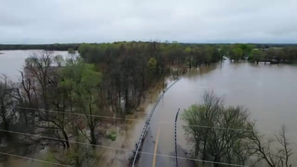
A drone video shared by the Hardin County Sheriff's Office in Kentucky provides a look at a highway in Glendale that was submerged in floodwaters on Sunday, April 6, 2025.
GLENDALE, Ky. – Kentucky continues to face historic flooding after a large weather system caused a deluge of rain.
In the western part of the state, the Nolin River reached a peak of nearly 30 feet Sunday evening in White Mills.
Drone video taken Sunday by the Hardin County Sheriff's Office showed a highway in Glendale submerged in the murky floodwater from the nearby Nolin River.
In the video, electrical lines stood in feet of water. As the camera panned, water sat across the highway, where the yellow dividing line faded into the abyss and only the guardrails remained visible.
SEE IT: KENTUCKY MEN GO VIRAL AFTER BURYING MINIVAN TO USE AS STORM SHELTER DURING SEVERE WEATHER
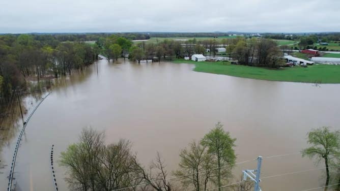
Farm sits on the edge of flooding in Glendale, Kentucky.
(Hardin County Sheriff's Office/Facebook / FOX Weather)
In the distance, lush green grass could be seen beyond the brown floodwater. A farm sat just on the edge, with some buildings already submerged.
As the drone continued to pan, a car drove across a neighboring highway not impacted by the flooding, but surrounded by it.
Photos posted by the Hardin County Sheriff's Office showed more flooded roads around the county Sunday evening.
FAMOUS BOURBON DISTILLERY SURROUNDED BY FLOODWATER AFTER KENTUCKY SEES MORE THAN A FOOT OF RAIN
![Drone photo shows a flooded Western Kentuck Parkway at the White Mills-Eastview Exit.]() Image 1 of 3
Image 1 of 3Drone photo shows a flooded Western Kentuck Parkway at the White Mills-Eastview Exit. (Hardin County Sheriff's Office/Facebook)
![Photo shows a flooded Highway 84 between WK & Four Corners.]() Image 2 of 3
Image 2 of 3Photo shows a flooded Highway 84 between WK & Four Corners. (Hardin County Sheriff's Office/Facebook)
![Flooded highway 1375 in Glendale, Kentucky on Sunday.]() Image 3 of 3
Image 3 of 3Flooded highway 1375 in Glendale, Kentucky on Sunday. (Hardin County Sheriff's Office)


The Nolin River began receding Sunday night and continued to recede Monday.
Flooding-related deaths have been confirmed by officials in Kentucky.