Pakistan flooding is so extensive it can be seen from space
Images provided by Maxar and NASA show just how terrible this year's monsoon flooding has been.
Shocking Pakistan flood images from space
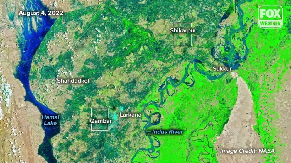
NASA shared these enhanced satellite images showing the intense flooding from the beginning of August to the end.
Pakistan is no stranger to monsoon rains. They can mark it on the calendar from June to September. However, this year, the rains kept coming.
They were more intense and devastating than most years, and eventually, the water had nowhere to go.
"The Pakistani people are facing a monsoon on steroids, the relentless impact of epochal levels of rain and flooding," U.N. Chief Antonio Guterres said in a video statement. "This climate catastrophe has killed more than 1,000 people with many more injured."
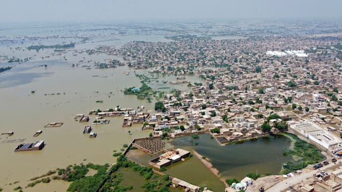
Compare this arial photo taken on August 31 to the satellite images. Aid workers have to airdrop emergency supplies to survivors because villages are cut off.
(FIDA HUSSAIN/AFP via Getty Images / Getty Images)
Some provinces have already received five to six times their average annual rainfall, according to NASA. That is a staggering amount considering the average consists of 30 years of data, including 2010 when 2,000 people were killed during the deadliest monsoon flooding in the county's history.
AID WORKERS STRUGGLE TO REACH THE 3.1 MILLION HOMELESS SURVIVORS OF PAKISTAN'S MONSOON FLOODING
Mountain snow and glacier melt just compounded the issue. Pakistan has the highest concentration of glacier ice outside the polar regions, according to NASA. Melt and monsoon rains accumulate in mountain creeks and speed downhill, touching off landslides.
The Pakistan Meteorological Department expects the monsoon season to taper off at the end of September.
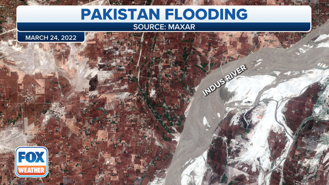
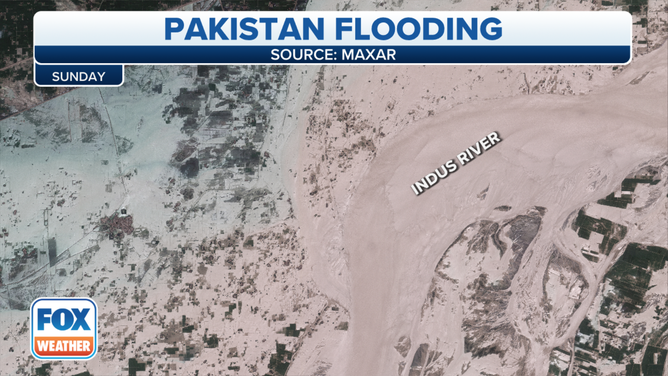
Satellites were able to document the historic flood from space. Images provided by Maxar and NASA show just how enormous this year's monsoon flooding has been.
![]() Image 1 of 2
Image 1 of 2This is a satellite picture from March of an area around the Indus River in Pakistan, before monsoon season. The image clearly shows the Indus, in gray, held within its banks surrounded by villages, ranches and farmlands. ( )
![]() Image 2 of 2
Image 2 of 2Months later, in late August, water completely inundated lands east of the riverbank. ( )
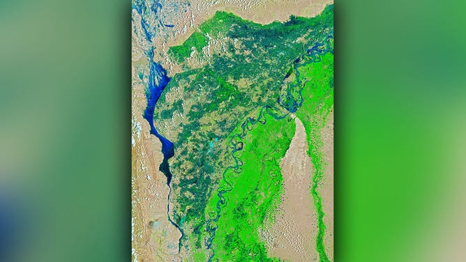
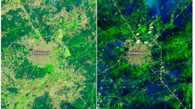
NASA's enhanced satellite image from August 4 still shows vast areas of green farmland with blue water contained within rivers and lakes.
(NASA)
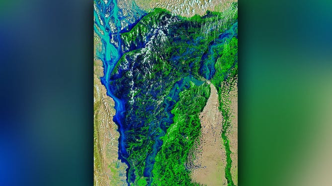
By August 28, enhanced satellite shows the blue water filling in much of the area between the lake and river.
(NASA)
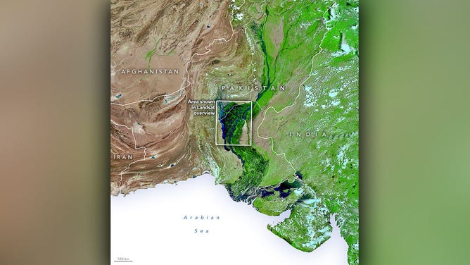
Here is a wide view of South Asia showing the hardest hit area in the box, south and west of the mountains and glaciers.
(NASA)
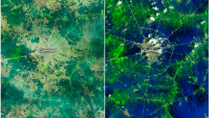
What was a mosaic of farmland in Qambar at the beginning of August turned to a 'sea' with islands by the end of the month.
(NASA)
Take a look at the vast difference in water coverage between the beginning and end of August.
(NASA)