These 7 states hold the most landslide-prone counties in the US
Lincoln County in Oregon tops the list for the entire country as the only county in the U.S. with a Landslide- Hazard Type Risk Score of 100 out of 100, according to FEMA.

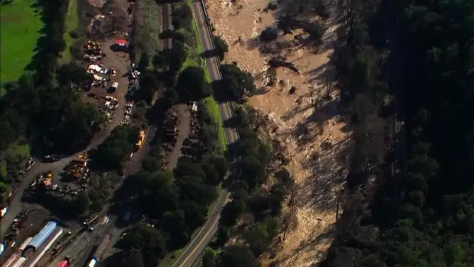
FILE: What sets the stage for landslides in California?
U.S. Geological Survey Landslide Hazards Program Research Hydrologist Matthew Thomas provides insight on FOX Weather.
Landslides can bring a sudden, devastating blow to a neighborhood or region. While they can happen most anywhere, the majority of the most landslide-vulnerable counties are located out West, according to data published by FEMA.
Landslides, which are sometimes called mudslides and rockfalls, are events when a mass of rocks, vegetation or other debris moves down a slope in an uncontrollable way.
These debris flows result in 25 to 50 deaths annually, according to the Centers for Disease Control and Prevention. This is largely due to the fact that they can occur without warning.
What causes landslides

Cathedral City residents are still stuck in their homes because mud over a foot thick covers some streets.
(Nicole Valdes / FOX Weather)
For most landslides, two ingredients need to be in place: a trigger and certain geography. Triggers include weather events, such as rainfall and droughts, in addition to geologic events, such as earthquakes and volcanic eruptions.
As far as geography is concerned, landslides commonly occur in mountainous areas. In fact, the most landslide-vulnerable counties are in states spanning the Cascades, the Rockies or the Appalachian Mountains, according to the FEMA National Risk Index.
Where landslides occur most in the U.S.
An ACE train was stalled because of a landslide in Niles Canyon in Fremont on Jan. 17, 2023.
(FOX 2 / FOX 2)
As part of their National Risk Index, FEMA evaluated the high-risk nature of landslides in the more than 3,000 U.S. counties between Jan. 1, 2010 and Oct. 2, 2021.
Based on their findings, specifically, the "Landslide - Hazard Type Risk Index Score," the 25 most landslide-vulnerable counties are in 7 states: Oregon, Washington, California, Idaho, Colorado, Kentucky and West Virginia.
However, one of those states is home to 11 of the top 25 high-risk counties.
Oregon
Landslides affect thousands of Oregon residents every year, according to the Oregon Department of Geology and Mineral Industries.
The reason why the Beaver State is prone to landslides is primarily due to unstable geology and torrential rains, said experts at Oregon State University. They noted that the rains occur frequently enough to make landslides in Oregon more common than in other more mountainous regions.
7 WARNING SIGNS THAT A LANDSLIDE OR MUDSLIDE IS IMMINENT

Crews work 24/7 to clear hazards from the right-of-way and respond to flooding and landslide emergencies.
(Portland Bureau of Transportation / FOX Weather)
These are the Oregon counties that top the ranks in the overall National Risk Index for Landslides:
1. Lincoln County
2. Douglas County
3. Coos County
4. Lane County
5. Wheeler County
6. Tillamook County
7. Linn County
13. Multnomah County
20. Curry County
22. Clatsop County
23. Marion County
25. Columbia County
Lincoln County, situated on the northern Oregon Coast, has the combination of both hilly terrain and sees about 70 inches of rain a year. It tops the list for the entire nation as the only county in the U.S. with a Hazard Type Risk Index Score of 100 out of 100.
Washington and California

A home sits at the bottom of a hill after sliding off its foundation in a recent landslide on January 20, 2022 in Washington.
(David Ryder / Getty Images)
But the landslide threat spans the Interstate 5 corridor from Washington to California.
Washington is one of the most landslide-prone states in the country, with hundreds to thousands of landslides every year, according to the Washington Geological Survey. On FEMA’s National Risk Index for landslides, the Evergreen State has four counties in the top 25:
8. Chelan County
12. Okanogan County
16. Clallam County
24. Island County
OSO PAUSES TO REMEMBER 43 KILLED IN MASSIVE 2014 LANDSLIDE
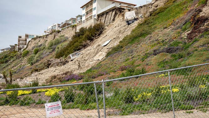
Landslide of cliff after major storm in residential area in California.
(Citizens of the Planet / UCG / Universal Images Group / Getty Images)
California is home to four counties in the National Risk Index for the most landslide-prone counties in the country – three along the coast and one in the heart of the Sierra Nevada.
15. Santa Cruz County
17. Mendocino County
18. Monterey County
19. Calaveras County
While landslides are sometimes triggered by earthquakes, most landslides are caused by intense and/or prolonged precipitation, according to the USGS. They noted that historically, what has caused the most damage were winter storms.
WHY CALIFORNIA IS PRIMED FOR LANDSLIDES
Idaho and Colorado
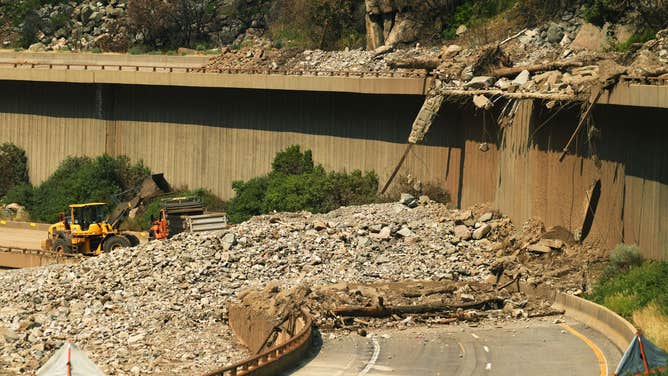
Colorado Department of Transportation crews work to clear a section of the interstate after the interstate closed due to recent mudslides on August 5, 2021.
(RJ Sangosti / MediaNews Group / The Denver Post / Getty Images)
But landslides are a risk far inland as well. Idaho and Colorado are each home to a top landslide-vulnerable county:
9. Elmore County, Idaho
10. Pitkin County, Colorado
7 THINGS TO KNOW ABOUT MUDSLIDES
Kentucky and West Virginia

Parts of eastern Kentucky are underwater Thursday morning as heavy rain causes a Flash Flood Emergency across the Blue Grass State. A stalled front has dumped over 6 inches of water in a short amount of time.
(Brandon Clement / LSM / FOX Weather)
Some spots on in the East made the list too. Nestled in the Appalachian Mountains are three of the most landslide-vulnerable counties in the U.S.:
11. Logan, West Virginia
14. Floyd County, Kentucky
21. Kanawha, West Virginia
These counties are part of a region known as the Logan Plateau, an area where landslides are ubiquitous and characterize the region, the USGS said.