What caused this incredible cloud display in Kansas?
Forecasters at the National Weather Service office snapped this incredible photo of mammatus clouds framed in the skies behind their office and their Doppler Radar dome.
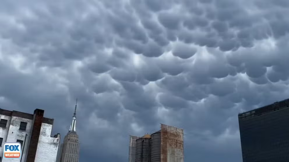
Severe storms bring mammatus clouds over Manhattan skyline
FILE - Mammatus clouds are most commonly found drooping from the underside of a cumulonimbus cloud’s anvil as the cloud reaches a later stage of development, but they can also accompany non-severe weather.
DODGE CITY, Kan. — Meteorologists are always giddy when the weather comes to them. That was the case in Dodge City, Kansas, on Thursday evening as severe weather swept through the Plains.
Forecasters at the National Weather Service office snapped an incredible photo of mammatus clouds framed in the skies behind their office and their Doppler Radar dome.
"Reminds us just how beautiful yet tumultuous the Kansas sky can be," they wrote on X.
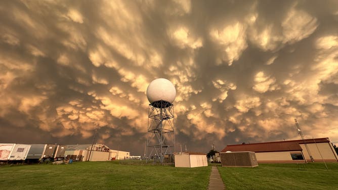
Mammatus clouds at the National Weather Service office in Dodge City, Kansas on June 13, 2024.
(National Weather Service, Dodge City, Kansas, / NOAA)
Mammatus clouds are identified by their trademark bumps. They are most commonly found drooping from the underside of a cumulonimbus cloud’s anvil as the cloud reaches a later stage of development, but they can also accompany non-severe weather.
They are also usually a sign of strong turbulence.
In this case, the clouds were certainly showing the tumultuous side of Kansas. Severe thunderstorms rolled through that evening producing winds up to 70 mph with visibility reported to be one-quarter mile in blowing dust. Spotters reported quarter-sized hail in the city as well.