Drone video shows flooded Ohio River creeping toward Cincinnati Reds' stadium
River levels are the highest recorded since Feb. 26, 2018, according to data from the National Water Prediction Service. NWPS data also shows the river will be in action stage in Cincinnati until at least April 14.
Drone video shows still-flooded Ohio River in Cincinnati
The Ohio River in Cincinnati crested on Monday evening at 60 feet high. The river hadn't reached levels that high since 2018.
CINCINNATI – The Ohio River is slowly receding in Cincinnati after cresting Monday night at more than 60 feet high, which broke a seven-year record.
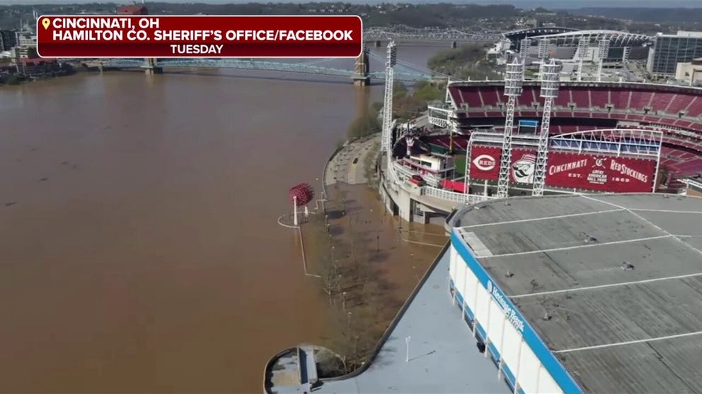
Drone video taken by the Hamilton County Sheriff's Office showed what river levels looked like in downtown Tuesday.
The video revealed flooding over roads near the river's edge, right outside Great American Ball Park – the home of the Cincinnati Reds.

Photo shows the flooded Ohio River in downtown Cincinnati on Tuesday, April 8.
(Hamilton County Sheriff's Office/Facebook / FOX Weather)
The John A. Roebling Suspension Bridge, which connects Ohio and Kentucky, can be seen in the background of the video. Cars were driving over the bridge, where the flooded river had risen considerably higher than usual.
WATCH: DOCK CRASHES INTO KENTUCKY BRIDGE AFTER BREAKING FREE DURING FLOOD
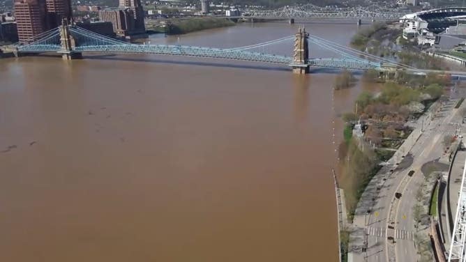
Ohio River levels remained high Wednesday in Cincinnati.
(Hamilton County Sheriff's Office/Facebook / FOX Weather)
Photos comparing the river at the bridge from March 21 to Monday show the difference in river levels, as well as the color of the water-- now a muddy brown.
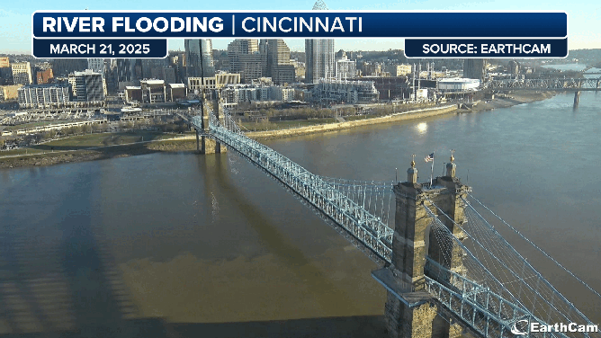
Images of the Ohio River in Cincinnati, Ohio on March 21 and after flooding on April 7.
(EarthCam/FOX Weather)
Riverfront parks, including Smale, Yeatman's Cove and Swayer Point, were closed over the weekend due to flooding. The Cincinnati Parks Department said it is preparing to spend time cleaning up parks as the water recedes.
A Flood Warning remains in effect for the Ohio River in Cincinnati until at least Thursday night.
River levels are the highest recorded since Feb. 26, 2018, according to data from the National Water Prediction Service. Currently, the river is in moderate flood stage. NWPS forecast data showed the river will be in action stage in Cincinnati until at least April 14.
The Ohio River is expected to continue its slow retreat back to normal levels over the coming weeks.