Odds increase for tropical development of Atlantic disturbance while another marches across Caribbean
The National Hurricane Center designated a tropical disturbance Invest 94L as it moves through the Caribbean Sea. A second disturbance west of Africa is also being tracked.
New Invest 95L more likely to become next named tropical storm
FOX Weather is tracking two potential tropical trouble spots. The NHC designated them Invests 94L and 95L. And, the NHC upped its chance of developing.
A tropical disturbance, Invest 94L, is percolating in the central Caribbean Sea, while forecasters said they are also monitoring a second disturbance, Invest 95L, west of Africa, that has a medium chance of development.
"The various computer forecast models agree that the overall atmospheric pattern across the tropics is slowly becoming more conducive to tropical development," said FOX Weather Hurricane Specialist Bryan Norcross.
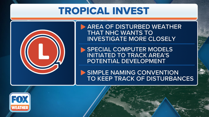
An "invest" is simply a naming convention used by the NHC to identify areas they are investigating for possible development into a tropical depression or tropical storm within the next seven days. Once a system is dubbed an invest, a collection of specialized datasets and computer forecast model guidance can begin. These computer models simulate the system’s projected track possibilities and predict its future intensity.
BRYAN NORCROSS: WATCHING WESTERN CARIBBEAN WHILE REST OF THE TROPICS REMAIN CALM

An invest is simply a designation that is given to an area of interest by the National Hurricane Center for further investigation with a simple naming convention.
(FOX Weather)
Where is Invest 94L?
Invest 94L is moving across the central Caribbean Sea and producing disorganized shower activity as it moves quickly westward at around 25 mph.
"Environmental conditions could become more conducive for some gradual development in a couple of days over the western Caribbean Sea or over the southwestern Gulf of Mexico during the weekend," the NHC said in its latest outlook.
The NHC gives the tropical disturbance a low chance of development.

(FOX Weather)
"A weak tropical disturbance just moving into the Caribbean islands will arrive in the western Caribbean at the end of the week. Computer forecast models indicate that a bubble of conducive atmosphere might allow the disturbance to develop, at least briefly," Norcross explained. "The National Hurricane Center is putting the chances in the low category at this point. The window of opportunity looks short."
Meteorologists will watch for the disorganized thunderstorms to develop around a closed low-level center, a so-called warm-core low.

(FOX Weather)
What is keeping Invest 94L's odds low from eventually impacting the US?
If Invest 94L does develop into a tropical storm, it will be named Beryl. A tropical storm has sustained winds blowing between 39 and 74 mph. Norcross said that he doesn't expect too much of an impact along the U.S. Gulf Coast.
"A strong area of high pressure is forecast to be sitting over the southern U.S. at the end of the week, which should hold the disturbance or whatever it becomes well to the south," Norcross said. "Heavy rain will, of course, be possible in Central America and southern Mexico, depending on what develops."
The disturbance will have to survive intact through incoming Saharan dust though, which is why chances of development are low.
MASSIVE PLUME OF SAHARAN DUST KEEPS TROPICS IN CHECK FOR NOW

(FOX Weather)
"As is usually the case this time of year, Saharan dust is in control. In fact, a significant dust outbreak just started, which will bring milky skies to many of the Caribbean islands this week," Norcross said. "When Saharan dust is present in the atmosphere, it creates a dry and stable layer, making it difficult for thunderstorms to organize and grow into tropical storms or hurricanes. This phenomenon is called the Saharan Air Layer (SAL)."
Invest 95L in eastern tropical Atlantic

(FOX Weather)
Invest 95L is located a few hundred miles southwest of the Cabo Verde Islands and must survive through the Saharan dust. However, it now has a medium chance for development.
Norcross said that the system might duck under the core of the dust cloud.
"Forecasts for undeveloped systems are always iffy. But we’ll watch this one carefully because a number of computer predictions show a better-developed system near the islands late in the weekend or early next week," Norcross said. "Upper-level winds are forecast to be somewhat supportive of development in the vicinity of the islands about that time."
A tropical depression could form over the tropical Atlantic by the end of the week or this weekend, according to the NHC.
Ninety-seven percent of the Atlantic hurricane season still remains ahead of us.
