6 types of clouds you might see during severe storms
Some have serious implications, while others just add drama to the sky

What are mammatus clouds?
Have you ever seen a ceiling of clouds with bumpy, pouch-like formations hanging down? Those are called "mammatus clouds." FOX Weather Meteorologist Ari Sarsalari explains how they form and whether they are a sign of a large storm nearby.
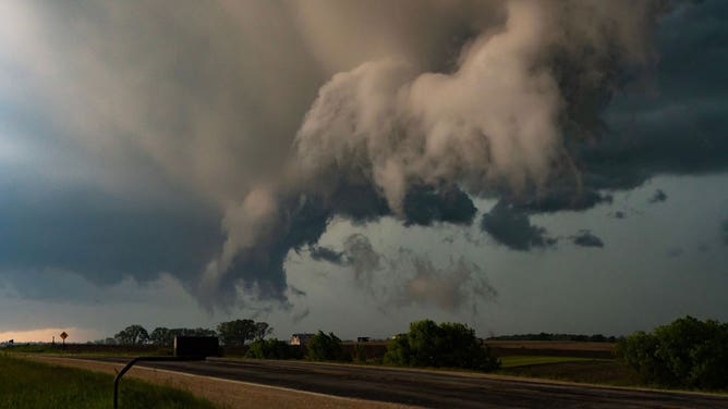
Skies become ominous whenever severe weather rolls through. Within those darkened skies, however, there are clouds that you will only see during thunderstorms. Knowing what they look like and what they mean can go a long way in helping you decide when to take shelter.
Let’s look at six types of clouds that might appear when severe storms develop in your area.
1. Cumulonimbus
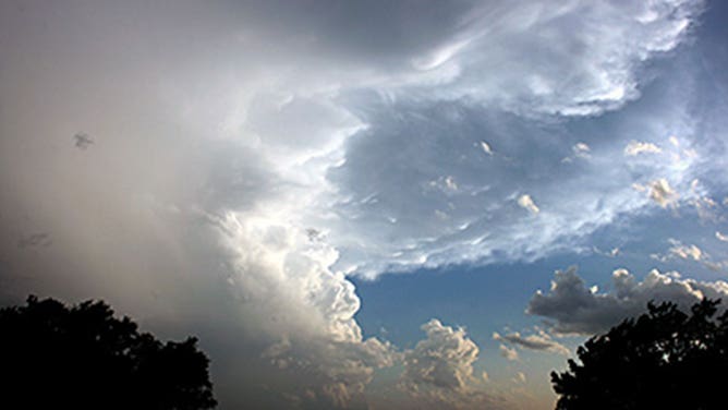
A cumulonimbus cloud.
(NOAA)
Description: These towering cousins of the fair-weather cumulus cloud are quite possibly the most common sight during severe weather. They grow vertically to heights of nearly 40,000 feet. These are sometimes called anvil clouds because of the way the upper-level winds shear the tops of the clouds and push them to one side.
Meaning: Strong thunderstorms are likely and severe storms are possible. Hail, high winds and tornadoes could accompany any severe thunderstorms that develop. Stay informed on the latest forecasts and weather alerts.
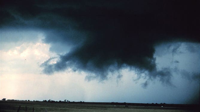
2. Shelf cloud

A large shelf cloud formation approaches Ormand Beach, Florida, on May 16, 2012.
(Jason Weingart/NASA)
Description: These foreboding clouds are typically found along the leading edge of a front or an outflow boundary from a collapsing thunderstorm. They get their name from the unusual wedge shape that they have.
Meaning: Strong, possibly damaging winds could be approaching. While they can look scary, these clouds are not usually associated with tornadoes. It’s best to head inside until these winds pass.
3. Wall cloud
A wall cloud is seen over a field in Oklahoma in June 1984.
(NOAA Photo Library, NOAA Central Library; OAR/ERL/National Severe Storms Laboratory (NSSL))
Description: These clouds usually appear as a lowering along the rain-free base of a cumulonimbus cloud. They form because of the strong winds that are feeding air into the thunderstorm. These winds are called an updraft. While most of these clouds take on a wall-like appearance, they don’t always stick to that. If the winds are strong enough, wall clouds can even being to rotate.
Meaning: A severe thunderstorm could produce a tornado at any moment. Seek shelter inside immediately and stay away from windows.
4. Funnel cloud
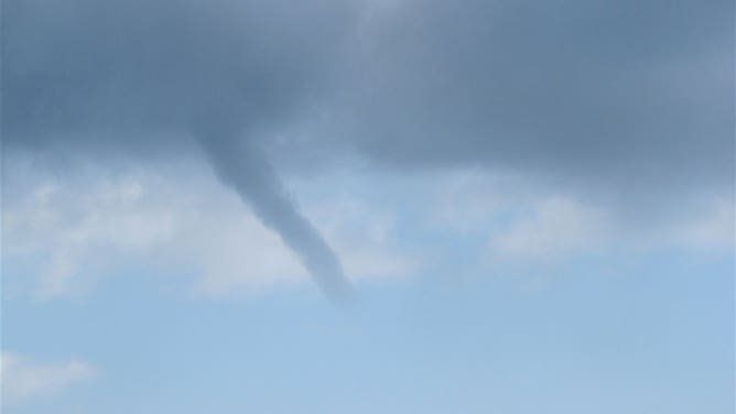
A funnel cloud is seen over the Gulf of Mexico in 2010.
(Officers and Crew of NOAA Ship PISCES; Collection of Commander Jeremy Adams, NOAA Corps)
Description: As the name conveys, these clouds are funnel-shaped. They are most commonly found along the base of a cumulonimbus cloud that is part of a severe thunderstorm, but they can also be found under showers and weak thunderstorms where the air aloft is extremely cold. These are called cold-air funnels. A funnel cloud becomes a tornado if it touches the ground or a waterspout if it touches the surface of the water.
Meaning: If associated with a severe thunderstorm, a tornado is imminent. Follow your tornado safety plan immediately. If associated with non-severe weather, these rarely reach the ground, but it might be a good idea to head inside until the system passes.
5. Scud
Scud clouds are seen in Hokah, Minnesota, on June 4, 2019.
(Dan Mckenzie/NOAA)
Description: These ragged clouds are usually found unattached to the base of a cumulonimbus cloud, shelf cloud or the leading edge of a front. They can appear to be moving at rapid speeds.
Meaning: While they can look scary, these clouds are usually harmless. However, depending on the circumstances, they can indicate a strong thunderstorm is in the vicinity.
6. Mammatus
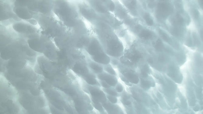
Mammatus clouds are seen over Duncan, Oklahoma, on May 20, 2013.
(Warren Bonesteel/NASA)
Description: These clouds look like puffy pouches that you would see in a quilt. They are most commonly found drooping from the underside of a cumulonimbus cloud’s anvil as the cloud reaches a later stage of development, but they can also accompany non-severe weather.
Meaning: If associated with a cumulonimbus cloud, a severe storm could be headed your way. Now is a good time to check the radar and see where the storm might be headed.

6 Types of Clouds you might see during a Severe Thunderstorm
Here are 6 types of cloud that indicate a severe thunderstorm is going to occur in your area.