Polar vortex: What is it?
The "polar vortex" is a wall of wind that encircles the North Pole, and when it begins to falter, it can have a big wintry effect on weather patterns across much of the U.S. in the form of bitterly cold temperatures and heavy snow.
What is the "Polar Vortex"?
When a significant snowstorm or cold snap arrives, you may hear it blamed on the "Polar Vortex."
When a significant snowstorm or cold snap occurs during the winter, you may hear it be blamed on the "polar vortex."
It sounds like a candidate for the latest Marvel character, and in some cases, it can be the hero of winter weather fans thwarting their arch-nemesis of a mild winter pattern. However, the term describes a band of strong winds that circles the North Pole from around 55 degrees north latitude (the latitude of Ketchikan, Alaska) about 10-30 miles above the Earth.
Why do those winds matter? Think of a spinning top: As long as the rotation is constant and stable, the top stays spinning in a nearly fixed pattern. When the polar vortex is stable, the spinning winds circling the pole act like a wall that keeps the arctic air bottled up atop the planet.
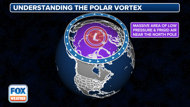
This image provides a visual understanding of a polar vortex.
(FOX Weather)
In that situation, the midlatitude areas, including much of the U.S., will typically avoid severe cold conditions.
About every other year, however, weather events in the lower atmosphere will send strong atmospheric waves up into the stratosphere, where they can interact with the polar vortex.
Going back to our example, this knocks our spinning top off its axis, causing it to lose speed and severely wobble or even topple over. In the atmosphere, disrupting the polar vortex will cause it to slow down and wobble, allowing the collapse of the protective wall around all that frigid air.
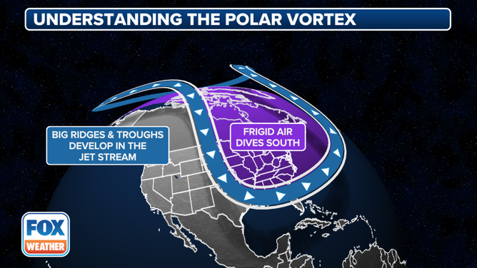
This image provides a visual understanding of a polar vortex.
(FOX Weather)
As cold air heads south toward southern Canada and the U.S., milder air can rush into the polar regions now that the protective wall is gone. If you ever hear the term "sudden stratospheric warming" start getting tossed around, it's a signal that the polar vortex has been disrupted, and the weather will start getting interesting across the midlatitudes in the days and weeks ahead.
How does it get cold at my house?
The cold air doesn't flood the entire hemisphere equally; it interacts with the polar jet stream, creating a wavy pattern with large troughs of low pressure (southward dips in the jet stream) filled to the brim with this escaping arctic air. These troughs can bring colder air farther south than usual, and those beneath the trough of low pressure will experience an extended and intense cold snap, with the potential for heavy snow if a moisture source is available.
Meanwhile, the weather for those outside the troughs will head in the opposite direction, becoming milder. Deep troughs will cause ridges of high pressure (northward bulges in the jet stream) to build on the other sides, generating an alternating pattern across the Northern Hemisphere of strong, cold troughs and corresponding strong, mild ridges that could bring unseasonably warm conditions.
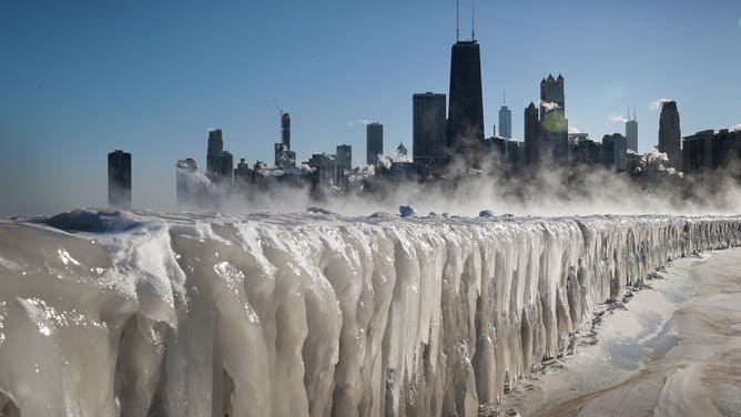
Ice covers the Lake Michigan shoreline on Jan. 30, 2019, in Chicago during a polar vortex event.
(Scott Olson / Getty Images)
Where the troughs and ridges set up will vary, but in North America, the Midwest and East Coast tend to end up inside the cold troughs while the West usually ends up in the milder sector. According to the NOAA, nor'easters are more common across New England when the polar vortex is in its faltering state.
WHAT MAKES A STORM A NOR’EASTER?
That's how "polar vortex" became such a household name, as it tends to bring cold and potentially stormy weather to a large portion of the U.S. population. Though the name has only garnered attention in the past decade, it's always been a part of the weather.
How can I track the polar vortex?
Meteorologists can use the Arctic Oscillation (AO) measurement to keep an eye on the winds circling the poles. The calculations are rather complex, but when the polar vortex is in its robust, stable state, the AO indicator will tend positive, and cold snaps will be less frequent.
THESE ARE THE 7 SNOWIEST CITIES IN THE US
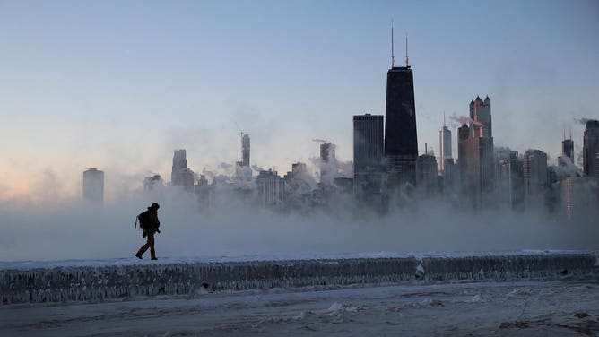
A man walks along an ice-covered break wall along Lake Michigan while temperatures were hovering around negative 20 degrees and wind chills nearing negative 50 degrees during a polar vortex event on Jan. 31, 2019, in Chicago.
(Scott Olson / Getty Images)
When the polar vortex begins to falter, and ensuing cold snaps could loom, the AO goes negative.
When the Great Texas Freeze occurred in February 2021, the AO had a robust negative reading in January – its lowest in eight years – just weeks before the record arctic blast hit Texas and the Midwest in early February.
So next time you hear the term polar vortex being bandied about, and you live in the central or eastern U.S., it just might be time to find that heavier coat and keep that snow shovel handy.
