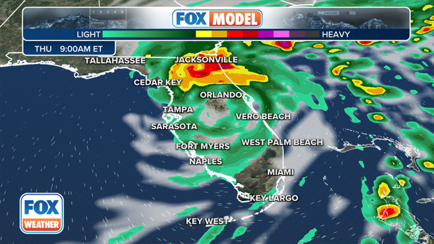
Ian regains hurricane strength ahead of final landfall after Florida pummeled by historic storm
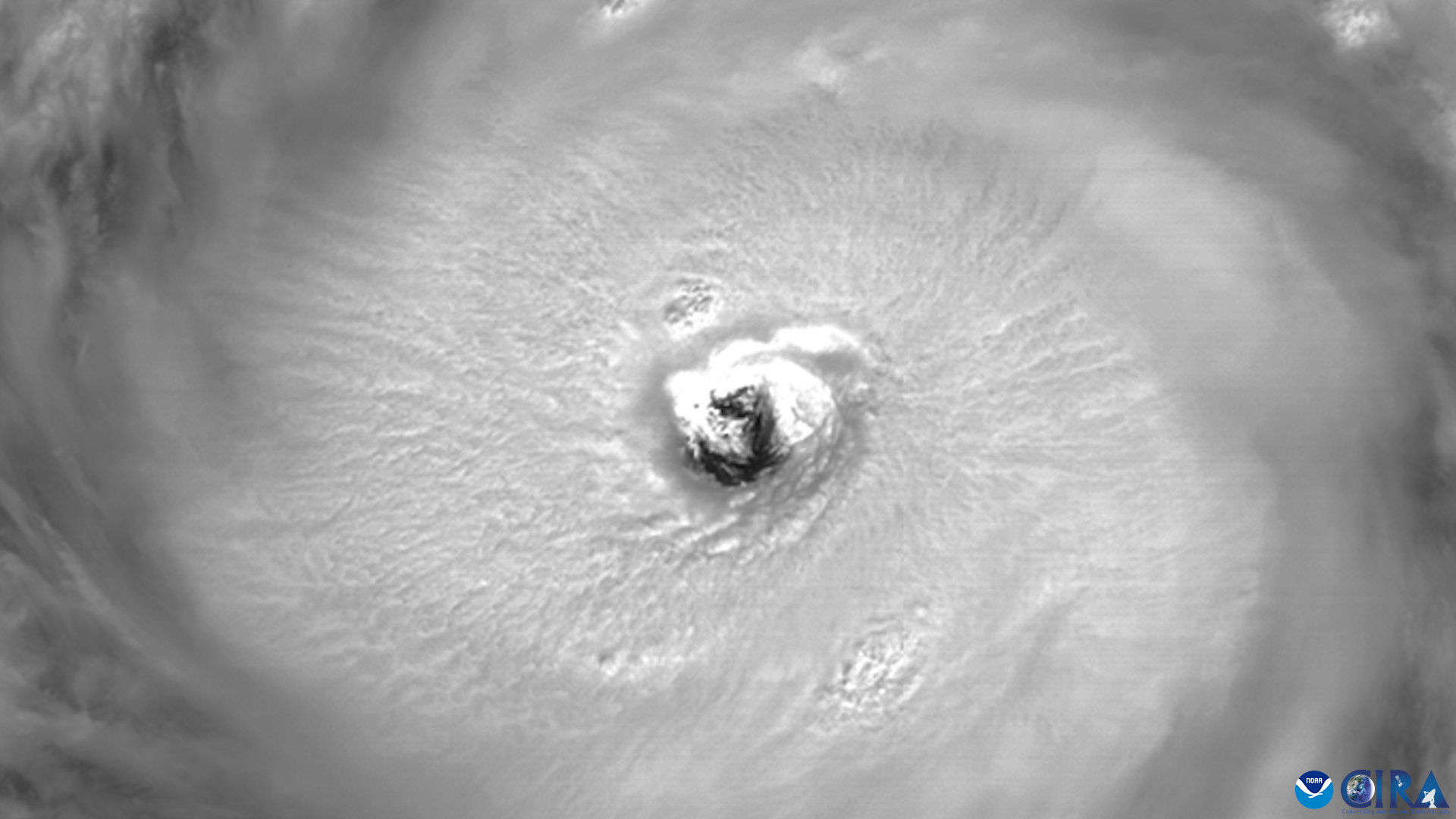
Hurricane Ian made two landfalls in Southwest Florida on Wednesday afternoon as a catastrophic Category 4 storm. Ian had maximum sustained winds of 150 mph as it crashed ashore near Cayo Costa, Florida. Ian will continue to bring life-threatening flooding, storm surge and high winds to parts of Florida on Thursday after it re-strengthened into a hurricane and is headed for a final landfall in South Carolina on Friday.
Coverage for this event has ended.
Live coverage of Hurricane Ian for Thursday, 09/29, has ended here. Live coverage of Hurricane Ian is now available by clicking here.
As of 11 P.M., Hurricane Ian had maximum sustained winds around 85 mph. This makes the hurricane a Category 1 on the Saffir-Simpson Hurricane Wind Scale.
Life-threatening storm surge will be possible through Friday along the coasts of Georgia and South Carolina.
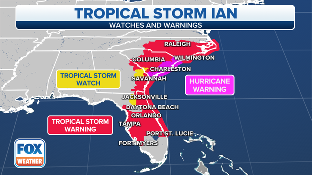
Hurricane Warnings stretch from the Georgia-South Carolina border to Cape Fear, North Carolina.
Storm Surge Warnings are in effect from the North Carolina border down south into northeastern Florida.
The FOX Forecast Center is tracking Ian movements: Click Here
Hurricane Ian is expected to make landfall on Friday in South Carolina. There are many questions people have about the expected weather impacts. FOX Weather has answers to those questions:
In a press conference held on Thursday, city officials confirmed the death of two individuals in Sanibel from Hurricane Ian.
"The most important thing we have to focus on is the people on the island," Sanibel Mayor Holly Smith said.
She said that 12 people were taken off the island with injuries.
Search and rescue operations are ongoing.
Savannah Ault, Fort Myers resident, says she is fortunate to be on the second floor of an apartment complex after neighbors experienced major flooding due to Hurricane Ian storm surge.
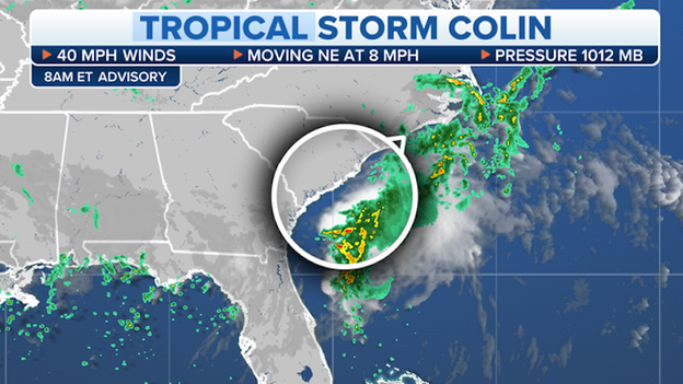
How does Hurricane Ian compare to Tropical Storm Colin earlier in summer?
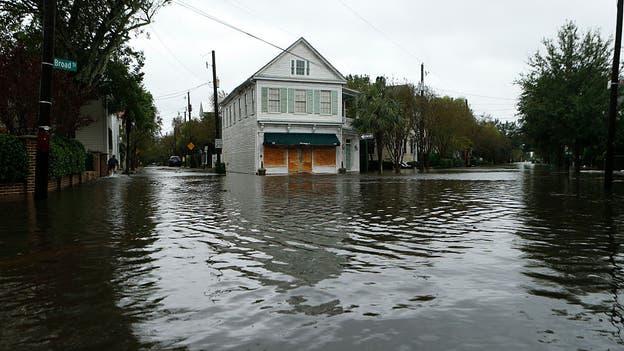
Tropical Storm Colin was about as weak as you will ever see a named storm. Sustained winds briefly reached 40 mph but what was more impressive was its rainfall. Despite being a weak tropical cyclone, Colin produced more than half more than half a foot of rain that quickly flooded some streets in downtown Charleston.
Hurricane Ian will be much stronger at impact. The National Hurricane Center expects winds upwards of 80 mph, a storm surge of between 4 – 7 feet and rains that could be between 6 – 12 inches.
Walt Disney World Resort and Universal Orlando will begin phased reopenings on Friday after closing for Hurricane Ian.
Some of the theme park properties and hotels were impacted by flooding rains.
Orlando International Airport will begin passenger flights on Friday at noon after closing operations due to Hurricane Ian.
Travelers are asked not to arrive before 10 a.m. as the airport is still working to prepare areas. All roads to the airport impacted by flooding will reopen Friday morning.
The Palmetto State sees tropical weather impacts nearly every season, but the last hurricane to make a direct landfall was Hurricane Matthew.
Matthew made landfall as a Category 1 storm on October 8, 2016 near McClellanville, South Carolina.
It ended up as the most powerful storm of the 2016 Atlantic basin season. While Matthew only scraped the South Carolina coast, it brought heavy rains to the region and was responsible for 25 deaths, according to the National Hurricane Center.
Damage from the storm was estimated at $10.3 billion.
Teams at Kennedy Space Center began clearing buildings and looking for any potential damage from Hurricane Ian on Thursday.
According to the KSC's latest update, most large facilities have been cleared with minimal damage.
Employees and contractors will return to work on Friday.
NASA and SpaceX are preparing for the Crew-5 astronaut launch next Wednesday.
Already experiencing flooding from Hurricane Ian, St. Augustine officials say they have one more high tide cycle of the night that could increase flooding in the historic city.
FOX 29 Philadelphia Meteorologist Sue Serio didn't expect to find herself under a Hurricane Warning while on vacation to South Carolina, but that's what happened as Hurricane Ian strengthened to a Category 1 storm again.
As Hurricane Ian progresses towards the Carolina coast, residents in Raleigh, NC, witnessed a glowing sky as the sun set on Thursday.
Clouds, mixed with the setting sun, made the sky look 'on fire' Thursday evening in parts of the Southeast.
The yellowish-red sunset is created through sunlight passing through a dense atmosphere. Short wavelengths are scattered by particles in the atmosphere to make it appear this vibrant color.
If you'd like to share your weather photos with FOX Weather, click here.
Florida Gov. Ron DeSantis surveyed some of the damage left behind by Hurricane Ian Thursday afternoon.
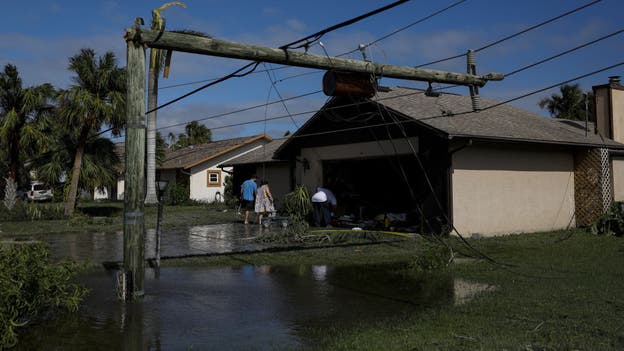
He spoke of seeing severely damaged homes from both floods and wind, roads filled with damaged boats; cars floating in flooded areas...
"Some of the damage was indescribable," DeSantis said.
The governor said he could not confirm any fatalities that are being reported by local officials yet but added, "we absolutely expect to have mortality from this hurricane."
DeSantis said more than 700 confirmed rescues so far "but likely many more."
Rescue crews are still going home to home in the hardest hit communities to see if people are OK. Lee County, where Hurricane Ian made landfall, is also dealing with a large water main break that is affecting water delivery there.
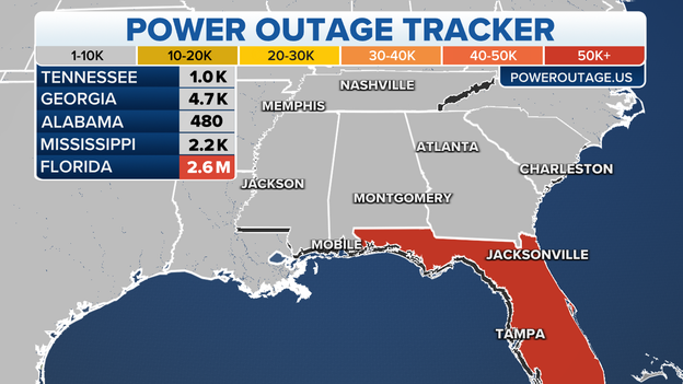
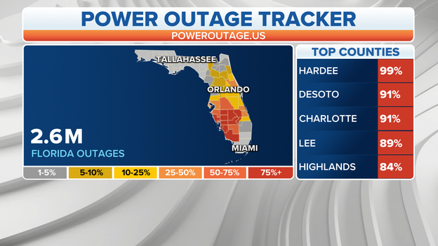
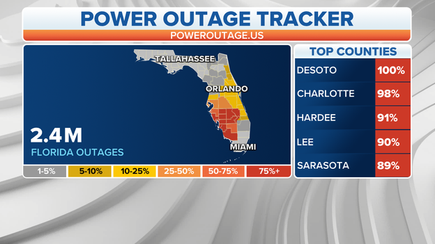
Power outages remain at about 2.6 million customers across the state, as while some power was restored in southwestern and central Florida, more power outages were reported in northeastern Florida.
Meanwhile, communities are rallying around Florida to raise money for relief efforts. So far, $10 million has been raised at www.volunteerflorida.org/donatefdf/ or you can text DISASTER to 20222.
As of 8 P.M., Hurricane Ian had maximum sustained winds around 75 mph. This makes the hurricane a Category 1 on the Saffir-Simpson Hurricane Wind Scale.
Life-threatening storm surge will be possible through Friday along the coasts of northeast Florida, Georgia and South Carolina.
Hurricane Warnings have now been expanded north beyond the South Carolina coast to include coastal North Carolina from Little River Inlet to Cape Fear.
Hurricane Watches have been issued from Cape Fear to Surf City, NC.A Storm Surge Watch has been issued for southeastern North Carolina and much of the Outer Banks, joining Storm Surge Warnings in effect from the SC/NC border down south into northeastern Florida.
The FOX Forecast Center is tracking the future movement of Ian: Click Here
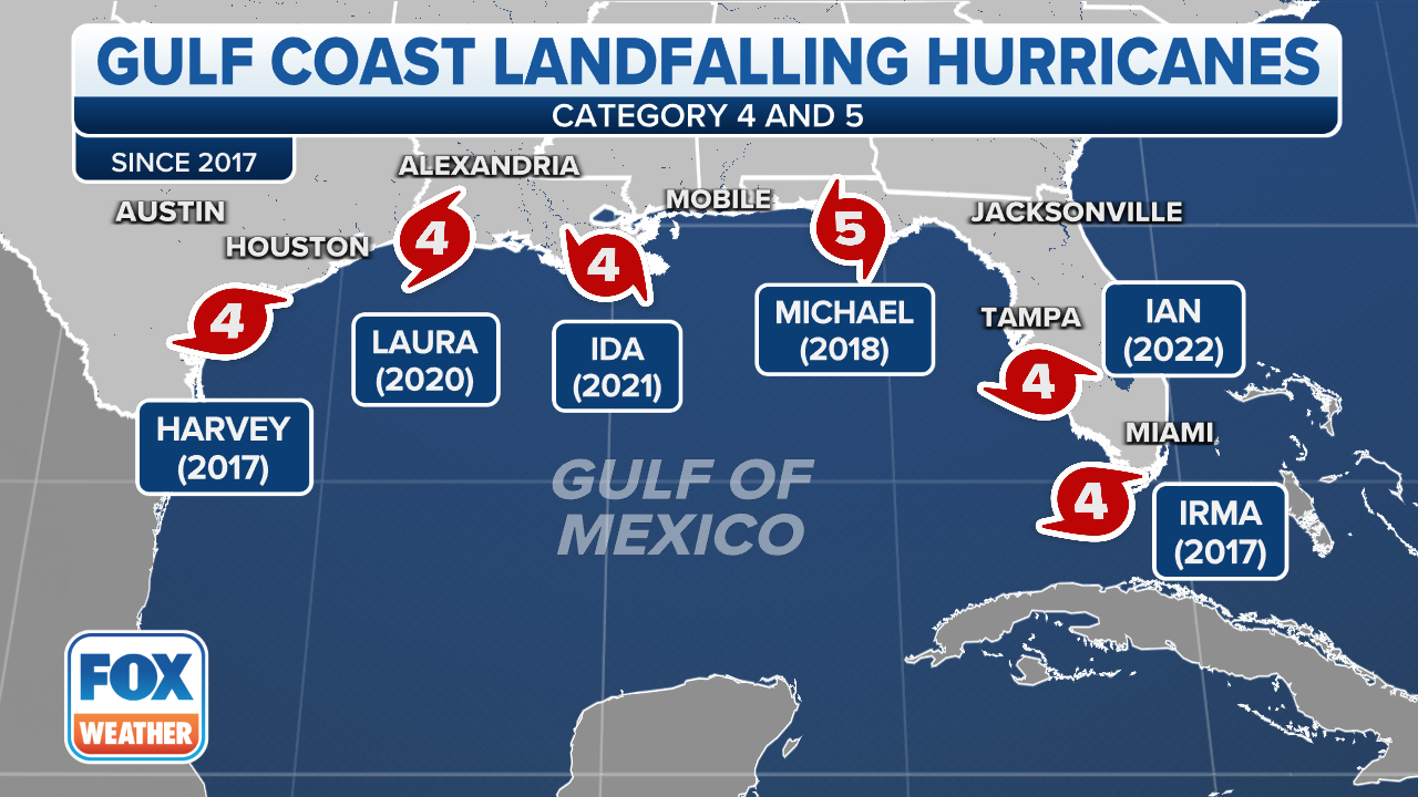
Since 2017, six major storms of either Category 4 or 5 strength have made landfall along the Gulf Coast, Hurricane Ian became the latest this week.
FOX Weather Meteorologist Katie Garner explains what Georgia, South Carolina and North Carolina residents can expect as Hurricane Ian is set to make a third landfall.
For more on what the Southeast can expect, click here for your full forecast.
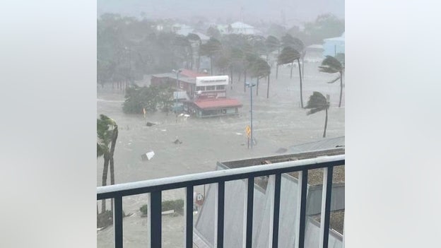
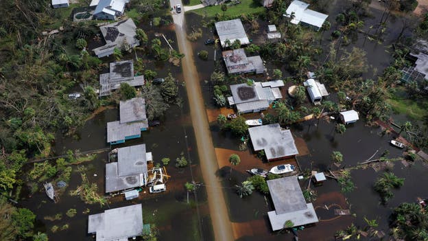
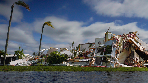
More than 12 feet of storm surge caused by Hurricane Ian moved a home off its foundation in Fort Myers, Florida on Wednesday.
A 38-year-old man in Lake County crashed his motorcycle on Sept. 28 and state medical examiners have determined his death was related to Hurricane Ian's impacts.
The man's death was confirmed by the Florida’s Medical Examiners Commission via the Florida Department of Law Enforcement.
The death marks the 9th related to the storm that made landfall Wednesday as a Category 4 storm in Southwest Florida.
Charleston County Council says it has declared a state of emergency as leaders prepare for upcoming impacts from Hurricane Ian.
Ian remains on track to make landfall in South Carolina on Friday. County leaders are now operating as if disaster or emergency is imminent.
Mary Ellen Pieciuk moved to Port Charlotte a week ago and was among thousands of people on Thursday across Southwest Florida awaiting word about the condition of their homes after the storm.
Charlotte County Commissioner Chris Constance tells FOX Weather that there have been seven storm-related deaths confirmed so far in the Southwest Florida county.
Search and rescue operations continue in Charlotte County and across Florida.
While the exact death toll of Ian remains unknown as search and rescue operations are still ongoing, one other storm-related death has been confirmed in Volusia County.
In St. Johns County, where the city of St. Augustine lies, streets are flooded and expected to receive more water as Tropical Storm Ian works its way northward.
The FOX Forecast Center expects storm surges of up to 6 feet for the area.
T.J. Holzapfel tells FOX Weather Meteorologist Ian Oliver it was surreal to see the storm surge from Hurricane Ian sweep his Fort Myers Beach restaurant away.
"The business is gone," The Rude Shrimp Company owner said. "It was a little surreal to see the surge come in and take the restaurant away but Mother Nature has her own agenda."
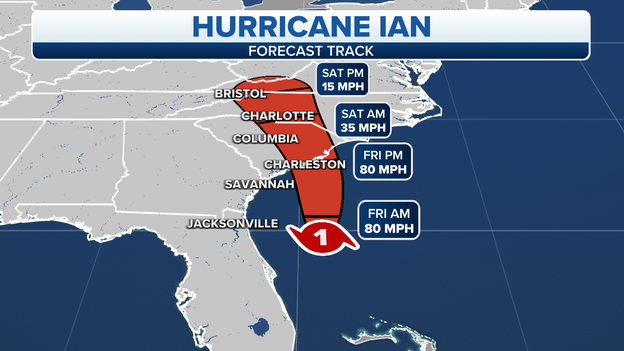
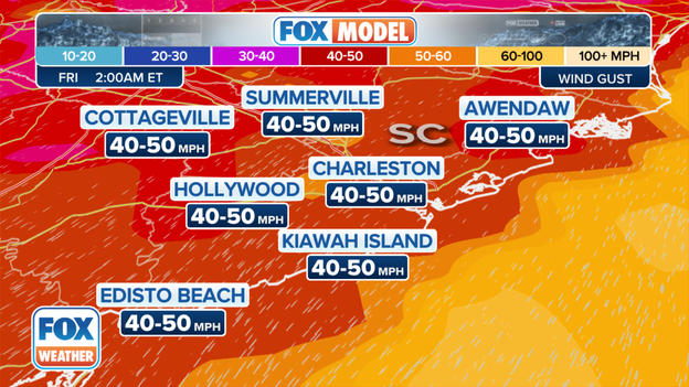
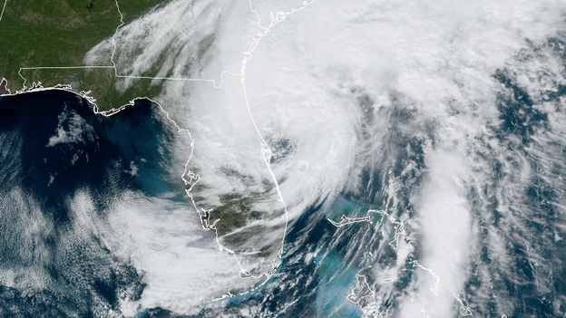
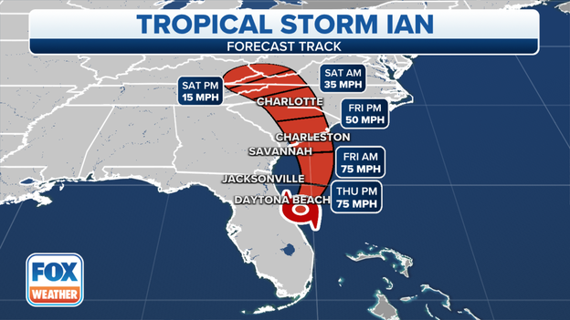
Ian has regained hurricane strength, and its winds now sit at 75 mph as it heads toward South Carolina, according to the 5 p.m. ET update from the National Hurricane Center. The storm is centered about 240 miles south of Charleston, South Carolina and was moving north/northeast at 10 mph. But Ian was expected to bend to the north later Thursday and then to the northwest by early Friday morning as it aims for a likely landfall on the South Carolina coast.
Ian could slightly strengthen before landfall Friday, reaching maximum winds up to 80 mph on its brief journey in the Atlantic Ocean.
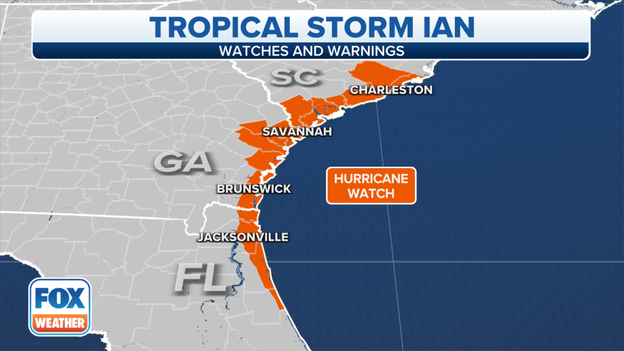
Hurricane Warnings have now been expanded north beyond the South Carolina coast to include coastal North Carolina from Little River Inlet to Cape Fear. Hurricane Watches have been issued from Cape Fear to Surf City, NC.
A Storm Surge Watch has been issued for southeastern North Carolina and much of the Outer Banks, joining Storm Surge Warnings in effect from the SC/NC border down south into northeastern Florida.
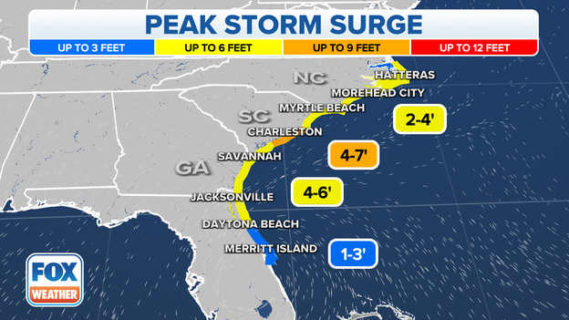
Peak storm surge forecasts include:
* Edisto Beach to Murrells Inlet...4-7 ft
* Flagler/Volusia County Line to Edisto Beach...4-6 ft
* Murrells Inlet to Cape Fear...3-5 ft
* Cape Fear River...2-4 ft
* St. Johns River...2-4 ft
* East of Cape Fear to Duck, including Pamlico and Neuse Rivers...2-4 ft
* Patrick Air Force Base to Flagler/Volusia County Line...1-3 ft
* Albemarle Sound...1-2 ft
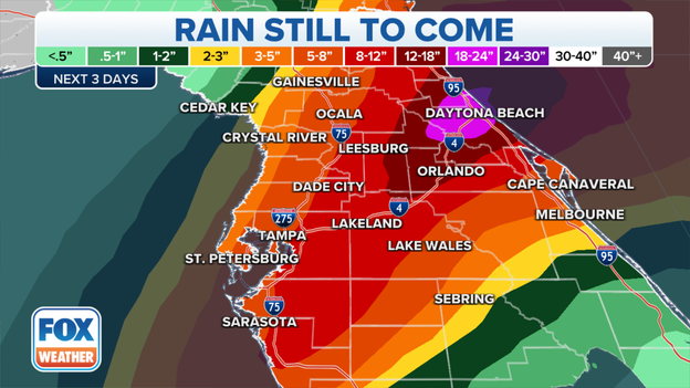
Ian will bring heavy rains across much of the Southeast, with the highest expected totals reaching 4-8 inches along northeastern South Carolina with isolated areas of 12 inches.
Officials say flooding around the Orlando International Airport will prevent operations from resuming on Thursday. The airport closed Wednesday ahead of Ian's impacts to Central Florida.
Flights could begin again Friday depending on damage assessments.
MCO recorded nearly 13 inches of rain in just over 24 hours.
Power crews are making progress in restoring electricity in the wake of Hurricane Ian. The number of customers without power in Florida has dropped to just over 1.9 million, according to poweroutage.us.
That number had peaked around 2.7 million late Wednesday night.
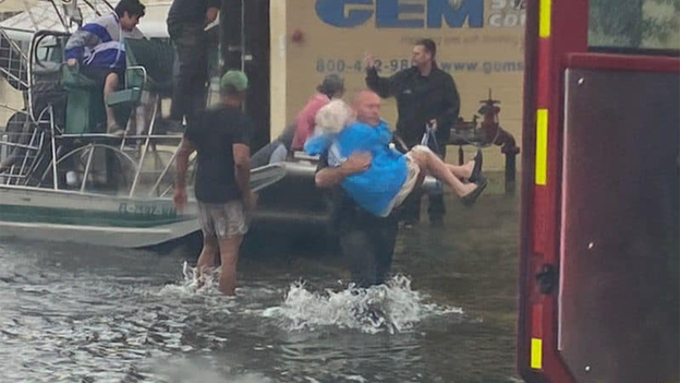
U.S. Coast Guard crews say they have rescued 39 people so far from Florida who became trapped during Hurricane Ian.
Earlier Thursday, search and rescue crews in Lee and Charlotte Counties said their search and rescue teams have rescued around 500 people so far from high waters.
Lee Health medical facilities in Lee County, Florida — which took the brunt of Hurricane Ian’s wrath — are in the process of evacuating their patients out of the county.
Dr. Larry Antonucci, president and CEO of Lee Health, says many of their hospital campuses and outpatient facilities sustained significant damage and are without power and running water.
The emergency room will remain open, but any patients who need to be admitted will also be moved to a medical facility outside the county.
“We must do this to ensure our patients’ safety,” Antonucci said.
In the meantime, Lee Health will offer telemedicine visits for free for the foreseeable future, Antonucci said.
Hurricane Ian brought wind gusts well over 100 mph to the Lee County coastline with several feet of storm surge.
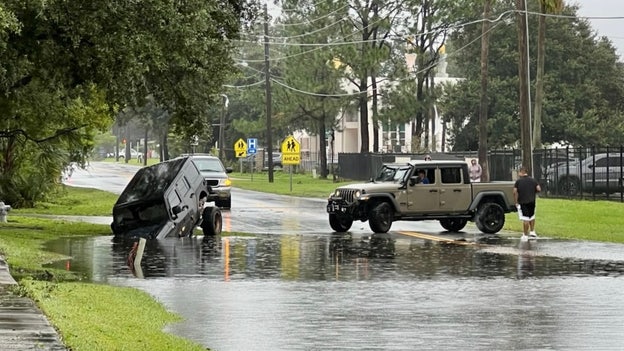
Police in Kissimmee, Florida where heavy rains have led to widespread flooding, are urging drivers to "stop driving around!"
This driver lost control on a flooded street and crashed into a ditch.
Flooding has been a major problem around central Florida where some rainfall totals from Hurricane Ian have neared 10 inches.
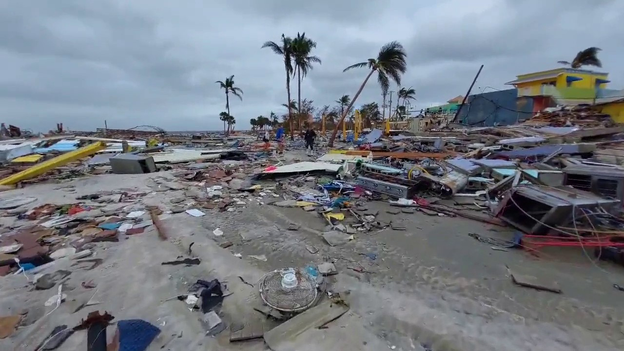
FOX Weather's Robert Ray shows the extensive damage around Fort Myers Beach in the aftermath of Hurricane Ian.
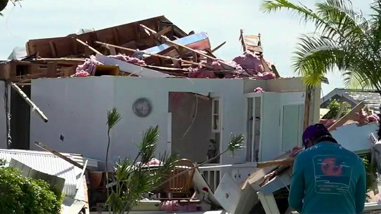
An EF-2 tornado was responsible for the significant damage that struck parts of Boca Raton and Delray Beach Tuesday evening as Hurricane Ian approached southern Florida, the National Weather Service said Thursday.
The twister touched down just before 9 p.m. Tuesday in Boca Raton and moved 6 miles into Delray Beach before dissipating. Peak winds were estimated at 125 mph, rating an EF-2 on the Enhanced Fujita scale.
Two people were hospitalized when the roofs collapsed inside their homes, and dozens were evacuated after damage at an apartment complex in Delray Beach. Storm survey teams found extensive tree and roof damage in the Kings Point community.
The twister was among at least 11 reported tornadoes across southeastern Florida Tuesday as the outer bands of Hurricane Ian moved ashore.
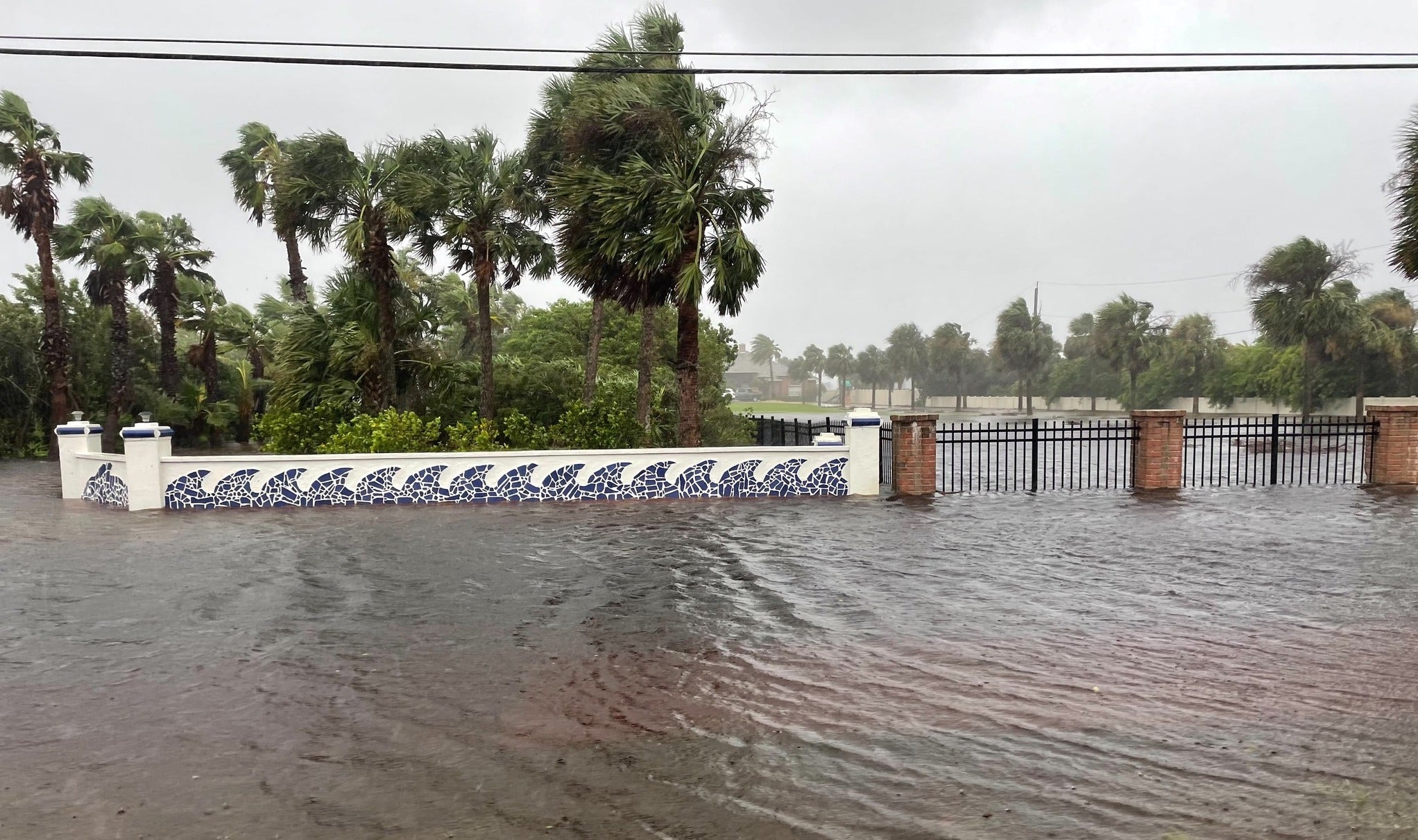
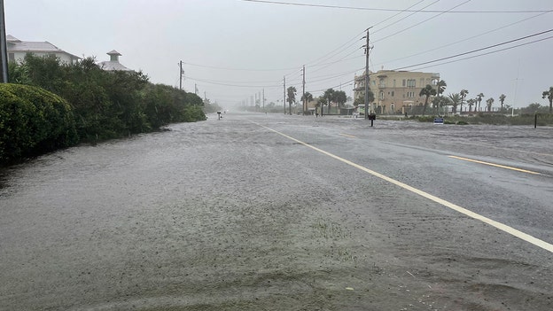
Officials in Florida's St. John's County, home to St. Augustine, say many roads along the St. Johns County coastline are impassable.
The photo was taken Thursday afternoon in the 7500 block of A1A South.
Florida emergency officials say more than 500 people have been rescued so far in Charlotte and Lee Counties as of Thursday afternoon since operations began in the morning.
Search & Rescue efforts continue in the affected areas, officials said.
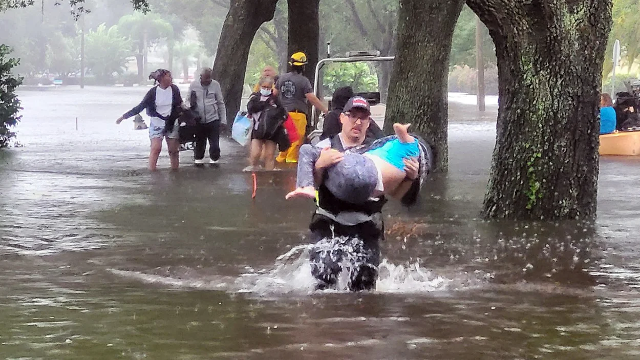
As Hurricane Ian dropped record rains across central Florida Wednesday night, first responders received multiple calls for high-water rescues.
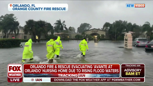
One of the largest was at Avante at Orlando, a nursing home with 106 residents that received about a foot of water inside the facility. Vehicles were submerged outside as firefighters brought patients out one-by-one on stretchers and in wheelchairs.
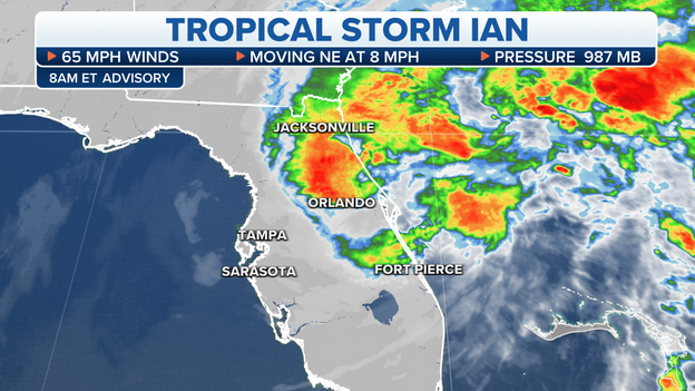
Tropical Storm Ian is still holding steady at 70 mph as it heads toward the Southeastern coast, according to the latest advisory issued by the National Hurricane Center.
The storm is 40 miles northeast of Cape Canaveral, Florida, as of 2 p.m. ET and is moving toward the north-northeast at 9 mph. A turn toward the north is expected later Thursday, then turning toward the northwest toward South Carolina on Friday.
Ian is expected to regain hurricane strength by Thursday evening and make landfall on Friday on the coast of South Carolina as a Category 1 storm.
Hurricane Warnings remain in effect for the entire South Carolina coastline. Storm Surge warnings remain in effect for the northeastern coast of Florida and all of the Georgia and South Carolina coastlines.
Storm Surge forecasts remain as follows:
* Edisto Beach to South Santee River...4-7 ft
* Flagler/Volusia County Line to Edisto Beach...4-6 ft
* South Santee River to Little River Inlet...3-5 ft
* St. Johns River...2-4 ft
* East of Little River Inlet to Duck, including Pamlico and Neuse Rivers...2-4 ft
* Patrick Air Force Base to Flagler/Volusia County Line...1-3 ft
* Bonita Beach to Chokoloskee including Charlotte Harbor... 1-3 ft
* Albemarle Sound...1-2 ft
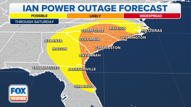
As Ian eyes South Carolina for its final landfall on Friday, more power outages are expected across the Southeast.
Power outages are most likely from Northeast Florida into eastern Georgia and much of the Carolinas.
Scattered power outages are possible farther inland from North Florida into the rest of Georgia and as far north as southern Virginia.
Ian is forecast to re-strengthen into a Category 1 hurricane Thursday evening and maintain that intensity until it moves inland across South Carolina on Friday.
According to PowerOutage. US, more than 2.5 million people are currently without power in Florida, with another 10,000 without power in Georgia.
The Tampa Bay Buccaneers announced Thursday that it will play Sunday night's game against the Kansas City Chiefs at Raymond James Stadium as originally scheduled.
We would like to thank all of the local government agencies and the thousands of emergency personnel who worked tirelessly over the past few days to ensure that our area would be ready to respond if needed," the team said in a statement. "We would also like to acknowledge the Miami Dolphins organization for their assistance and hospitality in allowing us to use their practice facilities this week.
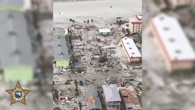
Lee County Sheriff Carmine Marceno shared video from a helicopter tour above the county that showed the devastation left behind when Hurricane Ian moved through the area on Wednesday afternoon.
As Ian eyes South Carolina for its final landfall on Friday, a significant storm surge is expected along the coasts of Florida, Georgia and the Carolinas.
The highest surge is forecast along the South Carolina coast, where an inundation of 4 to 7 feet is predicted from Edisto Beach to the South Santee River. This includes the city of Charleston, South Carolina.
Here is the expected storm surge along the path of Ian, which is forecast to re-strengthen into a Category 1 hurricane Thursday evening:
- Edisto Beach to South Santee River in South Carolina: 4-7 feet
- Flagler/Volusia County line in Florida to Edisto Beach in South Carolina: 4-6 feet
- South Santee River to Little River Inlet in South Carolina: 3-5 feet
- St. Johns River in Florida: 2-4 feet
- East of Little River Inlet in South Carolina to Duck in North Carolina, including the Pamlico and Neuse Rivers: 2-4 feet
- Patrick Air Force Base to the Flagler/Volusia County line in Florida: 1-3 feet
- Bonita Beach to Chokoloskee in Florida, including Charlotte Harbor: 1-3 feet
- Albemarle Sound in Georgia: 1-2 feet
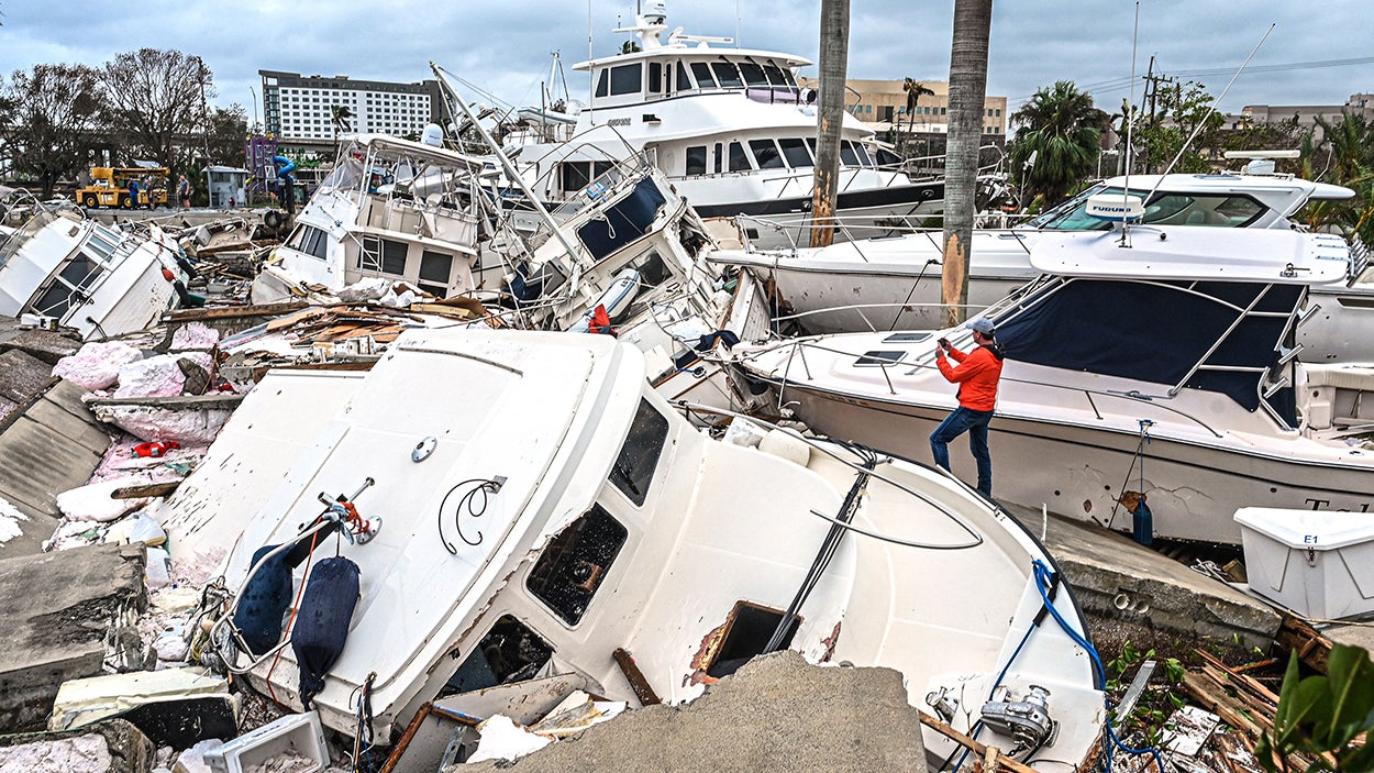
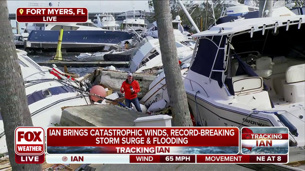
FOX Weather correspondent Robert Ray reported live from a marina on the shores of Fort Myers, one of the hardest hit areas in Florida, saying concrete docks had been split in two.
"Just a ridiculous amount of destruction," Ray said.
President Joe Biden spoke about Hurricane Ian at FEMA Headquarters on Thursday afternoon and said this could be the deadliest hurricane in Florida's history.
"This could be the deadliest hurricane in Florida history," he said "The numbers are still unclear, but we're hearing early reports of what may be substantial loss of life."
Tampa International Airport announced it will resume commercial operations at 10 a.m. on Friday.
The airport, like many others across the state, closed in preparation of Hurricane Ian ’s landfall on Wednesday.
“Friday’s 10 a.m. reopening for departing and arriving flights will give the airport and its partners such as the FAA, the TSA, airlines, and other time to take necessary steps for the safe resumption of business,” the airport said in a news release.
Passengers should check with their individual airlines regarding a flight status.
Despite weakening to a tropical storm Thursday morning, Ian is forecast to regain hurricane strength Thursday evening off the coast of Northeast Florida.
Due to Ian's expected re-strengthening, Hurricane Warnings have been issued for the entire South Carolina coast, where Ian is expected to make a final landfall as a Category 1 hurricane on Friday.
Farther south, Hurricane Watches have been issued from Northeast Florida into coastal Georgia.
Tropical Storm Warnings are also in effect from Central and Northeast Florida into eastern Georgia and portions of the Carolinas.
Click here to learn the difference between Hurricane and Tropical Storm Watches and Warnings.
The Orange County Sheriff’s Office shared photos and video of multiple people who needed to be rescued by rising flooding waters caused by Tropical Storm Ian in the community of Orlo Vista on Thursday morning.
Deputies report water is at least waist deep in several locations.
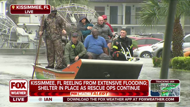
FOX Weather multimedia journalist Brandy Campbell is in Kissimmee, Florida, where water rescues are underway after major flooding due to the effects of Tropical Storm Ian.
Check out this video of water rescues taking place while Campbell was providing a live report on FOX Weather on Thursday morning.
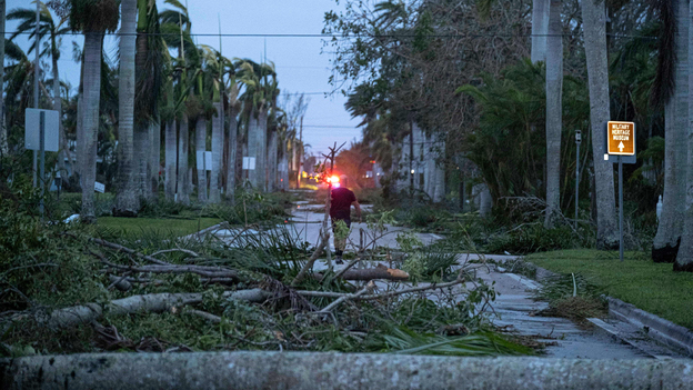
In a video shared with FOX Weather, Fort Myers Beach is looking like a warzone after Hurricane Ian.
The video shows the beach littered with debris from destroyed buildings and downed trees.
People are also seen sifting through all of the debris left behind.
The number of power outages in Florida now stands at 2.6 million, and that number could continue to climb as Tropical Storm Ian exits the state on a path that will eventually lead to a final landfall along the South Carolina coast on Friday.
In addition, the number of power outages reported in Georgia is also beginning to climb.
As of late Thursday morning, nearly 5,000 outages have been reported.
However, it’s unclear how many are attributed to the effects of Ian.
Hurricane Ian made landfall near Cayo Costa, Florida, on Wednesday afternoon as a catastrophic Category 4 storm.
The historic storm had maximum sustained winds of 150 mph as it battered the southwest portion of the state.
Now a tropical storm, it continues to bring life-threatening flooding, storm surge and high winds to parts of Florida on Thursday before its impacts spread toward Georgia and the Carolinas.
A shelter in place order remains in effect in Kissimmee, Florida, as extensive flooding remains a serious threat across the region.
Tropical Storm Ian caused widespread flooding across central and eastern Florida after making landfall in the southwestern part of the state as a Category 4 hurricane on Wednesday.
Tropical Storm Ian could regain hurricane status before making a final landfall along the South Carolina coast on Friday.
Hurricane Warnings are now in effect for the entire coast of South Carolina.
Ian weakened to a tropical storm Thursday morning, but the National Hurricane Center expects Ian will regain hurricane strength Thursday evening off the coast of Northeast Florida.
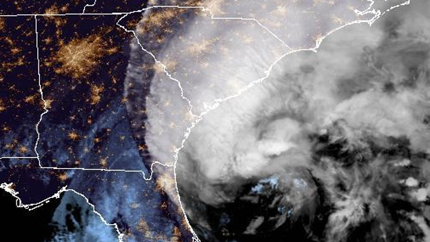
The center of Ian has now moved offshore from Florida's Space Coast and into the western Atlantic north of Cape Canaveral.
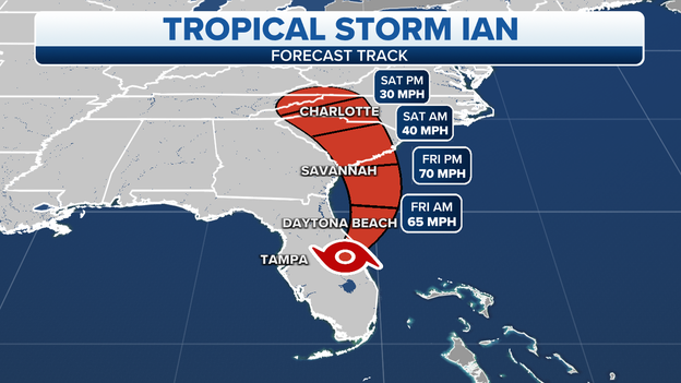
Ian is forecast to track northward off the southeastern U.S. coast in the direction of South Carolina through Friday.
Hurricane Warnings have been issued for the entire coast of South Carolina, where Ian is forecast to make its final landfall on Friday as a Category 1 hurricane.
Get the latest forecast for Tropical Storm Ian by clicking here.
There are no scheduled flights at Orlando International Airport on Thursday after the facility closed when Hurricane Ian moved across the state on Wednesday.
“All roads leading to Orlando International Airport are closed due to flooding,” the airport said.
Commercial operations are expected to resume on Friday.
President Joe Biden shared an image of him speaking with Florida Gov. Ron DeSantis on Thursday morning to discuss the ongoing situation after Hurricane Ian made landfall in the southwestern part of the state on Wednesday afternoon.
In a tweet, Biden said FEMA Administrator Deanne Criswell will be headed to the region on Friday.
Rising floodwaters is forcing the evacuation of a nursing home in Orlando.
Video shared by Orange County Fire Rescue shows first responders evacuating residents at Avante at Orlando.
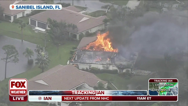
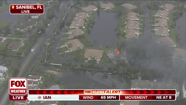
Check out this video of a home that is burning on Sanibel Island, Florida, on Thursday morning.
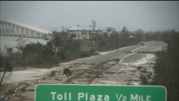
Damage to the Sanibel Causeway caused by Hurricane Ian is making it difficult for first responders to get to the scene.
FOX Weather correspondent Robert Ray stood among boats that appeared to be tossed around like toys in Fort Myers and spoke to one resident who said Hurricane Ian was one of the strongest storms he's ever experienced.
President Joe Biden on Twitter is telling Florida residents that his administration will be with them "every step of the way."
Earlier Biden approved Florida's disaster declaration, and Florida Gov. Ron DeSantis said more counties are likely to be included as Tropical Storm Ian continues to spin across the state.
The Osceola County Sheriff’s Office says no major structural damages have been reported in the county at this time, however major flooding has been reported in different areas.
Photos shared on Facebook also show water rescues that are ongoing in the county.
Residents are being asked to stay home and stay off the roads.
Florida’s Chief Financial Officer Jimmy Patronis has announced the deployment of four Urban Search and Rescue teams to southwestern Florida in the wake of Tropical Storm Ian.
“Early this morning the winds died down, so we got the teams closer to the impacted areas. When there’s light, these teams will be airlifted from the Ft. Myers area to area islands to begin lifesaving missions,” he said in a press release.
A senior living facility in Orlando has been evacuated as floodwaters continue to rise during Tropical Storm Ian.
Orange County Fire Rescue shared video of the evacuation taking place at Avante at Orlando on Thursday morning.
Aerial footage shown on FOX Weather Thursday morning shows the devastation in Sanibel, Florida, after powerful Tropical Storm Ian tore through the region on Wednesday.
Ian made landfall in southwestern Florida on Wednesday afternoon as a powerful Category 4 hurricane.
Despite weakening to a tropical storm Thursday morning, Ian is forecast to exit the Space Coast of Florida later Thursday and move into the Atlantic, where it has the potential to re-strengthen into a Category 1 hurricane before approaching the South Carolina coast on Friday.
Due to Ian's potential re-strengthening, Hurricane Watches have been issued along the Southeast coast from Northeast Florida into Georgia and South Carolina.
Tropical Storm Warnings are also in effect for these coastal areas, while Tropical Storm Watches are posted farther inland in eastern Georgia and central South Carolina.
Click here to learn the difference between Hurricane and Tropical Storm Watches and Warnings.
Orange County Fire Rescue shared photos on twitter of ongoing water rescues throughout the county.
Several inches of rain have fallen as Tropical Storm Ian continues to spin its way across Florida after making landfall Wednesday afternoon as a Category 4 hurricane.
Timelapse video shows how quickly the storm surge inundated Fort Myers, Florida, on Wednesday afternoon as Ian approached southwestern Florida as a Category 4 hurricane.
Florida Gov. Ron DeSantis said earlier comments made by Lee County Sheriff Carmine Marceno about fatality numbers being in the hundreds was “basically an estimate.”
"That number that was put out by Lee (County) is basically an estimate of how people were calling (9-1-1),” DeSantis said.
There have been unconfirmed reports of deaths, however.
“We have had the two unconfirmed fatalities in the sense that we don’t know that they’re linked to the storm” DeSantis said. “I mean, our assumption is it likely is.”
In a news conference on Thursday morning, Florida Governor Ron DeSantis said the disaster declaration approved by President Joe Biden will likely be expanded to other parts of the state as Tropical Storm Ian continues to affect the region.
Ian made landfall in the southwestern part of the state on Wednesday afternoon as a powerful Category 4 storm with winds of 150 mph.
Millions of people are in the dark and record-breaking flooding has been reported across the state.
Several Flash Flood Emergencies also remain in effect.
The National Weather Service issued a Flash Flood Emergency for Volusia County, including Daytona Beach, until 12 p.m. Eastern.
Officials say heavy rain and water rescues are ongoing.
Between 10 and 14 inches of rain has fallen, and another 3-5 inches are expected to fall.
The FOX Forecast Center has confirmed the Orlando area is currently experiencing a 200-year flood event in association with Ian.
Orlando International Airport received 12.49 inches of rain in the 24 hours ending at 8 a.m. Eastern time Thursday, which set a new all-time 24-hour rainfall record in the city and resulted in major flooding across east-central Florida.
A Flash Flood Emergency was in effect earlier Thursday morning on the northern side of the Orlando metro area near the Little Wekiva River, where catastrophic flooding was ongoing.
An additional 4 to 8 inches of rain is possible in portions of Central and Northeast Florida before the rain comes to an end on Friday.
Click here to learn more about what a 200-year flood actually means.
Watch live as Florida Governor Ron DeSantis provides an update on Tropical Storm Ian.
FOX Weather Hurricane Specialist Bryan Norcross says Tropical Storm Ian is slowly easing its grip on Southwest Florida, where it produced devastating storm-surge flooding, rainfall flooding, and wind damage across the region.
Damage assessments are underway at Tampa International Airport, but there has been no update on a planned reopening of the facility.
"We hope to have an update on reopening plans later today," the airport said in a tweet.
Several airports across the state shut down in advance of approaching Hurricane Ian.
Ian has since been downgraded to a tropical storm, but remains extremely dangerous.
The Volusia County Sheriff’s Office says a 72-year-old man died after going outside during Tropical Storm Ian overnight.
The sheriff said he went outside to drain his pool, and deputies later pulled him from a canal.
The sheriff’s office said deputies tried to perform CPR but were unsuccessful.
After confirming fatalities “in the hundreds” during a Thursday morning interview on Good Morning America, Lee County Sheriff Carmine Marceno now says he cannot confirm the number of fatalities.
“While I don’t have confirmed numbers, I definitely know the fatalities are in the hundreds,” he said on Good Morning America.
Tropical Storm Ian made landfall as a powerful Category 4 hurricane on Wednesday afternoon with winds of 150 mph.
Millions of utility customers are now in the dark , and catastrophic flooding has been reported across the southwestern part of the state.
Millions of people were told to evacuate the coast as well as low-lying areas in advance of predicted storm surge flooding.
Dramatic video shows major damage to the Sanibel Causeway in Fort Myers after Hurricane Ian pounded the area with strong wind and catastrophic flooding.
Ian was downgraded to a tropical storm on Thursday morning after making landfall in southwestern Florida on Wednesday as a powerful Category 4 hurricane.
Despite weakening to a tropical storm earlier Thursday morning, Ian is continuing to produce catastrophic flooding across east-central Florida as it crawls northeastward at just 8 mph near Florida's Space Coast.
A Flash Flood Emergency was in effect earlier Thursday morning on the northern side of the Orlando metro area near the Little Wekiva River, where major flooding was ongoing.
Nearly 12 inches of rain has fallen in Orlando since Wednesday morning, and up to 14.42 inches has fallen in Lehigh Acres, Florida, which is east of Fort Myers.
The Lee County sheriff said live on Good Morning America that fatalities number in the hundreds in the county and there are still thousands of people waiting to be rescued.
"While I don't have confirmed numbers, I definitely know the fatalities are in the hundreds," Lee County Sheriff Carmine Marceno said on Good Morning America. "There are thousands of people that are waiting to be rescued."
Ian was a powerful Category 4 hurricane when it made landfall on Wednesday afternoon with winds of 150 mph.
Catastrophic storm surge flooding has been reported, and more than 2.6 million power outages have been reported.
FOX Weather is gathering more information on this breaking news update
President Joe Biden has approved a disaster declaration for the state of Florida in response to the catastrophic flooding and widespread damage caused by Tropical Storm Ian.
Ian was a powerful Category 4 hurricane with winds of 150 mph when it made landfall in the southwestern part of the state on Wednesday afternoon.
Tropical Storm Ian is continuing to spin across Florida after coming ashore in the southwestern part of the state as an extremely powerful Category 4 hurricane on Wednesday afternoon with winds of 150 mph.
More than 2.6 million power outages have been reported so far, including a massive blackout that was reported in Orlando early Thursday morning.
Tropical Storm Ian forced millions of people to evacuate and caused catastrophic storm surge flooding as it grew closer to and eventually made landfall yesterday afternoon.
The National Weather Service has issued a Flash Flood Emergency for Little Wekiva River in Seminole County until 8:45 a.m.
The NWS says between 6-10 inches of rain has fallen, and an additional 3-5 inches are possible in the warned area.
The river level is currently at 30.6 feet, which is one foot above the previous record.
Other locations that will experience flash flooding include:
Altamonte Springs
Maitland
Lake Mary
Longwood
Wekiva Springs
Forest City
Fern Park
Heathrow
The Manatee County Sheriff’s Office is asking residents to stay off the roads and is asking for patience while deputies get ready to begin damage assessments from Tropical Storm Ian in the next few hours.
Ian was a powerful Category 4 hurricane when it roared ashore in the southwestern part of the state on Wednesday afternoon.
More than 2.5 million utility customers are in the dark and catastrophic storm surge flooding has been reported.
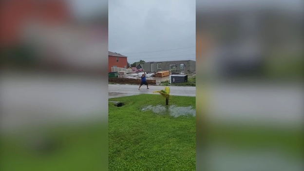
Video shows a Cape Coral resident waving the American flag through the winds of Hurricane Ian on Wednesday.
Ian was a monstrous Category 4 hurricane with 150 mph winds when it first came ashore on Cayo Costa, Florida, about 3 p.m. Wednesday.
About 90 minutes later, the hurricane made a second Florida landfall – this time just south of Punta Gorda with 145 mph winds.
Here’s where Tropical Storm Ian is headed next and a detailed look at the forecast.
A video by @colliercountycowboys_ shows the man being lifted from a vehicle submerged in floodwaters in Bonita Springs during Tropical Storm Ian and dragged through waist-high waters to safety.
The National Weather Service in Melbourne, Florida, has issued a new Flash Flood Emergency for Seminole County until 8:15 a.m.
Communities impacted by the Flash Flood Emergency include Sanford, Lake Mary and Heathrow.
“This is a particularly dangerous situation,” the NWS said. “Water rescues and life-threatening flash flooding is occurring.”
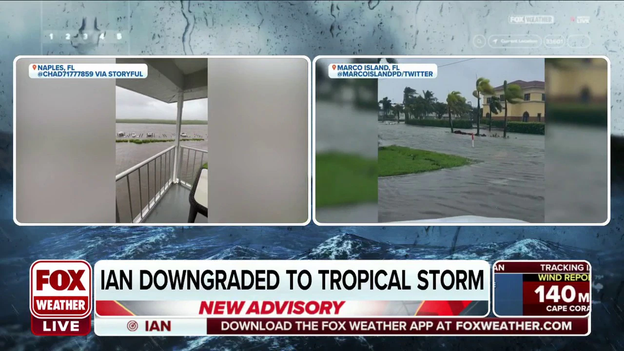
Check out this timelapse video of major flooding caused by storm surge on Marco Island as Tropical Storm Ian, at the time a powerful Category 4 hurricane, pushed closer to the coast of Florida.
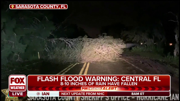
The Sarasota County Sheriff's Department shared video of the damage after Tropical Storm Ian moved through the region on Wednesday and Thursday morning.
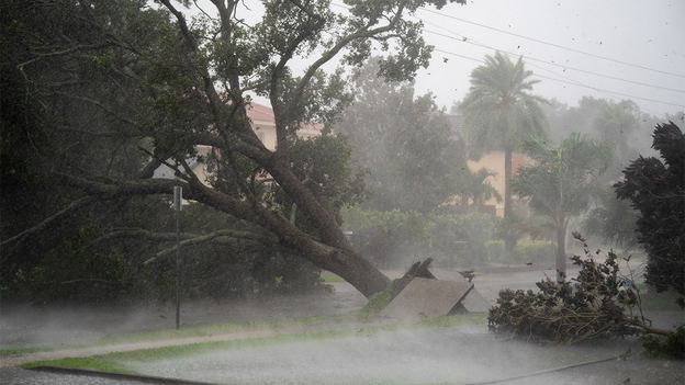
The video shows downed trees and power lines that littered the roads.
Damage assessments are now underway in the county.
Despite weakening to a tropical storm Thursday morning, Ian will still pose risks of life-threatening flooding, storm surge and strong winds as it crawls across the eastern Florida Peninsula on Thursday and then heads toward South Carolina on Friday.
The latest forecast from the National Hurricane Center suggests Tropical Storm Ian will maintain its 65- to 70-mph intensity through Friday, then it'll quickly weaken after it makes a final landfall along the South Carolina coast late Friday.
Ian's center of circulation will then dissipate over the Carolinas Saturday night or early Sunday.
Check out the incredible video above showing destructive winds and catastrophic flooding in Charlotte County as Tropical Storm Ian, which was a powerful Category 4 hurricane at the time, make landfall in southwestern Florida.
The Sarasota County Sheriff's Office says damage assessment has begun after powerful Tropical Storm Ian made landfall on Wednesday as a Category 4 hurricane with winds of 150 mph.
So far, more than 2.5 million utility customers are in the dark and catastrophic storm surge has been reported.
Tropical Storm Ian made landfall in southwestern Florida as a powerful Category 4 hurricane and is so far responsible for causing more than 2.5 million power outages in the state.
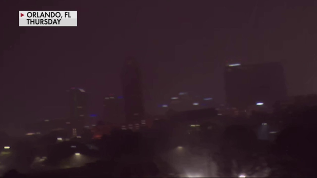
This video shows an eerie site as downtown Orlando was plunged into darkness when Ian was spinning its way across the state.
The FOX Forecast Center has been closely tracking the progress of Tropical Storm Ian as the storm crosses the state, and videos show significant flooding in the southwestern part of the state caused by storm surge when Ian made landfall as a powerful Category 4 hurricane on Wednesday.
Ian was downgraded to a Tropical Storm early Thursday morning, but remains an extremely dangerous storm.
Tropical Storm Ian has caused a record-setting storm surge along the state's Gulf Coast and has so far plunged more than 2.5 million utility customers into darkness.
At landfall on Wednesday afternoon, Tropical Storm Ian was a powerful Category 4 hurricane with winds of 150 mph.
As of 5 A.M., Tropical Storm Ian had maximum sustained winds around 65 mph.
The cyclone is over Central Florida and could emerge out over the Atlantic this afternoon.
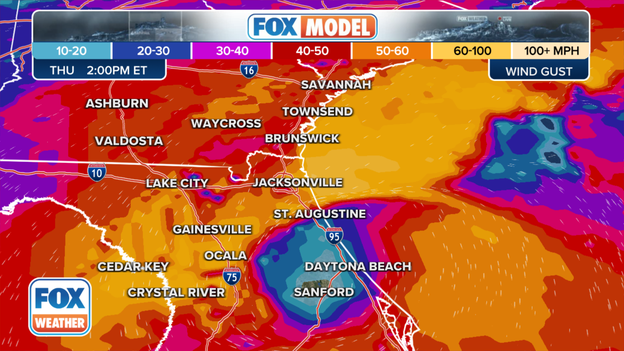
Wind gusts of between 39 mph to 73 mph will continue to impact the Peninsula through Thursday.
Once the cyclone exists Florida's East Coast, it will head in the direction of South Carolina.
Tropical Storm Warnings are in effect from Florida to southern North Carolina.
The FOX Forecast Center is tracking the future movement of Ian: Click Here
The National Weather Service has issued a Flash Flood Emergency for southwestern Seminole County in east-central Florida until 6:45 a.m. Eastern time.
Between 5 and 9 inches of rain has fallen. Additional rainfall amounts of 2 to 4 inches are possible in the warned area.
"This is a FLASH FLOOD EMERGENCY for Little Wekiva River in Seminole County," the NWS said in the warning. "This is a PARTICULARLY DANGEROUS SITUATION. SEEK HIGHER GROUND NOW!
Storm Chaser footage shows damaging wind whipping palm trees in Naples, Florida, on Wednesday evening.
The worst of the weather this morning will impact Central and North Florida. Communities around Orlando reported flash flooding overnight with several inches of rain. Ian is expected to move offshore later today and conditions will slowly improve during the evening.
Ian tracker: Where the storm is heading next
Despite the rapid weakening of Hurricane Ian, power outages are still growing in Florida. Nearly 2.5 million customers in the state are without electricity according to Poweroutage.US. The hardest hit areas are along the Gulf Coast and along the I-4 corridor and points southward.
Emergency managers have warned it could takes weeks to get power restored to the hardest hit areas. Here are some tips if you know someone planning to use a generator: 7 ways to stay safe
What was once nearly a Category 5 hurricane has weakened to a Category 1 storm. Even at this stage major impacts remain with flood and damaging winds that will last hours.
Hurricane Ian tracker: Click Here
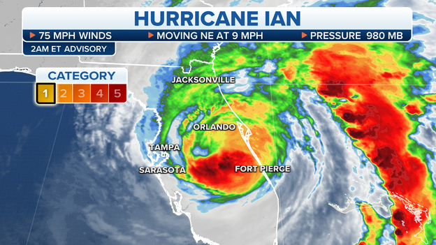
As of 2 A.M., Hurricane Ian had maximum sustained winds around 75 mph. This makes the hurricane a Category 1 on the Saffir-Simpson Hurricane Wind Scale.
The hurricane is over Central Florida and could emerge out over the Atlantic this afternoon.
Winds of at least tropical storm-force will continue to impact the Peninsula through Thursday.
Additionally heavy rainfall will lead to flooding on grounds that are already saturated.
Once the cyclone exists Florida's East Coast, it will head in the direction of South Carolina.
Tropical Storm Warning are in effect from South Florida to southern North Carolina.
The FOX Forecast Center is tracking the future movement of Ian: Click Here
Lee County officials said they have received reports of looting and have implemented a curfew to help limit the amount of people out on roadways.
Humans weren't the only ones needing rescue from Hurricane Ian. A cat that was stranded by the storm surge was rescued by a resident in Bonita Springs, Florida.
The region experienced some of the highest tide levels along the entire Gulf Coast.
See the impacts from Hurricane Ian in Fort Myers: Click Here
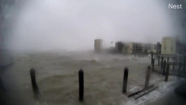
Storm surge of at least 12 feet impacted parts of the Sunshine State on Wednesday as Hurricane Ian made landfall. Video from a condo building showed significant inundation of streets.
FOX and the American Red Cross have partnered to collect donations for those impacted by the Hurricane Ian and Hurricane Fiona.
As of 11 P.M., Hurricane Ian had maximum sustained winds around 90 mph. This makes the hurricane a Category 1 on the Saffir-Simpson Hurricane Wind Scale.
The hurricane is about 70 miles south of Orlando.
Winds of at least tropical storm-force will continue to impact the Peninsula through Thursday.
Once the cyclone exists Florida's East Coast, it will head in the direction of South Carolina.
The FOX Forecast Center is tracking the future movement of Ian: Click Here
Live coverage of Hurricane Ian from Wednesday, 09/28, is available by clicking here.
Live Coverage begins here
