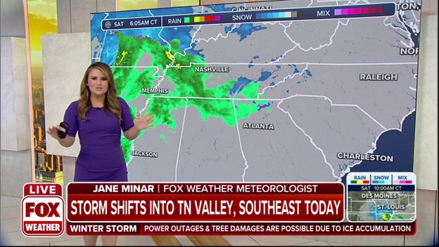
Southeast braces for blast of snow, ice from high-impact winter storm
A massive winter storm is left behind a mess for the Midwest and is unleashing its wrath on the Southeast.
Coverage for this event has ended.
Track the snow moving into Tennessee on the FOX 3D Weather Radar. Download a free version of the app right now to follow the overnight movements of the winter storm.
Apple Apps Store: Click Here
Google Play Store: Click Here
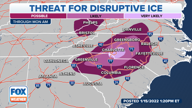
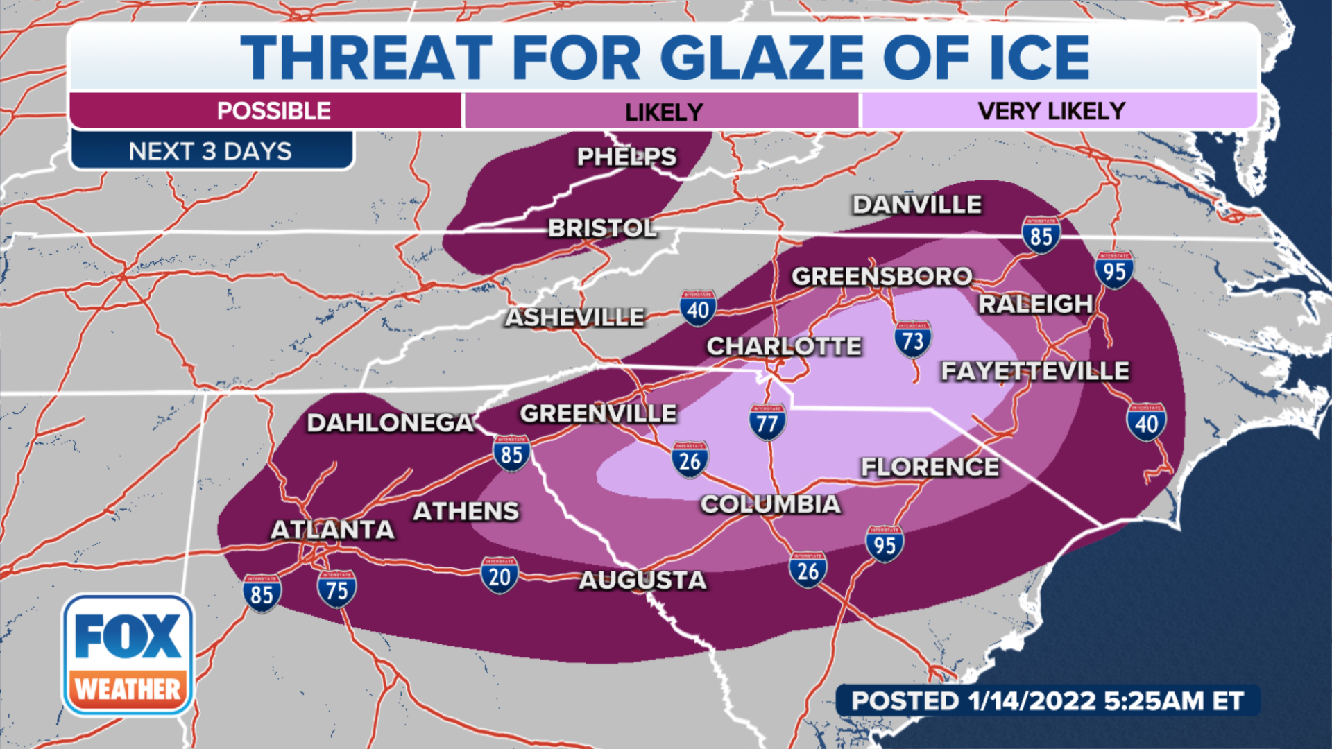
The threat for disruptive ice exists from Columbia, South Carolina into the Triad of North Carolina on Sunday. Rain will start in the region overnight, which will transition into ice as temperatures drop. Duke Energy warns that power outages could be significant in the region.
Utility crews are standing by to respond: Click Here
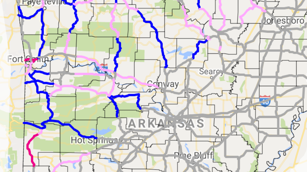
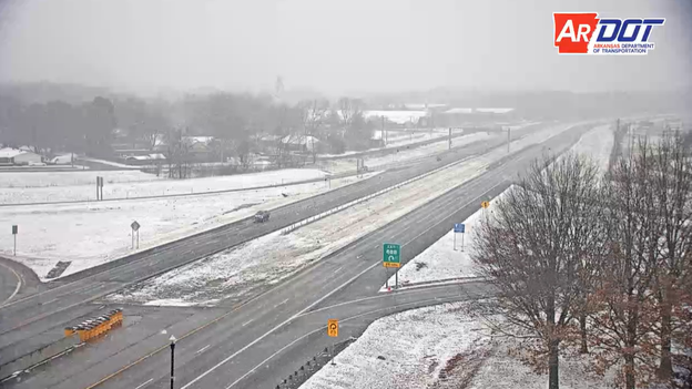
Snow and ice are accumulating on some roadways in Arkansas. Roadways with snow are highlighted in blue and routes with slush are colored in pink. Many areas will pick upwards of three inches of snow overnight.
Latest forecast: Click Here
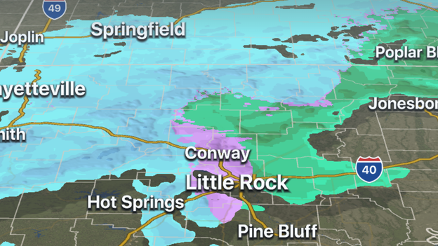
The FOX Weather 3D Radar is tracking freezing rain over Arkansas' capital city. The rain and ice is expected to transition into snow overnight. Upwards of three inches of snow could fall around the Little Rock metro area.
Download a free version of the app right now to follow the winter storm.
Apple Apps Store: Click Here
Google Play Store: Click Here
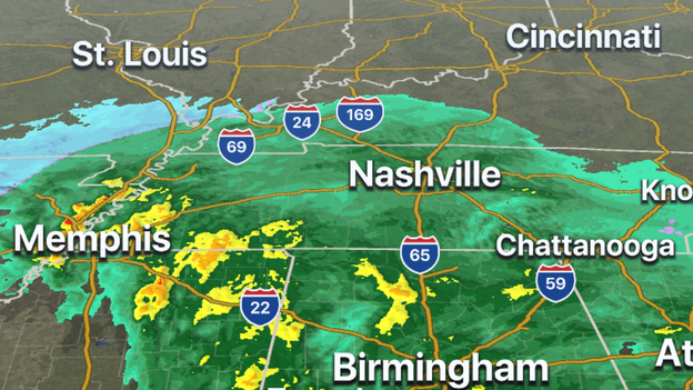
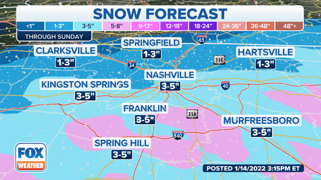
Metro Nashville will once again see a heavy blanket of snow. Forecast models show areas to the south of the city could pick up on half a foot of snow. The last winter storm that impacted the region happened just about a week ago.
Meteorologists say rain is expected to transition into snow on Sunday morning.
Rain has transitioned into snow over northern Arkansas and in the town of Mountain Home. Forecast models show upwards of five inches of snow could fall in the region, during the overnight hours.
Track the snow on the FOX Weather 3D Radar: Click here to download
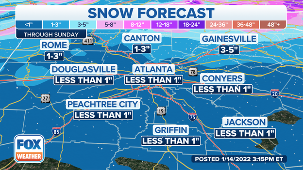
Most of metro Atlanta will see snow totals of less than one inch. Areas to the north and northeast of the city could see substantially more frozen precipitation. Forecast models show areas around Gainesville, GA could see upwards of five inches of snow.
Latest forecast: Click Here
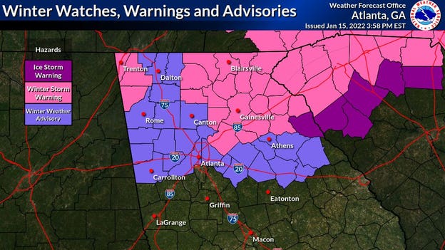
Winter Storm Warnings have been extended into the metro Atlanta region. Meteorologists expect upwards of two inches of snow, minor ice accumulations and wind gusts as high as on Sunday.
Latest forecast: Click Here
Moderate to occasionally heavy snow has begun to fall in northern parts of Arkansas. Forecast models show as much as 5 inches of snow could fall. Some roads southeast of Fayetteville, AR are reported to be snow-covered.
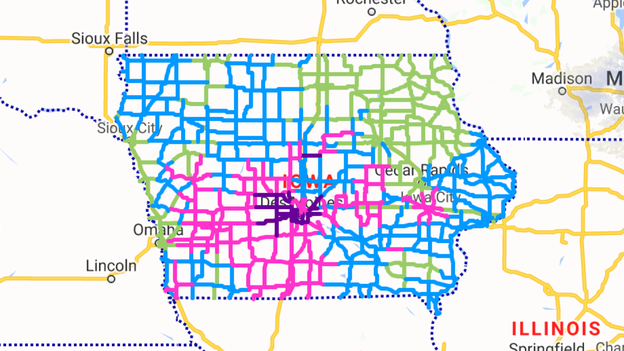
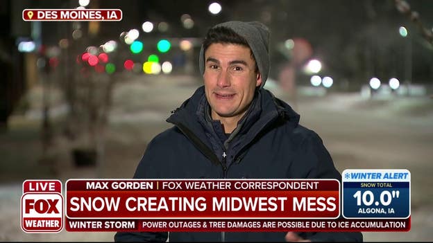
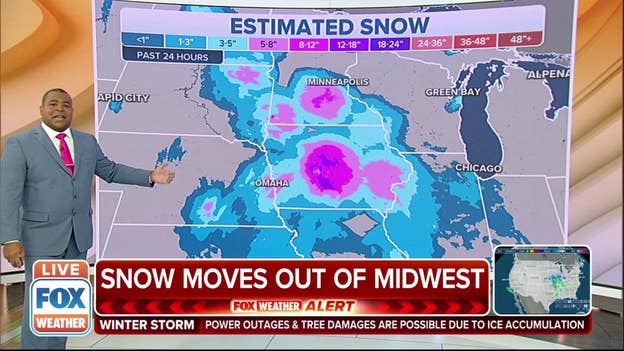
Snowfall totals of around a foot in the Des Moines area has made travel nearly impossible on many roadways in the central part of the state.
Roads that are partially covered are in blue
Roads that are completely covered are in pink
Roadways, where travel is not advised, are in purple
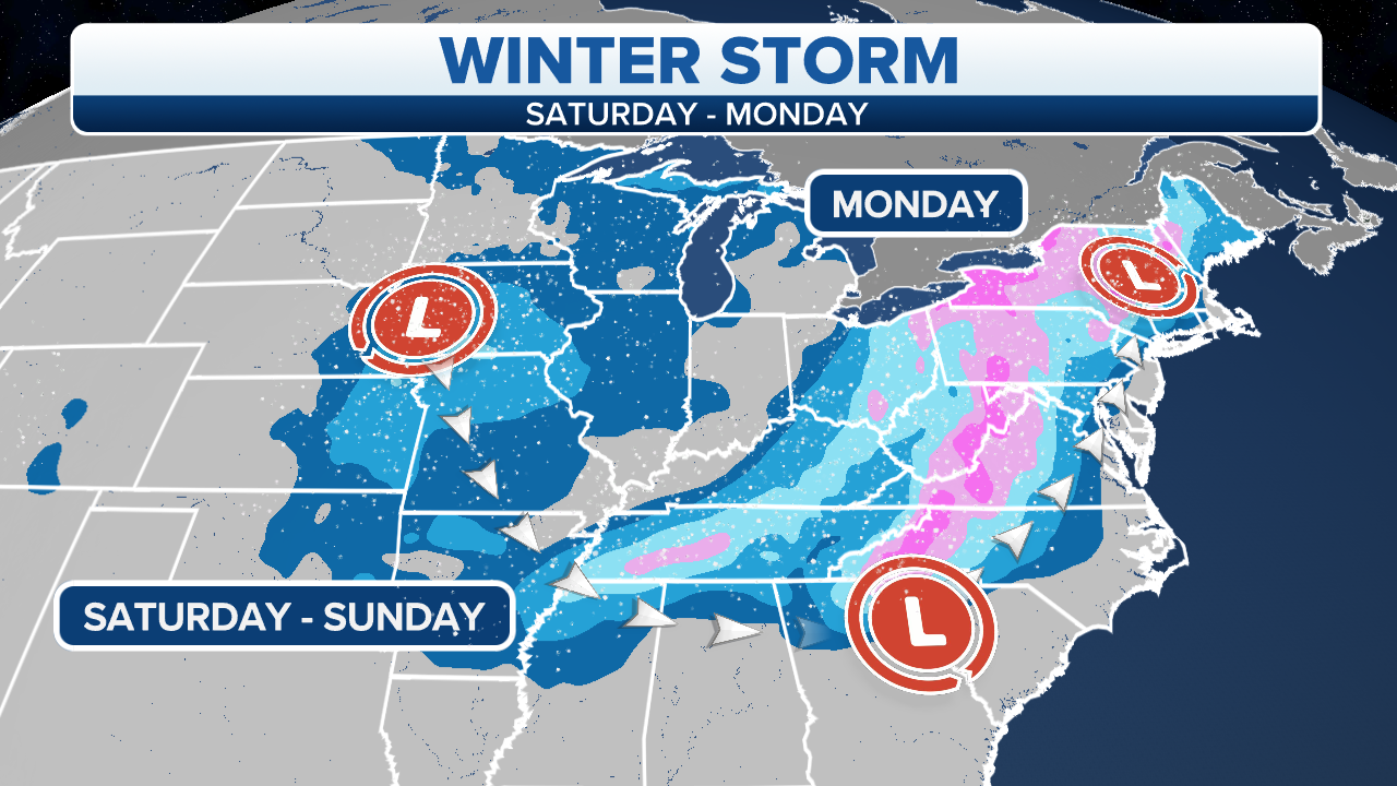
FOX Weather is tracking a high-impact winter storm that's going to affect two-thirds of the U.S. through Monday. More than 76 million people are under a winter storm alert Saturday morning. We are live in Iowa, Missouri, North Carolina and Tennessee.
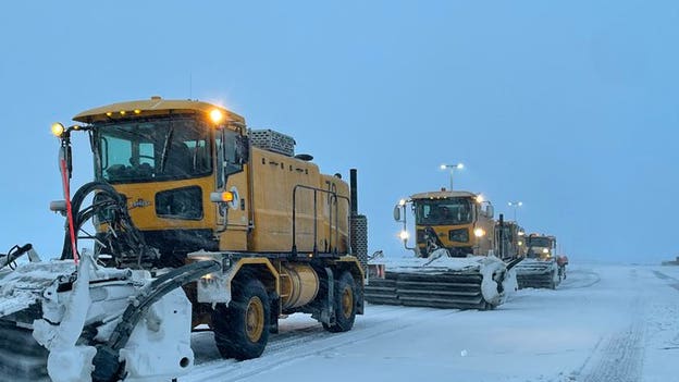
Crews from the Kansas City, Missouri, Aviation Department and airlines were out before dawn Saturday to tackle the snow. The airport said the airfield will be ready for the Pittsburg Steelers arrival for their bout with the Kansas City Chiefs on Sunday in the NFL wild-card game.
Sections of the Midwest are under a Winter Storm Warning with the National Weather Service saying travel will likely be dangerous at times.
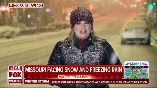
Here’s a look at the weather conditions in Columbia, Missouri, on Saturday morning.
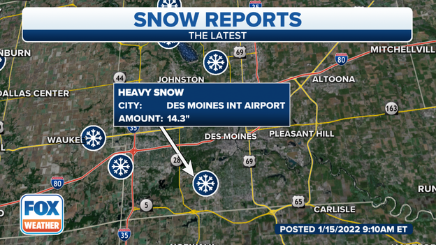
The highest snow report from this winter storm moving through the Midwest is from Des Moines, Iowa, with 14.3 inches.
It's their greatest two-day snow since Dec. 8-9, 2009, and eighth greatest on record.
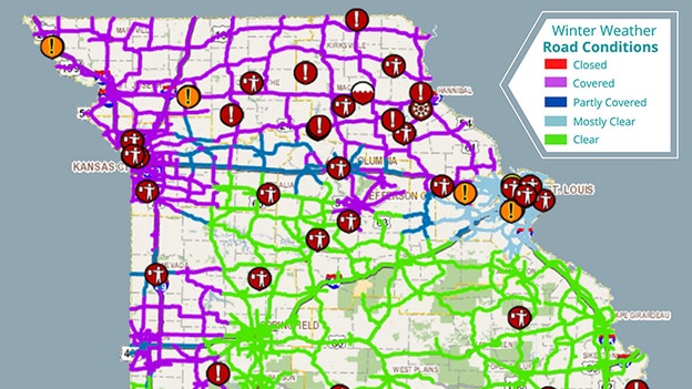
Crashes are stacking up on Missouri highways, according to the Missouri State Highway Patrol.
Trooper are currently out on Interstate 49 between Harrisonville and Peculiar after a semi-truck jackknifed.
"Most all other counties have slide off / crashes were troopers are responding to," the patrol said in a tweet.
The Missouri Department of Transportation said a lot has changed in just a few hours.
"The storm is now impacting travel conditions for more than half the state, including most major interstates and US routes," the department said in a tweet.
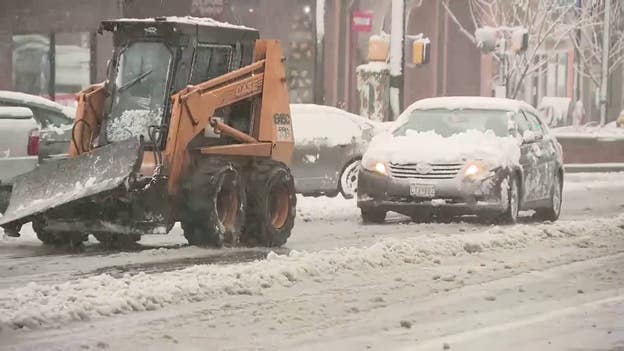
Be sure to give plows extra space as they work to clear the roads.
Snow-covered Iowa is waking up Saturday morning to some messy roads and bitter cold.
The Missouri Department of Transportation said drivers should use extreme caution if they must be out on the roads Saturday morning.
"Know the road conditions before you leave the house," MoDOT said in a tweet.
Snow will spread southward through the day Saturday into portions of southern Missouri, southern Illinois, western Kentucky, eastern Kansas, eastern Oklahoma and northern and western Arkansas. The snow could be locally heavy at times in some areas.
FOX Weather's Hunter Davis is in Columbia, Missouri, to show us what it's like there.
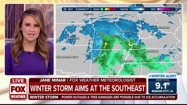
Winter Storm Watches, Winter Storm Warnings and Ice Storm Warnings are now in effect for the Southeast ahead of a major winter storm.
Snow is expected to come to an end by early Saturday afternoon in Kansas City, Missouri.
The National Weather Service said an additional 1 to 2 inches of snow is expected over the area.
Hazardous travel conditions are expected. You can check Missouri road conditions here.
A major winter storm currently impacting the Midwest will snarl travel as it tracks from the Midwest to the South and then up the East Coast with heavy snow, ice and strong winds through the Martin Luther King Jr. holiday weekend.
Live Coverage begins here
