WEATHER WIRE: Snow, ice disrupting travel from Texas to New England
The system is unleashing a variety of winter weather hazards, including heavy snow, sleet and freezing rain. Even severe weather was reported in the South on Thursday.
Coverage for this event has ended.
The FOX Weather 3D Radar is tracking heavy snow and freezing rain moving through the Northeast. Download the free app now to follow the movement of the winter storm.
Apple App Store download: Click Here
Google Play Store download: Click Here
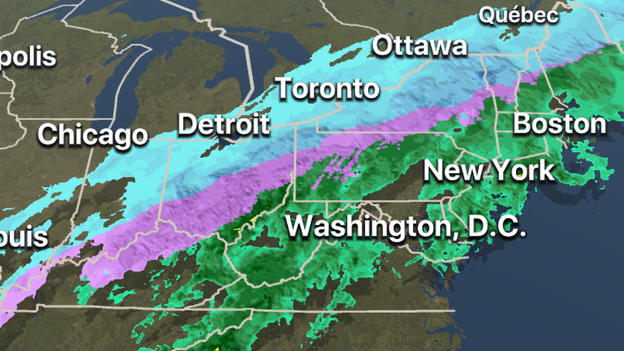
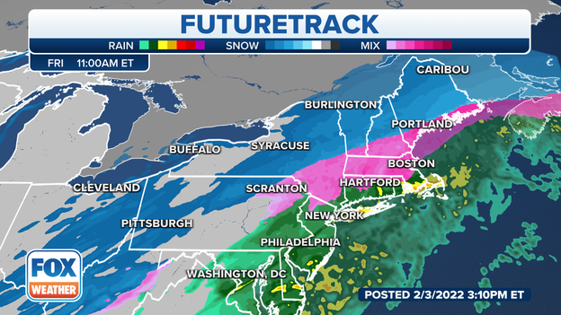
Residents in the Northeast could see a variety of forms of precipitation on Friday. Most of the precipitation along the coast will remain in the liquid form of rain. Areas further inland are expected to see freezing rain and locations in interior New England and the Northeast will see mostly snow thanks to colder air.
Latest forecast: Click Here
Ice on powerlines is causing big issues for electric workers from Texas into the Northeast. Restoration crews say it could take days for all of the power to be restored.
Travel is not recommended in parts of Ohio and Pennsylvania overnight because of the ice and heavy snow. These areas are expected to see more than half a foot of snow which will make travel treacherous.
Latest forecast: Click Here
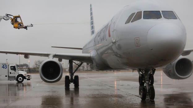
American Airlines canceled all flights bound for Dallas Fort Worth International Airport on Thursday evening. The airlines said conditions are having a significant impact on operations
Statement: "Due to conditions at the airport, the remainder of flights bound for DFW this evening have been canceled and we anticipate additional impact through tomorrow morning. We apologize to our customers whose travel plans may be affected and want to thank our team who is working tirelessly to help safely care for our customers.”
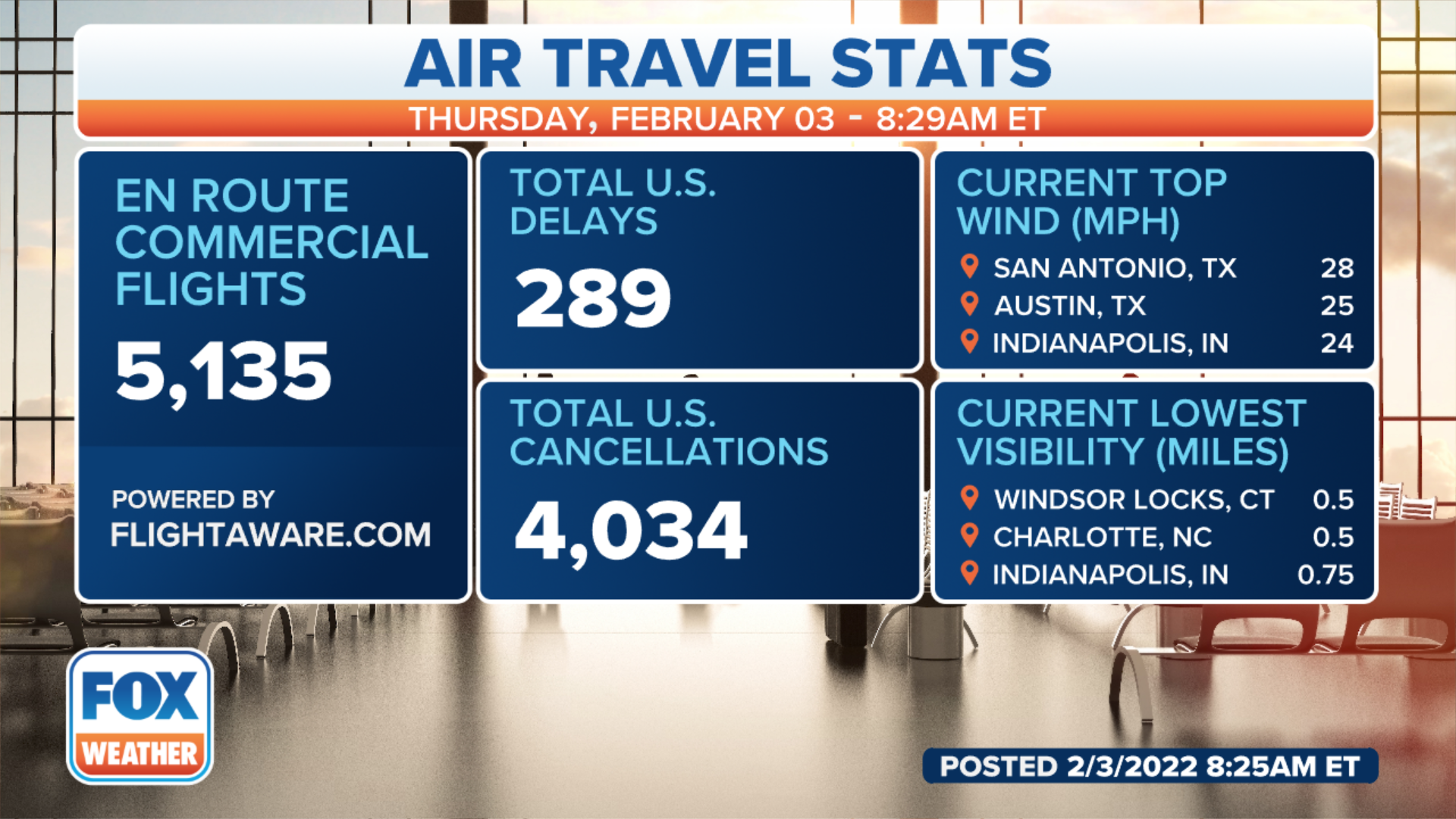
FlightAware reported more than 5,200 flights across the U.S. were canceled on Thursday and more than 2,000 flights have already been canceled on Friday.
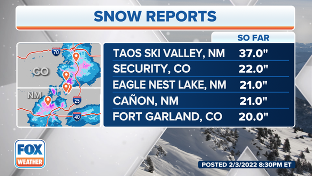
Mountains in northern New Mexico saw the largest accumulations from the winter storm. More than three feet of snow was reported at the Taos Ski Valley. See how your city fared: Click Here
Ohio DOT says they have more than 1,300 crews working to clear roadways in the Buckeye State. Heavy snow is responsible for forcing the closure of I-75 for several miles in the Dayton area on Thursday afternoon. Before the winter storm exists the region more than half a foot of snow could fall on a wide swath of the state.
Latest forecast: Click Here
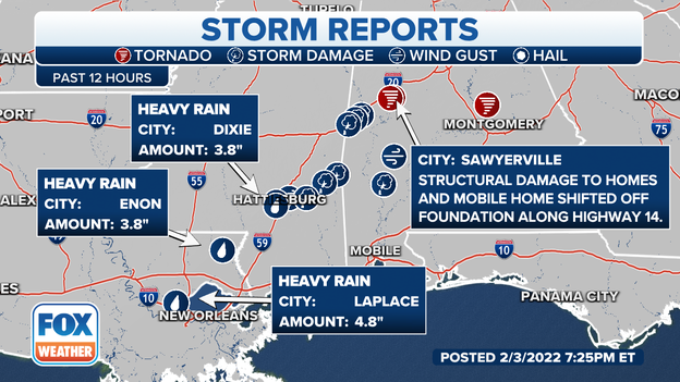
Thunderstorms ahead of the cold front sweeping across the South dropped inches of rain. In just the past 12 hours, take a look at these rainfall amounts:
- Enon, Louisiana 3.8"
- La Place, Louisiana 4.8"
- Dixie, Alabama 3.8"
Monroe, Baldwin and Clarke Counties in Alabama are under a Flash Flood Warning until early Friday morning. Emergency managers report that many roads are flooded and impassible after the area saw 3-5 inches of rain today. Those counties could see 2-4 more inches of rain.
Those same thunderstorms spawned a deadly tornado in Hale County, Alabama and two more potential tornadoes.
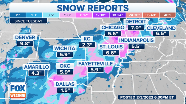
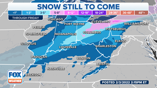
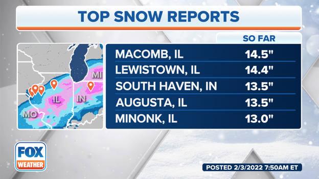
Most major cities from Oklahoma to Ohio have reported accumulations of around 5" but several rural areas have seen more. Snowfall totals of between 12" and 18" inches can be found in Illinois and parts of Indiana. Snow is expected to taper off on Friday as the system continues to push eastward.
Here's who has seen the ice and snow: Click Here
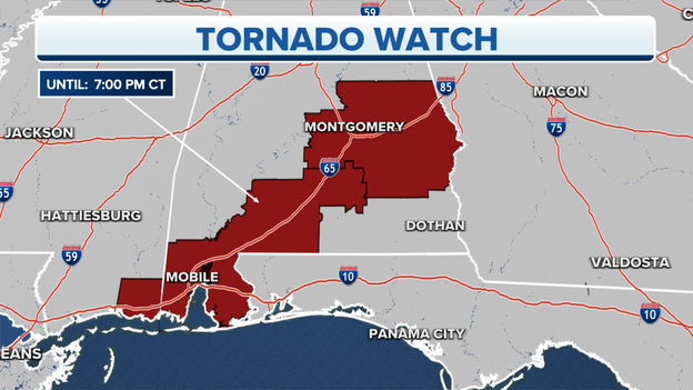
An area from Mobile, Alabama to Montgomery, Alabama remains under a Tornado Watch until 8 p.m. local time. One tornado was confirmed in Hale County where a woman died in the rubble of her home.
Emergency managers pulled the body of a woman from the rubble of her home reports WBRC FOX 6. Three more people have critical injuries and five people suffered minor injuries.
The tornado hit Hale County, Alabama this afternoon.
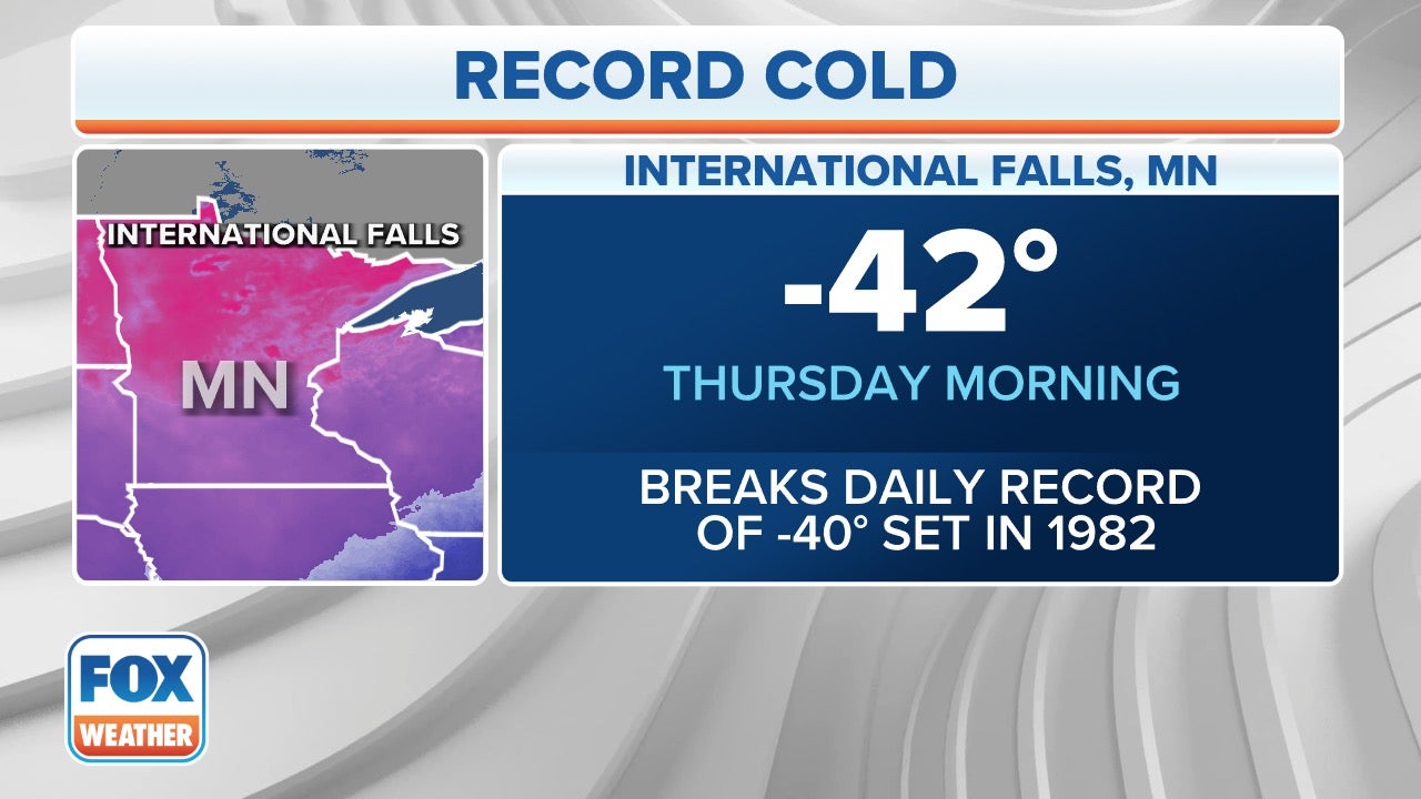
The winter storm pushing through the country is helping to usher in dangerously cold temperatures.
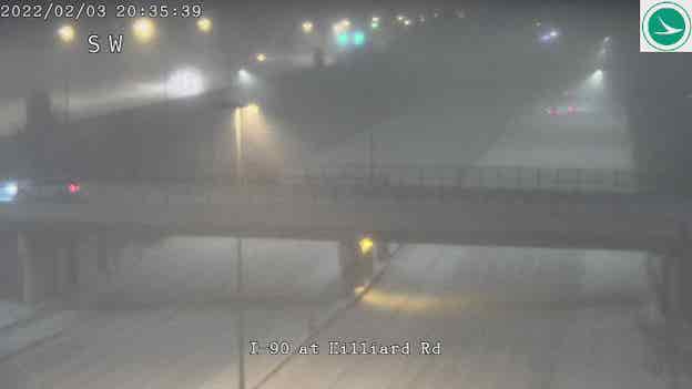
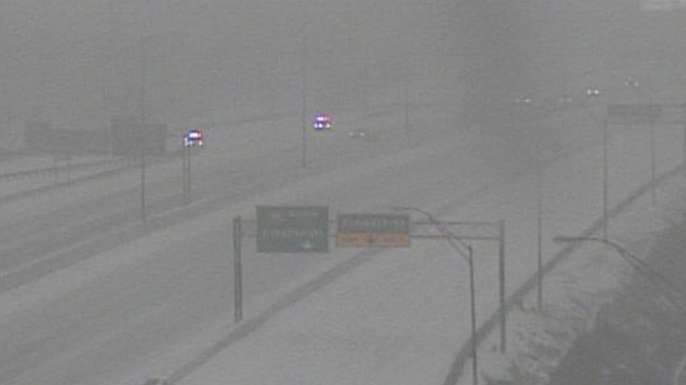
Due to the combination of several crashes and heavy snow, officials closed I-75 in Dayton, Ohio on Thursday afternoon. Police say traffic is being rerouted onto surface streets.
Snow is forecast to last for several more hours and forecast models show the area could pick up on more than half a foot of snow.
Here's what to do if you were involved in a weather-related crash: Click Here
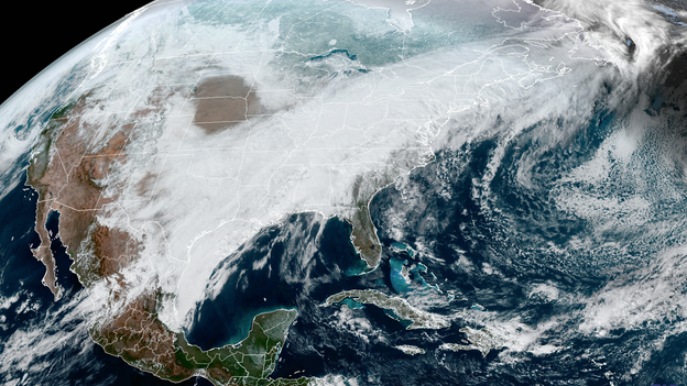
Image from the GOES-16 satellite shows the breadth of the winter storm that spans over 2,000 miles.
As freezing rain transitions into snow, areas north of the Ohio River will see the heaviest accumulations.
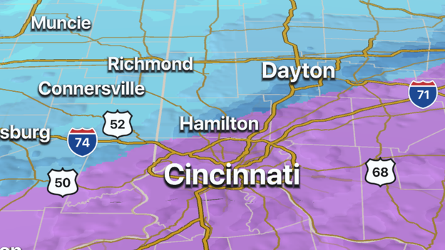
Cincinnati could see 3-5 inches of snow and areas between Columbus and Cleveland could see upwards of an additional 8 inches of new snow.
Latest forecast: Click Here
A Tornado Warning has been issued for Autauga, Dallas and Lowndes counties in Alabama until 4:30 p.m. A severe storm capable of producing a tornado was located near Selmont and moving northeast at 40 mph.
The FOX Weather 3D Radar is tracking a mixture of freezing rain and snow over southern Ohio.
Hamilton County, Ohio is now under a Level 2 Snow Emergency and officials warn road conditions are hazardous.
Download the free FOX Weather app to track the heavy snow overnight.
Apple App Store download: Click Here
Google Play Store download: Click Here
A tornado warning has been issued for southeastern Tuscaloosa County, northwestern Shelby County, northeastern Bibb County and southern Jefferson County which includes southwest Birmingham.
A severe thunderstorm capable of producing tornadoes is moving northwest at 45 mph.
The warning continues until 4:15 p.m. CST.
With heavy snow and ice in Missouri, snow plows have driven hundreds of thousands of miles Wednesday, according to the Missouri Dept. of Transportation.
“Our plows have driven nearly 800,000 miles already this storm," said Bekcy Allmeroth, MoDOT Chief Safety and Operations Officer. "That's three times the distance from the Earth to the moon."
By Friday, crews will be on their third 12-hour shift this week, MoDot said.
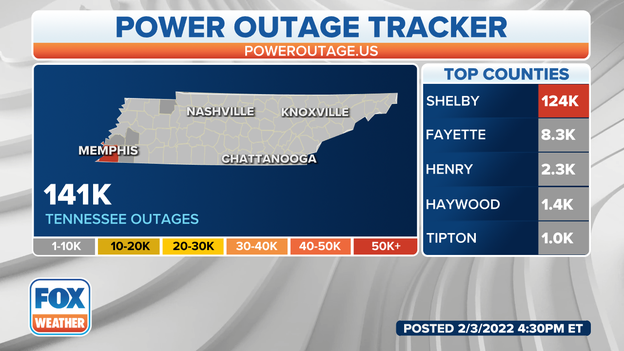
FOX Weather's Will Nunley is reporting live from Memphis, Tenn. where ice is covering the landscape, causing widespread power outages and travel dangers across the region.
Watch his latest update here.
FlightAware reports 4,963 flights were canceled on Thursday- many due to the winter storm.
Flight cancellations extend into Friday with nearly 1,500 flights that have already been impacted. Airports with the most impacts on Friday include Newark Liberty International, Boston Logan International and John F. Kennedy International.
Here’s where the weather will be the worst: Click Here
Due to the forecast of a wintery mix, all public schools in Boston will be closed on Friday. The city is under a Winter Weather Advisory due to the threat of freezing rain and sleet.
Forecast models show the mixed precipitation is expected to begin overnight and driving could be treacherous during Friday’s morning commute.
Here’s what you need to know if you plan on driving in the wintery mess: Click Here
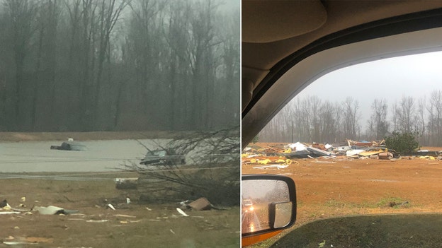
Bryan Wilson took these photos when he came across possible tornado aftermath in North Sawyerville, Alabama. He said two trucks had been thrown in a nearby pond.
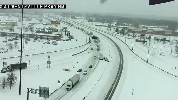
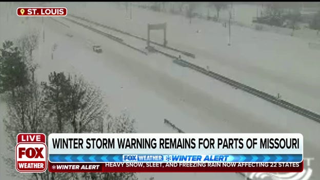
Snow accumulations of more than half a foot are causing travel problems around the St. Louis metro. Crews are working to clear a jackknifed tractor-trailer along I-70, to the northwest of the city. Closures are expected to last for a significant amount of time.
The snow is tapering off for the St. Louis metro area as the winter storm moves northeastward.
Latest forecast: Click Here
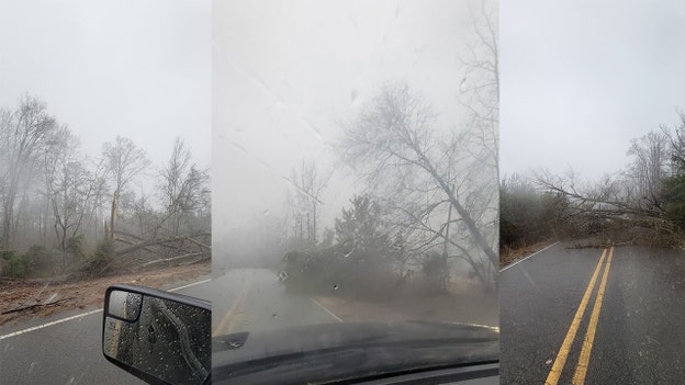
Several trees were down in Demopolis, Alabama on Highway 13 from the severe winter storm.
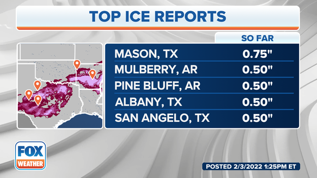
The winter storm produced significant ice totals in both Texas and Arkansas. Mason, Texas reported total ice accretion of three-fourths of an inch. The freezing rain and sleet has moved out of parts of western Texas and is the heaviest right now in the Ohio Valley.
If you have ice on your car, here's how to remove it the right way: Click Here
FOX Weather Meteorologist Ian Oliver provides the latest on the radar-confirmed tornado in Alabama.
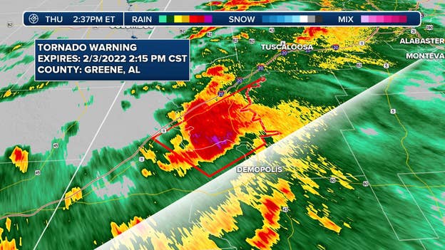
Now is the time to shelter for Greene and Sumter counties.
A tornado warning has been issued by the NWS in Birmingham for Southern Greene County and Sumter County.
At 1:18 p.m. CST, a tornado producing storm was located near The University Of West Alabama, or near Livingston, moving northeast at 45 mph.
The warning is in effect until 2:15 p.m. CT.
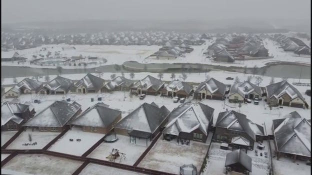
Snow and sleet fell across the Dallas-Fort Worth area on Thursday making roads in northern Texas treacherous.
Drone footage captured by Matt Lantz shows snow-capped homes in Parker County.
A wintry mix including freezing rain and sleet continue to fall across the I-35 corridor. Into the evening hours travel will remain hazardous as any precipitation will likely freeze over.
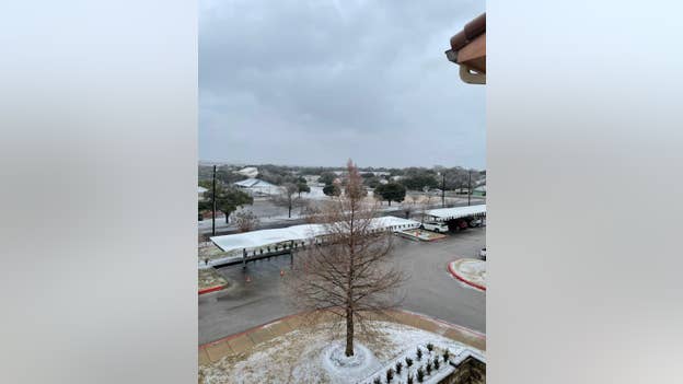
A FOX Weather Watcher sent us this photo from Dripping Springs, Texas.
The National Weather Service in Austin/San Antonio said this area of activity is forming along an area of enhanced energy aloft, and has sufficient moisture to work with as it continues its push to the northeast.
You can expect impacts in the Dropping Springs area over the next 2-3 hours.
Make sure to follow FOX Weather on social media for more videos, photos and coverage of this winter storm. Don't forget to tag us in your weather photos or use #FOXWeather.
FOX Weather on Facebook: facebook.com/FOXWeather
FOX Weather on Twitter: twitter.com/FOXWeather
FOX Weather on Instagram: instagram.com/FOXWeather
FOX Weather on TikTok: tiktok.com/@officialfoxweather
FOX Weather on YouTube: youtube.com/foxweather
About 70,000 Texans are without power Thursday as the state sees significant icing across mainly northern parts of the state.
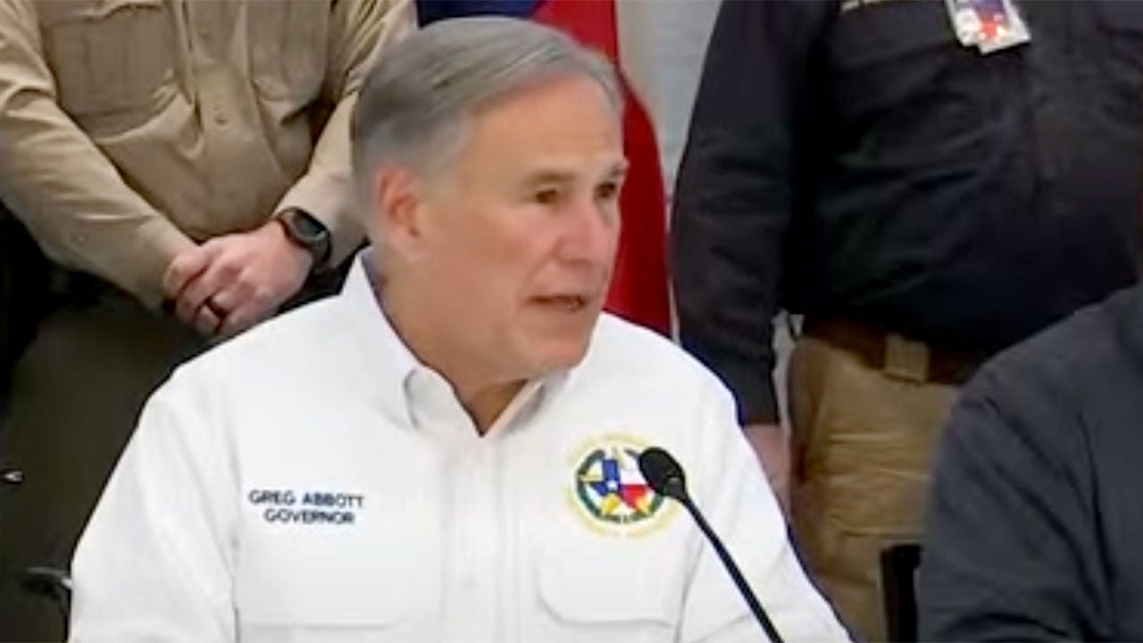
"We are dealing with one of the most significant icing events that we’ve had in the state of Texas in at least several decades," Texas Gov. Greg Abbott said during a news conference at the State Operations Center.
FOX Weather wants to see your winter storm photos and video. Email weather@fox.com for a chance to be featured on FOX Weather.
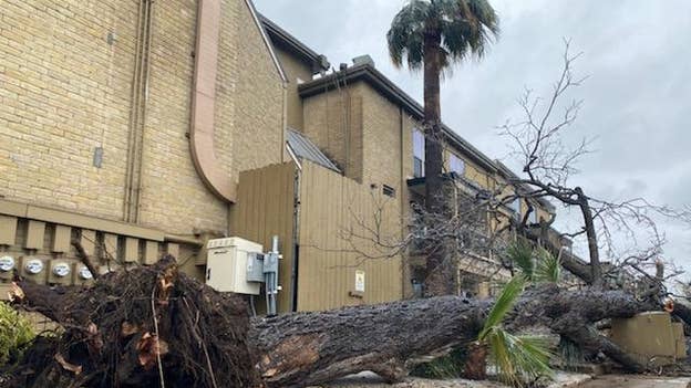
AUSTIN, Texas -- One person was injured after a tree fell on him.
Ice and sleet accumulations were forecast for portions of the Winter Storm Warning in the area where significant icing impacts have occurred.
Authorities were called about 9 a.m. Thursday to the Oak Park Apartment on West Duval.
The man was taken to an area hospital and expected to survive.
"Our crews were called out to shut off the water, but the damage appears to be on the property owner side. The apartment manager will be responsible for making the repairs,” Austin Water told FOX 7 in Austin.
Damage was reported to the building as well as a water device and power apparatus. Austin Energy is working to repair power in the area.
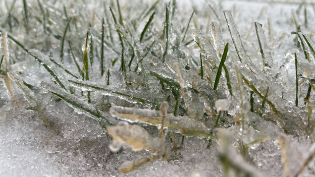
A thick layer of ice is covering grass, bushes and trees in Paducah, Kentucky.
The NWS Paducah office is forecasting up to a quarter inch of ice through Thursday night.
Gov. Greg Abbott will provide an update on the severe winter weather impacting the state of Texas. (Video Credit: KTBC)
Thousands of power outages have been reported due to the winter storm. Texas, Arkansas and Tennessee are seeing the most so far.
We will be covering the storm all day on FOX Weather. Make sure to watch for updates.
Here’s a look at the biggest snowfall and ice amounts reported so far, according to the National Weather Service.
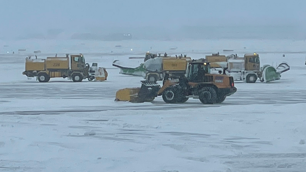
Dallas-Fort Worth International Airport has one runway back open after crews worked all morning treating the airport for ice and snow.
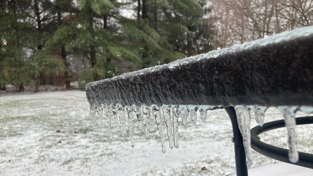
FOX Weather Watcher Tim Wolff sent us this photo from Waynesville, Ohio.
The National Weather Service in Wilmington, Ohio, said travel conditions are bad and getting worse. A transition to snow for areas south and east of Interstate 71 won't occur until later this afternoon. Sleet (with some freezing rain) is the predominant precipitation type right now, and it's raining in Southeast Ohio.
Make sure to follow FOX Weather on social media for more videos, photos and coverage of this winter storm. Don't forget to tag us in your weather photos or use #FOXWeather.
FOX Weather on Facebook: facebook.com/FOXWeather
FOX Weather on Twitter: twitter.com/FOXWeather
FOX Weather on Instagram: instagram.com/FOXWeather
FOX Weather on TikTok: tiktok.com/@officialfoxweather
FOX Weather on YouTube: youtube.com/foxweather
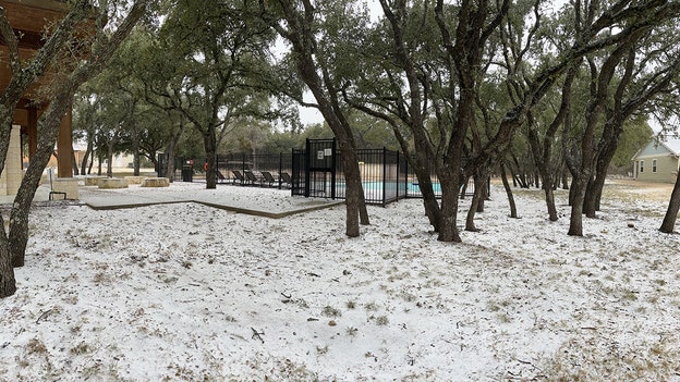
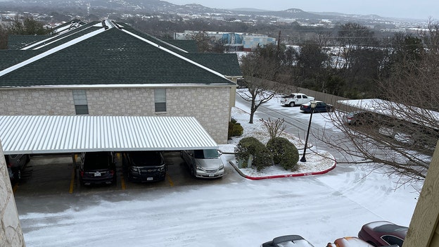
FOX Weather Watcher Ben Friberg sent us this photo from Kerrville, Texas.
The National Weather Service in Austin/San Antonio said most areas are now below freezing, with only parts of the Coastal Plains remaining at or just above freezing.
Sleet and freezing rain has been reported across Travis County already, with reports starting to come in from Bexar County.
Make sure to follow FOX Weather on social media for more videos, photos and coverage of this winter storm. Don't forget to tag us in your weather photos or use #FOXWeather.
FOX Weather on Facebook: facebook.com/FOXWeather
FOX Weather on Twitter: twitter.com/FOXWeather
FOX Weather on Instagram: instagram.com/FOXWeather
FOX Weather on TikTok: tiktok.com/@officialfoxweather
FOX Weather on YouTube: youtube.com/foxweather
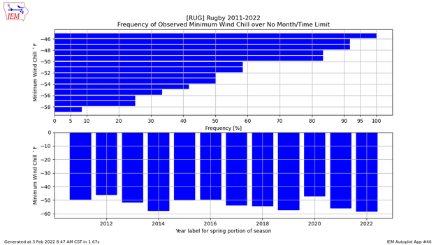
With a -54 degree wind chill, Rugby, North Dakota had the coldest weather of the day. Wind chills this frigid actually occur about 40-50% of the time during the winter in Rugby, according to FOX Weather Data Specialist Shane Brown.
FOX Weather's Will Nunley noticed a tree starting to lean and not even 10 minutes later when he passed by, it had fallen. Thousands are without power in Memphis, Tennessee, as the ice continues to build.
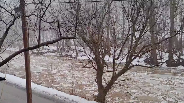
Ice is fast-flowing down Fish Creek in Marshall County West Virginia. See the full video here.
A semi-truck driver learned the hard way that you should give snowplows plenty of room on the roads.
The truck attempted to pass a snowplow this morning on U.S. 24 in Paulding, Ohio. Fortunately, nobody was injured.
Some places in Central Illinois got up to a foot of snow with this winter storm. FOX Weather’s Max Gorden has been tracking the action as the region now gets round two. Here is his report from Champaign, Illinois.
The Indiana DOT reports 140 Yellow Truck snow plow crews are still out clearing roads. Conditions are quickly deteriorating as ice builds in southwest Indiana.
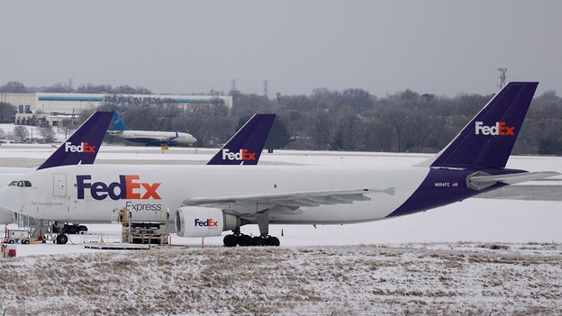
FOX Weather multimedia journalist Will Nunley reports that ice is causing FedEx to have substantial issues in Memphis. Click here to watch his latest report.
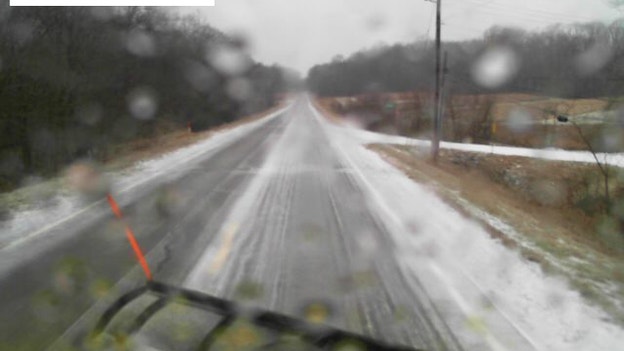
An Ohio Department of Transportation driver was unharmed Wednesday morning in Columbiana County on State Route 164.
The driver was taking it slow treating the roads when he hit the ice and slid off the road.
"This goes to show it doesn't matter what vehicle you're driving, ice is NOT forgiving," the transportation department said in a tweet.
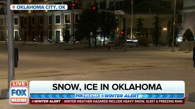
Crews work to keep the tracks clear for the streetcar in Oklahoma City, Oklahoma, on Feb. 3, 2022.
The Oklahoma Department of Transportation said travel in most parts of the state is strongly discouraged as more counties are affected by the low temperatures, new rounds of winter precipitation and blowing snow.
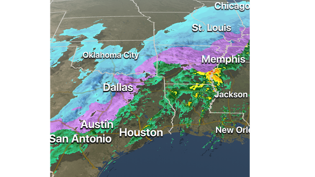
The FOX Weather 3D radar shows freezing rain, sleet and some snow are ongoing as of 8:30 a.m. Central time as far south as North and Central Texas, including the Dallas/Fort Worth, Austin and San Antonio metro areas, where icy roads are creating slick travel conditions.
A large area of snow and ice also extends northeastward into parts of the Midwest and interior Northeast. Up to an inch of sleet is reportedly covering the ground around the Little Rock, Arkansas, metro area right now.
A massive tree fell in midtown Memphis due to ice accretion. Memphis is under an Ice Storm Warning right now.
This photo was taken near Central Avenue and Anderson Street where a driver careened into the tree. No injuries have been reported at this time.
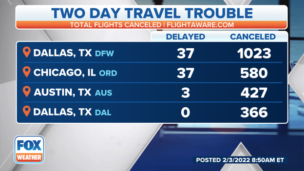
It is quite the mess in Dallas with over 1,000 flights canceled at Dallas-Fort Worth International Airport through tomorrow. There are 900-plus canceled today alone.
Another 360 flights were canceled at Dallas Love Field Airport.
Be sure to pack your patience today.
This sprawling winter storm got underway Tuesday night and Wednesday in the Rockies and Midwest.
Between 6 and 11 inches of snow fell in the Denver metro area, while up to 22 inches was measured in the higher elevations south and southwest of Colorado Springs, Colorado.
At least 6 inches of snow was reported over a broad area from northeastern Missouri into central and northern Illinois and northwestern Indiana, including portions of Chicagoland.
As of Thursday morning, the top snowfall total in the Midwest was 14.5 inches in Macomb, Illinois.
Up to three-tenths of an inch of ice was reported in Altamont, Illinois, from freezing rain on Wednesday afternoon.
One-quarter inch of ice accretion was measured in Preston, Missouri, while other parts of Missouri and southern Illinois recorded 0.15 to 0.20 inches of ice.
Many airlines have canceled or delayed flights around the country, including Memphis International Airport (MEM), due to snow and ice.
Be sure to check your airline before heading to the airport. You can keep up with all MEM flight statuses on their website here.
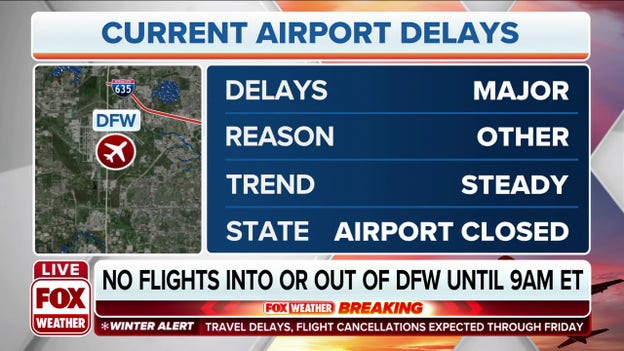
The FAA has grounded all flights in and out of DFW Airport (Dallas, TX). The airport will be closed until 12 p.m. Eastern due to issues with a massive winter storm.
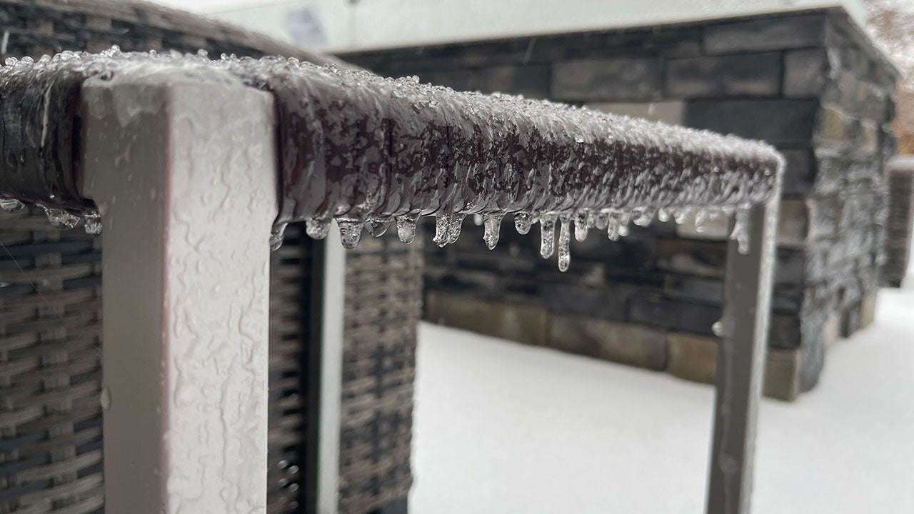
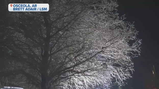
An Ice Storm Warning is in effect across much of the Mid-South through Thursday and freezing rain has begun to fall in the region. Ice is covering signage, trees, the grass and even areas of the roadway are dealing with frozen conditions.
Freezing rain was also beginning in the Memphis area where some freezing fog was also present near the I-40 bridge and Bass Pro Shops. Significant icing is expected by morning.
FOX Weather is keeping you updated this morning on any issues on the roads and skies.
Make sure to follow FOX Weather on social media for more videos, photos and coverage of this winter storm. Don't forget to tag us in your weather photos or use #FOXWeather.
FOX Weather on Facebook: facebook.com/FOXWeather
FOX Weather on Twitter: twitter.com/FOXWeather
FOX Weather on Instagram: instagram.com/FOXWeather
FOX Weather on TikTok: tiktok.com/@officialfoxweather
FOX Weather on YouTube: youtube.com/foxweather
When forecasters tell you an ice storm is on the way, you probably don't need anyone to remind you that roads are going to turn slippery and become dangerous to drive on.
But what you might not know is whether the ice will pose other threats to life and property such as long-duration power outages and severe tree damage. It all depends on the amount of ice that's expected during the storm. Click here to read more.
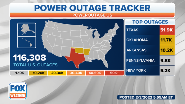
There are currently 116,308 power outages being reported across the U.S. early Thursday morning. The majority of the outages, nearly 52,000, are in Texas, where snow, sleet and freezing rain are falling across northern and central portions of the state.
More than 11,000 customers are without power in Oklahoma, and over 10,000 are in the dark in Arkansas. Snow and ice are also being reported in parts of those states.
Video shared with FOX Weather by Kyle Sikes (@ILoveTornadoes) on Twitter showed ice was being to accrete on elevated surfaces in Waco, Texas, about halfway between Dallas and Austin.
As of early Thursday morning, Winter Storm Warnings extend continuously from Crockett County, Texas, all the way to Aroostook County, Maine, on the border with New Brunswick, Canada. That's a distance of 2,120 miles as the crow flies.
More than 114 million people are currently under National Weather Service winter weather alerts for snow and ice.
Heavy rain has resulted in flooding in parts of Central Texas early Thursday morning, triggering the closures of 56 low-water crossings in the Austin metro area. Another 18 low-water crossings are closed in the San Antonio metro area.
The National Weather Service said falling temperatures will likely lead to icy roads later this morning as the rain changes over to freezing rain across Central Texas.
The flash flooding risk will increase by Thursday afternoon in portions of the Southeast. Click here to read about this threat.
Live Coverage begins here
