WEATHER WIRE: Tornadoes race across South during multiday severe weather outbreak
A multiday severe weather outbreak with tornadoes, damaging winds, large hail and flash flooding is expected to continue through Wednesday.
Coverage for this event has ended.
Follow live updates on the rolling warnings and watches being issued by the NWS as severe weather moves east.
A storm chaser told FOX Weather that he hadn't seen anything like this Texas outbreak in quite a while.
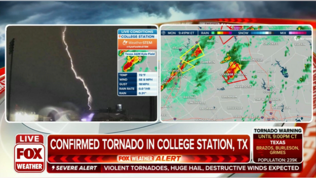
Significant damage was reported in Madison and Houston counties during the overnight hours.
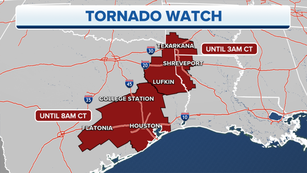
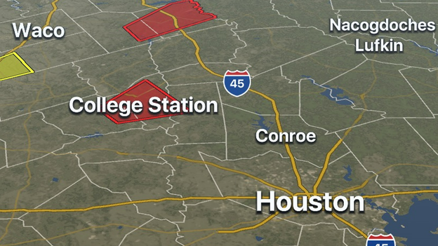
The Tornado Watch has been extended southward, which no includes cities like Houston, Galveston and College Station.
The Tornado Watch will be in effect for parts of Texas until 8 AM CDT.
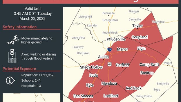
A Flash Flood Warning has been issued for several counties in Texas that include Austin.
The NWS says that 1-3 inches of rain have already fallen in the area and they expect another 1-3 throughout the rest of the overnight hours.
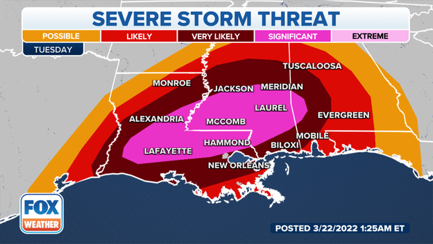
The system producing the severe weather over the South is expected to trigger more rounds of severe storms on Tuesday across parts of the South.
Tuesday's forecast: Click Here
See more video from the area around Austin: Click Here
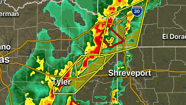
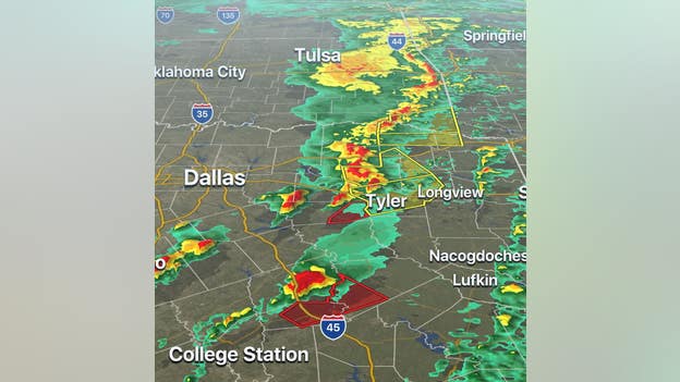
The FOX Weather 3D Radar is tracking two cells that could produce tornadoes in the eastern part of Texas. One storm is near Nacogdoches, Texas and the other is in the Ark-La-Tex region.
The National Weather Service has issued Tornado Warnings for the counties being impacted by both storms.
Download the FOX Weather App now and track the storms.
Apple App Store download: Click Here
Google Play download: Click Here
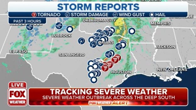
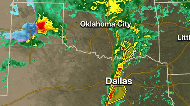
The National Weather Service so far amassed 66 reports of strong winds, tornadoes and large hail across Texas and Oklahoma. The line of storms continues to push east toward Arkansas and Louisiana.
Storm tracker Von Castor describes to FOX Weather the intense scene from Round Rock, Texas earlier this evening.
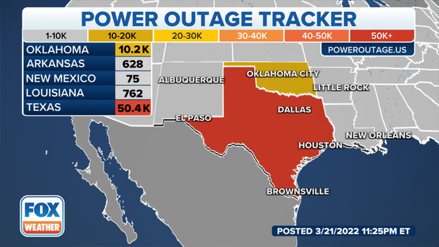
Almost 41,000 homes and businesses in Texas lost power from the storms. 32% of Madison County and 21% of Jack County, Texas are in the dark.
Over 10,000 in Oklahoma lost power including 67% of Marshall County.
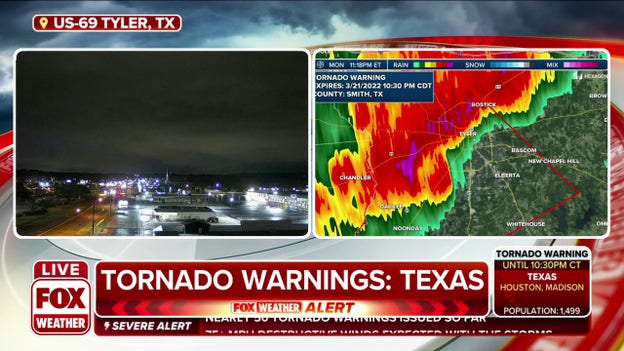
There have been reports of a tornado with the storm currently headed towards Tyler, Texas.
The Tornado Warning lasts until 11 p.m. CT.
Take shelter immediately if you live in the area.
Tornado warnings and severe thunderstorm warnings are ongoing at this hour in Texas.
Storms will continue to push east throughout the night.
A drone operator captured video of a tornado that moved through Elgin, Texas.
The severe storm threat will continue into the evening hours.
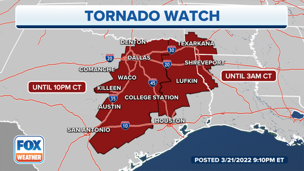
A Tornado Watch has been issued for parts of eastern Texas, Louisiana and Arkansas until 3 a.m. CDT.
Meteorologists warn conditions will continue to be favorable for tornadoes to develop during the overnight hours.
Latest Forecast: Click Here
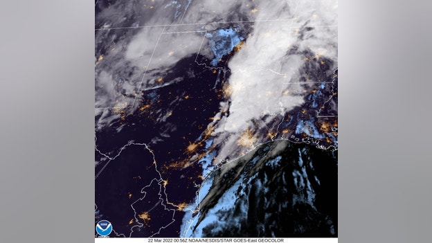
Visible satellite gives a view of the ongoing storms along with the night lights of the major cities in Texas.
Storms will continue to push east throughout the evening.
The Round Rock Police Department says two temporary shelter locations are being set up for storm victims. One will be at the Dell Diamond Heritage Center (3400 E Palm Valley Blvd) and the other will be Redbud Elementary School (1500 Ty Cobb Place).
Video shows extensive damage to a school in Jacksboro, Texas after a tornado ripped through the area.
At least one school in north-central Texas was damaged during the severe storms. Significant damage was reported at Jacksboro High School, where buildings and a gym appear to have sustained damage.
See more damage photos: Click Here
Video from central Texas shows a tornado moving through areas around Round Rock/
More than 80,000 power outages were reported as of Monday evening throughout Texas and Oklahoma according to PowerOutage.US.
Several reported tornadoes rolled the state: Click Here
Due to storms, air travel at the Dallas Fort Worth has been temporarily halted.
Hundreds of flights canceled: Click Here
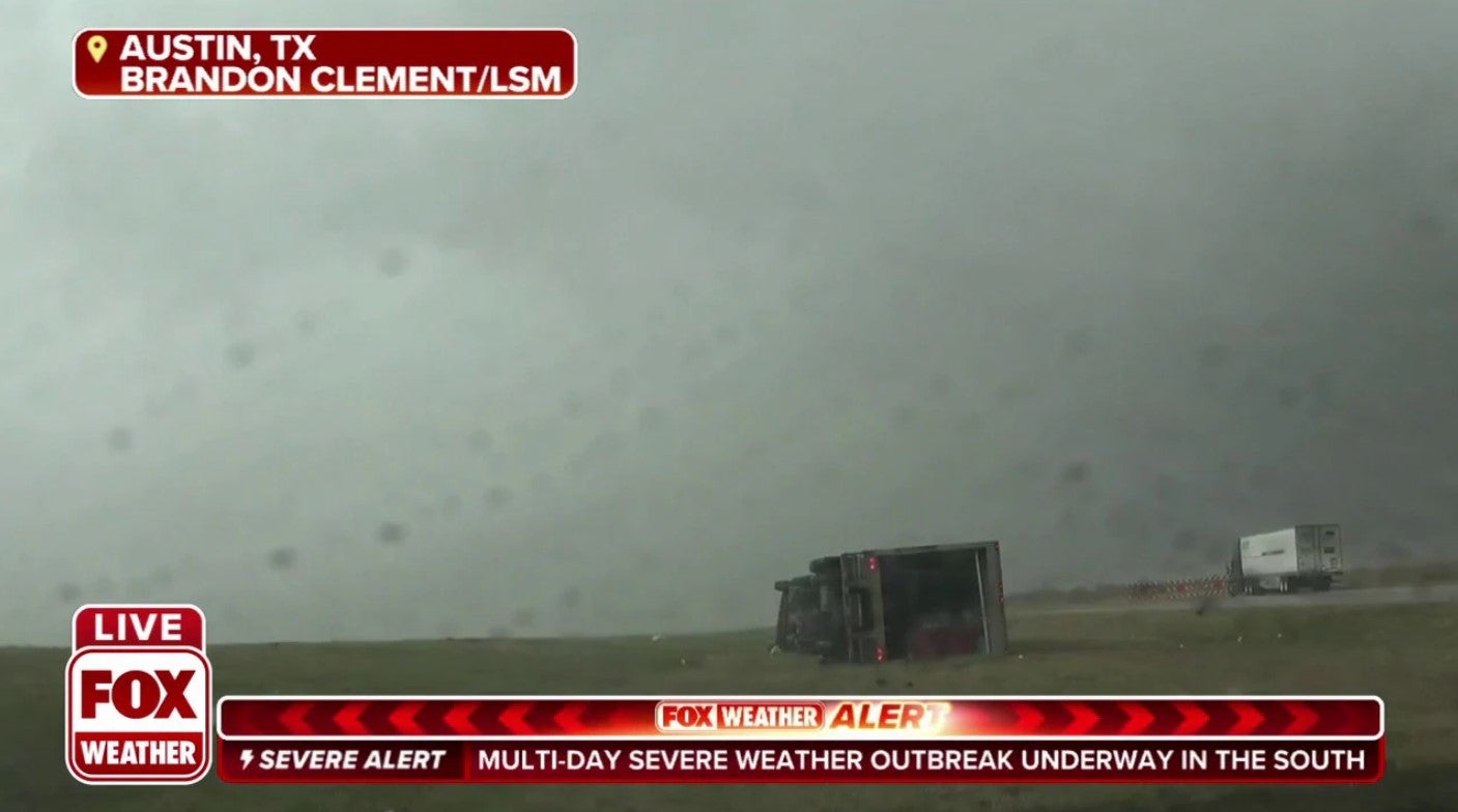
A tractor-trailer near Austin, Texas was blown over during the severe storms.
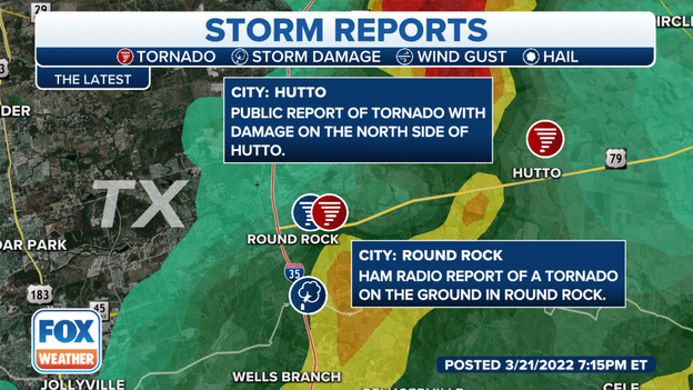
Multiple reports and photos show that a tornado passed through Round Rock, TX and crossed I-35.
This is one of several reported tornadoes across The Lone Star State this afternoon.
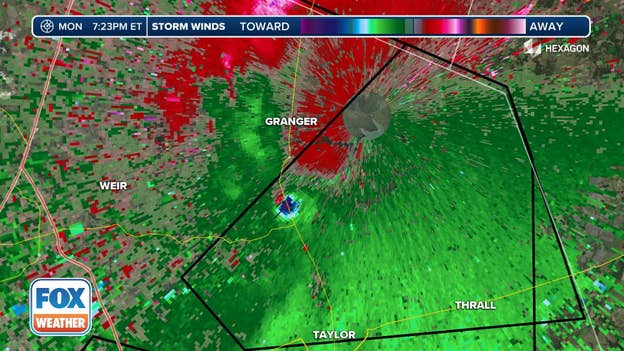
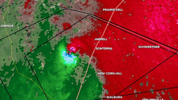
Strong rotation has been detected on radar near Jarrell, Texas along I-35.
Meteorologists say this means a tornado is likely on the ground and moving to the northeast through Williamson County.
Watch live coverage: Click Here
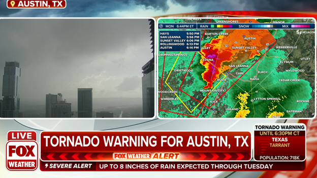
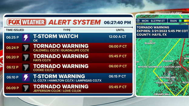
A Tornado Warning has been issued for Hays and Travis counties, which includes the city of Austin, until 6:15 p.m. CDT.
Meteorologists were tracking a severe thunderstorm capable of producing a tornado near Buda, moving northeast at 35 mph.
If you are in the path of the possible tornado, experts advise you to take cover in a basement or an interior room.
Two storms developing between San Antonio and Austin have triggered meteorologists to issue Tornado Warnings.
The storms will continue to push off to the north and the east at around 25 mph.
Storms earlier in the day caused damage in north-central Texas: Click Here
Several structures were reported damaged in Jacksboro, Texas after an apparent tornado moved through the town.
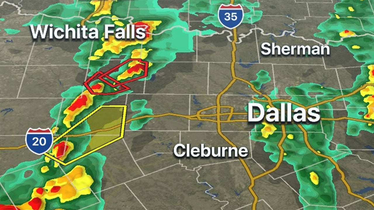
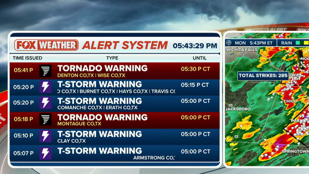
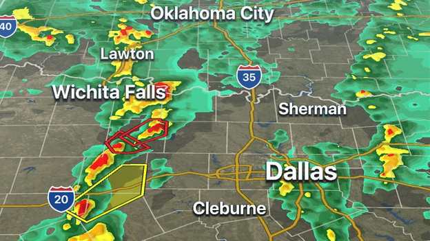
Meteorologists are tracking a storm with rotation in Wise and Denton counties that is capable of a tornado. Both counties are under a Tornado Warning until 5:30 p.m. CDT.
Latest forecast: Click Here
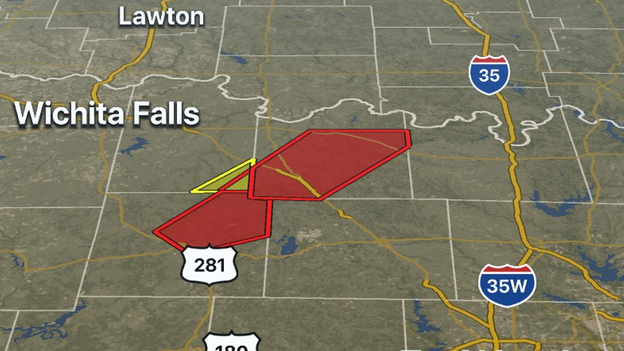
FOX Weather 3D Radar continues to track a tornado-warned storm moving towards the Texas-Oklahoma state line. Montague County in north-central Texas is the latest county to be put under a Tornado Warning until 5 p.m. CDT.
Meteorologists say this is the same storm that already produced a tornado in Jack County and could do so again.
Download the FOX Weather app: Click Here
Damage is being reported near the town of Jacksboro, Texas, after a tornado warning was issued for the area.
Jacksboro is located about 60 miles northwest of Fort Worth.
A debris signature associated with the tornado-warned storm was detected on radar. A short time later, the National Weather Service began receiving reports of damage in the area.
According to the NWS, lots of debris is being reported 6 miles west-southwest of Jacksboro. Damage to buildings, trees and mobile homes is also being reported. A roof is also reportedly collapsed on a home about a mile west of the town.
A tornado has reportedly caused damage near the town of Jacksboro, Texas.
Jacksboro is located about 60 miles northwest of Fort Worth.
A debris signature was detected on radar associated with the tornado-warned storm as it approached the town. The National Weather Service reported damage to trees and mobile homes has been reported.
The storm was moving northeast at 35 mph.
The Tyler Police Department is monitoring the severe weather and is advising people to take precautions before the system moves through.
Here's how to prepare for a tornado outbreak: Click Here
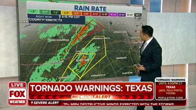
FOX Weather radar estimates that rain is falling at a rate of 5.41 inches per hour from a severe thunderstorm over Erath County, Texas. Much of the state is under a flood watch.
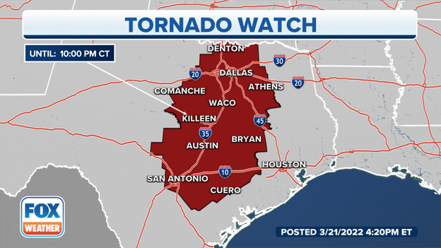
More than 13 million Texans are under a Tornado Watch until 10 p.m. CT. Areas include, College Station, Austin, San Antonio, Dallas and Sherman.
The National Weather Service has issued the first Tornado Warning of the severe weather event. Young, Jack, Stephens and Palo Pinto counties in north-central Texas are under a Tornado Warning until 3:30 p.m. CDT.
Meteorologists said they are tracking a thunderstorm capable of producing a tornado near Possum Kingdom State Park moving northeast at 50 mph.
Latest forecast: Click Here
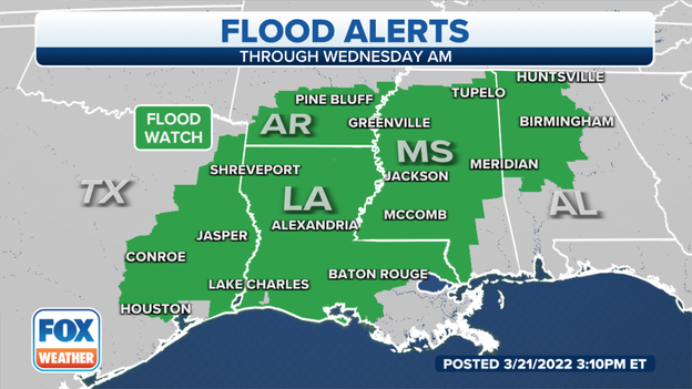
A Flood Watch is in effect until Wednesday morning for east Texas, most of Louisiana, south Arkansas, Mississippi and northwest Alabama.
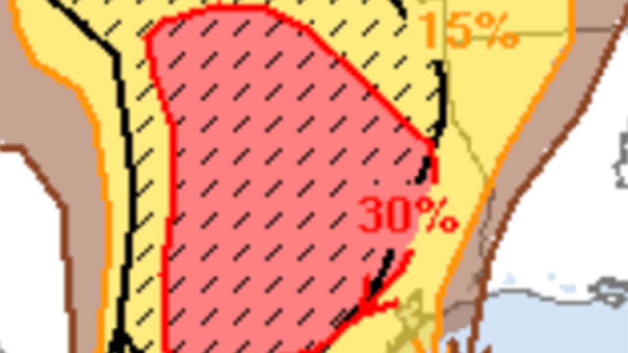
A "hatched area" means there is a significant threat of the particular type of severe weather being described in the associated map inside the highlighted area.
For example, if you are looking at the outlook map for hail, and you see a "hatched area," it means there is a good chance that large hail is possible inside that area.
The NWS has issued Wind Advisories for parts of south central and southeast Texas through Monday evening.
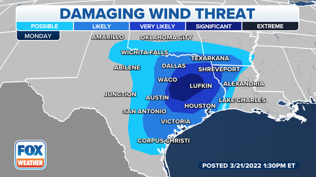
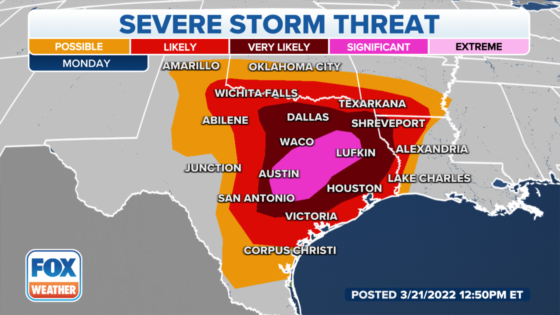
The possibility of damaging winds with gusts up to 45 mph is very likely for area including, Dallas, Shreveport, Houston and Austin. The threat becomes significant in Lufkin and Waco.
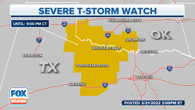
The NWS Storm Prediction Center has issued a Severe Thunderstorm Watch for portions of Southwest and South-central Oklahoma and Northwest Texas until Monday at 9 p.m. CT.
The primary threats will include large hail, damaging wind gusts up to 70 mph and possible tornado activity.
With the threat of tornadoes looming, don't wait until one is at your doorstep before preparing for severe weather. Charge your phone, make sure you have batteries and other essentials.
Follow these tips to be ready.
A clash of the jetstream and a low-pressure system will result in the potential for numerous severe storms to develop beginning Monday afternoon and continue into Wednesday as the system tracks east.
FOX Weather is closely monitoring the threat of a multiday severe weather outbreak with tornadoes, damaging winds, large hail and flash flooding that will impact the south-central and southeastern U.S.
Here's where things stand with the forecast.
Live Coverage begins here
