WEATHER WIRE: Severe storms rake across South yet again
Tornadoes, hail and damaging winds are possible in the storm-weary South this week, making for the third severe weather outbreak in the region in a month.
Coverage for this event has ended.
Latest on the damage across the South: Click Here
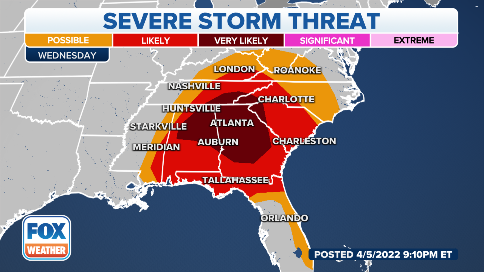
Strong to severe storms will be possible on Wednesday across some of the same areas that saw severe weather on Tuesday.
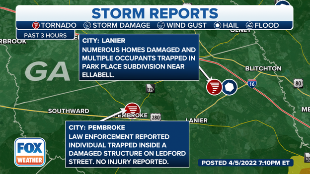
The National Weather Service reported at least one person was killed Bryan County, Georgia when the severe storms moved through.
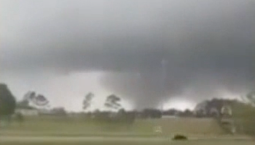
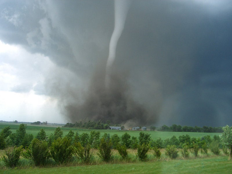
A large funnel was spotted outside of Savannah, Georgia on Tuesday evening.
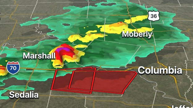
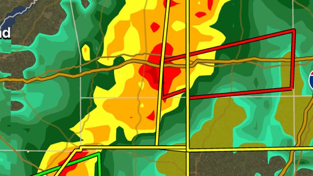
A supercell is Missouri is lighting up the FOX Weather 3D Radar. Tornado Warnings have been issued to the west of Columbia, MO along Interstate 70.
Track the storm on FOX Weather 3D Radar.
Google Play download: Click Here
Apple App Store download: Click Here
Meteorologists expect the chance of severe storms to linger into Wednesday across parts of the South.
Latest forecast: Click Here
Initial reports out of Bryan County, GA indicate several homes were damaged and some occupants might even be trapped. A tornado-warned storm moved through the area early Tuesday evening.
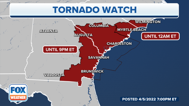
Parts of South Carolina's Grand Strand and coastal North Carolina are under a Tornado Watch until midnight. Meteorologists believe severe thunderstorms could continue into the evening and have the possibility of producing tornadoes.
Updated forecast: Click Here
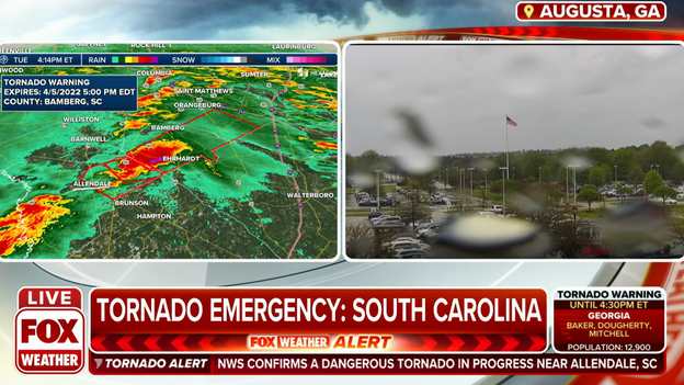
Video captured the storm that triggered the Tornado Emergency around Allendale, South Carolina.
Meteorologists have issued a Tornado Warning for several counties in the Lowcountry of South Carolina because of radar detected rotation in a supercell.
Latest forecast: Click Here
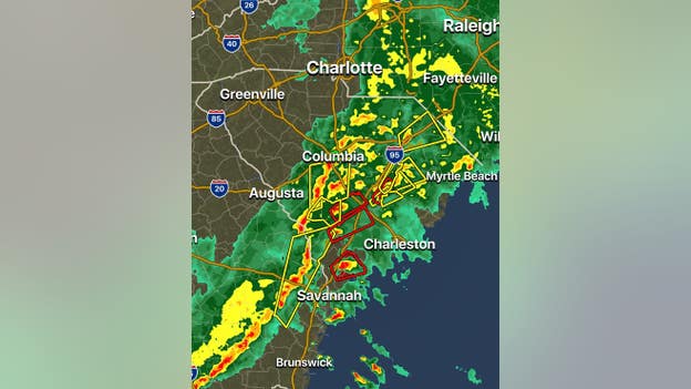
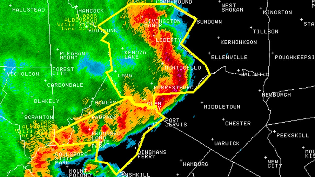
Here is a look at the current warnings across the Southeast.
As of 6:30 p.m. ET, warnings were posted in Georgia and South Carolina.
Make sure to download the FOX Weather app to track the weather in your area.
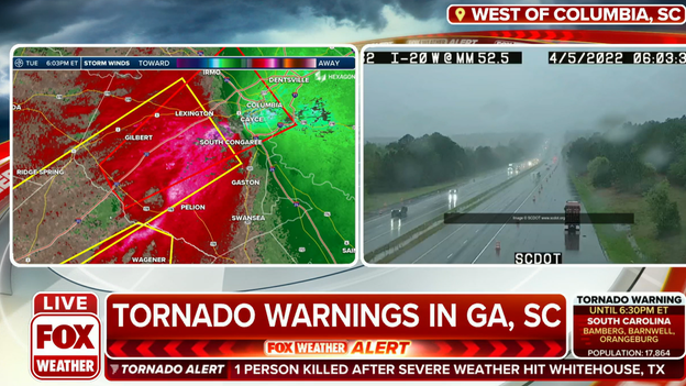
Severe storms produced torrential rainfall along Interstate 20 in South Carolina.
A severe storm with a possible tornado continues its east to northeast trek through South Carolina and now is closing in on Columbia. Lexington County, SC is under a Tornado Warning until 6:15 p.m.
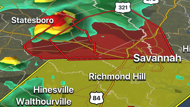
Meteorologists say radar is picking up on rotation and possible debris in a thunderstorm that is moving through southeast Georgia and will likely stay just to the north of Savannah.
The storm has triggered several Tornado Warnings along its path including for Effingham County, Georgia until 6:15 p.m. EDT.
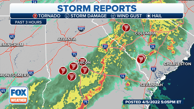
The Storm Prediction Center says they have received more than 2 dozen reports of tornadoes, so far today. Meteorologists from National Weather Service offices will examine damage paths to determine if tornadoes are responsible for damage and the strength of the twisters.
How meteorologists determine if a tornado is to blame for damage: Click Here
As severe storms rolled through South Carolina, tornado sirens sounded in Newberry, South Carolina.
A pair of storms capable of producing tornadoes are moving through South Carolina between Columbia and Charleston. Both storms have triggered several Tornado Warnings. Even if the storms do not produce a tornado, damaging winds, hail, heavy rainfall and lightning will be concerns.
The FOX Weather 3D Radar is tracking a pair of tornado-warned storms in South Georgia. Mitchell, Colquitt and Worth counties in South Georgia are under a Tornado Warning as a line of severe storms moves eastward.
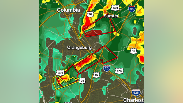
Meteorologists are tracking a dangerous storm with a history of producing a tornado in parts of South Carolina. Both Bamberg and Orangeburg counties in South Carolina are under a Tornado Warning.
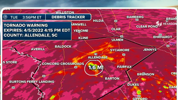
Radar is showing strong rotation and even debris in Allendale County, SC that meteorologists say is likely from a tornado. Bamberg, Orangeburg and Allendale counties are under a Tornado Warning because of the dangerous storm.
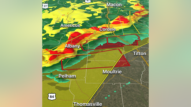
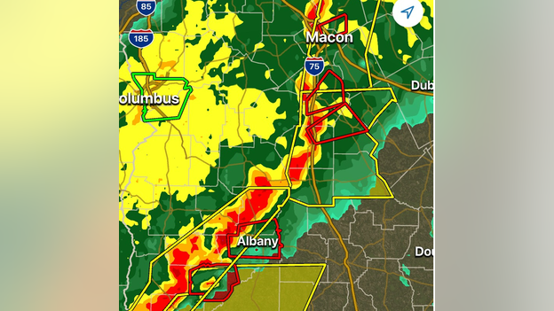
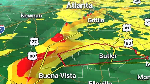
The FOX Weather 3D Radar is tracking a line of severe thunderstorms capable of producing tornadoes from around Albany, Georgia through Macon, Georgia. The line of storms is moving eastward is producing damaging winds, heavy rainfall and the potential for tornadoes.
Track the storms on the FOX Weather 3D Radar: Click Here
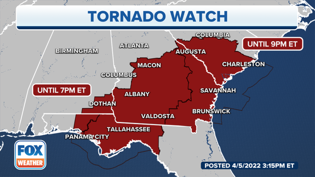
A Tornado Watch has been issued for parts South Carolina and Georgia until 9 p.m. A line strong to severe thunderstorms is moving across Georgia during the evening hours.
Latest forecast: Click Here
Severe storms rolled through parts of Alabama on Tuesday morning producing heavy rainfall and gusty winds.
In addition to the threat for severe weather, the storms are capable of producing several inches of rain in a short time period. Street flooding was reported near the Florida-Alabama line.
Latest forecast: Click Here
The National Weather Service in Birmingham said Alabama Power will begin gate operations at Martin Dam about 2:30 p.m. Tuesday.
This is due in part to Alabama Power's flood control procedure.
Those downstream of the dam should stay informed of revised river forecasts for the lower Tallapoosa and Alabama rivers, the NWS said.
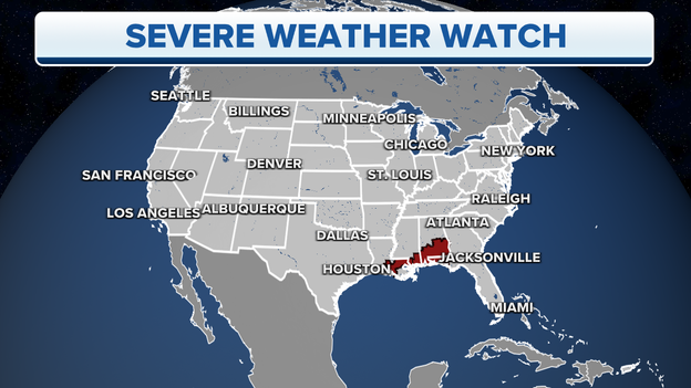
NOAA's Storm Prediction Center has issued the following severe weather watches:
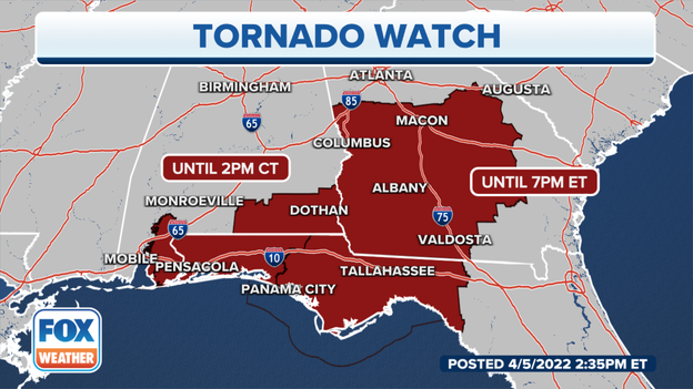
A Tornado Watch is valid until 2 p.m. Central time for extreme southeastern Mississippi, southern and southeastern Alabama. This watch area includes Mobile in Alabama and Pensacola and Panama City in Florida.
A Tornado Watch is valid until 7 p.m. Eastern time for Middle and South Georgia, including Albany, Columbus and Macon, and the Florida Panhandle.
The National Weather Service in Peachtree City has issued a Tornado Warning for northeastern Marion County, southeastern Talbot County and Taylor County in west-central Georgia until 3 p.m. Eastern.
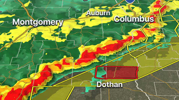
The National Weather Service in Tallahassee, Florida, has issued a Tornado Warning for east-central Dale County and southern Henry County in southeastern Alabama until 2 p.m. Central.
Tornadoes, hail and damaging winds are possible in the storm-weary South this week, making for the third week in a row of severe weather for the region.
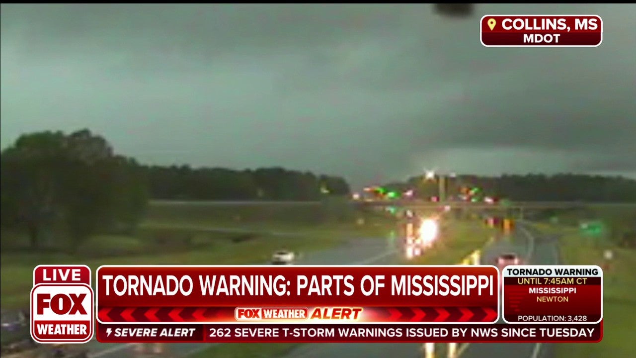
The Mississippi Department of Transportation posted footage of a suspected tornado passing their district office in Newton.
"Despite the rough conditions, our crews have been out since early morning hours working to get roads open for drivers as quickly and safely as possible," the department said in a tweet.
Due to severe weather across the region, organizers with The Masters have canceled Tuesday's practice round and gates will remain closed.
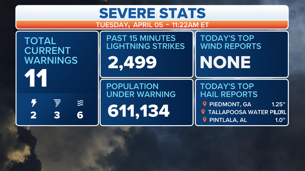
The Augusta National Golf Club was forced to suspend play and evacuate the grounds at 10:55 a.m. Eastern.
Purchasers of Tuesday's practice round tickets will be guaranteed the opportunity to purchase the same tickets next year.
"The safety of everyone at Augusta National was the determining factor in the decision to suspend Tuesday's Practice Round and evacuate the grounds," said Fred S. Ridley, chairman of Augusta National Golf Club and the Masters Tournament. "We share in the disappointment of our patrons, though we look forward to welcoming them back next year."
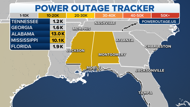
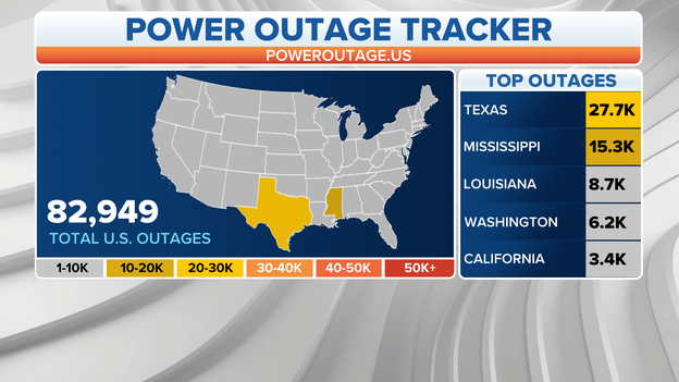
Just over 23,000 people are without power in Alabama and Mississippi due to severe storms, according to PowerOutage.us . About another 25,000 remain without power in Texas due to earlier severe storms.
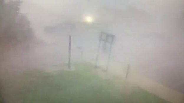
The FOX Forecast Center is no longer referring to this as a possible tornado.
Initially, this appeared to be a tornado. After further review, FOX Weather believes it to be a rain curtain moving from left to right across the screen.
"There’s no visible rotation to support the idea that it is a tornado. And, the 'power flash' that the on-camera meteorologists initially referred to appears to be simply lightning," FOX Weather meteorologist Mike Rawlins said. "A power flash would have appeared much smaller on the screen, originating from the ground."
NOAA's Storm Prediction Center has issued the following severe weather watches:
A Tornado Watch is valid until 2 p.m. Central time for southeastern Mississippi, southern Alabama and the Florida Panhandle. This watch area includes Biloxi and Gulfport in Mississippi, Montgomery and Mobile in Alabama and Pensacola and Panama City in Florida.
A Tornado Watch is valid until 7 p.m. Eastern time for Middle and South Georgia, including Albany, Columbus and Macon.
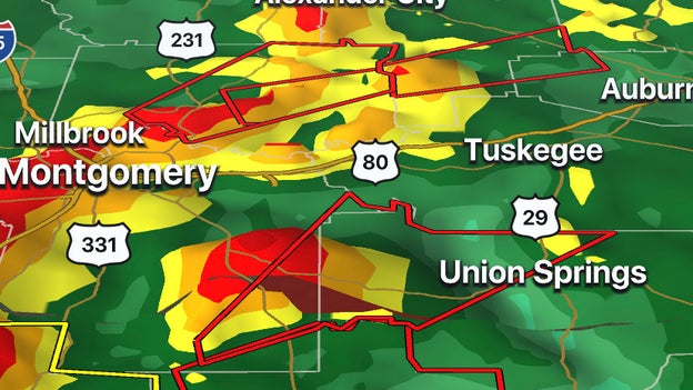
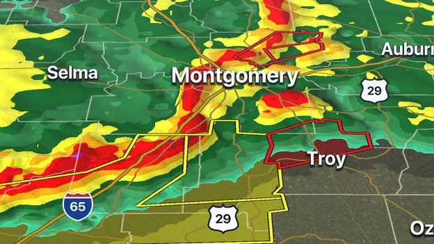
The National Weather Service in Birmingham, Alabama, has issued a Tornado Warning for northwestern Lee County, southeastern Tallapoosa County, northwestern Bullock County and southeastern Montgomery County until noon Central.
The FOX Weather 3D Radar is tracking severe storms moving through the South. Download the free app now to follow the movement of the winter storm.
Apple App Store download: Click here
Google Play Store download: Click here
Severe weather, including apparent tornadoes, moved across Mississippi early Tuesday morning and brought down trees and power lines, forcing officials to close roads while crews worked to clear debris.
The National Weather Service in Birmingham, Alabama, has issued a Tornado Warning for northwestern Pike County and southeastern Montgomery County until 11:30 a.m. Central.
Central Elmore County in east-central Alabama is also under a Tornado Warning until 11:45 a.m.
This includes cities like Ansley, Linwood, Orion, Wetumpka, Blue Ridge and Eclectic.
Stunning footage shows flooding near Dallas, Texas on Tuesday. Some residents in McKinney needed to be rescued from floodwaters on Monday night.
Documentation and receipts are some of the most important things when it comes to storm damage insurance claims.
Click here to hear more from the Insurance Information Institute.
The National Weather Service in Mobile has issued a Tornado Warning for southeastern Butler County and central Crenshaw County until 11:15 a.m. Central.
This includes cities like Luverne, Rutledge and Petrey.
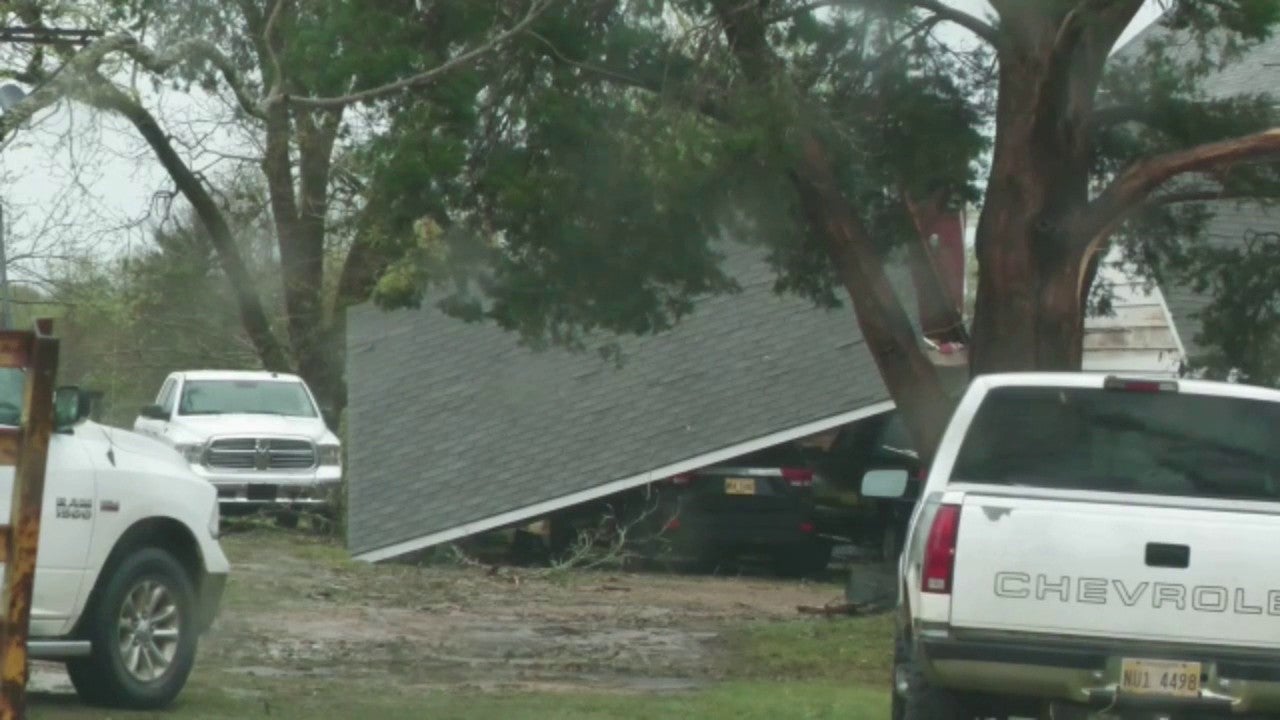
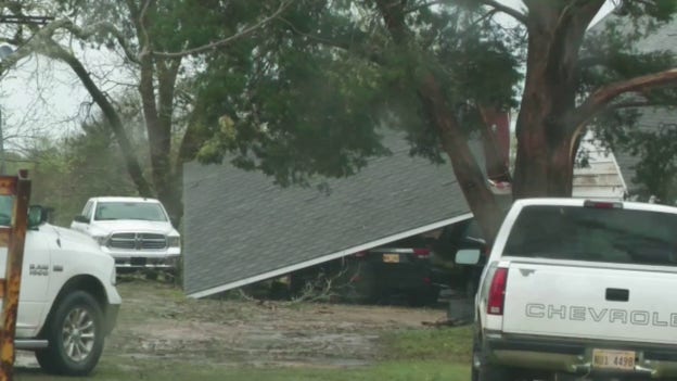
Storm damage around Newton, Mississippi, shows trees knocked down along U.S. Highway 80 near the Mississippi Department of Transportation office along Morgan Field Road.
Structural damage was also noted as a carport became detached and smashed a vehicle at a home. Numerous large oak trees were also uprooted and snapped as well.
When severe weather is lurking in the neighborhood, you'll likely see social media posts referencing "SPC" risks such as "Slight" or "Enhanced" or "Moderate". Here's what they mean:
FOX Weather Watcher Cary Longstaff shared this video of a flooded creek outside Forrest General Hospital in Hattiesburg, Mississippi.
The Hattiesburg Police Department issued a caution to drivers along Bay Street because the roadway was flooded.
The National Weather Service in Jackson said showers and thunderstorms producing heavy rain will continue to move across the forecast area through Tuesday morning, with a potential for heavy rain across far southern parts of the area continuing into the afternoon hours.
Localized flash flooding is possible, especially where multiple storms move over the same areas.
The storm-fatigued South dealing with another multiday severe weather outbreak. Click for the latest from Whitehouse, Texas.
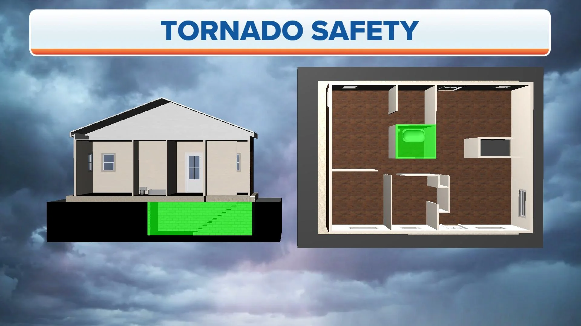
Do you know the safest area to go in your home or apartment in case a tornado hits? It’s important to know where your safe place is before danger hits to better protect you and your family.
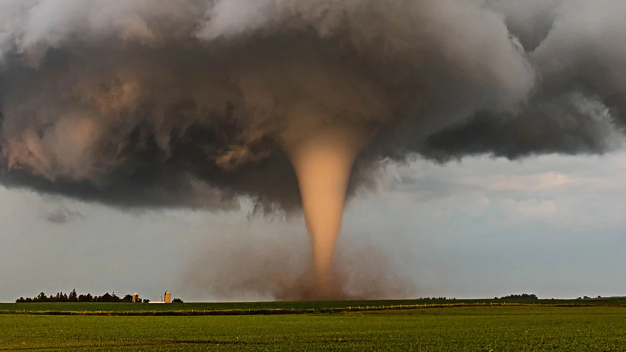
Although every tornado is different, there are certain conditions required for a twister to develop. The lifecycle of a tornado can be explained in a series of four stages. Click here as FOX Weather discusses each stage.
Forecasters can generally forecast the threat of tornadoes, but where they touch down is still a bit unpredictable.
Preparing for a twister ahead of time can help you stay safe in the event one sweeps through your area.
Here are some steps you can take now to prepare for a future tornado.
FOX Weather Watcher Ken Michaels shared this video of storms moving through Whynot, Mississippi.
Make sure to follow FOX Weather on social media for more videos, photos and coverage of the severe storms. Don't forget to tag us in your weather photos or use #FOXWeather.
FOX Weather on Facebook: facebook.com/FOXWeather
FOX Weather on Twitter: twitter.com/FOXWeather
FOX Weather on Instagram: instagram.com/FOXWeather
FOX Weather on TikTok: tiktok.com/@officialfoxweather
FOX Weather on YouTube: youtube.com/foxweather
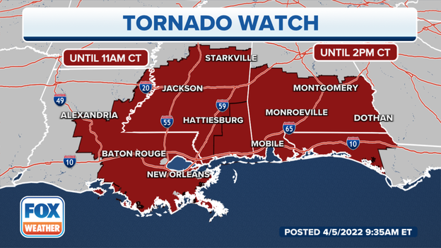
NOAA's Storm Prediction Center has issued the following severe weather watches:
A Tornado Watch valid until 11 a.m. Central time for southern and eastern Louisiana and central and southern Mississippi. This watch area includes New Orleans and Baton Rouge in Louisiana and Jackson and Hattiesburg in Mississippi.
A Tornado Watch valid until 2 p.m. Central time for southeastern Mississippi, southern Alabama and the Florida Panhandle. This watch area includes Biloxi and Gulfport in Mississippi, Montgomery and Mobile in Alabama and Pensacola and Panama City in Florida.
One person is confirmed dead in Whitehouse, Texas, following overnight severe storms, Smith County, Texas, Fire Marshal Jay Brooks said.
City officials said a storm cell produced either straight-line winds or a downburst about 1:45 a.m. Central. The National Weather Service will later confirm.
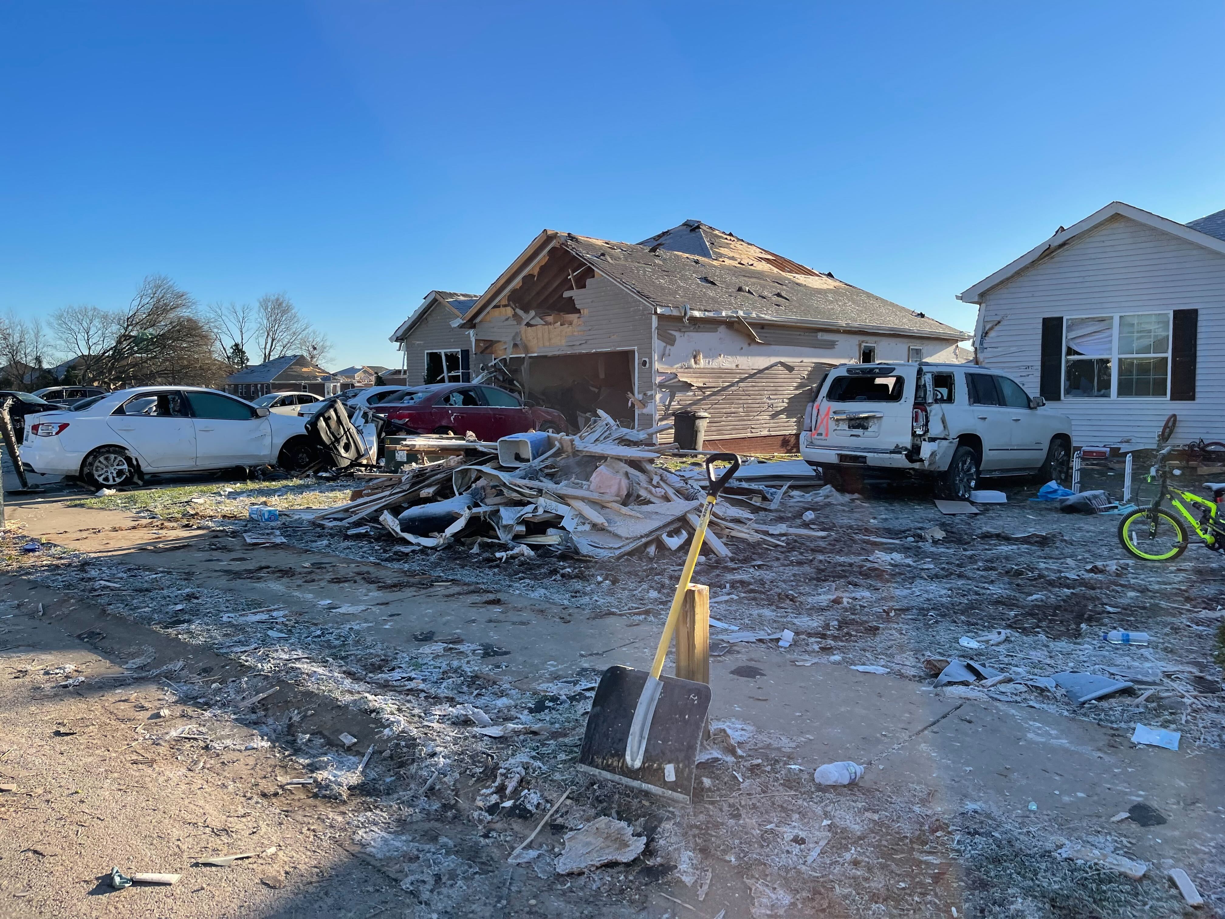
A very early assessment reveals the majority of the impact was to the south and southeastern portion of the city. The damage consists of downed power lines and downed trees causing road closures and power outages.
At daybreak, authorities launched a damage assessment.
The Whitehouse School District has canceled classes Tuesday and scheduled trash services will be delayed.
Police are asking residents to stay home and off of roadways if at all possible.
Stay with FOX Weather for the latest developments.
The National Weather Service in Mobile, Alabama, has issued a Tornado Warning for southwestern Choctaw County, northwestern Washington County and Wayne County in southeastern Mississippi until 9 a.m. Central.
This includes Waynesboro and Buckatunna, Mississippi, and Millry, Alabama, until 9 a.m. Central.
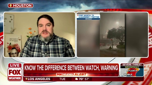
When severe weather is happening, meteorologists at the National Weather Service use a variety of statements to keep you informed about the dangers you could face. Some of them are more urgent than others, and knowing the differences in each of them can help you stay safe.
Click here to take a closer look at the terms used.
A squall line of strong to severe thunderstorms is currently charging eastward through the Deep South, prompting several Severe Thunderstorm Warnings. Damaging wind gusts are the primary threat, including the risk of a few gusts to 75 mph. A few tornadoes and isolated large hail are also possible.
Preparing for a tornado ahead of time can help you stay safe in the event one sweeps through your area. FOX Weather Senior Digital Content Producer and Meteorologist Aaron Barker discusses steps people can take to prepare for a tornado.
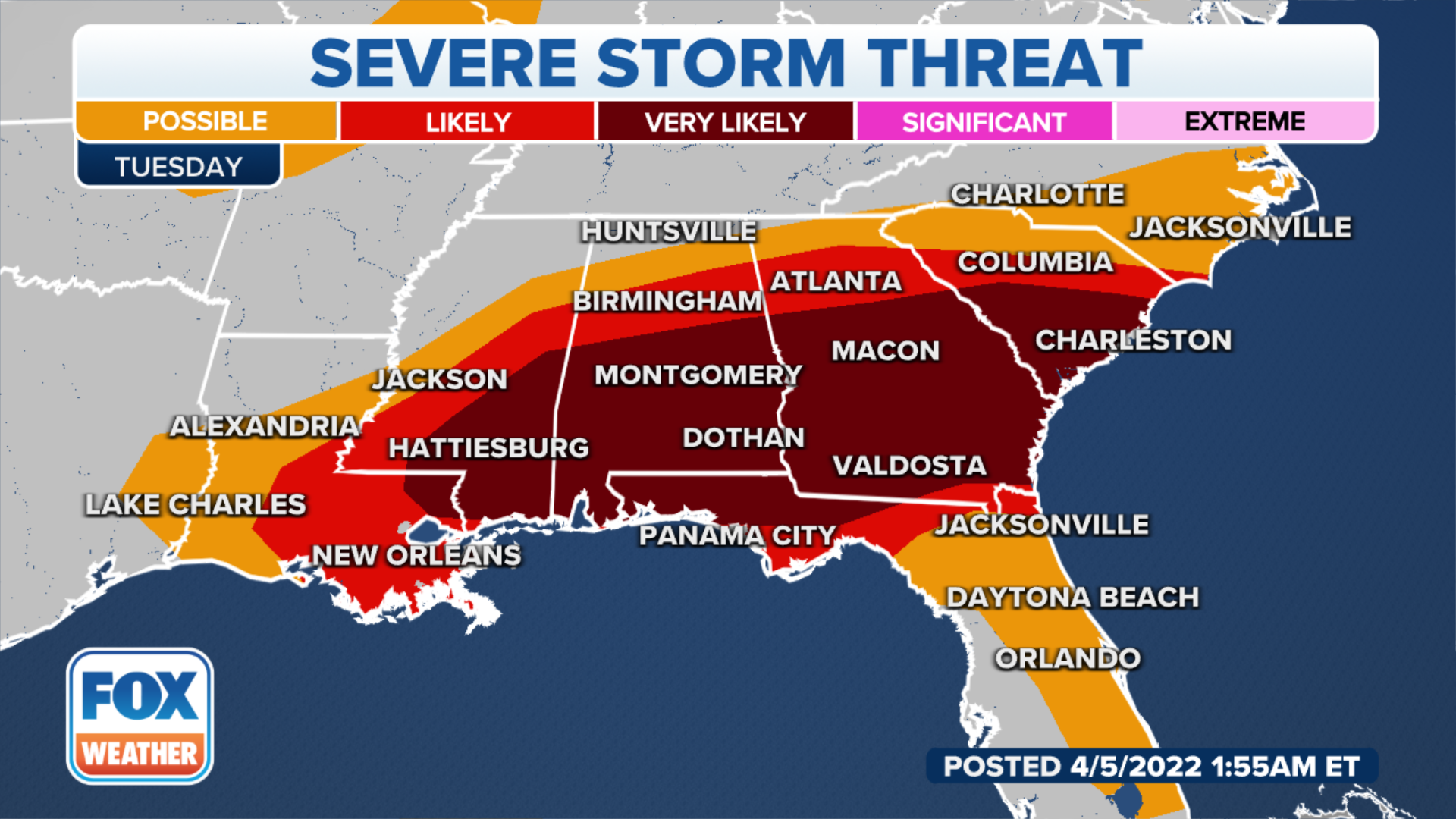
Severe thunderstorms packing damaging winds, large hail and tornadoes will rumble across the storm-fatigued South through Wednesday.
Damaging straight-line winds will by far be the main threat. Gusts to 70 mph are likely and some gusts may top 80 mph. A few tornado spin-ups are likely as well.
Tornado warnings have been issued in Mississippi on Tuesday morning.
The first was issued for Scott County and was in effect until 7:15 a.m. Central. The National Weather Service confirmed that a tornado was on the ground in the area. People should seek shelter immediately. That warning was extended into Newton County until 7:45 a.m.
The second was issued for Covington and Jefferson Davis counties until 7:45 a.m. This radar-indicated tornado was expected to move near Clem, Lone Star, Mount Olive and Collins. People should seek shelter immediately.
Live Coverage begins here
