WEATHER WIRE: Tornado threat across Mid-South
Tornadoes threaten Severe thunderstorms, possible tornadoes march across Arkansas into Missouri.
Coverage for this event has ended.
Parts of Howell and Oregon Counties in Missouri are now under a Tornado Warning until 11 p.m. local time. The NWS warns residents of Brandsville, Thomasville and Greer to take shelter. A thunderstorm capable of producing a tornado was near West Plains moving northeast at 65 mph.
A trio of Severe Thunderstorm Warnings remain in effect across Southern Missouri and Central Arkansas.
A line of dangerous storms continues to slowly move through Arkansas and Missouri. The NWS issued several new Severe Thunderstorm and Tornado Warnings.
- A severe thunderstorm capable of producing a tornado was near Gainesville, Missouri and moving northeast at 40 mph. Ozark County, Missouri remains in a Tornado Warning until 10:30.
- Another thunderstorm capable of producing a tornado was over Bull Shoals, Arkansas putting Marion and Baxter Counties in Arkansas under a Tornado Warning until 10:30 as well. The storm is moving northeast at 60 mph.
- Wind damage is likely due to a severe thunderstorm capable of producing a tornado near Duff, Arkansas. Parts of Searcy, Marion and Baxter Counties in Arkansas are under a tornado warning until 10:30.
- Areas of Shannon, Howell and Texas Counties in Missouri are under a Tornado Warning until 10:45. The thunderstorm capable of producing a tornado was near Mountain View moving east at 45 mph.
The NWS issued three more Tornado Warnings for Arkansas.
- Portions of Marion County, Arkansas are under a warning until 9:45 p.m. A thunderstorm capable of producing a tornado was near Lead Hill moving east at 40 mph.
- Areas of Scott, Polk and Montgomery Counties are under a warning until 10 p.m.
- Parts of Searcy, Newton, Marion and Boone Counties are under a warning until 10:15 p.m.
A radar confirmed tornado near Gainesville, Missouri was moving northeast at 55 mph. The warning extends across Douglass and Ozark Counties in Missouri expiring at 9:15 p.m.
Taney and Ozark Counties are under a warning until 9:15. A thunderstorm capable of producing a tornado was near Diamond City moving northeast at 45 mph.
A thunderstorm capable of producing a tornado and ping pong ball-sized hail near Ravenden is moving northeast at 55 mph. The warning for Randolph, Lawrence, and Sharp Counties in Arkansas expires at 9 p.m.
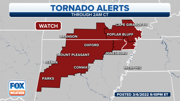
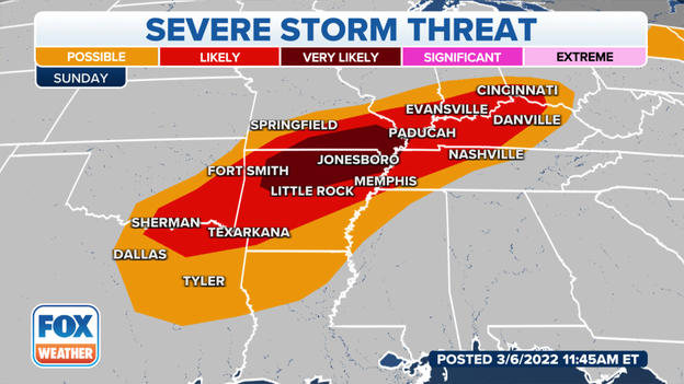
The NWS extended the Tornado Watch for Arkansas and Missouri until 2 a.m. local time. Storms will continue to form ahead of a cold front. NWS' Forecast Discussion detailed two separate threats. The first encompasses the Tornado Watch in which damaging winds, hail and tornadoes are possible. The second round arrives early Monday morning bringing flooding rain and high winds. (Isolated tornadoes are still possible.)
The National Weather Service issued two new Tornado Warnings.
Radar identified a thunderstorm capable of producing a tornado near Self in Boone County, Arkansas moving northeast at 50 mph. The warning expires at 8:15.
Another storm capable of producing a tornado and ping pong ball-sized hail was near Ravenden, Arkansas. Randolph, Lawrence and Sharp Counties in Arkansas are in the warning until 9 p.m. local time.
The National Weather Service extended the Tornado Warning for Izard County Arkansas until 8:30 local time. This severe thunderstorm capable of producing a tornado and golf ball-sized hail is near Melbourne, Arkansas and moving northeast at 40 mph.
Randolph, Lawrence and Sharp Counties in Arkansas are also in the warning area.
FOX Weather Tracker shows towns in the path of a possible tornado: Lone Star, Melbourne and Belview.
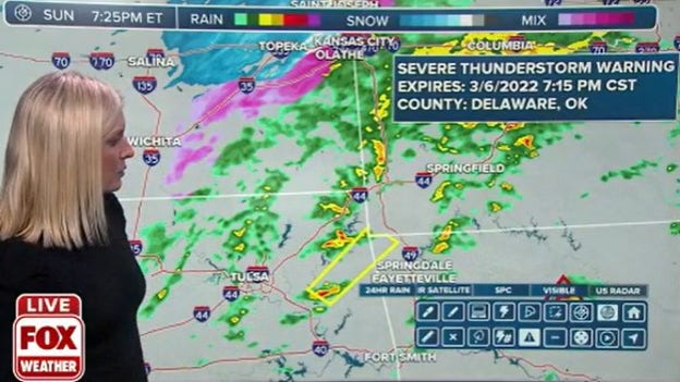
Quarter-sized hail and 70 mph winds were reported from a thunderstorm. The National Weather Service issued a Severe Thunderstorm Warning until 7:15 local time for areas of Delaware, Mayes, Adair, Wagoner and Cherokee Counties in Oklahoma and Benton County, Arkansas.
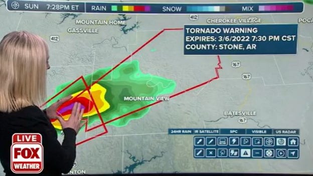
The National Weather Service issued a new Tornado Warning for portions of Stone, Izard, Searcy and Baxter Counties in Arkansas until 7:30 p.m. local time. Weather radar indicated a thunderstorm capable of producing a tornado and golf ball-sized hail near Elba.
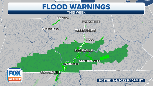
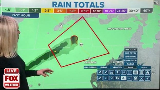
Thunderstorms dropped 1-2 inches of rain in the path of a potential tornado. Watch for quickly rising creeks and ponding on roadways.
A confirmed tornado downed trees in Piney, Arkansas. More trees were downed near Hector by a potential tornado.
Discrete storms have spawned three tornadoes so far in Arkansas.
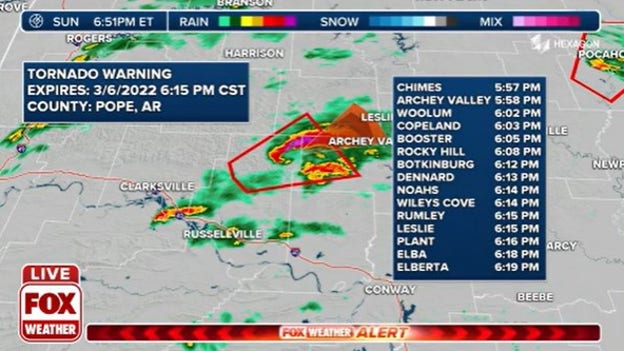
A spotter confirmed tornado is moving across Pope County. Copeland, Noahs and Elba are in the path.
Several radar indicated tornadoes and a confirmed tornado are driving through Arkansas.
Live Coverage begins here
