WEATHER WIRE: Triple threat of severe storms, blizzards, extreme fire weather threatens millions
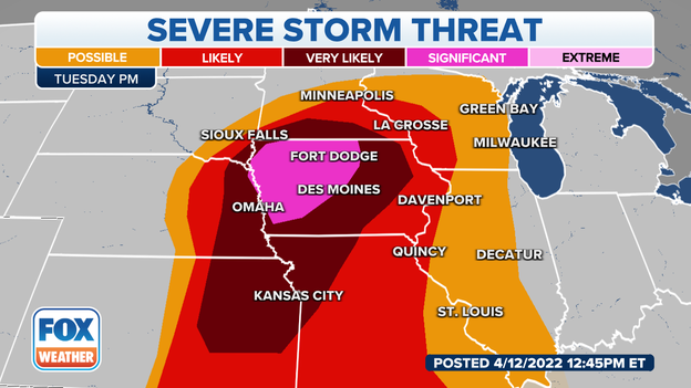
It's a tale of Earth, wind and fire on Tuesday as a severe storm threat places more than 62 million Americans from Texas up to Minnesota in the danger zone. To the north, a potentially historic blizzard is unleashing heavy snow and high winds across the Northern Plains. Plus, the High Plains are on alert for a significant wildfire outbreak.
Coverage for this event has ended.
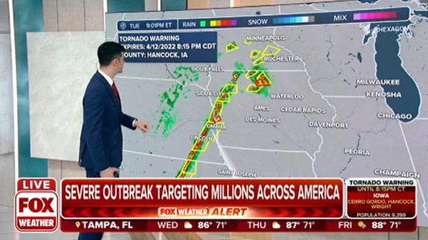
The FOX Weather Alert System is live as severe storms threaten an area from Texas to Iowa on Tuesday.
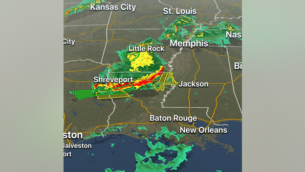
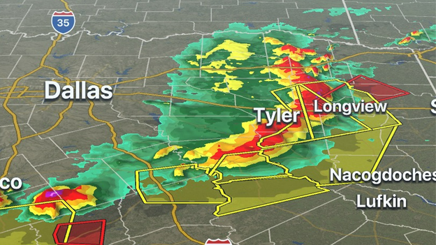
The FOX Weather 3D Radar is tracking the last Severe Thunderstorm Warnings in effect across Louisiana. Thunderstorms are expected to weaken overnight before another round of severe storms redevelops on Wednesday.
Wednesday's forecast: Click Here
Download the FOX Weather app to track the storms: Click Here
A tornado was caught on video moving through Jarrell, Texas on Tuesday evening.
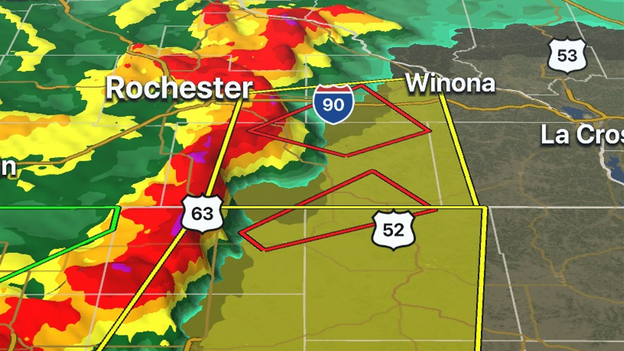
Meteorologists are tracking severe thunderstorms capable of producing tornadoes in southeastern Minnesota that are headed in the direction of Wisconsin. Thunderstorms are expected to gradually diminish in intensity but will remain significant for the next several hours. Winona County, MN is under a Tornado Warning until 12 a.m. CDT.
Here's the difference between a warning and a watch: Click Here
Meteorologists expect severe thunderstorms with the capabilities of producing large hail, damaging winds, and tornadoes to continue into the overnight hours.
For that reason, a Tornado Watch has been issued for parts of Arkansas, Louisiana and Mississippi until 4 a.m. CDT.
Latest forecast: Click Here
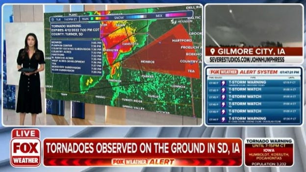
Storm chasers captured video of a roof being ripped off a building in Gilmore City, Iowa.
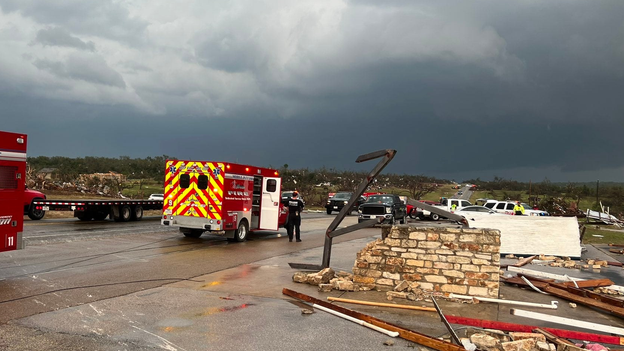
Officials in Bell County report at least 23 people were injured during the severe weather in Texas. Out of the injuries, one person is reported to have sustained critical injuries. So far, there are no reports of any deaths in the Lone Star State.
Where the severe weather is expected to go: Click Here
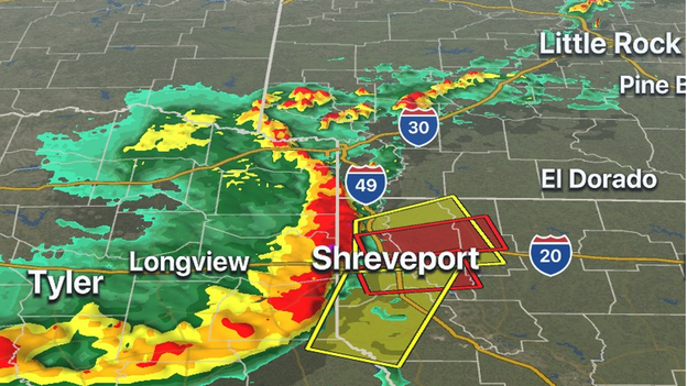
Several tornado-warned storms are moving through northwestern Louisiana right now, which includes the Shreveport area. A line of storms continues to move eastward into the state and could produce damaging winds, hail and tornadoes.
The area is under a Tornado Watch until 2 a.m. CDT: Click Here
Latest forecast: Click Here
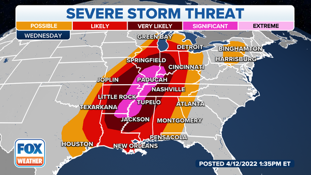
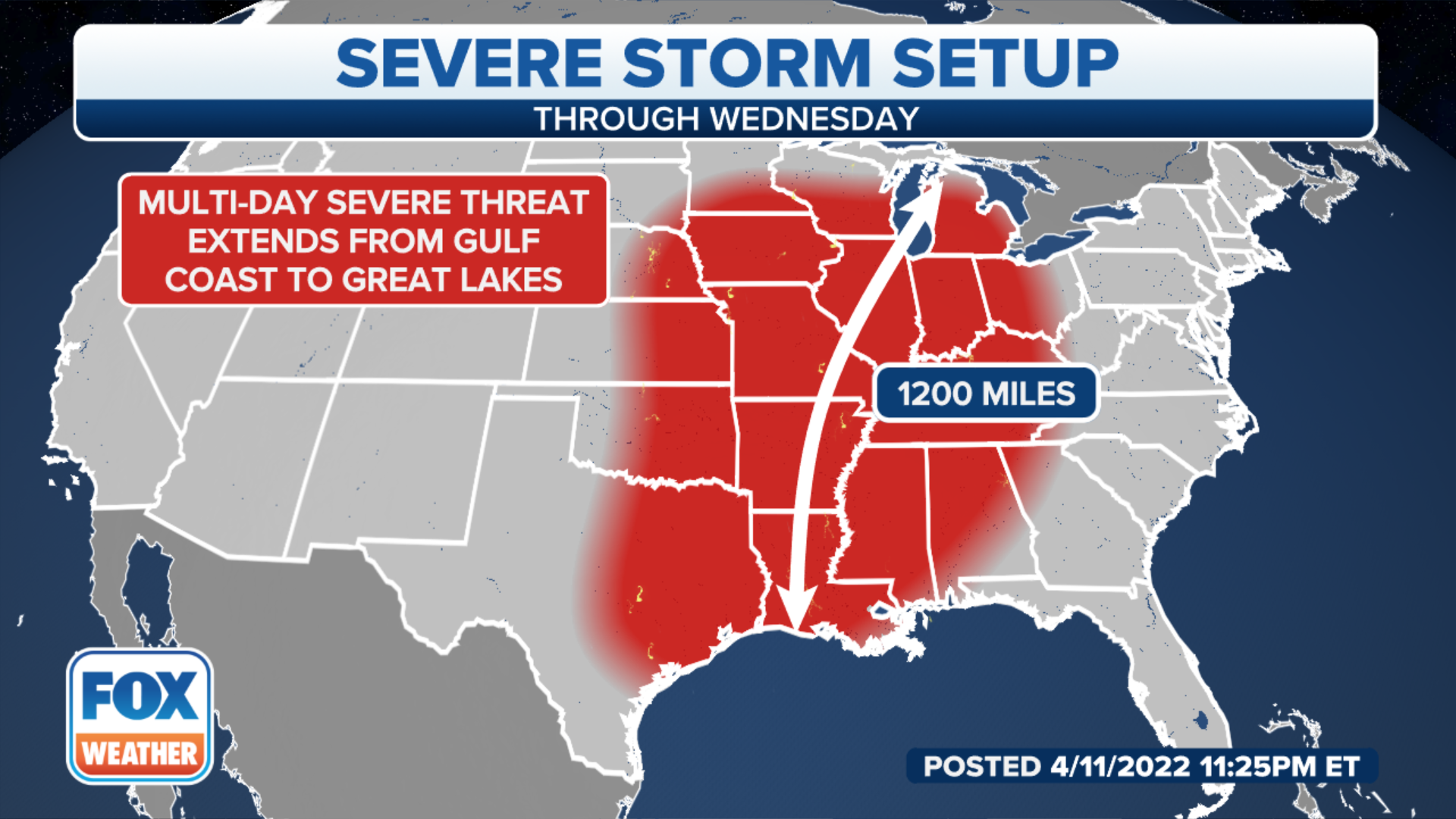
The threat of severe storms is expected to expand on Wednesday and include areas from the Gulf Coast to the Midwest.
Latest forecast: Click Here
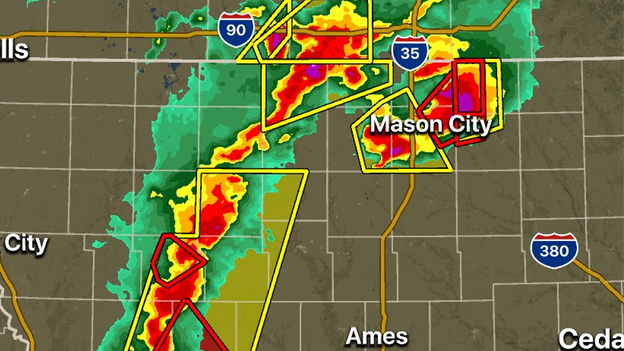
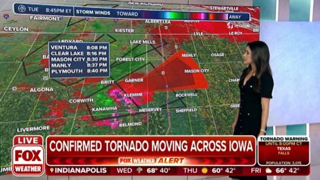
The FOX Weather 3D Radar is tracking three tornado-warned storms moving through the Hawkeye State. All of north of Interstate 80 and continue to move off to the east and northeast. PowerOutage.US reports there are more than 7,000 electric outages in the state.
A Texas resident captured video of a reported tornado in Central Texas on Tuesday afternoon.
The FOX Weather 3D Radar is tracking two tornado-warned storms in the Lone Star State. One storm is north of College Station and the other is near Longview. Both cells are moving east to northeast. More than 67,000 electric outages were reported by PowerOutage.US.
Track the storms on the FOX Weather app.
Google Play download: Click Here
Apple App download: Click Here
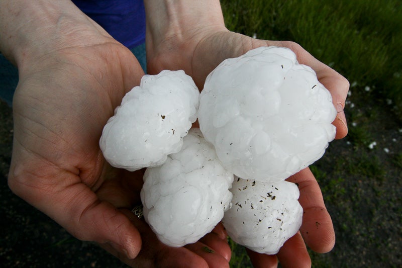
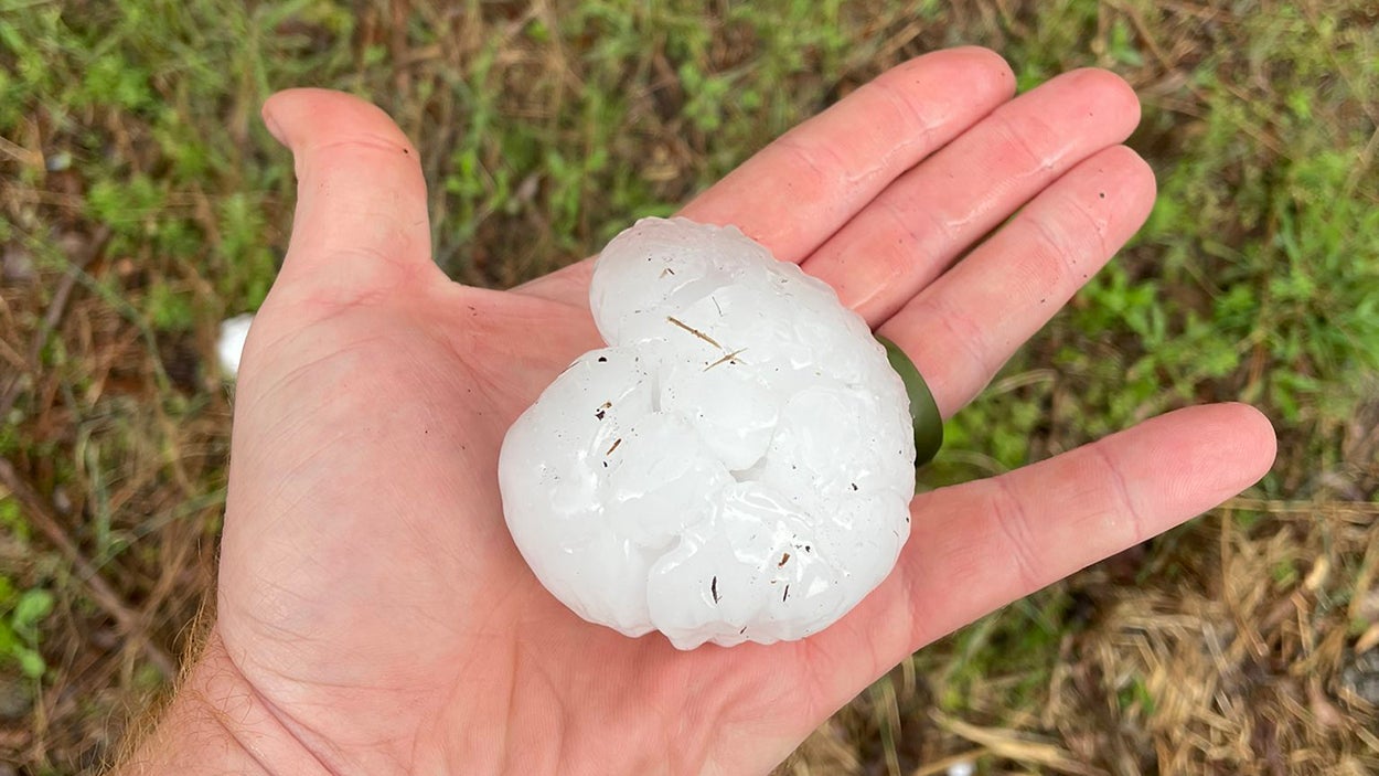
Severe thunderstorms dropped hail larger than grapefruits in Central Texas Tuesday afternoon.
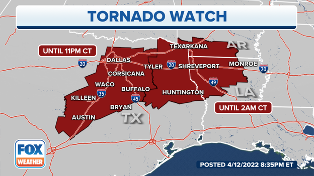
Parts of Texas, Louisiana and Arkansas are under a Tornado Watch until 2 a.m. CDT. Meteorologists say damaging wind gusts to 70 mph, large hail and a few tornadoes will be possible into the overnight hours.
Latest forecast: Click Here
Pottawattamie and Harrison Counties in Iowa and Washington County, Nebraska are under a Tornado Warning until 8:15. A thunderstorm capable of producing a tornado was over Fort Calhoun and moving northeast at 60 mph. Spotters reported a funnel cloud.
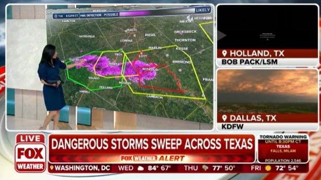
A thunderstorm capable of producing a tornado and golf ball-sized hail was near Rosebud, Texas moving east at 30 mph. The NWS issued a Tornado Warning for Milam and Falls Counties until 8:30 p.m.
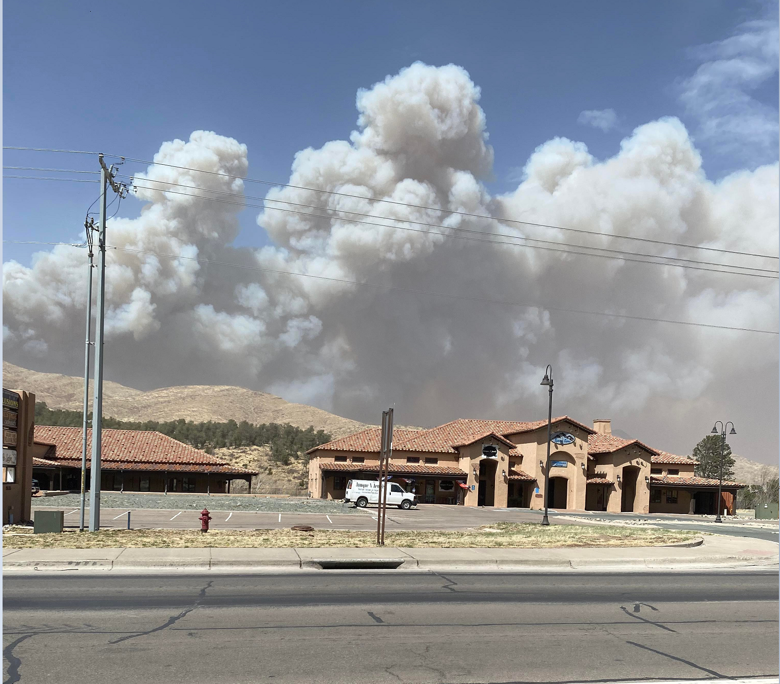
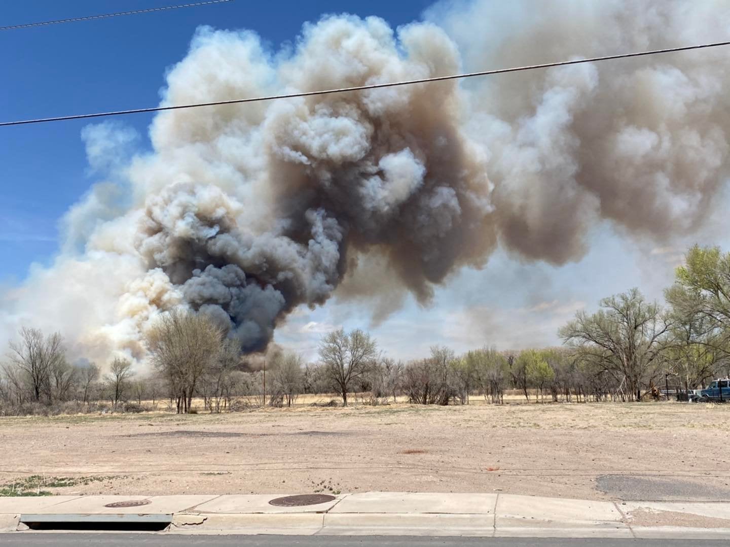
At least 50 structures have either been damaged or destroyed by fast-moving wildfire in New Mexico.
Weather spotters confirmed a tornado south of Britt, Iowa moving east at 55 mph. Wright, Hancock, and Cerro Gordo Counties are under a Tornado Watch until 8:15.
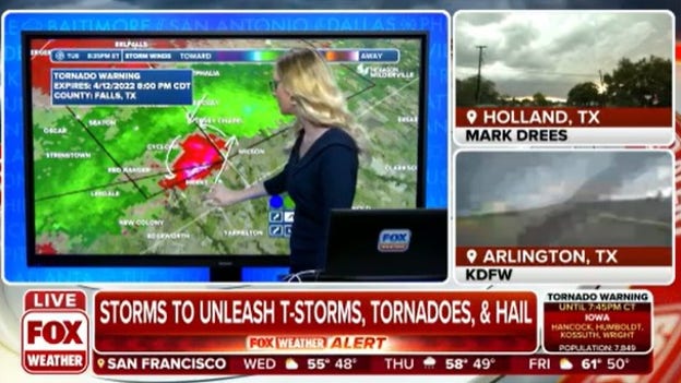
The NWS issued another Tornado Warning for Bell and Falls Counties in Texas until 8 p.m. The radar indicated the tornado was north of Rogers moving northeast at 25 mph. Along with destructive winds, the storm could produce ping pong ball-sized hail.
Earlier, a confirmed tornado marched through Salado, Texas in Bell County.
Eli Underwood posted this video on Facebook of the Bell County, Texas tornado heading for Salado.
Violent thunderstorms with huge hail and strong winds continue to batter Texas. FOX Weather has the latest Warnings.
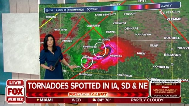
The NWS expanded a Tornado Warning for Wright, Kossuth, Hancock and Humboldt Counties in Iowa until 7:45 p.m. FOX Weather indicates two areas of rotation. One has been confirmed 7 miles northeast of Dakota City moving northeast at 40 mph.
A confirmed tornado is near Clayton, South Dakota moving east at 40 mph. The NWS issued a Tornado Warning until 7 p.m. for McCook, Turner and Hutchinson Counties.
The County Deputy Sheriff said baseball-sized hail smashed his windshield.
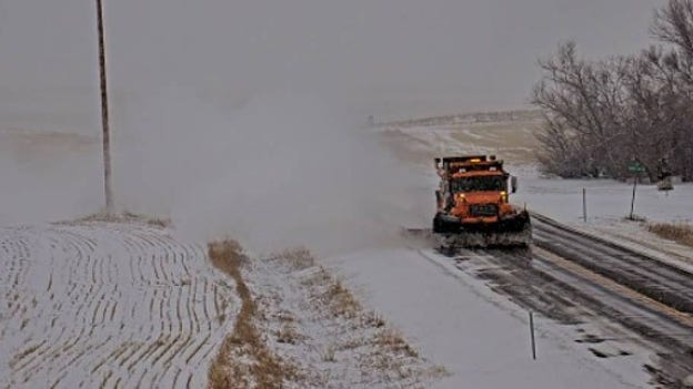
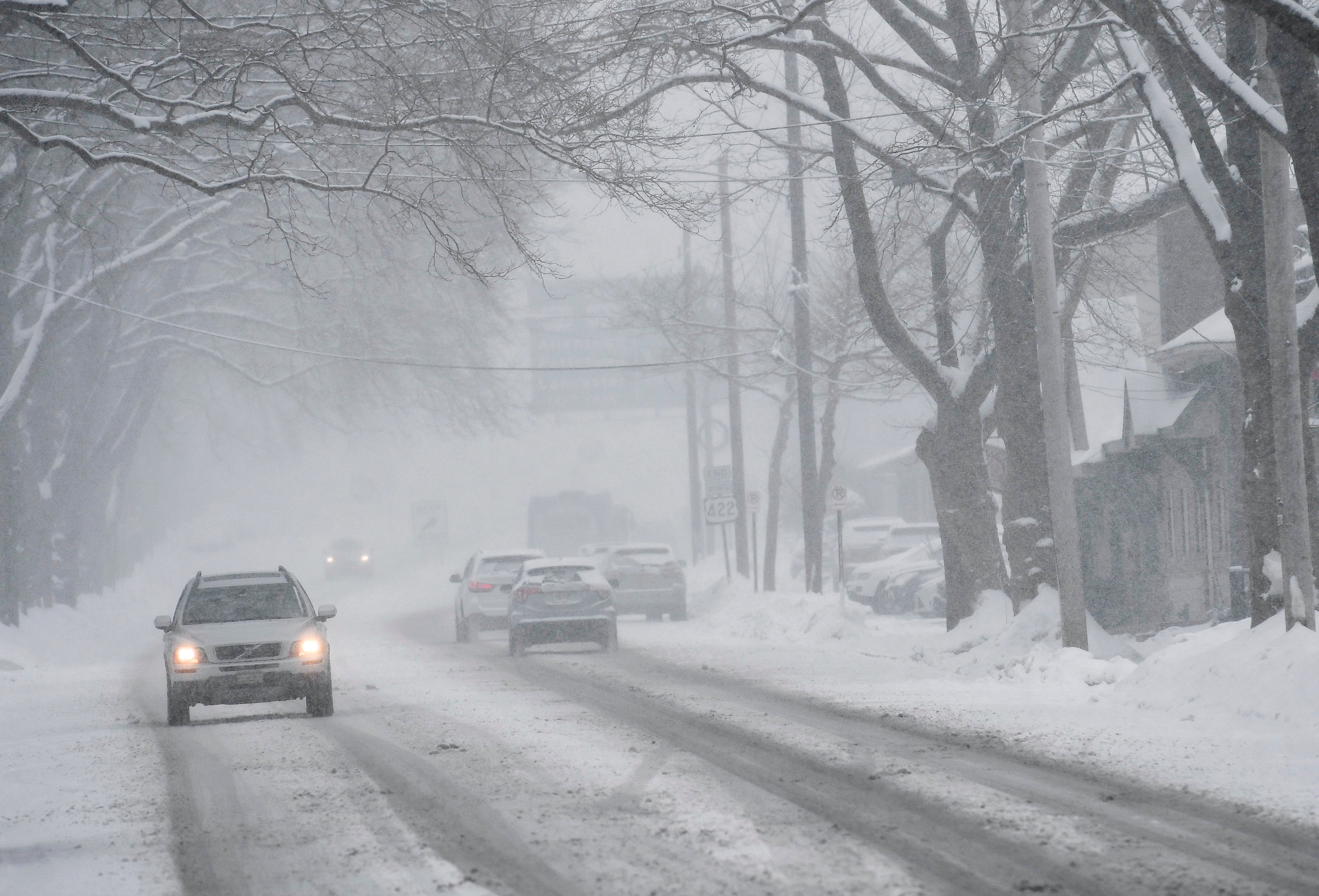
Road crews will stay busy in Montana as a major April snowstorm hits the region. The Montana Department of Transportation posted, "MDT crews are out working hard to clear roads during this major snowstorm across the state! Make sure to give them plenty of room to work. #DontCrowdThePlow."
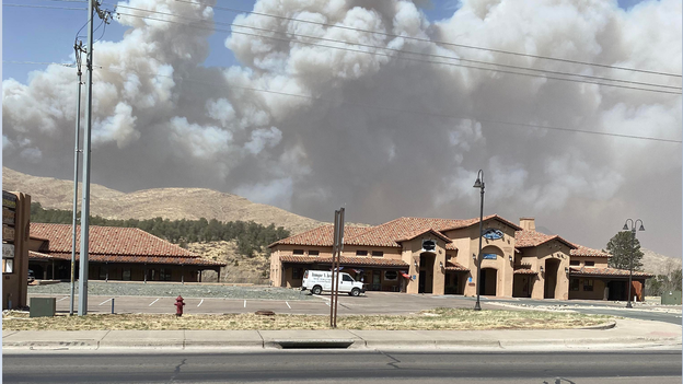
Authorities report the fire around Ruidoso, NM has burned multiple structures. Parts of the town are under an immediate evacuation notice and has burned more than 1,000 acres.
Why the area is under a high fire danger: Click Here
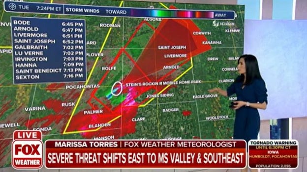
A confirmed, large tornado is on the ground east of Pocahontas, Iowa. The NWS extended the Tornado Warning until 7:15 p.m. for Pocahontas, Kossuth and Humboldt Counties. Arnold, Livermore and Irvington are in the path of the storm.
Officials cleared the nine overturned tractor-trailers from I-35 after strong winds earlier in the day. Wind Advisories remain across the area through midweek.
Hail looked more like snow falling on a patio in Spring Valley, Nevada. Look at the stones bounce.
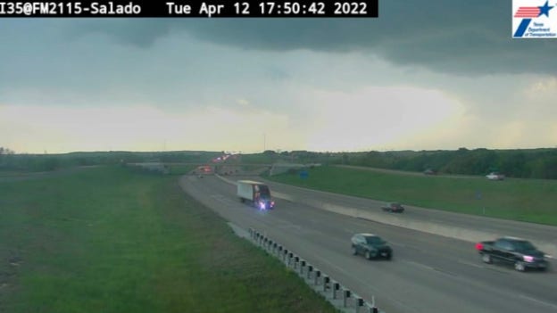
This Texas DOT camera caught the tornado warned storm approaching I-35 near Salado.
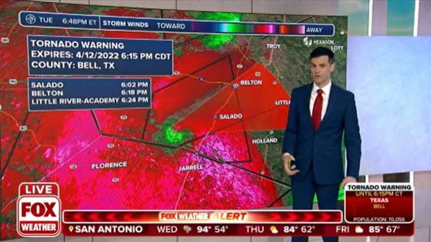
FOX Weather is tracking a possible tornado in Bell County, Texas. The communities of Salado, Belton and Little river are in the path of the storm.
Several schools in southern New Mexico have been evacuated due to the fire burning near Ruidoso, NM.
The Mcbride Fire has burned more than 1,000 acres and has forced several neighborhoods to evacuate.
The Ruidoso Schools have evacuated all students from Sierra Vista and White Mountain to the Ruidoso Convention Center.
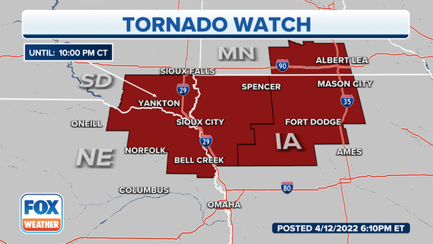
The NWS expanded the northern Tornado Watch to include areas of Minnesota.
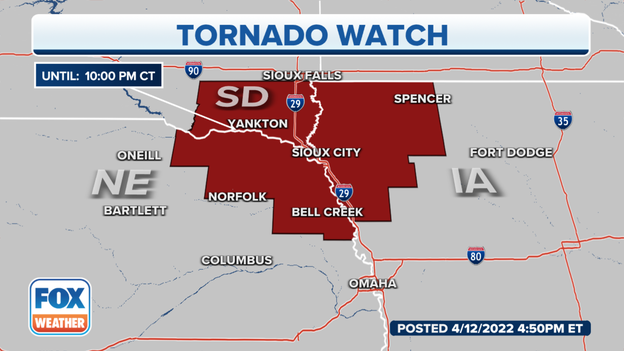
The Watch is active until 10 p.m. for many counties across Nebraska, South Dakota, Iowa and Minnesota.
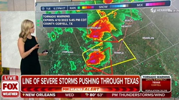
The NWS issued a Tornado Warning for Williamson County until 5:45 p.m. The severe thunderstorm capable of producing a tornado was near Florence and moving east at 25 mph.
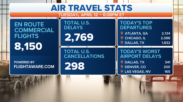
A groundstop has been issued at the Dallas-Ft Worth International Airport because of approaching storms. The FAA says air traffic arriving to the airport could be impacted. So far, more than 2,700 flights were delayed on Tuesday due to a variety of reasons.
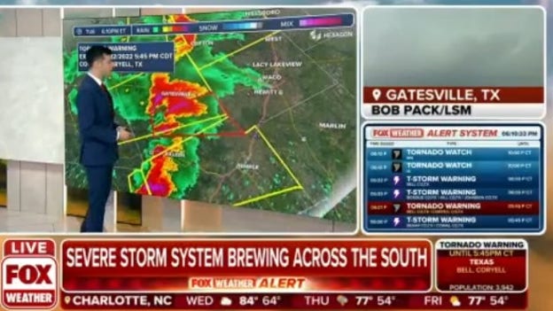
The National Weather Service issued a Tornado Warning for Coryell and Bell Counties in Texas until 5:45 p.m. A spotter observed the tornado in Coryell, Texas.
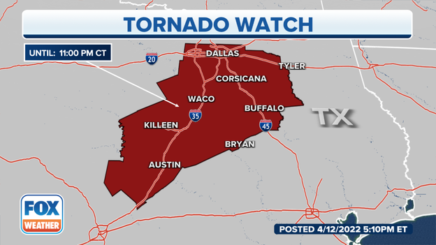
The National Weather Service issued a Tornado Watch for several counties in central Texas until 11 p.m. Dallas, Fort Worth, Austin and Waco are all under the Watch.
WATCH VS. WARNING: HERE ARE TEH DIFFERENCES BETWEEN THESE WEATHER TERMS THAT COULD SAVE YOUR LIFE
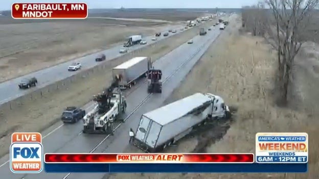
After wind gusts overturned 9 big rigs, I-35 northbound near Faribault remains closed. Authorities set up detours. I-35 southbound is open.
Experts say overturned big rigs could take hours to clear from highway.
'I'M SHOCKED': VETERAN TRUCKER REACTS TO WRECKS IN SEVERE STORMS
The National Weather Service issued a Tornado Watch for several counties across Iowa, Nebraska and South Dakota until 10 p.m. local time.
WATCH VS. WARNING: HERE ARE THE DIFFERENCES BETWEEN THESE WEATHER TEMS THAT COULD SAVE YOUR LIFE
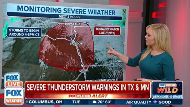
Meteorologists at the NWS's Storm Prediction Center report that areas of Nebraska, Iowa and South Dakota have a 95% chance of being under a Tornado Watch. They expect storms to begin between 4-6 p.m. local time.
102 MILLION AMERICANS TO DEPEND ON LIFE-SAVING WEATHER ALERTS FROM THIS OFFICE IN OKLAHOMA
Hillcrest Elementary School in Plainview, Texas was evacuated Tuesday afternoon due to a grass fire that was approaching the campus. Students were moved to a stadium until parents could pick them up.
Strong southwest winds have pushed the Hermits Peak wildfire burning near Las Vegas, New Mexico toward the areas of San Ignacio, La Canada, Las Tusas, Manuelita, Southwests Sapello, Canoncito and Southern Tierra Monte Canon, forcing immediate evacuation orders for those areas, according to the San Miguel County Sheriff's Office.
An evacuation shelter is available at Old Memorial Middle School in Las Vegas, NM.
Minnesota officials are on the scene now of a stretch of I-35, south of Minneapolis where strong winds have so far blown over 9 big rigs.
Faribault right now is rainy with winds gusting to 21 mph.
It’s currently unknown if anyone has been injured.
For more information on the severe weather, click here.
For more information about the severe weather outbreak, click here.
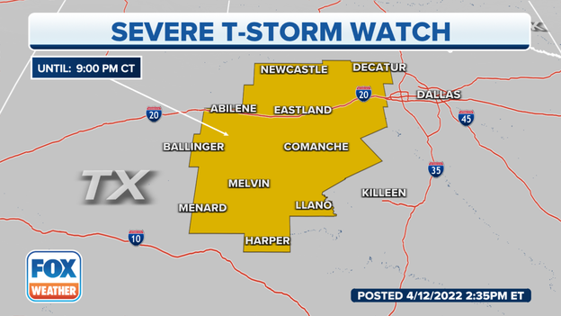
The Severe Thunderstorm Watch is in effect until 9 p.m. Central.
For more information, click here.
Be sure to download the free FOX Weather app to receive important weather alerts in your area.
You can also watch the 24/7 livestream of America’s Weather Team.
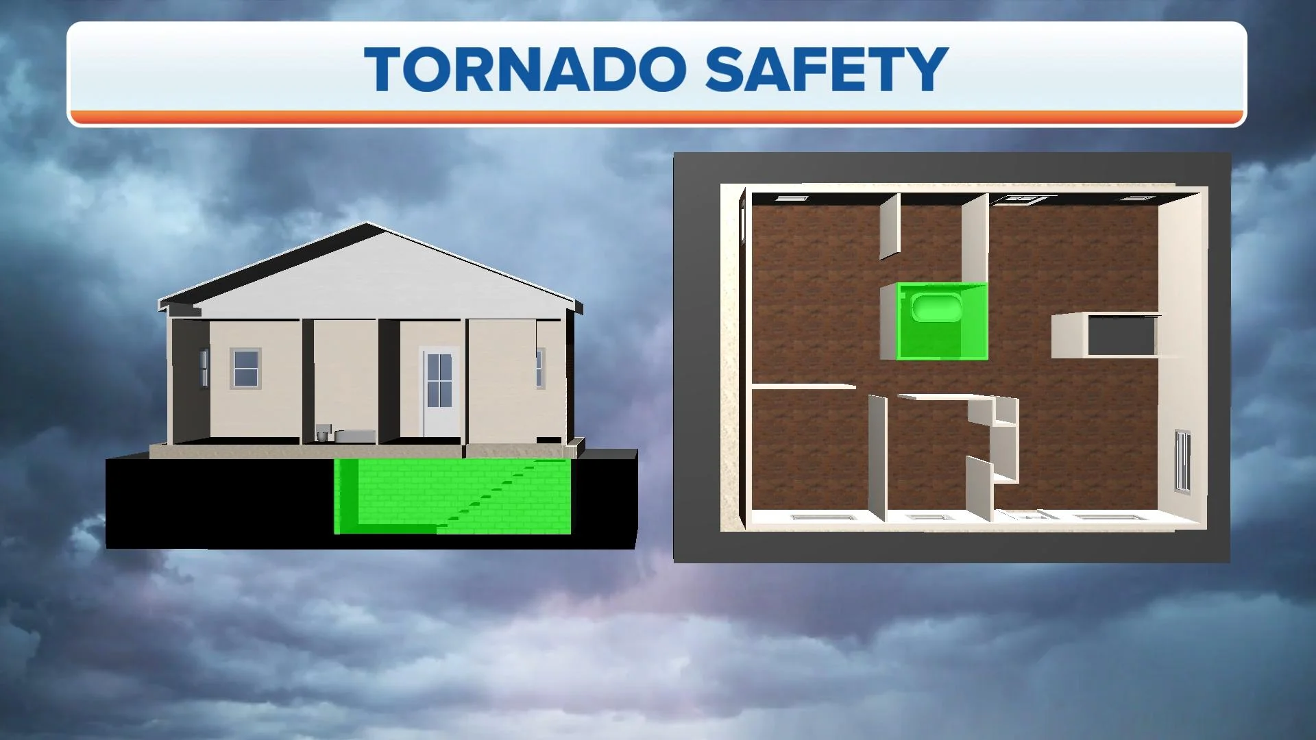
It’s important to know where your safe place is before danger hits to better protect you and your family.
The Storm Prediction Center has increased the risk of severe weather in the Mississippi Valley on Wednesday to "significant."
For more information, click here.
Here’s a list of seven facts you may not know about those pellets of ice.
Pres. Joe Biden is expected to be in Iowa on Tuesday and the area has a moderate risk of severe weather.
For more information about the storms, click here.
There were six reports of tornadoes on Monday, including at least one twister that was confirmed by the weather observer at Little Rock Air Force Base, which triggered the National Weather Service to issue a rare Tornado Emergency.
The primary goal of any statement issued by the NWS is to protect life and property.
This article takes a closer look at the terms used in these statements, starting with the least serious.
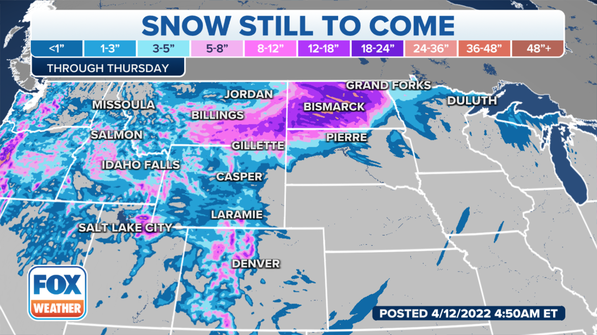
Some parts of the Plains could see more than 30 inches of snow through Thursday.
For more information about the storm, click here.
Another multiday severe weather outbreak – the fourth in four weeks – is targeting the Plains, Midwest and South, where thunderstorms will be capable of spawning several tornadoes, damaging winds and large hail.
For more information on the severe weather threat, click here.
The National Weather Service in Omaha, Nebraska, shared satellite images of clouds starting to clear from the region, which will set the state for severe weather Tuesday afternoon.
For more information, click here.
The first FOX Weather Beast, one of four news-crew trucks custom-built by Accelerated Media Technologies, will take its maiden voyage Tuesday from New York City.
The 4x4 vehicle will traverse across the country heading into the storm system that's moving from the Plains and South all the way to the Midwest and East Coast.
Emergency managers will use three levels to convey the urgency of the situation, according to the U.S. Forestry Service.
The region has been extremely dry, and winds are expected to remain strong, leading to the rapid growth and spread of fires if any were to ignite.
The National Weather service in Billings, Montana, has reported 1 foot of snow so far.
For more information about the blizzard, click here.
Check out this list of important items to keep in your car just in case you end up getting stuck in the snow.
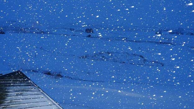
The flakes are flying in Sapphire Village, Montana, making the area look like a winter wonderland.
Photo: Wade Clark, Jr.
For more information about winter driving, click here.
The snow first swept across portions of the West on Monday, even accumulating at very low elevations such as Portland, Oregon, where measurable snowfall (at least 0.1 inches) was reported for the first time on record during the month of April.
Now, the Northern Plains will get hammered by this storm. Snow and high winds began moving into the region Tuesday morning.
This latest outbreak kicked off late Monday when baseball- to softball-sized hail pelted parts of Arkansas.
Live Coverage begins here
