Marshalltown, IA
See RadarCurrent Weather Forecast for Marshalltown
IA 50158 | 1:31am
Weather Conditions
Tonight
Tomorrow
Tomorrow night
Local Weather Radar - Marshalltown, IA
Live Marshalltown Local Radar Forecast by FOX Weather
Next 12 Hours Forecast in Marshalltown
Hourly Weather Forecast & Temperature
Latest Stories from Iowa

Dangerous severe weather threat builds from Southern Plains to Upper Midwest during final week of April
A powerful spring storm system is poised to sweep across the heartland next week and produce severe weather from Tulsa and Oklahoma City, northward to Minneapolis and Duluth. The greatest risk area appears to focus on Iowa and nearby Kansas, Minnesota and Wisconsin, where an intensifying low-level jet could enhance the intensity and coverage of storms.
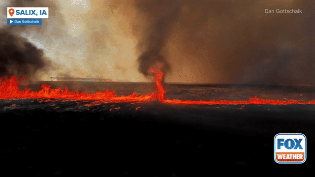
See it: Fire whirl spins through burning Iowa field sparked by severe storm's lightning
A fire whirl, otherwise known as a ‘firenado’ was caught on camera in Iowa after severe weather on Thursday night.

Severe storms target Midwest, Plains over Easter weekend
Severe weather unleashed its fury across the central Plains on Thursday evening. Several storm chasers, including FOX Weather Storm Tracker Brandon Copic, captured video of a tornado forming and then rolling across the fields of Missouri Valley, Iowa.
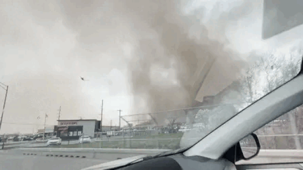
Terrifying dust storm engulfs car in York, Nebraska: 'Oh my God, I'm in a tornado'
A harrowing scene unfolded across eastern Nebraska on Thursday as storms marched across the Plains.