Grand Island, NE
See RadarCurrent Weather Forecast for Grand Island
NE 68802 | 9:24pm
Weather Conditions
Tonight
Tomorrow
Tomorrow night
Local Weather Radar - Grand Island, NE
Live Grand Island Local Radar Forecast by FOX Weather
Next 12 Hours Forecast in Grand Island
Hourly Weather Forecast & Temperature
Latest Stories from Nebraska

Blizzard conditions, ferocious winds blast Plains with dangerous whiteout conditions
Residents across the northern Plains and parts of the Midwest are preparing for a powerful winter storm that will bring strong winds, blowing snow and plummeting temperatures, potentially creating blizzard conditions and hazardous travel.
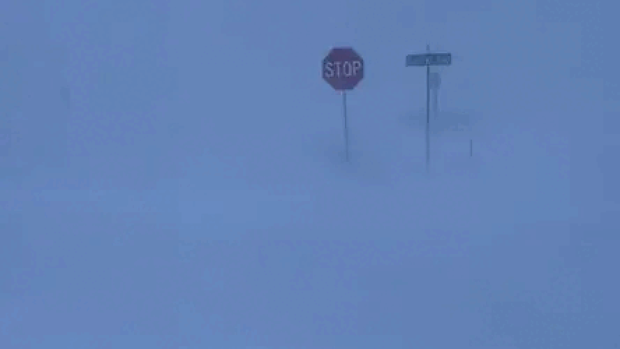
3 killed as blizzard pummels Plains, Midwest with whiteout conditions amid 60-90+ mph gusts
At least three people were killed as a powerful winter storm created blizzard conditions across parts of the Midwest, part of a sprawling storm that brought a dangerous mix of severe weather, including tornadoes, flooding, heavy snow, blizzards and high winds.

Daily Weather Update from FOX Weather: South faces dangerous severe weather threat from coast-to-coast storm
Top weather news for Tuesday, March 4, 2025: A sprawling coast-to-coast storm brings a significant severe weather threat to the South, while Blizzard Warnings cover parts of five states.

Deadly winter storm leads to crashes across central US as millions still face threat of heavy snow
Another major influx of winter weather impacted major cities in the Plains and Midwest before the heavy snow charged eastward into areas suffering from recent flooding in Kentucky and Tennessee.