FOX Forecast Center tracking 4 systems across the Atlantic
The next three systems to develop into tropical storms with sustained winds of at least 39 mph will earn the names Hermine, Ian and Julia, depending on the order of formation.
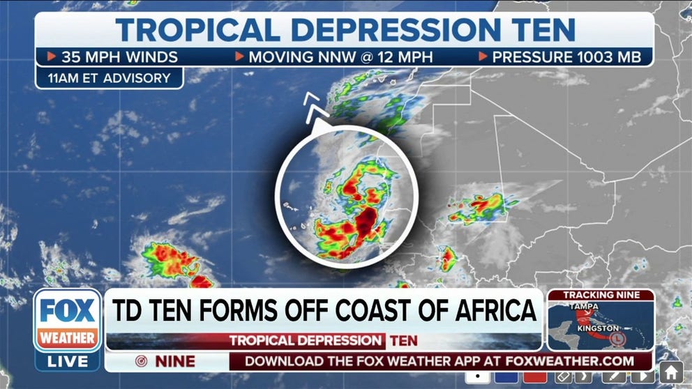
Tropical Depression 10 forms near Africa
Tropical Depression Ten has formed off the coast of Africa, and this storm has the potential be named Hermine or Ian in the coming days.
A slow start to the 2022 Atlantic hurricane season has turned into a busy peak with the FOX Forecast Center tracking several tropical systems across the basin.
Hurricane and Tropical Storm Warnings have been issued for portions of Atlantic Canada as Hurricane Fiona heads toward the eastern part of the country after impacting Bermuda, the Turks and Caicos and several islands in the Caribbean.
Additionally, Tropical Depression Nine formed in the central Caribbean Sea on Friday morning. The Florida Peninsula is already included in the cone of uncertainty of the system that's likely to become either Hurricane Hermine or Ian in the days ahead.
The FOX Forecast Center is also closely monitoring Tropical Storm Gaston, which is bringing tropical-storm-force winds (39-plus mph) and heavy rain to the Azores. A Tropical Storm Warning has been issued for the islands as Gaston meanders in the North Atlantic.
Friday morning also saw the development of Tropical Depression Ten near the western coast of Africa, which does not pose a threat to the U.S. at this time.
There is also a fifth system, which FOX Weather has dubbed "Tropical Disturbance No. 1," being monitored in the central tropical Atlantic. More information about this system can be found below.
HOW TO WATCH FOX WEATHER ON TV

(FOX Weather)
Tropical Disturbance No. 1: Invest 99L in the central tropical Atlantic
According to the FOX Forecast Center, Invest 99L is tracking through the central tropical Atlantic.
"Invest" is simply a naming convention used by the National Hurricane Center to identify an area of weather that it is investigating for possible development into a tropical depression or tropical storm over the next several days.
The disturbance, which the NHC has dubbed Invest 99L and the FOX Forecast Center is calling "Tropical Disturbance No. 1," is located in the central tropical Atlantic. The broad area of low pressure is centered several hundred miles west-southwest of the Cabo Verde Islands and is continuing to produce disorganized showers and thunderstorms.
Some slow development of the system is possible over the next several days as it slowly moves to the northwest and then north over the central tropical Atlantic.
The NHC is currently giving this tropical disturbance a low chance of development.

(FOX Weather)
