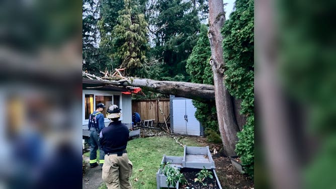
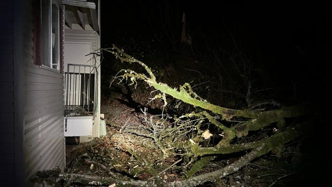
Bomb cyclone slamming Washington to California with life-threatening flooding, blizzard conditions
A powerful bomb cyclone will slam Washington, including Seattle, through parts of California. The West also faces High Wind Warnings associated with this major atmospheric river that'll bring flooding rain and feet of snow to the mountains.
Multiday atmospheric river to blast West
A major atmospheric river is set to hit the West Coast, from Washington to California, midweek. Forecasts show a big stream of moisture arriving Tuesday night and sticking around through late in the week, possibly into the weekend.
SEATTLE – A powerful bomb cyclone associated with a major atmospheric river is forecast to drench the West Coast, from Washington to California, this week and could potentially lead to life-threatening flooding and blizzard conditions.
"Bomb cyclone" comes from the meteorological term "bombogenesis" or "explosive cyclogenesis." This happens when a storm system's central pressure drops at least 24 millibars within 24 hours.
Powerful Pacific bomb cyclone to be one of strongest on record in region
A bomb cyclone is expected to hit the Pacific Northwest. This rapidly intensifying low-pressure system could bring significant impacts, including power outages, flash flooding and blizzards. The storm's rapid development, known as bombogenesis, is making it a particularly dangerous event. Cliff Mass, an atmospheric sciences professor at the University of Washington, joins FOX Weather to provide more details on the storm and its potential impacts.
This storm could be of historic strength. According to NWS Seattle, the lowest pressure recorded off Washington was on Oct. 24, 2021, at 942 mb (27.81 inches). Model forecasts indicate the storm will approach this pressure level Tuesday evening, according to the FOX Weather Center.
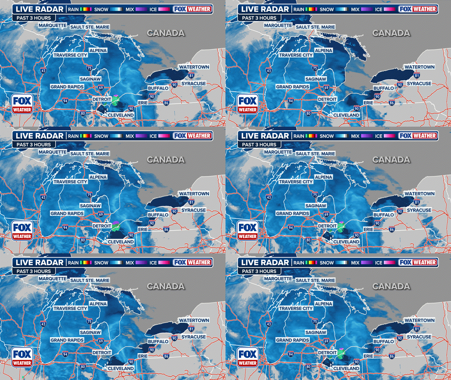
(FOX Weather)
‘High risk’ flood threat for Northern California
A big stream of moisture is set to arrive Tuesday night and will stick around through late in the week, possibly into the weekend, according to the FOX Forecast Center.
The system will bring steady, moderate rain for several days. This will likely lead to flooded roads, streams and even larger rivers.
Northern California will be the bull's-eye of this atmospheric river. From Wednesday to Friday, some areas could see 2-4 inches of rain daily, with even higher amounts possible in the mountains.
Bomb Cyclone sparks powerful pacific storm
A powerful bomb cyclone will slam Washington, including Seattle, through parts of California. The West also faces High Wind Warnings associated with this major atmospheric river that'll bring flooding rain and feet of snow to the mountains.
This has prompted the Weather Prediction Center to issue a rare "high risk" flash flood area for Northern California on Thursday.
WHY RARE 'HIGH RISK' FLOOD DAYS NEED TO BE TAKEN SERIOUSLY
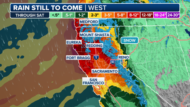
Daily rain amounts of 2-4 inches are expected over the course of several days.
(FOX Weather)
80-mph wind gusts possible
Strong winds will also begin to blow in Tuesday evening as the storm moves in. Gusts of 60-70 mph are expected in exposed areas like ridges, headlands and parts of the coastal plains, the FOX Forecast Center said. The worst winds will occur Tuesday night and back off by Wednesday.
DOWNLOAD THE FREE FOX WEATHER APP
Blizzard in the mountains
In the Cascades, the winds will combine with heavy snow to produce dangerous blizzard conditions. Travel is expected to become impossible Tuesday evening through Wednesday morning. Like most atmospheric rivers, this one will dump feet of snow in the Cascades and Sierra Nevada. However, the warmer Pacific air being pulled in by strong winds will raise snow levels higher than usual.
Blizzard Warnings have been posted for all the Cascades from late Tuesday afternoon through Wednesday morning. This is where high winds are most likely to overlap with snow and reduce visibility to a quarter-mile or less for at least three consecutive hours.
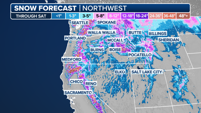
This atmospheric river will dump feet of snow in the Cascades and Sierra Nevada.
(FOX Weather)
Snow will likely begin around 3,500 feet, with the heaviest amounts above 4,000 feet, blanketing mountain ranges with several feet of snow.


