San Francisco has first-ever Tornado Warning as atmospheric river slams California
San Francisco had its first-ever Tornado Warning issued as a powerful atmospheric river brought thunderstorms and an 83 mph wind gust to the City By the Bay, part of an extensive storm system affecting the entire West Coast.
San Francisco gets Tornado Warning as atmospheric river slams West Coast
Over 1 million were under a brief Tornado Warning Saturday morning in the heart of San Francisco as a strong atmospheric river hit the West Coast. Heavy rains were still bringing a risk of flash flooding in northern California.
SAN FRANCISCO – A strong atmospheric river drenched Northern California with heavy rains and damaging wind gusts Saturday, leaving well over 200,000 without power in the state.
The San Francisco Bay Area dealt with multiple threats as the storm swept through Saturday morning – including a brief Tornado Warning.
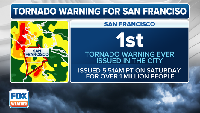
The National Weather Service issued the rare alert when Doppler radar indicated rotation inside a strong thunderstorm that was heading for more than 1 million people in downtown San Francisco just before 6 a.m., likely jolting many of those awake when their phones blared the urgent alarm.
The NWS said it believes it was the first Tornado Warning issued in the city of San Francisco since records have been kept.
The threat passed about 20 minutes later with no initial reports of any touchdowns or damage. However, NWS meteorologists said they sent a storm survey team out across the greater San Francisco area to check on possible storm and/or tornado damage.

The San Francisco Bay Area dealt with multiple threats as the storm swept through Saturday morning – including a brief Tornado Warning.
(FOX Weather)
The thunderstorm did bring a gust of 83 mph to San Francisco International Airport – believed to be the fourth-highest gust ever recorded at the airport. Gusts reached 78 mph in Monterey and 59 mph in Oakland.
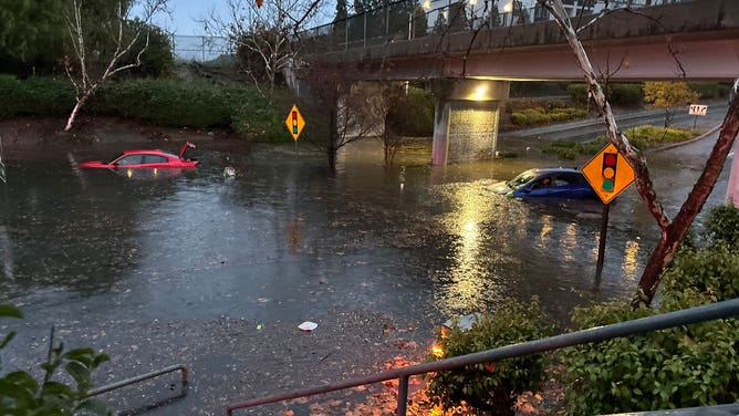
Meanwhile, 1-2 inches of rain fell across the Bay Area, temporarily flooding roads and underpasses. A scene from Livermore in the East Bay showed cars submerged to their door handles along a flooded road.

A road is flooded in Livermore, California on Dec. 14, 2024.
(Livermore Police Dept. / FOX Weather)
Officials reported standing water on a freeway interchange in Dublin and flooded lanes along Interstate 280, U.S. Highway 101 and California Highway 35, along the San Francisco Peninsula.
To the south of San Francisco, the NWS confirmed an EF-1 tornado with winds of 90 mph tore through the community of Scotts Valley. Videos and photos from the area showed debris in the roads and cars flipped after the storm.
Caught on video: Tornado slams Northern California
Authorities in Santa Cruz County are investigating the touchdown of a tornado on Saturday in the area of Scotts Valley.
NOAA’s Storm Prediction Center had placed the Bay Area in a Level 1 out of 5 severe weather threat through Saturday morning for potentially severe thunderstorms that could bring large hail, damaging wind gusts over 55 mph – and still a risk of an isolated tornado.
Farther east, heavy snow was expected in the Sierra Nevada, with Winter Storm Warnings in effect. As much as 8-20 inches was expected in the higher elevations.
Wind gusts were predicted to reach upwards of 120 mph along the mountain ridgetops and over 45 mph in the valleys. A wind gauge atop Ward Peak at Alpine Meadows Ski Resort clocked a gust of 159 mph Saturday morning.

(FOX Weather)
Weather will improve across the Bay Area and Northern California on Sunday as the storm moves farther inland.
Strong winds, coastal flooding pummel western Washington
While California took the brunt of the storm's atmospheric river, the Pacific Northwest felt the effects of the passing low-pressure center as it headed toward Vancovuer Island, bringing strong winds and a risk of coastal flooding.
Gusts along the Washington coast reached 62 mph in Forks and 61 mph in Hoquiam early Saturday morning, while a gust reached 71 mph at Whidney Island's Naval Air Station. Gusts reached 45-55 mph around the Puget Sound area.
At the storm's peak, over 90,000 had lost power in western Washington, according to PowerOutage.US.
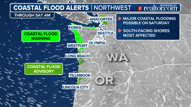
A dangerous combination of pounding surf of 20-23 feet, extreme spring tides and low atmospheric pressure threatened significant storm surge and coastal flooding.

Coastal flood alerts.
(FOX Weather)
NWS Seattle warned of floodwaters reaching 2.5-3.5 feet deep along shorelines and low-lying areas during high tide late Saturday morning.
"This is expected to lead to numerous road closures," NWS Seattle warned. "Low lying property including homes, businesses, and some critical infrastructure may be inundated. Shoreline erosion or damage may occur."
Another atmospheric river – what will be the third in the week – is heading to the West Coast early this week but is expected to be weaker than Saturday’s event.

