Evacuation warnings issued in California as intense atmospheric river storms target state
A Pineapple Express Saturday soaking California will be quickly followed by a days-long atmospheric river storm Sunday into the workweek that renews threats of flooding and landslides, especially across Southern California.
Atmospheric rivers bring renewed flooding threat to California
Millions of people in California face the threat of flooding as powerful atmospheric river storms arrive.
SAN FRANCISCO – A pair of storms are soaking California once again this weekend, bringing fresh rounds of heavy rain that renew concerns for dangerous flooding and increased risks of mudslides.
The first storm pushed through much of the state Saturday. This "Pineapple Express" tapped into some tropical moisture stretching back near Hawaii, carrying areas of heavy rainfall. That storm will be quickly followed by a days-long atmospheric river storm from Sunday into the workweek that renews flooding threats and landslides, especially across Southern California.

(FOX Weather)
"Wave by wave, opportunity by opportunity, it just stacks up," FOX Weather Meteorologist Britta Merwin said. "As we work our way through the weekend, more issues will pop up. The snow up the mountains will be epic. Be careful with weekend travel, and then also travel coming back after a ski weekend with another storm on the way."
WATCH: SOUTHERN CALIFORNIA HOMES DANGLE ON EDGE OF CLIFF AFTER STORMS CAUSE EROSION

(FOX Weather)
The National Weather Service has issued a Flood Watch that covers most of the California coastline from the San Francisco area south to the Los Angeles area, encompassing nearly 27 million people.

(FOX Weather)
Officials in Santa Barbara County issued evacuation warnings Saturday for portions of the county, which was hit hard by atmospheric river storms just last week. Officials said residents covered by the warnings should prepare to leave if evacuation orders are issued.
Saturday's soaker an appetizer before second storm's main event
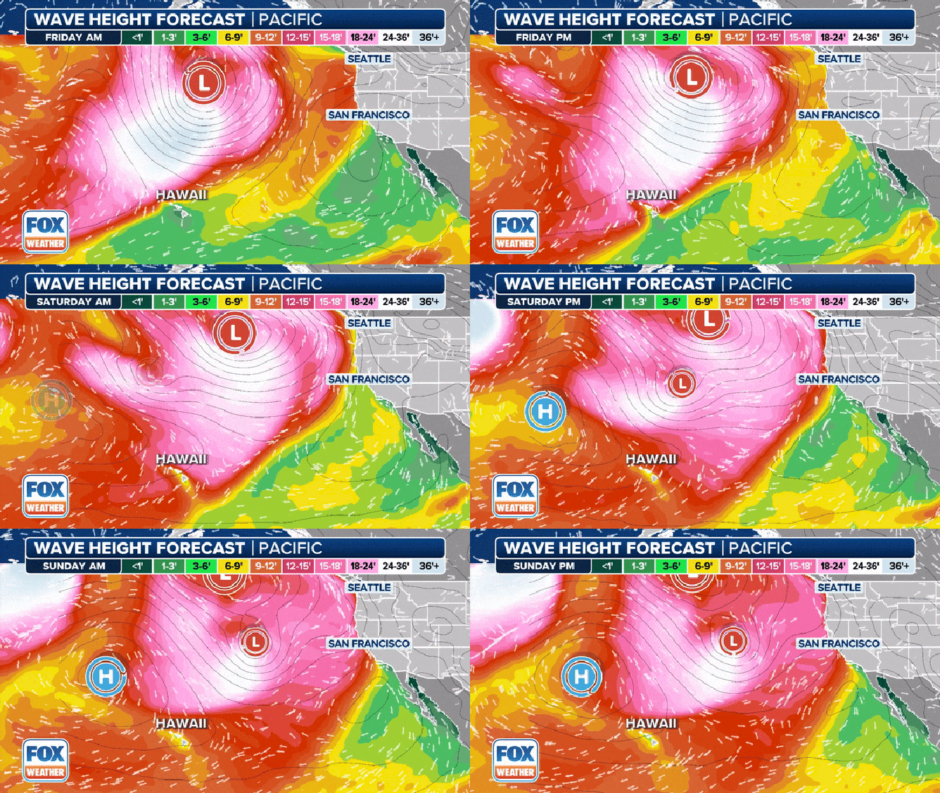
After sending massive waves to Hawaii, a big sprawling area of low pressure spinning in the Gulf of Alaska swung a cold front into northern and Central California on Saturday.
The storm brought periods of moderate to heavy rain and gusty winds. Rainfall totals were expected to remain under an inch around the San Francisco Bay Area with just minor flooding possible. Heavier rain was forecast to fall along the coastal ranges north of the Bay Area, where the greatest risk for some flash flooding was expected.
A mudslide had already blocked both directions of U.S. Highway 101 in Northern California near the Oregon border.
50 YEARS OF MEMORIES WASHED AWAY FOR SAN DIEGO FAMILY FOLLOWING FLOODS
Trees toppled as rock slide closes California highway
A segment of US Route 101 was fully closed at Last Chance Grade in Del Norte County, California due to a rock slide on the evening of Friday, February 16, the California Department of Transportation (Caltrans) said.
Gusty winds reaching 30-40 mph around the Bay Area, with higher gusts in the mountains, could bring scattered power outages and downed trees and branches.
The storm brought heavy surf to the coast. Large, breaking waves of 18-22 feet were possible along west-facing beaches from Saturday morning through Sunday. Local areas with steep beaches could experience waves up to 28 feet, the National Weather Service said.
CALIFORNIA WOMAN RESCUED FROM 25-FOOT CESSPOOL OUTSIDE HOME FOLLOWING RELENTLESS STORM

The storm is kicking up large surf across the Pacific.
(FOX Weather)
Strongest storm system arrives late Sunday
The final and most impactful storm will impact California starting Sunday night as a slow-moving Pacific storm sends another atmospheric river toward the state.
While the amount of moisture coming off the Pacific will be less concentrated than past atmospheric events, it's the duration of the rain that will be problematic.
The FOX Forecast Center said models are indicating steering winds, which usually push along low-pressure systems, will considerably weaken, allowing the storm to sit and spin off the coast for 2-3 days. This would keep the rain falling right through the middle of next week.

(FOX Weather)
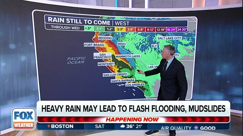
While these slow, staggering storms are notoriously hard to forecast, there is strong evidence that the heaviest rain in Southern California will be on Monday, the FOX Forecast Center adds. The San Francisco Bay Area and Los Angeles metro area are at a Level 2 risk out of 4 for flash flooding, while parts of Santa Barbara County have been upgraded to a level 3 risk.
About 2-5 inches of rain are expected along the Southern California coast and inland valleys, with 8 inches expected in the mountains. In Northern California, about 1-3 inches of rain are forecast for the Bay Area and valleys, with 3-6 inches or more in the mountains.
Rain totals won't be as extreme as the major flooding events of early February. Still, given the extremely saturated soils already in place, there will almost certainly be more flooding, landslides and rock falls.

(FOX Weather)
"Even though rain amounts with this storm may end up lower than the last storm [from earlier in February], significant storm-related impacts are still expected," NWS forecasters in Los Angeles said.

(FOX Weather)
"Streams and small rivers will rise quickly (likely even faster due to the antecedent conditions), trees will be more prone to falling even with lower wind speeds, mud and rocks slides are almost a guarantee in the hills and mountains, and area roads will be very hazardous, especially during periods of heavier rain. Residents are encouraged to begin storm preparations as soon as possible before the rain starts," the NWS continued.
Wind gusts will also hit 40-60 mph, risking power outages, and heavy surf will continue to pound the coasts, with risks of coastal erosion and moderate coastal flooding, especially Sunday and Tuesday mornings.
STRONG WINDS CRASH TREE INTO SACRAMENTO, CALIFORNIA, HOME: 'OH MY GOD! THE ROOF JUST COLLAPSED IN!'
To top it all off, scattered thunderstorms may bring periods of intense rainfall and frequent lightning.
The stormy weather looks to calm down toward the end of the week.

