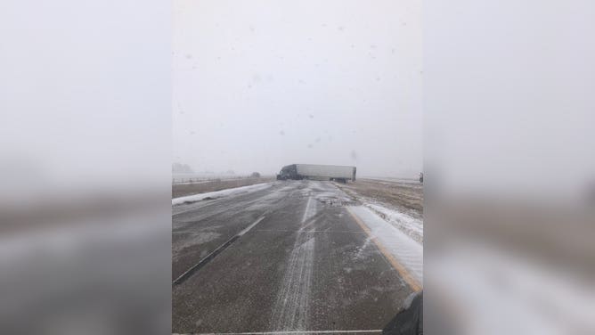
Blizzard snarling travel across Plains, Midwest as winter storm wallops US with snow, wind
More than 30 states will feel the storm's effects, from wind to snow to flooding rain and severe storms. A stripe of 8-plus inches of snow is expected to pile up in a corridor from Nebraska through northern Michigan.
1 foot of snow may fall in parts of Iowa, Wisconsin on Tuesday
The blizzard that has crippled parts of the Plains with nearly a foot of snow and whiteout conditions is on the move as the low pressure peaks in intensity as it moves into the Great Lakes. FOX Weather’s Nicole Valdes is live in Des Moines, Iowa with the latest.
A larger, more potent storm than the one that made headlines over the weekend is punishing the Plains and Midwest with an early-week blizzard.
"Boy, the weather pattern has changed over the past week and a half or so," FOX Weather Winter Storm Specialist Tom Niziol said. "This blizzard is going to pack a punch on the winter side, the severe side and the heavy rain side across the United States."
Impacts
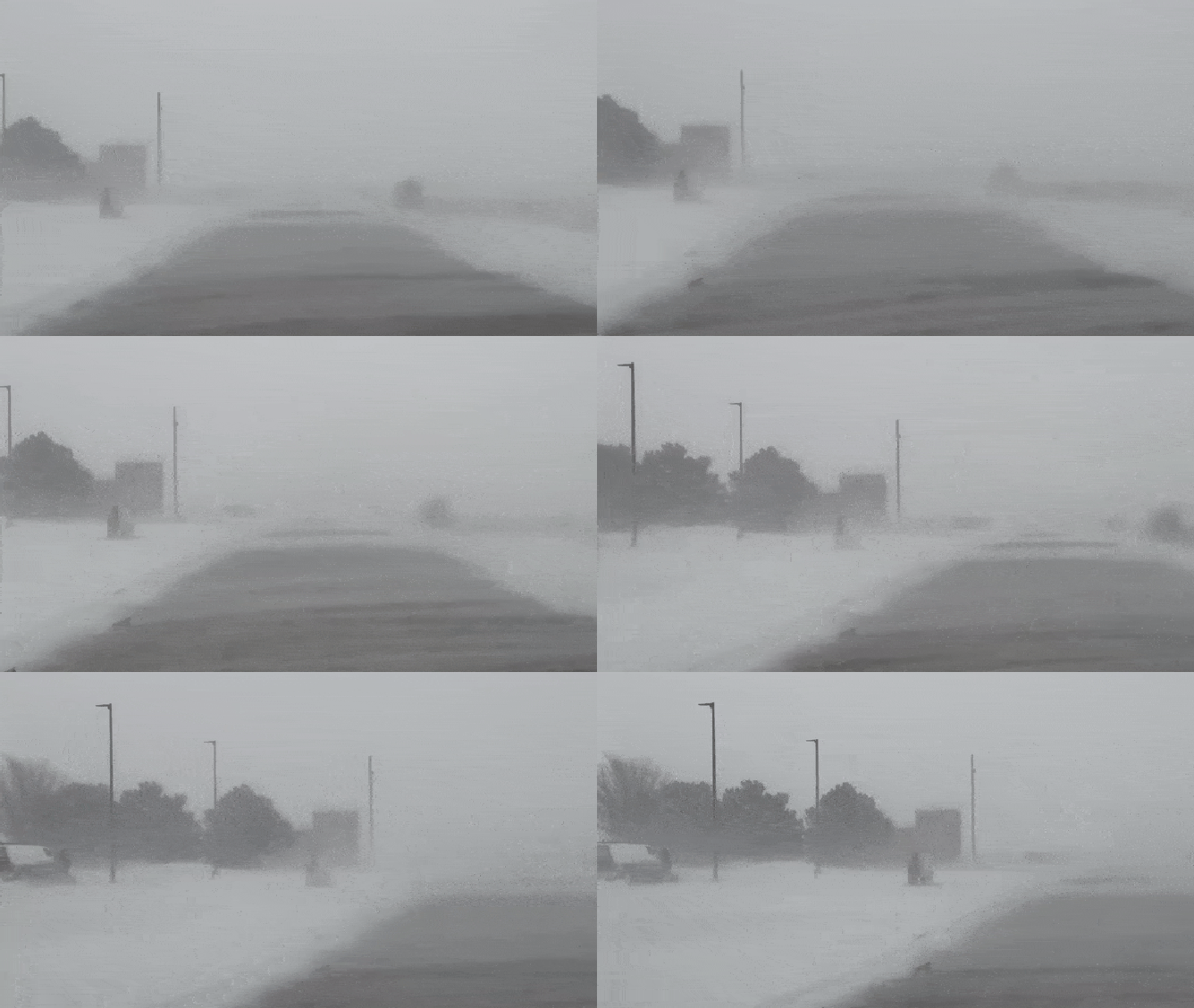
More than 30 states will feel the storm's effects, from wind to snow to flooding rain and severe storms. Tropical-storm-force wind gusts and falling snow created near-whiteout conditions, making travel dangerous, if not impossible.
WHAT MAKES A BLIZZARD DIFFERENT FROM AN ORDINARY SNOWSTORM?
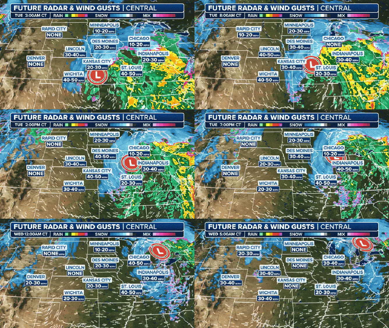
Future radar and wind gusts through Wednesday.
(FOX Weather)
The National Weather Service issued winter weather alerts, including Blizzard Warnings, across the Plains and Midwest through Tuesday morning. Winter storm alerts extend as far south as the Texas and Oklahoma panhandles. Winter Weather Warnings push into the Great Lakes and continue into Wednesday.
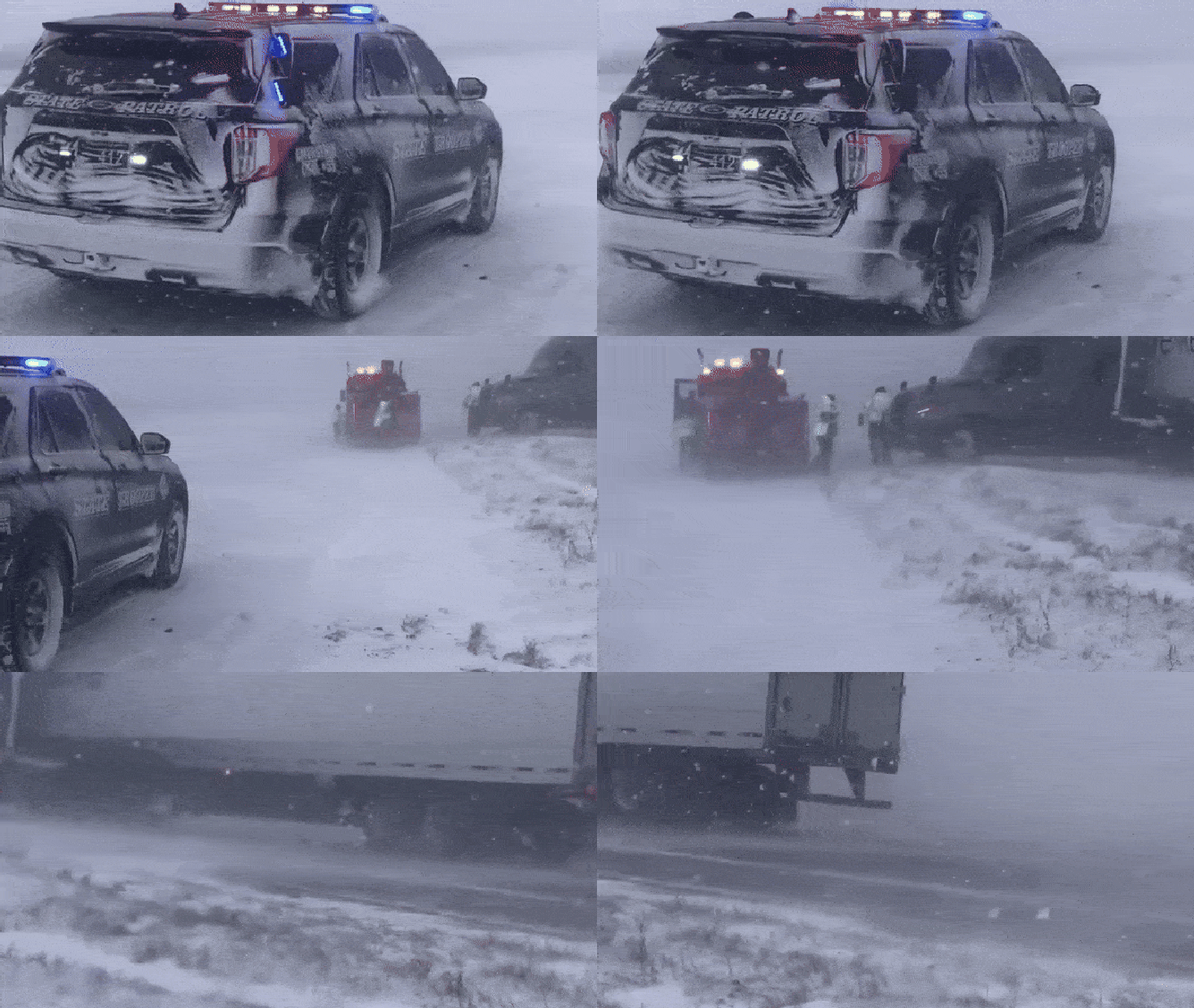
On Monday, the Nebraska State Patrol responded to 50 weather-related accidents due to slick roads.
Officials have closed several highways from Colorado to Kansas to Missouri so far. That includes I-70 in both directions in western Kansas and I-80 in Nebraska.
"In just the last hour, it went from 'it's not too bad out there. This was not covered in snow at all, maybe even a little bit of rain'. And now we are close to that blizzard conditions situation," Mark Suddath, Exclusive FOX Weather Storm Tracker said while covering the storm. "The winds are gusting pretty strong out here. Snow blasting in the parking lots covered. People coming in to take shelter."
SEE BLIZZARD BLAST THROUGH PLAINS AS SNOW LIMITS VISIBILITY ON MAJOR HIGHWAYS
WHAT YOU SHOULD KNOW ABOUT BLOWING AND DRIFTING SNOW
Late Monday Kansas' Governor Laura Kelly issued a state of disaster emergency for winter storms. She propositioned emergency response crews across the state, expecting the heaviest snow overnight.
"When this storm really begins to tighten up, produces those blizzard conditions over the Plains and through the Upper Midwest, we're likely going to see some significant travel issues, even up into the Chicago area, where most of the precipitation ahead of the system and with the system will be in the form of rainfall, especially your air travel in the Chicago area Tuesday night into Wednesday," Niziol said.

(FOX Weather)
Before the snow comes to an end Wednesday, a stripe of 8 to 12-plus inches of snowfall is expected to pile up in a corridor from Nebraska through northern Michigan.
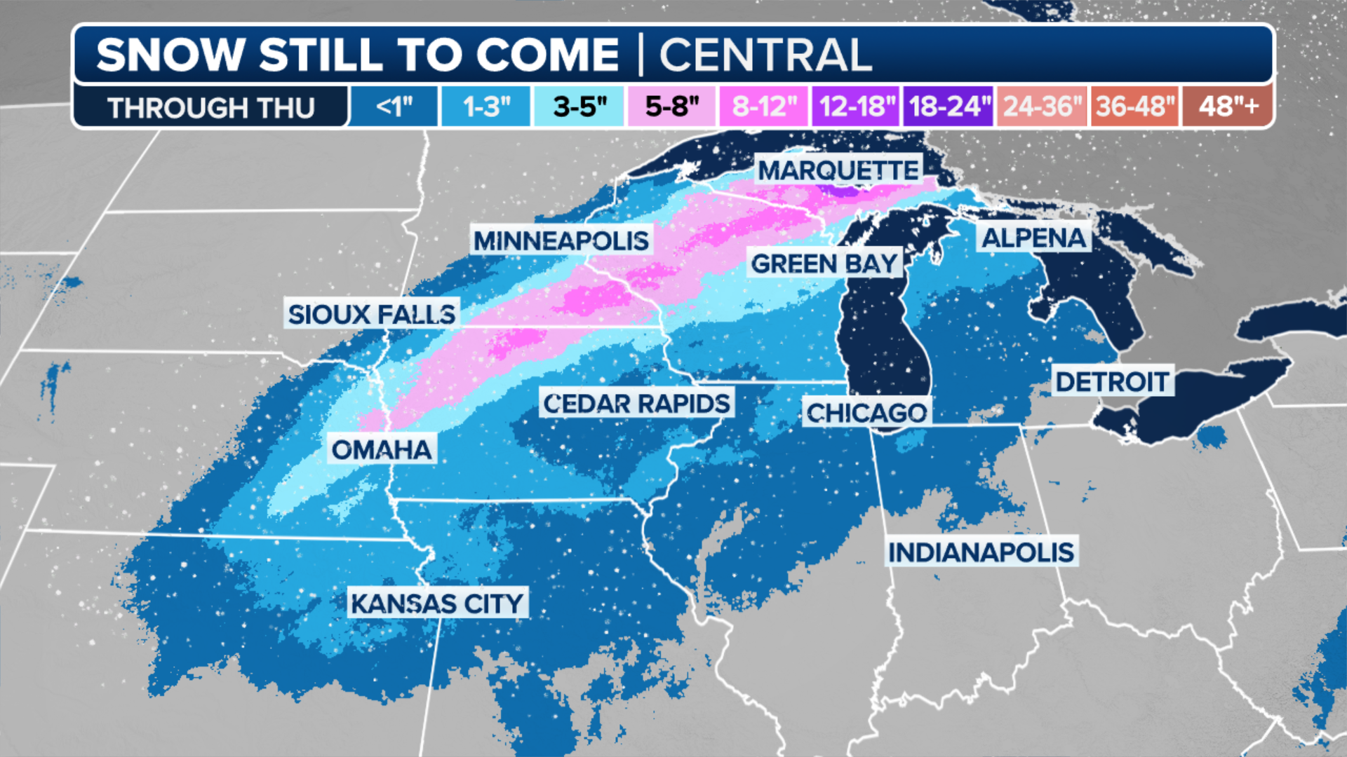
(FOX Weather)
SOUTH FACES MULTIDAY SEVERE WEATHER THREAT WITH NIGHTTIME TORNADOES, LARGE HAIL POSSIBLE
Tuesday
The powerful storm heads into the Great Lakes on Tuesday, but gusty winds will linger across the Plains even after the precipitation ends. The backside of the storm is much cooler, so areas like Chicago could see some snow along with frigid temperatures late Tuesday.
"On the backside, though, look at those strong winds in places like Wichita as we get into Tuesday morning. I should say 50- to 60-mph wind gusts," Niziol said. "And then the system will continue moving up across the Great Lakes region. So, very significant issues for that portion of the Midwest as we get into Tuesday and Wednesday. Big blizzard conditions for that area."

(FOX Weather)
Wednesday
Detroit, Cleveland and Indianapolis will have to contend with tricky commutes on Wednesday because of strong winds and blowing snow lingering across the Great Lakes region.
Rain could also linger over parts of New England early in the day, with snow piling up in portions of interior Maine. Winds will stay gusty even after the precipitation pushes off the East Coast.

(FOX Weather)
More to come
The current pattern of the jet stream, dipping south over the center of the country, will drive another couple of storms from the West into the southern Plains and then to the Northeast late this week and into next week.
Get ready for another round of snow and rain for the weekend
Winter Storm Specialist Tom Niziol highlights the very active weather pattern across the country. The nor'easter has just departed now the next storm is creating a blizzard and severe storms in the mid-section of the country. What is forecast to be a bomb cyclone moves into the West Coast early week and the storm takes the same track.
HOW COLD DOES IT HAVE TO BE TO SNOW?
"I've been working with winter weather for over 30 years and I haven't seen many setups like this," said Winter Storm Specialist Tom Niziol. "This is going to be not just one storm after the other, but one major high impact winter storm after the other."
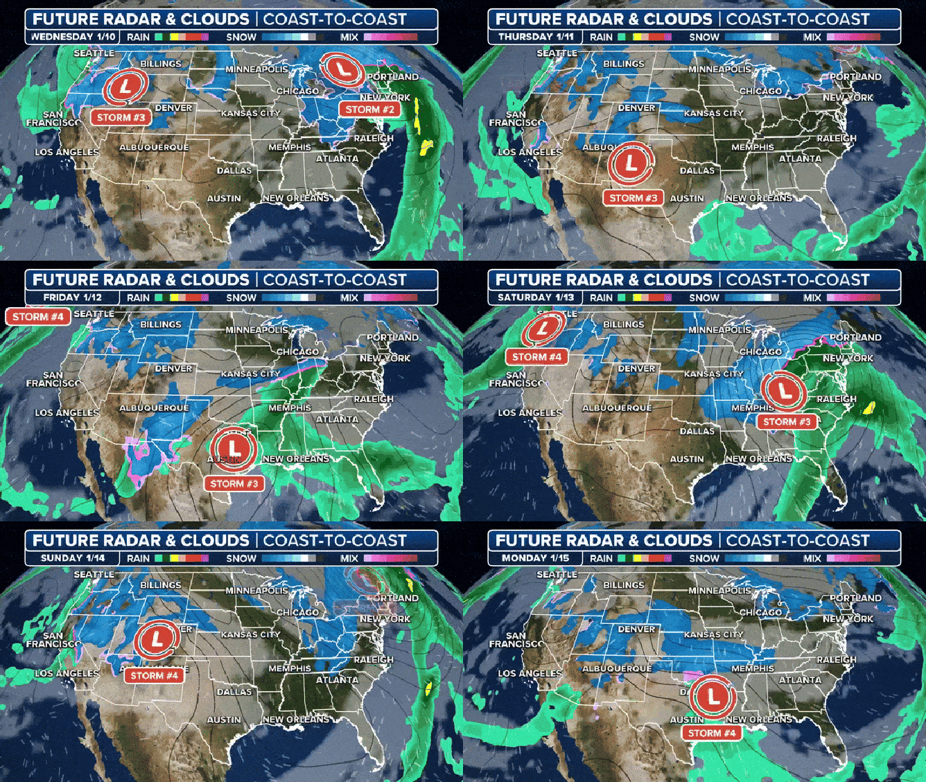
Two more storms will ride the jet stream from the West into the southern Plains and then to the Northeast late this week and into next week.
(FOX Weather)

