Bryan Norcross: Alberto's effects fade today in Texas as we watch two other systems
As Tropical Storm Alberto moves into Mexico, the National Hurricane Center is now monitoring a new tropical disturbance in the Gulf of Mexico and another one approaching the Southeast coast.
Invest 92L could develop into tropical depression off Southeast coast
The National Hurricane Center has raised the odds of development for a tropical disturbance off the Southeast coast, noting that a tropical depression could form before it reaches the coast of Florida or Georgia by early Friday.
Updated Thursday at 9 a.m. ET
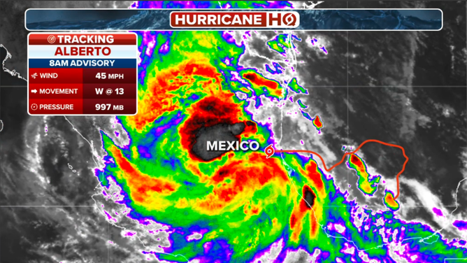
Sprawling Tropical Storm Alberto is moving into Mexico, so the gusty winds that extend hundreds of miles north into Texas will diminish today. However, this morning's high tide could still be a problem in vulnerable areas of coastal Texas.
The persistent onshore wind from a combination of Alberto and the heat-dome high-pressure system to the north will still cause the tide to be higher than normal around the western half of the Gulf. The air is being squeezed between the large, tropical low-pressure system and the extra-strong heat dome. Like squeezing a toothpaste tube, the air speeds up between two weather systems.

Tropical Storm Alberto location in the Gulf of Mexico.
(FOX Weather)
Alberto's strongest spiral band with the heaviest rain has moved well inland. Dangerous flash flooding is still possible in the Mexican mountains, where up to 20 inches of rain might fall. In Texas, periodic tropical downpours are still possible today, but nothing sustained. The weather should be much better by tomorrow.
Alberto developed from a combination of a broad low-pressure system that often develops over Central America in June called the Central American Gyre (in this context, a gyre is a large-diameter circular system) and a weak disturbance from the Caribbean. That scenario is forecast to repeat itself, more or less, over the weekend when another Caribbean disturbance will be flung toward the Gulf with an opportunity to organize.
New system in the Gulf
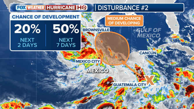
The National Hurricane Center now has the chance of at least a tropical depression forming out of Disturbance #2 in the medium range. We'll watch over the weekend to see what develops, but at least a depression is increasingly likely. Whatever form the system takes, high pressure is forecast to hold sway across the Southeast, blocking it from moving very far north.

The National Hurricane Center is watching a new system in the Gulf of Mexico for potential development.
The current forecasts call for the system to be less intense than Alberto with less impact on South Texas. It's never smart, however, to count on forecasts for a system that hasn't yet developed. On the current schedule, the disturbance will move into the southern Gulf on Saturday where it will have an opportunity to organize. If blocking high pressure moves into place across the southeastern U.S. as forecast, it would track relatively quickly into Mexico by about Monday. We'll see.
Atlantic swirl to reach the Southeast coast tomorrow
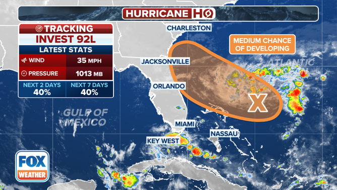
A small low-pressure system has developed offshore of the Bahamas from the remnants of the front that was part of the big deluge in South Florida the week before last. It’s officially being dubbed Invest 92L because the Hurricane Center is "investigating" it. There is high confidence that the system will track toward the Southeast coast, arriving about Friday.

The outlook for Invest 92L in the southwestern Atlantic.
(FOX Weather)
A defined swirl is obvious from satellites, but the moisture and thunderstorms are not organized around it, so it doesn't qualify to be a tropical depression. The National Hurricane Center is giving the system a decent chance of attaining some organization today before it reaches the coast tonight or tomorrow. Whether it officially becomes a depression or not, gusty winds and a moisture surge are likely. People near the North Florida, Georgia, and Carolina coasts should stay informed. And mariners beware.
After these systems move inland, nothing seems to be in the offing.
