Bryan Norcross: Tropical Storm Ernesto to impact northeast Caribbean islands on Tuesday, Wednesday
There is high confidence that Ernesto will begin its turn to the north when it's in the vicinity of Puerto Rico. The atmospheric pattern looks very conducive to strengthening, so Hurricane Ernesto is likely by Wednesday night or Thursday as the storm pulls away from the islands.

FOX Weather is your Hurricane HQ.
(FOX Weather)
Updated at 9 a.m. ET Tuesday, August 13, 2024
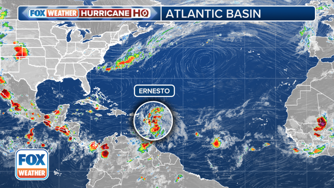
The center of Tropical Storm Ernesto will track across the northeastern Caribbean Sea on Tuesday and pass over or near Puerto Rico and the Virgin Islands by Tuesday night and Wednesday.
Rainfall amounts of 4-6 inches are forecast over the affected islands, with up to 10 inches in Puerto Rico because of the higher terrain.
Ernesto is forecast to continue to organize, so it should slowly get stronger as it tracks near the islands. Everybody in Puerto Rico, the Virgin Islands and the northeast Caribbean should stay informed. Winds will likely gust near hurricane strength and mudslides are possible in the higher elevations.
The center of Tropical Storm Ernesto will track across the northeastern Caribbean Sea on Tuesday and pass over or near Puerto Rico and the Virgin Islands by Tuesday night and Wednesday.
(FOX Weather)
There is high confidence that Ernesto will begin its turn to the north when it's in the vicinity of Puerto Rico. The atmospheric pattern looks very conducive to strengthening, so Hurricane Ernesto is likely by Wednesday night or Thursday as the storm pulls away from the islands.
A pronounced dip in the jet stream will push a cold front into the south and tug Ernesto north, well offshore of the East Coast.
Around the weekend, the jet stream dip will move on, and Hurricane Ernesto's progress is forecast to slow down. The storm might be in the vicinity of Bermuda at that time, so residents there should stay in close touch with local information and instructions. The timing might also coincide with Ernesto's peak intensity.
Late in the weekend, another dip in the jet stream will move across the northern tier of states and pull Ernesto north. Eventually, the steering should turn Ernesto out to sea. The outside edge of the track possibilities shows a very slight chance of the storm brushing New England, with a little better chance of it affecting Atlantic Canada.
In any case, high surf and dangerous ocean conditions are likely along most of the U.S. East Coast beginning late in the week.
Elsewhere in the Atlantic, dry air and Saharan dust continue to dominate the tropics. Disturbances moving off Africa are finding a hostile environment as they move west. As a result, no other tropical systems are expected to develop in the next week.