Bryan Norcross: Remembering Hurricane Andrew less than 5 days from landfall as Ernesto heads north
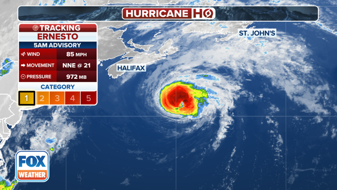
Hurricane Ernesto is charging into the North Atlantic. It will run out of warm water after today and then transition into a non-tropical system. It will likely brush Newfoundland in far eastern Atlantic Canada late tonight, but the worst of the storm should stay offshore.

FOX Weather is your Hurricane HQ.
(FOX Weather)
Updated at 9 a.m. ET on Monday, August 19, 2024
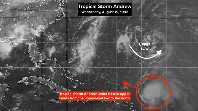
On this day 32 years ago, Tropical Storm Andrew was just a big smudge on the satellite. None of us were anxious, though building high pressure to the north nagged me.

On this day 32 years ago, Tropical Storm Andrew was just a big smudge on the satellite.
(NOAA)
On TV, I gave Andrew a slightly better-than-even chance of affecting South Florida, though I never imagined what happened.
Andrew was 1,400 miles from Miami at 5 p.m. that Wednesday. A large upper-level low was ripping at the storm, keeping it weak, but there were indications it would move out of the picture. Although forecasts were iffy at that time, so that wasn’t certain.
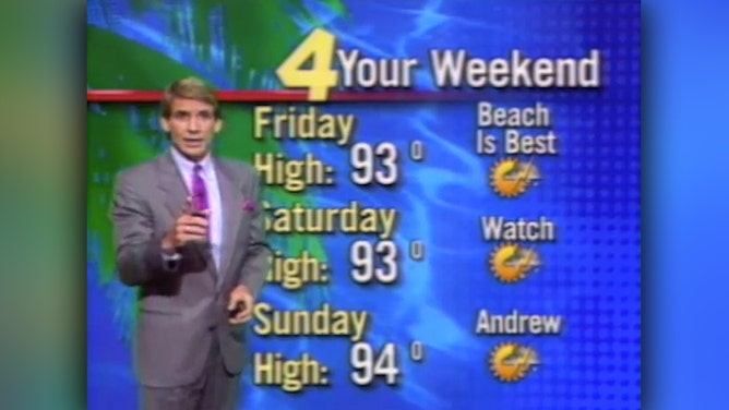
On WTVJ/NBC in Miami that evening, I premiered the proto-cone. Graphics systems of the era didn't allow the cone to be filled in like we do today. That didn't come until 1996 with the new technology we installed at WFOR/CBS. Average forecast errors were large in 1992, so the proto-cone arcs went from Cuba to the Carolinas.

On WTVJ/NBC in Miami that evening, Norcross premiered the proto-cone.
(WTJV)
The National Hurricane Center forecast that Wednesday was pretty good, however. The NHC’s best computer forecast model was the NHC90, so their official forecast pretty much followed that. (Computer models weren't distributed to the public or TV stations in those pre-internet days.)
If Andrew did affect South Florida, I was worried that the timeline for preparation would be short if the storm ended up just east of the Bahamas on Saturday – just 3 days later. So in the extended forecast, I put "Watch Andrew" for the weekend. Just in case.

On this day 32 years ago, Tropical Storm Andrew was just a big smudge on the satellite.
(WTJV)
Little did we know that evening what that weekend would bring.
Hurricane Ernesto is charging into the North Atlantic. It will run out of warm water after today and then transition into a non-tropical system. It will likely brush Newfoundland in far eastern Atlantic Canada late tonight, but the worst of the storm should stay offshore.

Tracking Hurricane Ernesto.
(FOX Weather)
Robust tropical disturbances are coming off Africa, but none are positioned to avoid the dry air over the tropical Atlantic according to the computer forecast models. So no development is expected for the next week, at least.