Bryan Norcross: Tropics continue on July break
While the atmosphere is not conducive to storm development at the moment, the water temperatures and the depth of the warm water from the tropical Atlantic across the Caribbean continue to be off the charts.

FOX Weather is your Hurricane HQ.
(FOX Weather)
Updated at 10:30 a.m. ET on Thursday
A strong high-pressure system is sprawled across the Atlantic. The high is a mountain of air, and the flow of air down the mountain suppresses any significant development under its dome of control. In addition, flow around the south side of the big high is dragging a giant plume of Saharan dust across the tropical Atlantic and the Caribbean.

This graphic shows the tropical Atlantic Ocean.
(FOX Weather)
These features will be slow to dissipate, so no tropical development is expected for at least the next 7 days.
This part of July is often quiet in the tropics because, historically, Saharan dust peaks about this time. Saharan dust season started slowly this year, but now it's in full force. The dust plume will reach Florida over the weekend and spread as far west as Texas next week.
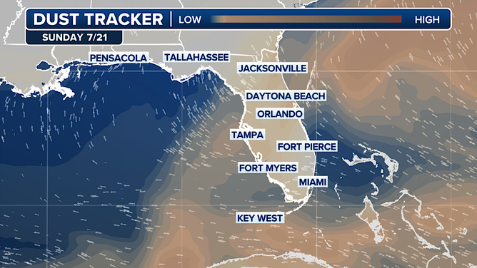
This graphic shows the Saharan dust tracker in Florida.
(FOX Weather)
The sky will be milky and thunderstorm development will be limited while the layer of dry, dusty air is in the atmosphere. Sunsets should be extra intense, however.
On average, the first hurricane doesn't develop until August 11, and the fourth named storm arrives on August 15. So we are well ahead of schedule for the third week of July.
While the atmosphere is not conducive to storm development at the moment, the water temperatures and the depth of the warm water from the tropical Atlantic across the Caribbean continue to be off the charts.
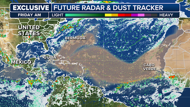
This graphic shows the future radar and Saharan dust.
(FOX Weather)
So, when a more conducive atmospheric pattern kicks in next month, we still expect storms to become stronger faster than we're used to.
The extra energy in the ocean can also help spin up storms that wouldn't be able to consolidate in an average tropical environment. This is why the forecast number of named storms has been so high this season.
Enjoy the lull while we have it.