Bryan Norcross: Keeping an eye on the Caribbean, but nothing will develop quickly
The possibilities seem to include a weak system meandering in the Caribbean and eventually dying out, a stronger system tracking toward Haiti, the Dominican Republic or Puerto Rico, or something in the middle. The current odds favor the system staying weak for the foreseeable future, but we'll see.

FOX Weather is your Hurricane HQ.
(FOX Weather)
Updated at 10:30 a.m. on Tuesday, Oct. 29, 2024
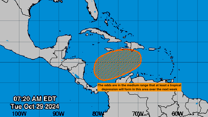
Hostile upper-level winds across the northern Caribbean Sea will likely keep anything from organizing through this week. Over the weekend or early next week, a sharp dip in the jet stream will come along, which could help induce an area of low pressure to develop in the southwestern Caribbean.

Area to watch in the southern Caribbean for potential tropical development.
(NHC / NOAA)
The steering currents will be light, but the system will probably drift north or northeast initially. After that, we're looking so far in the future that it's not worth speculating on what might happen.
The possibilities seem to include a weak system meandering in the Caribbean and eventually dying out, a stronger system tracking toward Haiti, the Dominican Republic or Puerto Rico, or something in the middle. The current odds favor the system staying weak for the foreseeable future, but we'll see.
The National Hurricane Center is keeping the chance of development in the medium range, for now. By the weekend, we might have a system to look at, which will give the computer forecast models something to latch onto.
The pulse that moves around the Earth that alternately enhances and suppresses tropical development will move into an enhancement phase over the Caribbean in the next week or so. Whether that will encourage development or not is an open question, but it won't be an inhibiting factor.
It would take an unlikely scenario farther out than we can forecast for the system to affect Florida. So, for now, we'll just keep an eye on it.