Bryan Norcross: Slowly developing scenario could produce a tropical system in the Caribbean next week
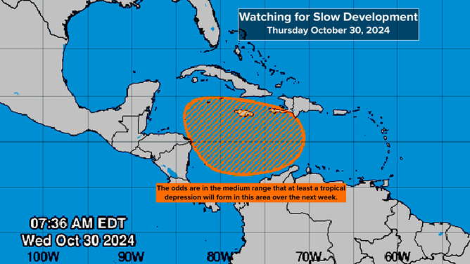
The National Hurricane Center has the odds in the medium range that at least a tropical depression will form in the Caribbean over the next week.

FOX Weather is your Hurricane HQ.
(FOX Weather)
Updated 9:00am Wednesday, Oct. 30, 2024
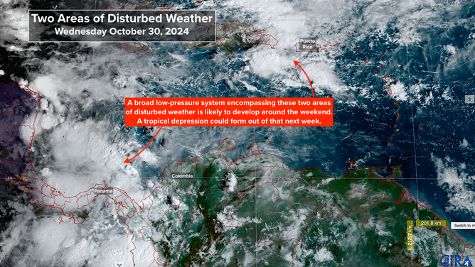
A cold front has pushed into the northeastern Caribbean Sea. Meanwhile, a weak tropical disturbance has arrived from the Atlantic. The combination of those systems plus the strong winds behind the front is producing a very moist weather pattern over Puerto Rico and the surrounding islands.

Satellite imagery shows two areas where there could be potential tropical development.
(NOAA)
In the extreme southern Caribbean, general low pressure combined with an upper-air pattern conducive to thunderstorm development is producing clusters of tropical downpours.
By the weekend, the consensus of the computer model forecasts is that a broad low-pressure area will develop encompassing both of these areas of disturbed weather. A sharp dip in the jet stream reaching into the Caribbean will help energize the development of the broad tropical disturbance.
Long-range forecasts indicate that a consolidated tropical system might form from the initial broad low-pressure area. The National Hurricane Center has the odds in the medium range that at least a tropical depression will form over the next week.

Medium chances for tropical development in the Caribbean over the next week
The computer forecasts have come into general agreement that the tropical system, if it forms next week, will slowly rotate north and then west in the Caribbean. The upper-level winds across the northern Caribbean are forecast to remain hostile to significant strengthening for at least several days, so a strong system doesn't appear likely during that time.
Until some sort of disturbance consolidates in the Caribbean around the weekend, the forecasts for late next week will continue to jump all over the place. For now, we'll just keep an eye on developments.