Bryan Norcross: Hurricane Milton's impacts in Florida increase through the day with landfall overnight
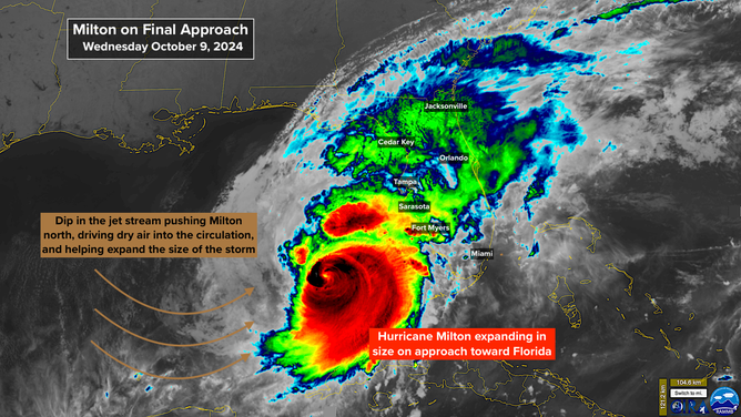
Hurricane Milton is bearing down on the west coast of Florida. Here are the key points.

FOX Weather is your Hurricane HQ.
(FOX Weather)
Updated at 10:30 a.m. ET on Wednesday, Oct. 9, 2024
Hurricane Milton is bearing down on the west coast of Florida. Here are the key points:
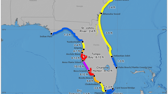
- The hurricane has been slightly favoring the right side of the cone, so the National Hurricane Center has edged the cone south a bit. But this does not mean that the Tampa Bay area is off the hook. Some models have wobbled back and show a direct hit. And Milton could certainly wobble left just like it did to the right. Even if the eye comes just south, there will be significant surge in the Bay. The threat of damaging storm surge covers the Tampa Bay area, Bradenton, Sarasota, Venice, Englewood, the Charlotte Harbor area and Fort Myers and Southwest Florida.
(NOAA)
- Gulf water will likely be pushed over the barrier islands in some parts of the Gulf coast between Tampa and Naples. Mainland areas are threatened by rising Gulf water as well.
- Dangerous water levels will surge inland into inlets, bays, harbors and up rivers.
(NHC / NOAA)
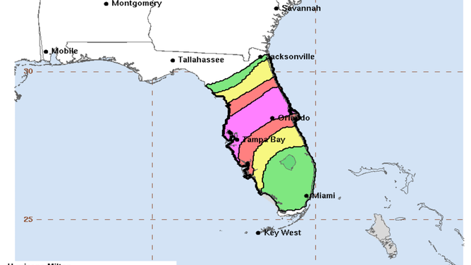
- South of a line approximately from Fort Myers to Melbourne, dangerous weather will come in outer bands containing very gusty winds, tropical downpours and some tornadoes. The waves of bad weather will arrive during the day today, well before Milton's center reaches the coast, and continue into the night.
- North of the Fort Myers-to-Melbourne line, heavy rain will build and be continuous once it starts. Embedded squalls with winds to hurricane-force will bring down trees and cause power outages. Tornadoes are also possible. Rainfall up to 18 inches in some areas will cause life-threatening flash flooding.
(NWS / NOAA)
- As Milton's center is exiting into the Atlantic, the reverse flow on the north side will push Atlantic water against the coast and into the inlets and rivers in North and Central Florida, Georgia and the southern part of South Carolina, causing significant saltwater flooding in some areas.
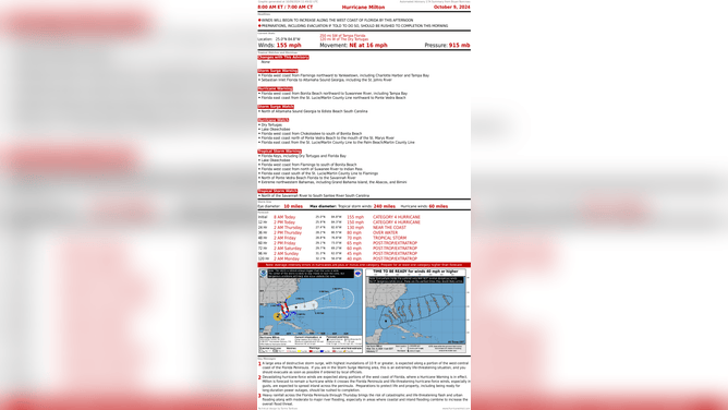
- If you are riding out the storm at home in the Tampa Bay or Sarasota metropolitan areas (meaning, do you watch Tampa or Sarasota TV stations for local news?), you will likely be in the path of the strongest winds. Set up an area in the center of your home – in an interior bathroom or hallway is usually the best - as your safe spot to ride out the worst of the storm. Remember, a mattress is good protection if somehow your house gets breached.
(NHC / NOAA)
- If we lose people from this storm, it will likely be because they stayed in areas that were ordered evacuated. Not everybody who evacuates will end up having needed to. But if the system works perfectly, everyone who needed to will have been told to evacuate.
- Everyone on the Florida Peninsula needs to be sure to keep their phones and critical electronics charged today. Many households will likely lose power by tonight or early tomorrow.
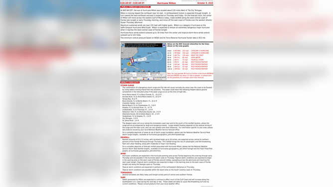
(NHC / NOAA)
- You still have time to fill pots and pans and other containers with tap water to be sure you have water to drink after the storm.
- If you have a plastic painter's drop cloth, use it as a tub liner and fill your tub three-quarters full. That's the water you'll use to wash and flush the toilet if your town water system is compromised.
- Get gas for your car (if you can find it), cash and prescription drugs as soon as possible today in the Hurricane Warning zone.
Take care everyone. Hope for the best, but prepare for the worst.