Bryan Norcross: Developing storm officially called Invest 95L to impact the Carolinas
Flooding rain is possible in northeastern South Carolina and eastern North Carolina tomorrow as the system moves toward land. After landfall late tomorrow or early Tuesday, the moisture is likely to spread up the coast through the mid-Atlantic into the Northeast.

Bryan Norcross analyzes Invest 95L off Southeast US coast
FOX Weather Hurricane Specialist Bryan Norcross takes a deep dive into the tropical disturbance off the Southeast U.S. coast, which has been dubbed Invest 95L by the National Hurricane Center. The system could develop into Tropical Storm Helene over the next day or two as it tracks toward the coasts of North Carolina and South Carolina.
Updated at 11 a.m. ET on Sunday, Sept. 15, 2024
Gray skies, gusty winds and periods of rain impact coastal sections of South and North Carolina as a low-pressure center develops offshore. The low has non-tropical origins but could develop into a tropical system late today or tomorrow before making landfall, probably in North Carolina.
The air to the north of the system will be squeezed between a strong high pressure over northern New England and the developing low. The winds in the channel of pinched air are already at 40 mph. If the National Hurricane Center determines the system has developed some tropical characteristics, it will get the name Helene. By definition, a tropical system is separate from any fronts and at least partially fueled by warm ocean waters.
If it's partially tropical and partially non-tropical, it will be called Subtropical Storm Helene.
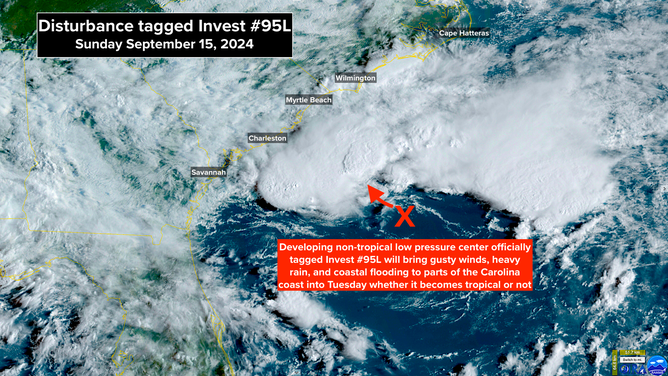
Satellite image of Invest 95L on Sunday morning, Sept. 15, 2024.
(NOAA)
The storm isn't going to have very long over the water, so there is no expectation that it will reach hurricane strength, but a couple of nasty days of weather along the Carolina coast are likely. And there is the possibility of winds right at the coastline reaching tropical storm strength.
Flooding rain is possible in northeastern South Carolina and eastern North Carolina tomorrow as the system moves toward land. After landfall late tomorrow or early Tuesday, the moisture is likely to spread up the coast through the mid-Atlantic into the Northeast.
Some flooding along the coast and in and around the sounds in North Carolina is likely from persistent onshore winds and the astronomically high tide. Tides are forecast to run up to 2 feet above normal.
Since the storm is just developing, the details and the forecast are subject to change, so stay informed along the Carolina coast today and tomorrow.
In the eastern Atlantic, Tropical Storm Gordon is going nowhere fast. It's forecast to drift around for several days as a weak system. Eventually, it might get pulled north and strengthen in the open ocean.
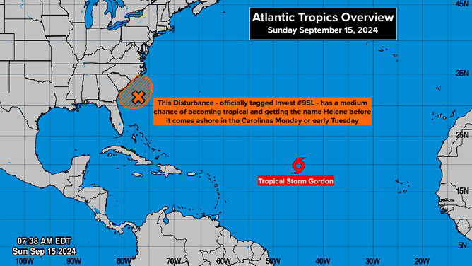
Invest 95L and Tropical Storm Gordon are the only two systems being tracked in the Atlantic Basin.
(National Hurricane Center)
Nothing else looks likely to develop right away. As we move toward the end of September, our focus switches to the western Caribbean and the southern Gulf. There are hints of possible development coming from there next week, but nothing to think about yet.