Bryan Norcross: Tropical disturbance moving into Caribbean where it has best chance of developing
We've been watching this system for so long. Out of kindness, you would think it would have developed by now. But it's just a blob of thick tropical moisture with some gusty winds, moving across the Caribbean islands from Puerto Rico to South America.
3 disturbances in Atlantic monitored for potential tropical development
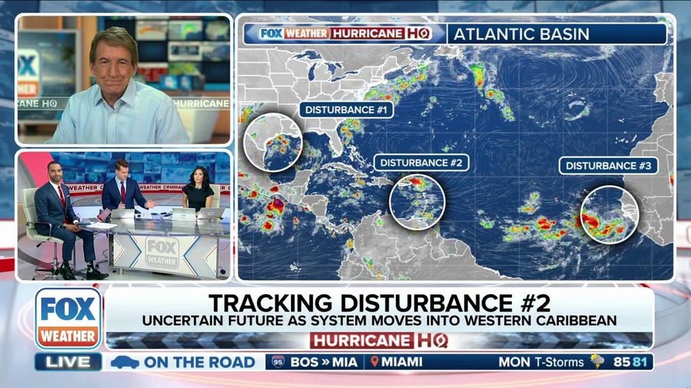
The National Hurricane Center is monitoring several disturbances for potential tropical development as the hurricane season nears its peak. FOX Weather Hurricane Specialist Bryan Norcross has the latest.
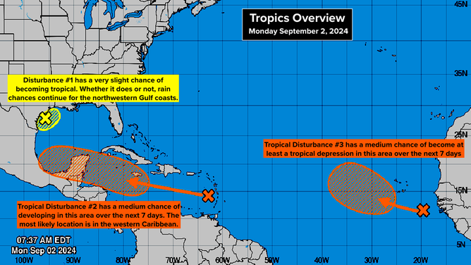
The National Hurricane Center is noting three disturbances from Texas to Africa, but Tropical Disturbance #2 is the one to pay attention to.
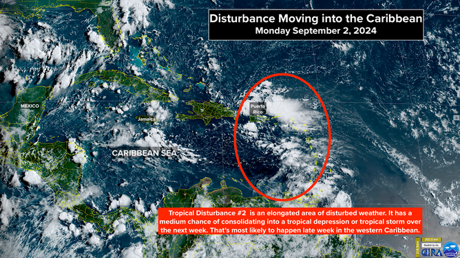
We've been watching this system for so long. Out of kindness, you would think it would have developed by now. But it's just a blob of thick tropical moisture with some gusty winds, moving across the Caribbean islands from Puerto Rico to South America.

Satellite image of Tropical Disturbance No. 2
(NOAA)
A tongue of dry air and slightly hostile upper winds seem to be among the factors keeping the system disorganized. The National Hurricane Center still has its odds of development into a tropical depression or tropical storm in the medium range. The various computer model forecasts are all over the place for both the system's future track and intensity.
It's not clear where, if anywhere, a center of circulation might develop within the stretched-out area of disturbed weather, which means the forecast will continue to jump around until the system begins to consolidate. Assuming it does.
In a couple of days, the disturbance is forecast to be in the central Caribbean Sea. The atmospheric pattern up to that point looks pretty hostile, so development is not likely.
By the end of the week, when the system is in the western Caribbean, however, the pattern is forecast to be more conducive for development, and the system looks likely to be over high-energy seawater. This is where the computer forecasts drastically diverge.
Over the weekend and into next week, there is still a chance that a strong storm could move north into the Gulf. Although the odds of that happening have diminished, the computer forecasts have flip-flopped on this system multiple times. Slow-moving, broad, disorganized systems are notorious for inducing changeable forecasts.
If the system doesn't organize sufficiently by the time it encounters the supportive environment in the western Caribbean, it will likely continue west without any dramatic strengthening. It's too early to know how this will play out. We'll see what happens in a couple of days.

Three disturbances in the Atlantic Basin
(NOAA)
Over the Texas and Louisiana coast, the upper-level low-pressure system and tropical moisture, which are combining to create a rainy weather pattern, are not going anywhere fast. The National Hurricane Center is giving the system low odds of developing tropical characteristics, but whether it does or not, some tropical downpours will continue.
Off Africa, a robust new system has moved into the Atlantic. It has good rotation, but it's going to encounter dry and dusty air. The National Hurricane Center is giving it a medium chance of developing into at least a tropical depression. The early forecasts are that it will not be a threat, but we'll watch to be sure.
