Coast-to-coast storm threatens more severe weather, heavy snow next week
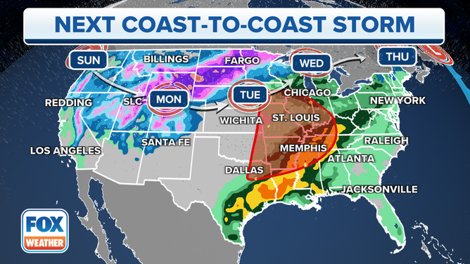
A new storm is about to take a five-day journey across the U.S., unleashing a variable wrath of impacts from rain and snow in the Northwest to another budding severe weather outbreak in the South to heavy snow in the northern Plains and Upper Midwest.
Severe storms likely in Central US next week with coast-to-coast system
The next coast-to-coast storm system is expected to move into the central U.S. by Tuesday. A severe weather outbreak may occur in the southern U.S. while heavy snow is possible for the northern Plains and Upper Midwest.
Another early-spring storm is set to take an adventurous journey across the U.S. next week, unleashing a variable wrath of impacts from rain and snow in the Northwest to another budding severe weather outbreak in the South to heavy snow in the northern Plains and Upper Midwest.
The symphony of storminess makes its final act in the Northeast by the middle of next week, bringing a round of heavy rain.
Northwest gets rain and snow to kick off the week
The storm begins with a chilly reception in the Northwest, where it's set to dampen the weekend with an unseasonably cool mix of lowland rain and mountain snow in Washington and Oregon.
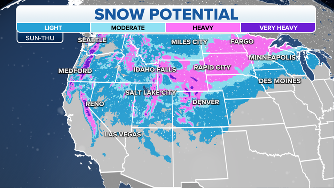
The snow potential between Sunday and Thursday of next week.
(FOX Weather)
By Monday, the storm is bringing widespread snow as it moves into the Great Basin and Rockies, especially Utah and Wyoming, with snow also in the higher elevations of the Inland Northwest. Even Spokane in Washington may see some wet snow showers.
Severe weather threat builds Tuesday
As the storm moves into the central U.S. on Tuesday, dual threats develop from severe weather to its south and heavy snow to its north.
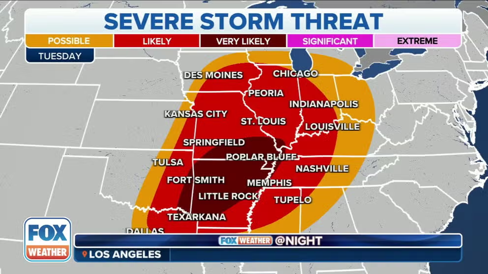
Already, NOAA's Storm Prediction Center is highlighting a region covering about 26 million people, centered over the Mississippi Valley, as an area of concern for severe weather Tuesday. Early forecasts indicate the possible development of supercells ahead of a line of strong to severe thunderstorms.

(FOX Weather)
St. Louis, Little Rock in Arkansas and Memphis in Tennessee are three cities highlighted in this early outlook for severe weather, which includes possibly significant tornadoes, large hail and damaging winds.
WE'RE ENTERING AMERICA'S MOST ACTIVE TIME OF YEAR FOR TORNADOES
It's generally the same area facing a dangerous severe weather threat on Friday, which is on the heels of last week's deadly tornado outbreak across the South.
(FOX Weather)
"I gotta be honest, looking at the forecast, everything that’s in the atmosphere, the setup for Tuesday does look to be more of a concern than what we have for (Friday’s severe weather forecast)," FOX Weather meteorologist Britta Merwin said. "Temperatures down South are pushing into the 80s (Tuesday), and that’s a game-changer because heat equals energy which equals dangerous storms."
Heavy snow falls in northern Plains, Upper Midwest
Meanwhile, the calendar will conflict in the northern Plains and Upper Midwest, where the date will say "April" but the skies will once again suggest winter has forgotten to check.
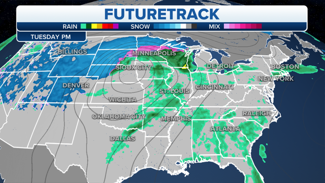
The FOX Weather FutureTrack for Tuesday, April 4, 2023.
(FOX Weather)
Heavy snow is possible across the region Tuesday, with the Dakotas and northern Minnesota so far seeing the potential for several inches of accumulation as high temperatures only reach the 20s to lower 30s. This too is just four days after another snowstorm with even blizzard conditions was sweeping across this area Friday.
WHEN CAN YOU EXPECT THE LAST SNOW OF THE SEASON?
Snow will taper off Wednesday, but it'll be a very windy day across the Upper Midwest and Great Lakes as the powerful low-pressure system slides into Ontario, Canada.
Storm has soggy finale in East
The storm will lose its snow and much of its severe weather potential as it moves into the East on Wednesday, but it's still destined to make its presence felt.
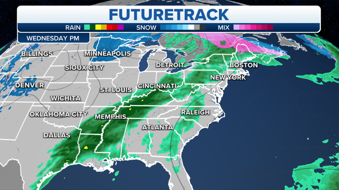
The FOX Weather FutureTrack for Wednesday, April 5, 2023.
(FOX Weather)
Widespread rain is expected from the Canadian border southward to the Gulf of Mexico as the storm's cold front drags across the nation, with particularly soggy conditions in the Tennessee and Ohio valleys.
But even New England will have two days of rainy weather Wednesday and Thursday until the storm finally slides offshore into the Atlantic.
