Arctic assault on US coming to an end but frigid temperatures remain on Sunday
The coldest day overall was Saturday, the FOX Forecast Center said, as around 75% of the country woke up to below-freezing temperatures and experienced below-average temperatures all day long.
Another frigid day expected before mild air returns this week
Millions of people across the U.S. are having to deal with another day of frigid temperatures, but some relief is on the way.
A renewed surge of arctic air swept into the eastern U.S. over the weekend, leaving tens of millions in dangerously cold weather. While this surge of frigid air is not as cold as the previous arctic outbreak that produced numerous records across the Plains and lower Mississippi Valley last week, this surge resulted in high temperatures 20-30 degrees colder than Thursday, the FOX Forecast Center said.

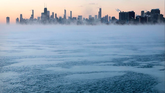
Morning sunrise over the city skyline and the steaming frigid waters of Lake Michigan at Montrose Beach on Jan. 16, 2024, in Chicago.
(Antonio Perez/Chicago Tribune/Tribune News Service / Getty Images)
The recent cold weather caused dozens of deaths across the U.S. and affected Amtrak services, with over a dozen cancellations on Thursday. By Sunday morning, tens of millions of Americans were under some type of wind chill alert stretching from the Midwest to Florida.

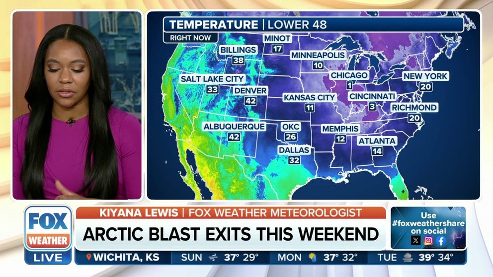
(FOX Weather)
Wind chills overnight Saturday into Sunday morning across the northern Plains and Midwest were well below zero, dropping to -13 in Minneapolis and Kansas City, Missouri, and -7 in Chicago. But single-digit wind chills were spread into the East and South, as it felt like a chilly 7 degrees in New York City while the wind chill was 0 degrees in Memphis and 4 in Atlanta.
Dallas residents found feels-like temperatures around 22, and even northern Florida felt like it was below freezing.
Cities from the Midwest to the mid-Atlantic, Northeast and New England will struggle to get above freezing on Sunday, if they can even make it that "high."
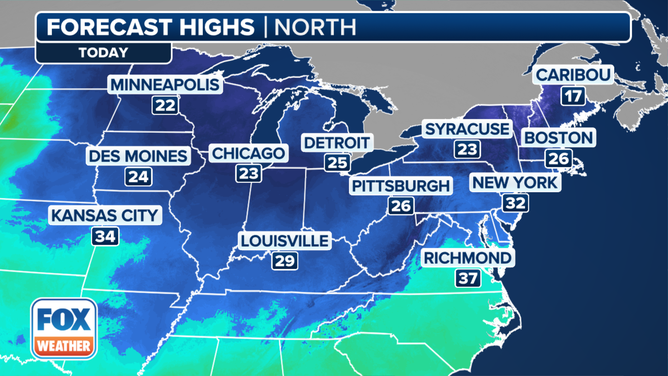
Minneapolis, Chicago and Detroit will all remain in the lower to mid-20s on Sunday, with similar temperatures being found farther east in Pittsburgh and Syracuse in New York. New York City should hover around the freezing mark on Sunday, but cities in New England will likely remain below that. Boston, for example, will be around 26 degrees on Sunday.
In the South, temperatures will range from about 32 degrees in Nashville to the mid- to upper 30s from Oklahoma City to Dallas, as well as Little Rock in Arkansas.
Temperatures in the mid- to upper 40s are expected along the Gulf Coast from Houston to New Orleans.
When will the cold snap end?
Temperatures will begin to moderate Sunday, and by Tuesday, the cold will be but a memory. The upcoming week will bring about a major shakeup in the predominant weather across the U.S., the FOX Forecast Center said. The days of arctic air and widespread snow will be gone, replaced by mild temperatures and widespread rain.
The driving features will be two strong areas of high pressure. The first will set up off the Southeast coast. Winds around the high will send warmer air from the Gulf of Mexico north through much of the eastern U.S.
END OF ARCTIC AIR ON HORIZON WITH JANUARY THAW DAYS AWAY

(FOX Weather)
The other will park itself well off the coast of California, with its winds pulling in mild Pacific air to much of the West.
High temperatures will rise 20-30 degrees compared to last week, bringing them back above average for this time of year.
As moisture streams north from the Gulf of Mexico, it will be met with a storm system that will swing out of the Four Corners, the FOX Forecast Center said. This will result in increasing rain that will quickly ramp up Monday and Tuesday for parts of the southern Plains and into the lower Mississippi Valley.
Repeated heavy rain could produce flash flooding. The rain will even be accompanied by rumbles of thunder – quite a change for places that have been well below freezing since last week.


