Mapped: Where Florida’s Gulf Coast is susceptible to hurricane storm surge
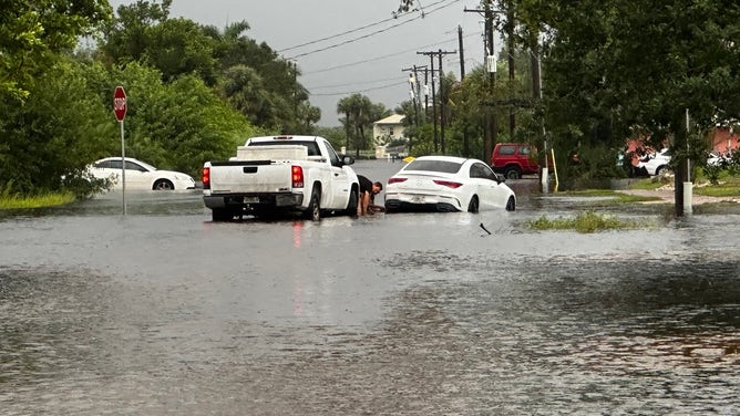
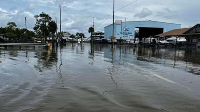
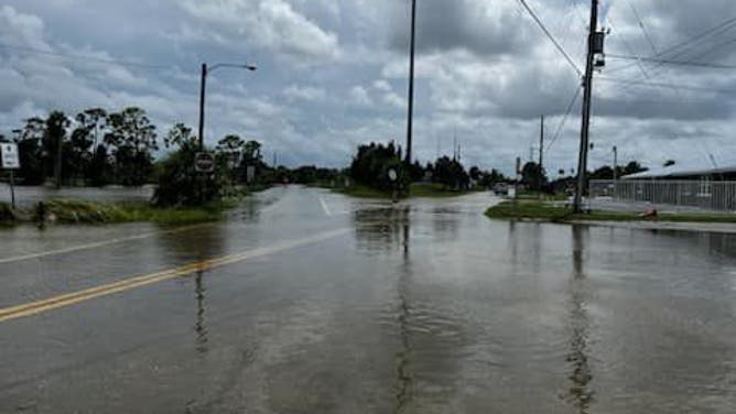
Due to the threats posed by Helene, storm surge alerts have been issued along much of Florida's Gulf Coast, including the Tampa metro area.
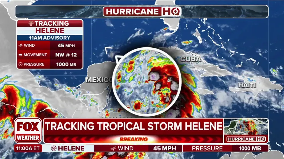
Tropical Storm Helene forms in Caribbean, threatens Florida as major hurricane
Helene is expected to strike Florida as a major hurricane on Thursday. Hurricane Watches have been issued along the Gulf Coast, and more are likely to follow. The storm is forecast to be large and powerful, with potential impacts reaching as far north as Atlanta. Florida's governor has declared a state of emergency for 61 counties, urging residents to prepare for a dangerous and destructive storm as time begins to run out to take necessary precautions.
Given Florida’s distinctive coastline, its topography makes it particularly vulnerable to storm surge flooding during hurricanes and other significant storm systems.
Storm surge refers to the increase in water levels directly attributed to the cyclone, excluding additional contributions from rainfall or wave size, which can further elevate the surge even more.
Due to the threats posed by Helene, storm surge alerts have been issued along much of Florida's Gulf Coast, including the Tampa metro area.

(FOX Weather)
The National Hurricane Center expects the worst of the tidal flooding to occur north of Tampa Bay and along the Big Bend region.
Forecast models indicate there could be a storm surge rise of 10-15 feet for communities between the Ochlockonee River and Chassahowitzka, including Cedar Key.
The shape of the coast and the shallow shelf waters allow water to funnel in during even the weakest of storms, making the area one of the most surge-prone regions in the country.

(FOX Weather)
KNOW YOUR ZONE: FLORIDA EVACUATION MAP SHOWS WHO WILL HAVE TO LEAVE BEFORE A HURRICANE STRIKES
If the forecast holds, the surge will be higher than the levels observed during Hurricane Idalia just over a year ago.
Idalia made landfall along Florida’s Big Bend as a Category 3 hurricane and produced a storm surge of 7-12 feet.
In many locations, the values were the highest levels seen since the Storm of the Century in 1993.
![Birds float in the flooded water near the Steinhatchee Marina in Steinhatchee, Florida, on August 30, 2023, after Hurricane Idalia made landfall. (Photo by CHANDAN KHANNA / AFP) (Photo by CHANDAN KHANNA/AFP via Getty Images)]() Image 1 of 5
Image 1 of 5Birds float in the flooded water near the Steinhatchee Marina in Steinhatchee, Florida, on August 30, 2023, after Hurricane Idalia made landfall. (Photo by CHANDAN KHANNA / AFP) (Photo by CHANDAN KHANNA/AFP via Getty Images) (Photo by CHANDAN KHANNA/AFP via Getty Images)
![Flooding from Idalia in Charlotte County in southwest Florida.]() Image 2 of 5
Image 2 of 5Flooding from Idalia in Charlotte County in southwest Florida. (Charlotte County Emergency Management / Facebook)
![Flooding in Hernando Beach, Florida from Idalia. August 30, 2023.]() Image 3 of 5
Image 3 of 5Flooding in Hernando Beach, Florida from Idalia. August 30, 2023. (Hernando County Sheriff's Office / Facebook)
![Flooding in Hernando Beach, Florida from Idalia. August 30, 2023.]() Image 4 of 5
Image 4 of 5Flooding in Hernando Beach, Florida from Idalia. August 30, 2023. (Hernando County Sheriff's Office / Facebook)
![Hurricane Idalia]() Image 5 of 5
Image 5 of 5A flooded street is seen near the Steinhatchee marina, Florida on August 30, 2023, after Hurricane Idalia made landfall. (CHANDAN KHANNA/AFP)


NOAA forecasters said Idalia’s surge could have been 3-4 feet higher if the hurricane had moved onshore during a period of high tide.
Features such as the low-and high-tide cycles and the status of the Moon can impact how water levels rise.
Due to Earth’s rotation, coastal communities experience two high tides and two low tides every 25 hours, which can mean a difference of upwards of around 4 feet for coastal communities such as Ceder Key.
A new or full Moon cycle contributes to a water rise, but it is less significant when compared to the King Tides that occur during Supermoons.
FLORIDA UNDER STATE OF EMERGENCY FOR MAJOR HURRICANE THREAT FROM HELENE
NOAA says storm surge is often the greatest threat to life and property during hurricanes and accounts for nearly half of the deaths associated with the landfall of a tropical cyclone.
In 2022, Hurricane Ian made landfall in Southwest Florida, causing at least 156 fatalities along its path of destruction.
According to NOAA data, nearly 60% of those who died in the hurricane drowned, with many in the storm surge zone.
The combination of heavy rainfall at high tide can lead to additional flooding that Storm Surge Warnings and Watches do not account for.
Communities facing this threat would be placed under what is known as a Flash Flood Warning, which would remain in effect until water levels recede.