Eastern Pacific shows signs of life with a brand-new tropical storm
Activity in the Eastern Pacific is running far behind what is considered to be a normal rate. Usually, by July 24, five named systems have formed, including two hurricanes. An El Niño–Southern Oscillation status, which has transitioned out of the El Nino stage and into a neutral and even a La Nina status, is likely behind the overall reduction of activity.

Tropical Storm Bud forms in Eastern Pacific
On Wednesday, the National Hurricane Center named only the second storm of the Eastern Pacific hurricane season, designating an area of disturbed weather over 400 miles off the coast of Mexico as "Bud." Tropical Storm Bud was expected to exist for only around a day or two before beginning to weaken while in the open waters of the Pacific and working westward.
The Eastern Pacific is showing signs of tropical activity in what has been a relatively quiet year for tropical storms and hurricanes across the basin.
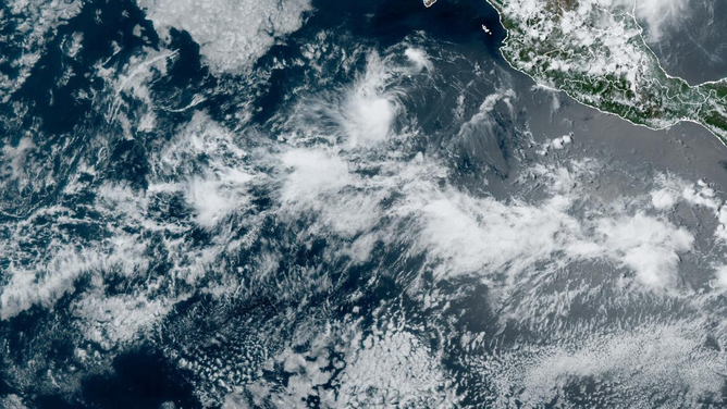
On Wednesday, the National Hurricane Center named only the second storm of the season, designating an area of disturbed weather over 400 miles off the coast of Mexico as "Bud."
Tropical Storm Bud was expected to exist for only around a day or two before beginning to weaken while in the open waters of the Pacific and working westward.

(FOX Weather)
Its anticipated weakening ensures that the Eastern Pacific will remain hurricane-free for the foreseeable future.
The 2024 Pacific hurricane season began on May 15, and so far, neither Tropical Storm Aletta nor Tropical Storm Bud has strengthened beyond minimal tropical storm status.
Activity in the basin, like many other Northern Hemisphere oceans, is running significantly below normal levels.
Usually, by July 24, the basin has produced five named systems, including two hurricanes.
A LOOK AT HOW ACTIVE THE HURRICANE SEASON COULD BE IN THE EASTERN PACIFIC
Tracking Tropical Storm Bud in the Eastern Pacific.
(NOAA)
Before the season began, Mexico’s national weather service expected 15-18 named storms to form, with 7-9 becoming hurricanes and 3-4 strengthening into major hurricanes.
The expectations were in line with the markings of an average season across the basin.
Seasons in 2010 and 1977 produced the least amount of activity in the basin’s history, with only eight named storms.
One of the many factors that could be weighing down on activity is the status of the El Niño–Southern Oscillation or what is commonly referred to as the ENSO for short.
The ENSO currently sits at a neutral stage with computer models showing the entrance into a La Niña state by the end of 2024.
A La Niña pattern results in cooler water and more hostile upper-level winds in the Eastern and Central Pacific.
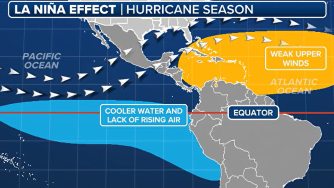
La Nina hurricane season impacts
(FOX Weather)
Some hurricane forecasters believe that a quiet year in the Pacific will be one of the many factors leading to an active season in the Atlantic, potentially producing two dozen or more named cyclones.
So far, the Atlantic basin has experienced three named storms, with one reaching major hurricane status.
Hurricane Beryl shattered records by becoming the earliest Category 5 storm by more than two weeks and was one of the fastest-strengthening systems ever witnessed in the Atlantic basin.
The hurricane affected islands in the Caribbean, Mexico’s Yucatán Peninsula and Texas before becoming absorbed in frontal boundary over northern U.S. and Canada.
The hurricane season in both the Atlantic and Eastern Pacific runs through November 30.
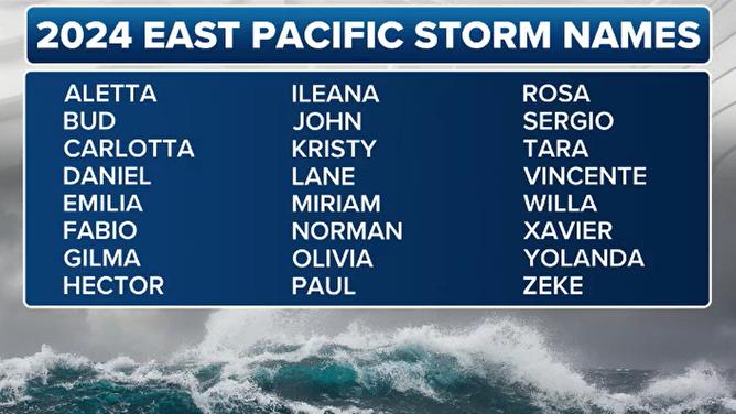
Pacific tropical cyclone names in 2024
(FOX Weather)