La Nina climate pattern ends as Pacific Ocean returns to neutral state
Each cycle typically lasts around 9-12 months, but there is not a regular schedule for when the globe enters a La Niña or El Niño state. A warming of the ocean surface indicates an El Niño could be in charge, while a decrease in water temperatures leads to a La Niña.
The meaning of El Nino and La Nina
The status of whether the world is being impacted by an El Nino or a La Nina is determined by water temperatures in the central and eastern Pacific. (NOAA)
As the world cruises through spring, meteorologists and climatologists are closely watching ever-changing water temperatures in the Eastern and Central Pacific Ocean to determine the status of the El Niño-Southern Oscillation (ENSO).
NOAA's Climate Prediction Center (CPC) issued its final La Niña Advisory on Thursday morning, noting that La Niña had concluded after ENSO-neutral conditions returned during March in the equatorial Pacific.
While the CPC noted ENSO-neutral conditions are favored during the Northern Hemisphere summer, with a greater than 50% chance through the August-October period, the exact forecast remains uncertain as the unpredictability of pattern changes during the spring often complicates things.
As of late March, sea-surface temperatures in the region of the equatorial Pacific have shifted closer to average, signaling the end of a weak La Niña.
However, the exact timing of the transition from one ENSO status to another remains uncertain.
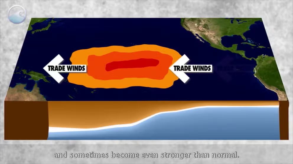
The oscillation status is influenced by various factors, including fluctuations in trade winds, atmospheric pressure and ocean temperatures.
While the ENSO-neutral phase is favored for the coming months, climatologists caution that the predictions can sometimes be murky, which is known as the spring predictability barrier.
HOW THE SPRING PREDICTABILITY BARRIER IMPACTS LA NINA, EL NINA FORECASTS
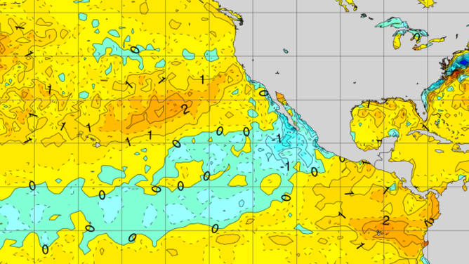
Water temperature anomalies in the central and eastern Pacific on 4/9/2025
(NOAA)
What does ENSO neutral mean?
The ENSO is considered to be in a neutral state when regions of the central and eastern Pacific have anomalies between 0.5 °C and -0.5 °C.
Similar to the El Niño and La Niña extremes, neutral conditions impact weather across the country and around the globe.
Typically, there are fewer changes in the jet stream, meaning more regional patterns may dominate local weather.
Predicting ENSO is no easy task
The ENSO status can be complicated by the Sun’s movement over the Northern Hemisphere as it approaches the summer solstice.
During this time of the year, regions across the Northern Hemisphere, particularly in the Pacific, heat up, but the exact way in which waters warm is not uniform and changes year over year.
A lack of weather observations, similar to the information needed to track hurricanes, may also come into play. If there is a lack of data from satellites or buoys in the vast stretch of ocean, forecasts become less dependable.
WHAT ARE EL NIÑO AND LA NIÑA CLIMATE PATTERNS?
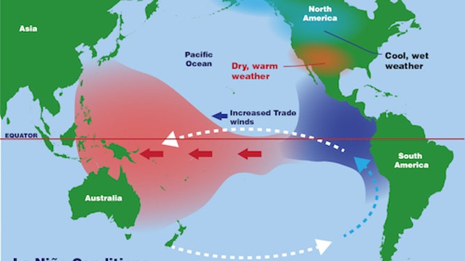
A La Nina tends to bring drier air over South America.
(NOAA / FOX Weather)
The difficulty in accurately predicting ENSO patterns is exemplified by what happened in 2024, when the collapse of an El Niño took longer than initially expected.
Last year, some models showed a possibility of El Niño conditions ending by early spring, but in fact, the warm cycle of the ENSO took until early summer to collapse.
The status of ENSO plays a significant role in everything from spring severe weather outbreaks to droughts, from hurricanes to winter storms.
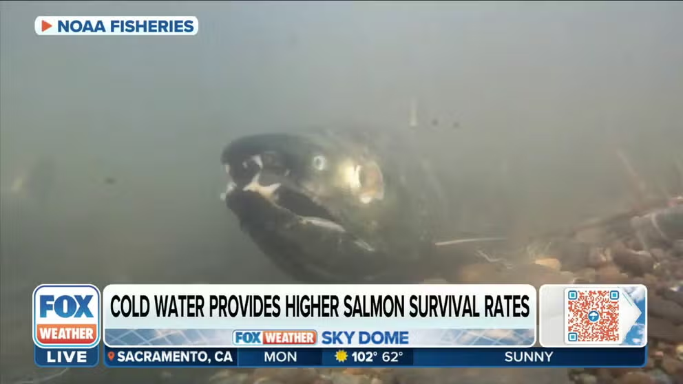
Salmon numbers rise and fall during El Nino and La Nina
Nate Mantua, Climate Scientist at NOAA Fisheries, explains how salmon numbers rise and fall during El Nino and La Nina.