Seemingly endless summer in Pacific Northwest to shatter more heat records, increase fire danger
Temperatures are set to rise again this weekend, combining with a hot, dry offshore wind that will create critical fire weather conditions and blow a renewed round of wildfire smoke into the Seattle area, setting more all-time heat records in the process.
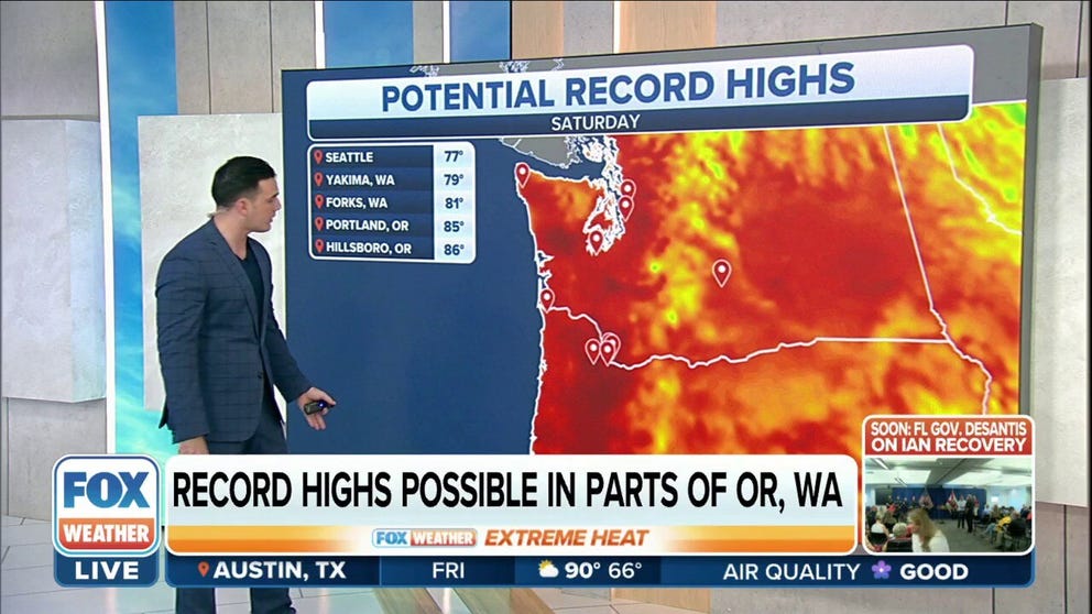
Record highs possible in parts of Northwest as they experience above-average temps
Above-average temperatures will accompany dry conditions as high temperatures will feel like late August or early September.
SEATTLE -- Summer has blown through the stop sign of the autumnal equinox in the Pacific Northwest and has continued to bake the region with several days of record-high temperatures and an absence of rainfall even as the calendar turns into mid-October.
Temperatures are set to rise again this weekend, combining with a hot, dry offshore wind that will create critical fire weather conditions and blow a renewed round of wildfire smoke into the Seattle area, setting more all-time heat records in the process.
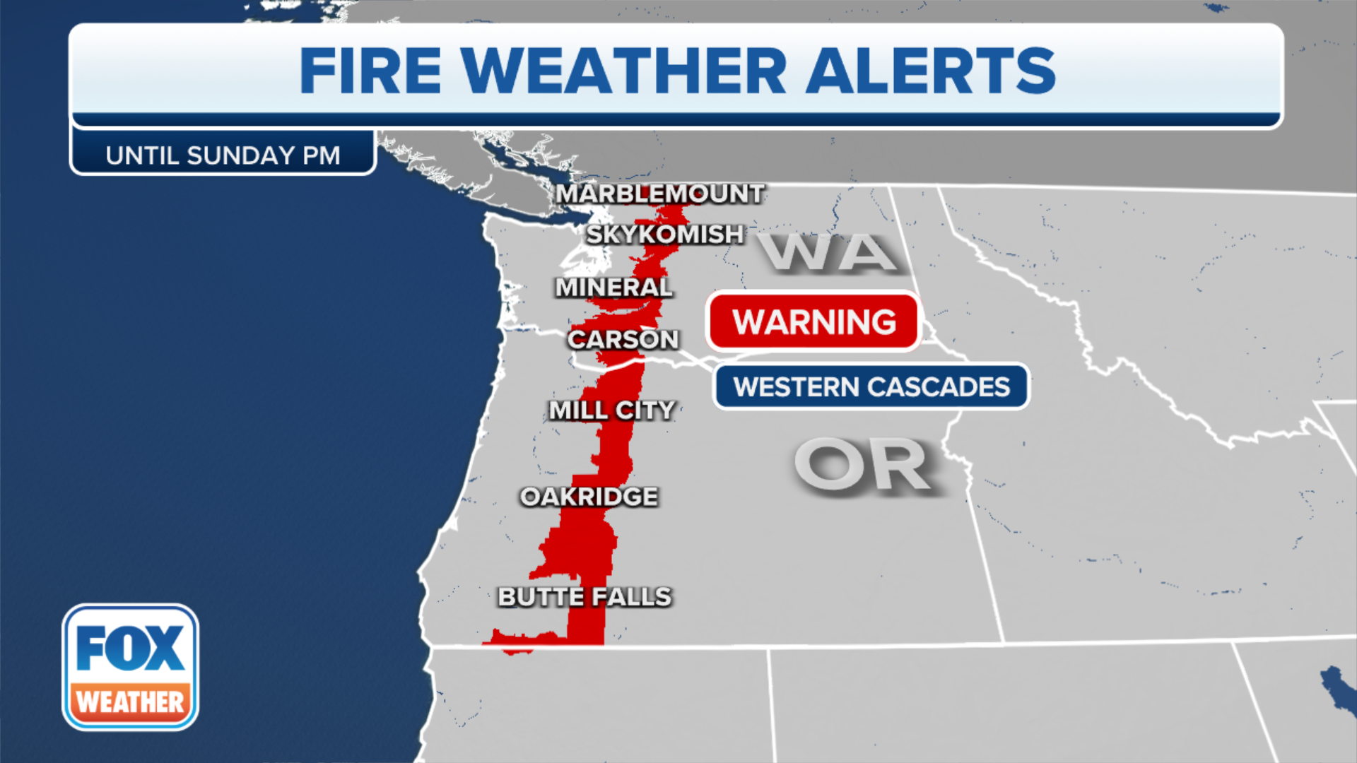
Fire Weather Warnings are in effect for the Washington and Oregon Cascades as gusty, dry easterly winds will drop humidity levels down to about 20%, meaning any fire starts will easily spread across the arid landscape. Much of the region has seen a half inch of rain or less since the start of July.
HOW TO WATCH FOX WEATHER ON TV
(FOX Weather)
Smoky skies are here again
The dry weather has allowed wildfires to burn for months in central and eastern Washington. Frequent easterly winds have carried smoke into the Seattle and Western Washington area, and a renewed wave of thick smoke will push into the metro area over the weekend, further degrading air quality that had already been somewhat smoky for days.
"As we see that heat begin to build in, it gets hotter and that helps to trap more of the pollutants at the surface," said FOX Weather meteorologist Jane Minar. "Burning eyes, scratchy throat and runny nose — all signs you’re getting irritated from that smoke and air quality."
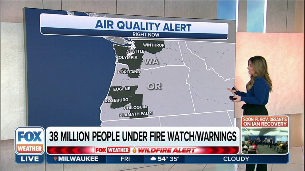
Air Quality alerts are posted for much of Western Washington, including the Seattle metro area, with unhealthy conditions expected to last through the weekend and into Monday. Officials advise those with health conditions to avoid outdoor exposure and warn that even healthy people could suffer smoke-related health issues.
Smoke from wildfires cause air quality concerns in Pacific Northwest
Smoke from wildfires is causing air quality concerns in the Pacific Northwest.
Toasty temps in Seattle
The relentless warmth continues to rewrite the early autumn temperature books across Washington and Oregon.
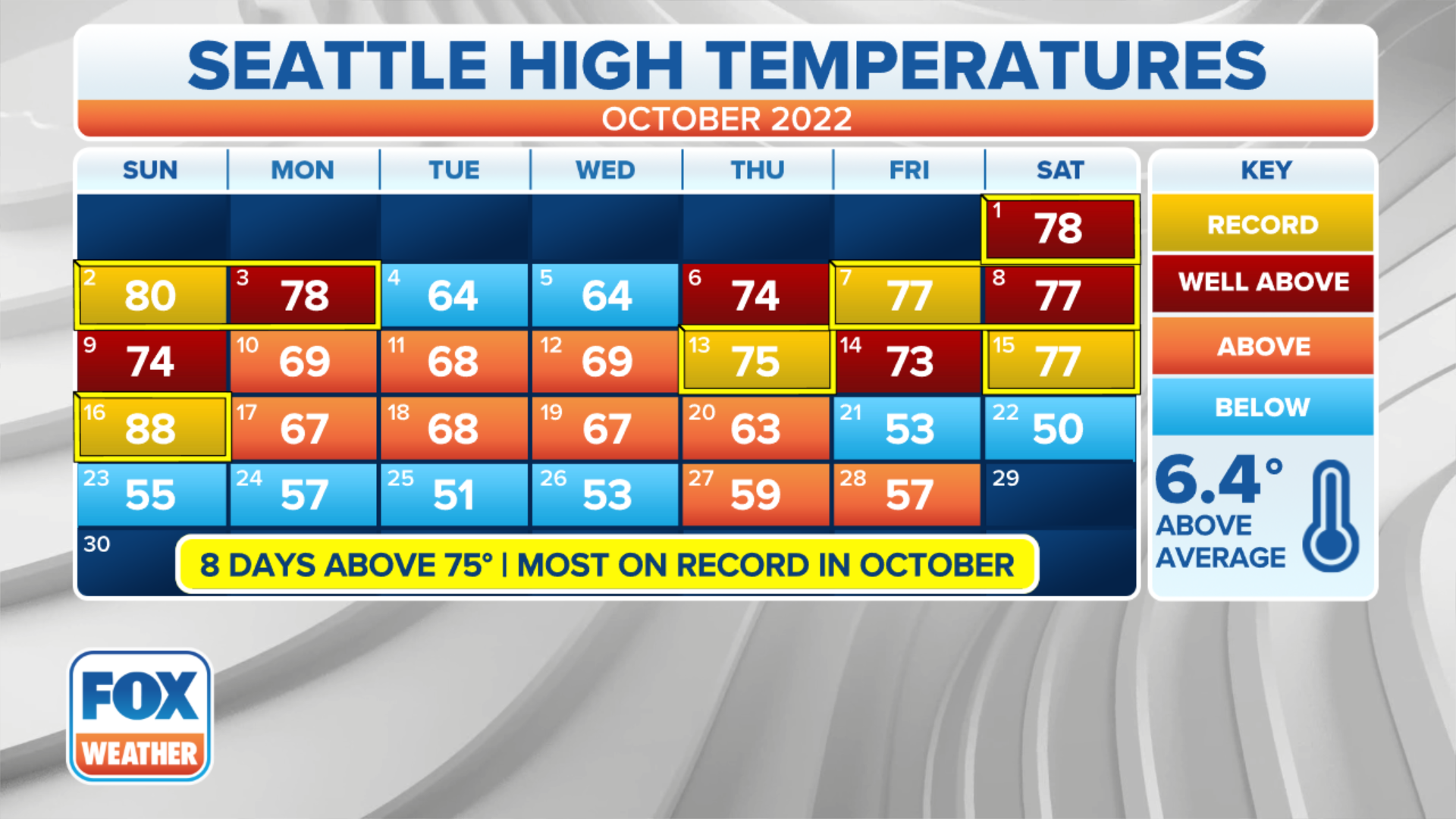
In Seattle, the temperature has already exceeded 75 degrees six times in October, breaking the record of five days set in 1991, with temperatures forecast to zoom well past 75 degrees over both weekend days. According to the National Weather Service, the six days over 75 matches the number observed in Seattle combined over the past 25 years.
(FOX Weather)
The forecast of 79 on Saturday would set the record high for any date on or past Oct. 15 (previous record: 77, set on Oct. 15, 1991).
It's a record that looks to stand for one day. The forecast high for Sunday is 81, which would only be the ninth time Seattle has reached the 80-degree mark in October -- but the second time this month. The previous record for the latest 80-degree day on record is Oct. 14, 1961.
"It’s the afternoon heat that continues because of that Rex block," said FOX Weather meteorologist Steve Bender. "High pressure (puts a) stagnant condition in place, so it just allows everything to bake, and so you’ll see the temperatures reach 20-30 degrees above average."
Average highs are right around 60 degrees this time of year. Seattle hasn't seen a day more than 2 degrees below average since Aug. 10.
As you might expect, Seattle will easily set the record for the hottest first half of October, beating the old all-time average high-temperature record by more than a full degree.
Meanwhile, the 0.49" of rain received since July 1 is far and away the lowest total on record and a far cry ahead of the second-place total of 1.19 inches observed in 2017.
Portland baking too
It's been even hotter in Portland, where the thermometer has already reached over 85 degrees four times in October, with Thursday's near-miss of 84 setting a daily record as a consolation prize.
The nine days in the 80s have already shattered the October record of six, with perhaps at least another four days in the 80s on the horizon this weekend and next week.

(FOX Weather)
Portland too is about to shatter its record for the hottest first half of October by average high temperature and may break that record by a full three degrees, averaging 80 degrees for a high in that period for the first time in its history.
Nearly matching Seattle with 0.48 inches of rain since July 1, it will also be Portland's driest stretch over that period.
Relentless ridge and Rex block the culprits
Much of the Pacific Northwest has been stuck under stubborn ridges of high pressures so that even as one fades, another isn't too far behind to pick up the baton.
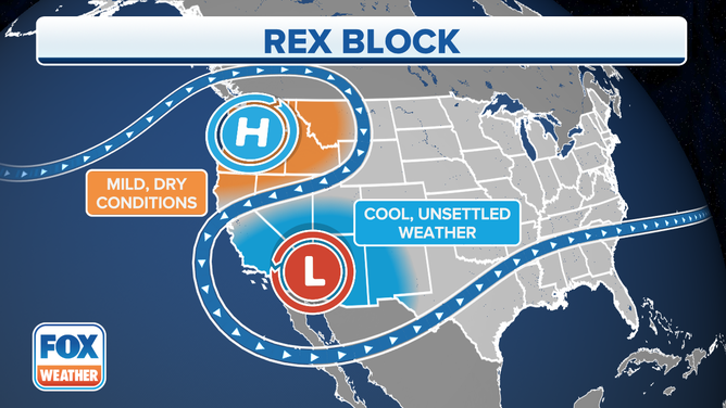
This past week, a massive "Rex block" weather pattern is to blame.
The stubborn weather pattern anchors hot and dry conditions over the Pacific Northwest and cool and stormy conditions over the Desert Southwest. It requires a strong high-pressure system setting up north of an upper-level low-pressure system. This essentially cuts off the low-pressure system from the westerlies that usually steer it.
WHAT IS A REX BLOCK? THIS STUBBORN PATTERN IS CREATING WACKY WEATHER IN THE WEST
(FOX Weather)
The block is named for meteorologist Daniel Rex who studied the pattern. The jet stream meanders between the two systems instead of its normal west-to-east flow. When meteorologists see bulges and pockets like this, it spells unusual weather -- in this case, unusually warm and dry weather.
"The unfortunate thing is that we are not expecting any changes any time soon, and it's been this blocking pattern," FOX 13 Seattle meteorologist Abby Acone told FOX Weather on Tuesday. "This high pressure acts like a lid right over us. It gives way to that sinking air, clears out our air, at least when it comes to storm systems, but it traps those pollutants."
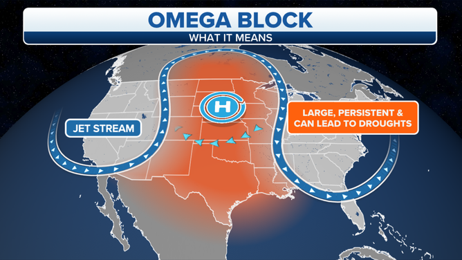
The weather pattern is shifting slightly over the weekend to what's known as an "omega block," -- which uses two low-pressure centers instead of one to clog up the atmospheric flow.
Omega blocks occur when a high-pressure center is flanked by two low-pressure centers on each end, caused when warm air aloft ends up on the northern, cooler side of the jet stream. It’s a very stable pattern that tends not to budge for days. It gets its name from its appearance on upper-air wind chars that steer winds around the lows and highs in the shape of the Greek letter omega (Ω).
(FOX Weather)
Finally, signs of relief on the horizon
While the dry and warm weather is expected to last through much of next week, there are finally signs of change in the long-range forecasts.
The omega block looks to break down at the end of next week, allowing a more traditional late-October rainy pattern to set up shop in the Northwest and, if it holds, is forecast to bring the region's first soaking rain in months.
NOAA's 8-14 day outlook paints high confidence in a wetter-than-average pattern setting up shop along the West Coast for the end of next week and through next weekend.

(FOX Weather)
