Flood threat persists Wednesday from mid-Atlantic to Ohio, Tennessee valleys, including waterlogged Kentucky
Much drier weather will return from Thursday through the weekend as the slow-moving front finally pushes into the southeastern US.
Flood threat persists in the weary Ohio Valley and mid-Atlantic
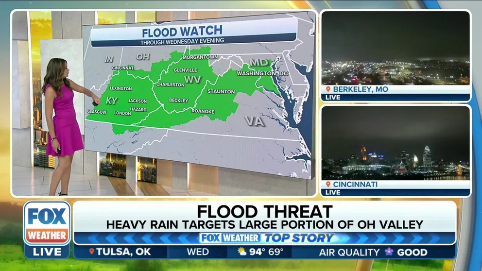
Flood Watches have been issued across eastern Kentucky, much of West Virginia and extreme southern Ohio, as well as the Baltimore/DC area through Wednesday.
A slow-moving front extending from the mid-Atlantic southwestward to the Ohio and Tennessee valleys on Wednesday will cause the threat of flash flooding to persist for one more day, including in waterlogged Kentucky, which continues to recover after historic and catastrophic flooding killed at least 37 people about two weeks ago.
While not every location across these regions will see heavy rain, there will be numerous pockets of showers and thunderstorms developing along the front through Wednesday night, posing the potential to drop a lot of rain in a short amount of time.
These showers and storms will lead to an enhanced flash flood threat, especially in areas where the ground is already saturated from heavy rain and flooding in recent weeks, such as eastern Kentucky.
HOW TO WATCH FOX WEATHER ON TV
"The slow-moving cold front is just tapping into all of this intense moisture that's moving in from the Atlantic, and that's allowing for the rain to really come down at a quick pace," said FOX Weather meteorologist Britta Merwin. "When we start to see these thunderstorms set up, we could easily pick up 1 to 2 inches of rain in less than an hour, and that can lead to additional flooding."
You can see the areas of showers and thunderstorms tracking sluggishly along the slow-moving front on the three-hour radar loop below.

(FOX Weather)
Earlier this week, heavy downpours associated with the same slow-moving front turned streets into rivers in parts of Maryland. The video below from Monday night shows the water rushing down roads in Landover Hills, less than 10 miles northeast of Washington.
Streets turn into rivers in Landover Hills, MD
A trash can is caught on video floating down a street as roads flood in Landover Hills, Maryland.
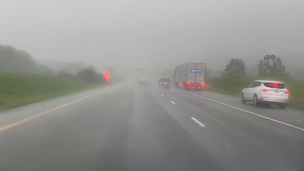
On Tuesday, visibility was reduced by a band of heavy rain in Middle Tennessee on Tuesday, which might have helped contribute to some reported vehicle accidents in the region.
Heavy rain reduces visibility along I-40 in Tennessee
FOX Weather’s Will Nunley films a pocket of heavy rain falling along I-40 between Dickson and Franklin, Tennessee. Two vehicles were reported to have crashed.
Isolated areas could pick up 3 to 5 inches of rain through Wednesday night
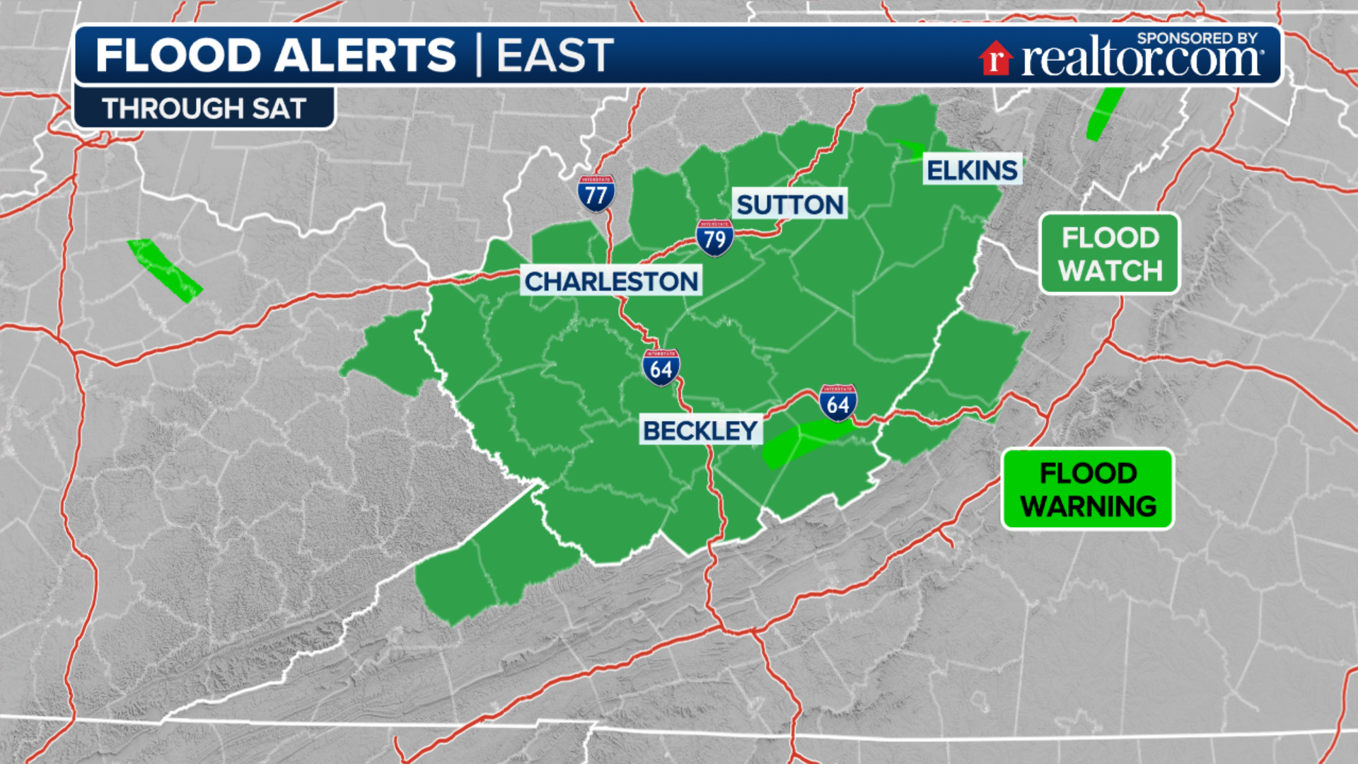
Flood Watches have been issued by the National Weather Service from eastern Kentucky into extreme southeastern Indiana, southern Ohio, far southwestern Pennsylvania, West Virginia, western and northern Virginia and central and southern Maryland through Wednesday evening.
EXPLAINING FLOOD ALERTS ISSUED BY THE NATIONAL WEATHER SERVICE
(FOX Weather)
A broad area from the mid-Atlantic southwestward to the central Appalachians and the Ohio and Tennessee valleys faces the threat of flash flooding through Wednesday night.
This includes the cities of Nashville and Knoxville in Tennessee, Hazard in Kentucky, Charleston in West Virginia, Richmond in Virginia, Washington, Baltimore and Philadelphia.
HOPE REMAINS AS VOLUNTEERS HELP FLOODED KENTUCKY TOWN BACK ON ITS FEET

(FOX Weather)
An additional 1 to 3 inches of rain is expected in most areas along the slow-moving front through Wednesday night. However, isolated pockets of 3 to 5 inches can't be ruled out, especially from eastern portions of the Ohio Valley into the central Appalachians.
The rainfall will certainly be welcome news for the Northeast, where drought conditions have developed in recent weeks due to a lack of rain, but it will only add to flooding concerns in the already-saturated areas of Kentucky and the central Appalachians.

(FOX Weather)
CLICK HERE TO GET THE FOX WEATHER UPDATE PODCAST
Much drier weather will return to all of these regions from Thursday through the weekend as the slow-moving front finally pushes into the southeastern U.S.
Intense outflow from storms in Church Hill, Tennessee
Strong winds whip trees and a flag around in Church Hill, Tennessee on Wednesday. (Video: Eli Bray / Twitter)
"Behind this front, though, we have a really nice cooldown, but most importantly, a huge drop in humidity, and that will be moving into these hard-hit areas as we go into the end of the workweek and pushing into the weekend," Merwin said. "We really just have to get through today, and then we'll see some improvements as we go into Thursday."
