Hawaii closely tracking Hurricane Gilma, two invests in Central Pacific
While the Atlantic Ocean remains calm, the Eastern Pacific is heating up with the formation of Hurricane Gilma on Wednesday morning.

Tropical trouble brews east of Hawaii while Atlantic remains quiet
Hawaii is keeping an eye on a few tropical systems brewing east of the Aloha State while the Atlantic Ocean remains quiet - for now.
UPDATE: Tropical Depression 1C has formed, and this story is no longer being updated. Follow the latest details here.
HILO, Hawaii – Forecasters are keeping their eyes on a few tropical systems brewing east of Hawaii, but it’s still too soon to determine what impacts they could have on the Aloha State.
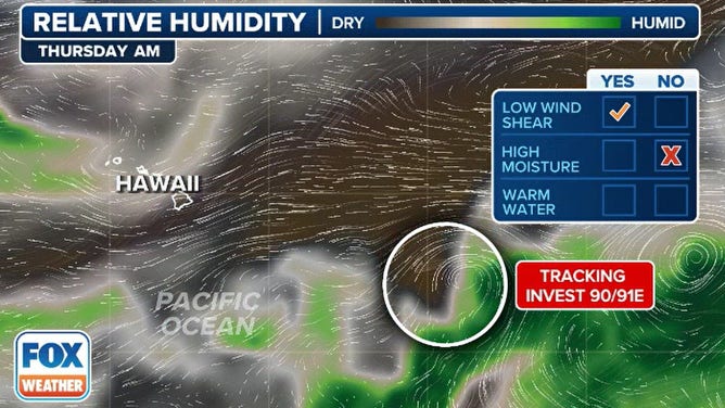
The National Hurricane Center (NHC) is tracking major Hurricane Gilma, and two invests – 91E and 92E – which have a high chance of development.
Gilma became the second hurricane of the 2024 Eastern Pacific hurricane season, and it turned into a large powerhouse when winds reached Category 3 strength on Thursday.
The large cyclone is in open water and is much farther away from the Aloha State than Invest 91E.
Forecast models show gradual development of Invest 91E over the next several days, and a tropical cyclone is expected to form by the time it enters the Central Pacific.
"Interests in Hawaii should closely monitor this disturbance, though it remains too early to determine the exact location and magnitude of potential impacts," the NHC said.
Hurricane Hunters will start investigating the system Thursday, according to the FOX Forecast Center. Low-level missions that actually fly into the storm may begin as early as Friday afternoon.
HURRICANE HUNTERS HEAD TO HAWAII AS MULTIPLE TROPICAL THREATS SWIRL IN THE PACIFIC

(FOX WEATHER)
Direct strikes on the Hawaiian archipelago are rare, but periods of increased waves and wind are more common with passing tropical cyclones.
Just over a year ago, a series of wind-driven wildfires were triggered by a significant pressure gradient, with a ridge of high pressure to the north of the islands and a major hurricane named Dora to the south.
The Category 4 hurricane passed more than 500 miles south of Honolulu, but its influence was strong enough to impact the weather pattern for thousands of miles – a setup that some forecasters believe could be a once-in-a-generation event.
HURRICANE INIKI 30 YEARS LATER: HOW A MONSTER STORM IN HAWAII IMPACTED FILMING OF JURASSIC PARK
Dry air around Hawaii on computer model forecast.
(FOX Weather)
Any impacts from Gilma, the hurricane east of Invest 91E, would occur during the final week in August. Given how much time there is between now and the closest approach, the range of possible scenarios greatly varies.
Both the presence of dry air and cooler near-shore water temperatures play a significant role in the strength of tropical cyclones near the islands.
In nearly all cases, these features act as barriers to tropical cyclones approaching the islands and lead to rapid weakening or dissipation.
A LOOK AT HOW ACTIVE THE HURRICANE SEASON COULD BE IN THE EASTERN PACIFIC
Lack of data to give definitive forecast for impacts on Hawaii
Unlike the majority of tropical systems in the Atlantic, which are monitored by planes, drones and other methods, large parts of the Pacific lack many technologies to closely examine storm systems.
Data typically collected by Hurricane Hunters, satellites and other methods are fed into computer systems to provide forecast models with the most accurate picture of the atmosphere.
Without large amounts of data, there could be greater variability in forecast models – one day depicting a hurricane strike, only to be replaced with dry air in the next model run.
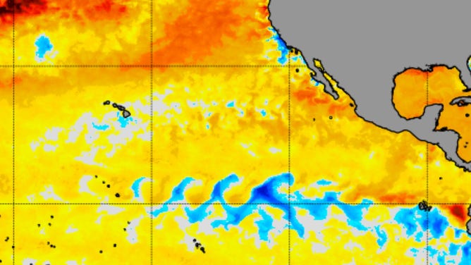
Blue colors indicate waters that are cooler than average while yellow and orange colors indicate temperatures that are above average
(NOAA)
What's in a name?
Additionally, the naming process could be complicated by the disturbance’s location.
If the system quickly becomes organized, it would be given an Eastern Pacific name, such as Hector or Ileana.
A slower-developing system could allow the disturbance to cross the 140-degree west longitude marker and enter the Central Pacific.
The area of responsibility between 140 degrees west and the International Date Line (180 degrees) falls under the Central Pacific Hurricane Center (CPHC), which uses an entirely different list of names.
5 DIFFERENT NAMES FOR HURRICANES AROUND THE WORLD
The first tropical cyclone that develops in 2024 in the Central Pacific will be given the name Hone.
NOAA’s Central Pacific Hurricane Center, in coordination with the agency’s Climate Prediction Center, expects between one and four tropical cyclones to traverse the ocean, which is below the typical four to five tropical depressions, tropical storms and hurricanes.
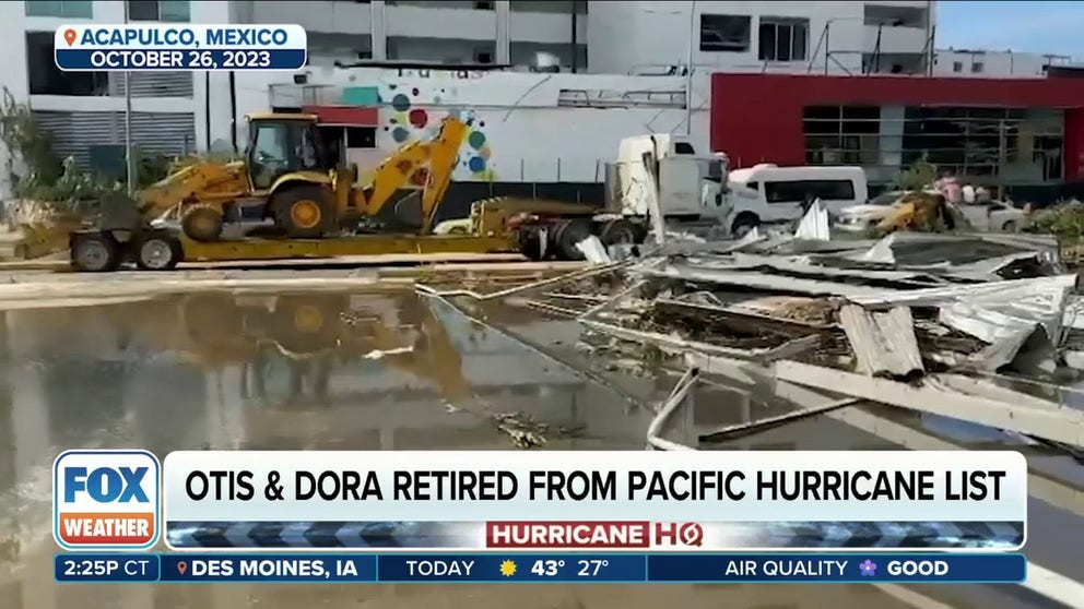
Hurricane names Dora and Otis retired
The WMO voted to retire North Eastern Pacific hurricane names Dora and Otis. For the first time since 2014, the committee did not retire any Atlantic names.