Widespread heavy rain expected for Northwest through the weekend
The heaviest rain looks to fall over the weekend, with an even greater risk of flooding for northeastern Oregon and far southeastern Washington
Pacific Northwest Under Rain Threat
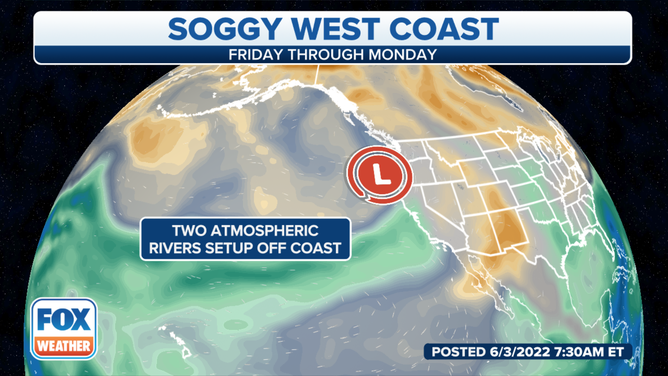
The Pacific Northwest of the United States is under a heavy rain threat today.
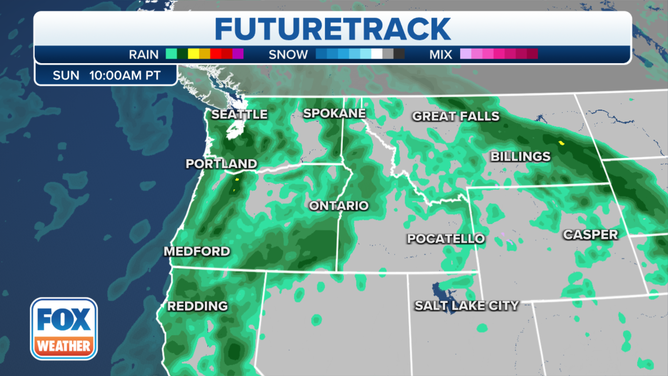
A weak Pacific storm system approaching the West Coast will mark the beginning of an active period for the region, with rain in the forecast each day through Monday.
HOW TO WATCH FOX WEATHER ON TV
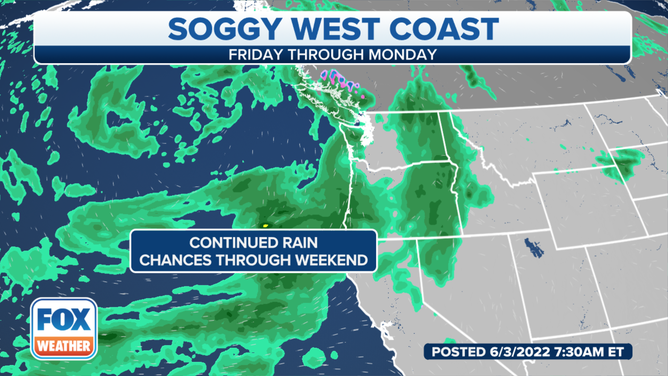
Showers and thunderstorms are expected throughout the weekend. A few strong storms may even occur.
Locally heavy rain, small hail and gusty winds will accompany the strongest storms. Repeated rounds of storms will also lead to an increased risk of flooding in areas of poor drainage and in low-lying areas.
Up to 3 inches of rain could fall through Monday.
The National Weather Service in Spokane, Washington, said widespread thunderstorms Friday created more than 1,200 lightning strikes in northeastern Washington.
Omak, Washington, received more than 1 inch of rain over 24 hours as of Saturday morning. Deer Park and Kettle Falls received more than a half-inch, according to the NWS.
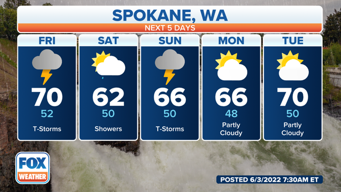
Spokane, Washington daily forecast.
(FOX Weather)
The storms will also pose the risk of mudslides or debris flows around recent burn scars in the North Cascades and Okanogan Highlands.
HOW WILDFIRE BURN SCARS COULD HAVE LASTING IMPACTS
A Flash Flood Watch has been issued for parts of southeastern Washington and northwestern Oregon through Saturday at noon local time. The watch includes Asotin and Garfield counties in Washington and the foothills of the Northern and Southern Blue Mountains, Grande Ronde Valley and John Day Basin in Oregon.
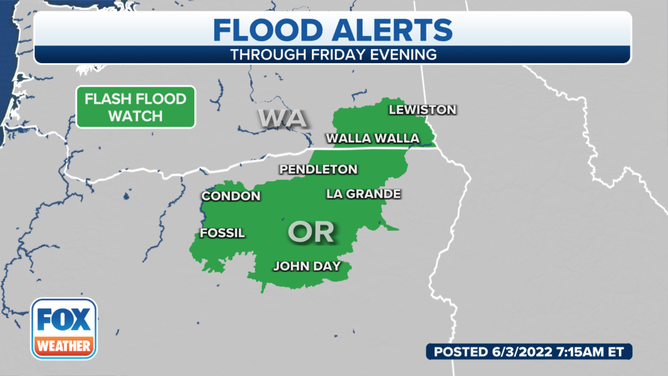
A Flood Watch is in effect until noon Saturday for parts of Washington and Oregon.
(FOX Weather)
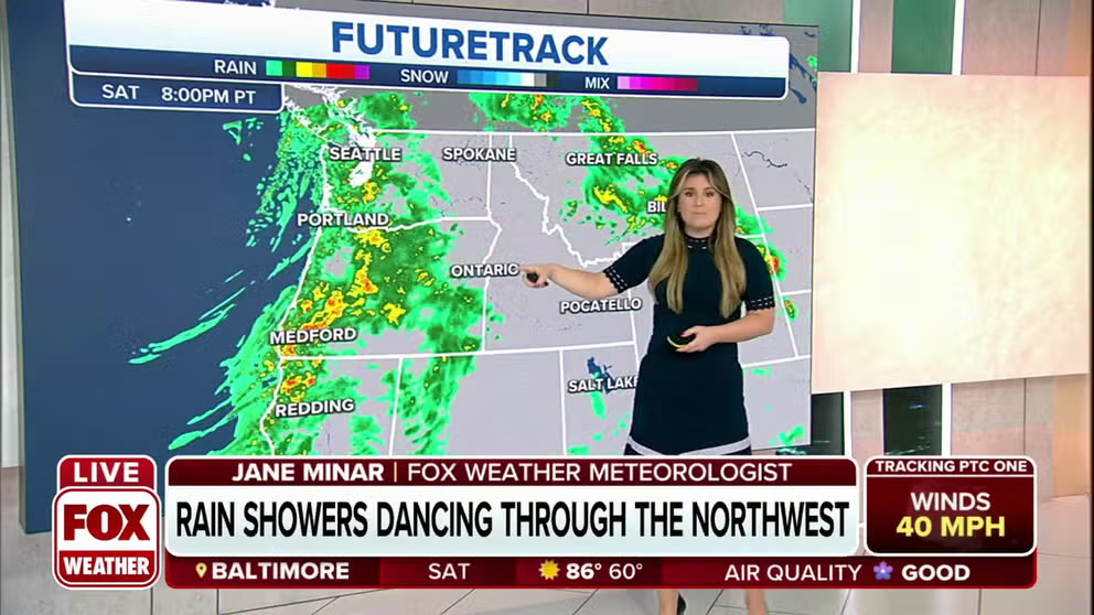
The heaviest rain looks to fall Saturday and Sunday, with an even greater risk of flooding for northeastern Oregon and far southeastern Washington. Snow will be confined to the highest peaks and elevations and will not be a concern.
7 FACTS YOU SHOULD KNOW ABOUT FLASH FLOODS
(FOX Weather)
Up to 3 inches of rain could fall by Monday. And with the region locked in drought conditions, the rain will be more beneficial than anything.
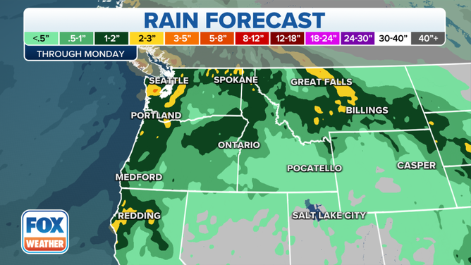
Here's a look at the rain forecast through Monday across the Northwest.
(FOX Weather)
The moisture and energy with this system will move slowly inland to the northern Rockies and Great Basin by Sunday, the NWS said.
CLICK HERE TO GET THE FOX WEATHER UPDATE PODCAST
Download the FOX Weather app to get the latest forecasts, as well as any weather alerts that are issued.