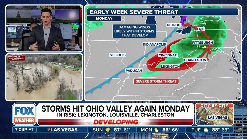
Easter week cold front to produce rain, storms for Ohio Valley and Northeast
Most river gauges are on the decline across the Ohio Valley but still remain close to bank full. According to the Ohio River Forecast Center, around a dozen gauges were at major flood stage before the additional round of wet weather arrived. In Cincinnati, the Ohio River reached above 60 feet for the first time since 2018, causing flooding in Southern Ohio and Northern Kentucky.
A look at severe weather chances during Easter week
A cold front will mean some communities in the Ohio Valley will start the holiday week off on a wet note. Behind the frontal boundary, cooler air will prevail.
CINCINNATI - Parts of the Ohio Valley are bracing for rain and the potential for severe thunderstorms to kick off the Easter week, as a fast-moving cold front pushes through the region on Monday.
Cities across Ohio, Indiana, Kentucky, Pennsylvania and West Virginia are under a heightened risk for severe weather from Monday into early Tuesday.
Forecasters say the primary threat will be damaging winds, though storms are known to trigger numerous hazards.
In addition to strong wind gusts, any thunderstorm that develops can produce frequent cloud-to-ground lightning and periods of torrential rainfall.
While the front is expected to move through quickly, limiting total rainfall accumulations, localized totals of one to two inches are still possible.
EASTER TRADITION GETS A MAKEOVER WITH DYED POTATOES
The increased rain threat comes at a time when many rivers in the region are already running high, with some still dealing with lingering impacts from recent flooding, including along the Ohio and Kentucky rivers.
In Cincinnati, the Ohio River rose above 60 feet - its highest level since at least 2018 - prompting temporary closures of riverfront parks, roadways and the activation of floodgates to protect low-lying areas.
Further west, in Princeton, Indiana, cleanup efforts are still underway following an EF-1 tornado that touched down on Thursday.
The storm damaged dozens of homes, and now the region faces additional showers and storms that could complicate recovery efforts.
"There's going to be enough heat and instability in the atmosphere, triggered by that cold front, to support strong storms that will intensify through the afternoon and persist into the evening," said FOX Weather meteorologist Steve Bender. "That means places like Pittsburgh and Charleston, West Virginia, could face a nighttime severe weather threat, which is always more dangerous."
Drone video shows still-flooded Ohio River in Cincinnati
The Ohio River in Cincinnati crested on Monday evening at 60 feet high. The river hadn't reached levels that high since 2018.
DRONE VIDEO SHOWS FLOODED OHIO RIVER CREEPING TOWARD CINCINNATI REDS’ STADIUM
Following the passage of the cold front, the weather pattern remains uncertain for the remainder of the holiday week.
Some forecast models suggest additional weak frontal boundaries could approach the region, but they are not currently expected to bring widespread rainfall due to a lack of instability and moisture.
Temperatures across the Ohio Valley are expected to remain cooler than average through much of the week.
While mid-April typically sees high temperatures in the mid to upper 60s, many areas will experience highs several degrees below seasonal norms.

(FOX Weather)


