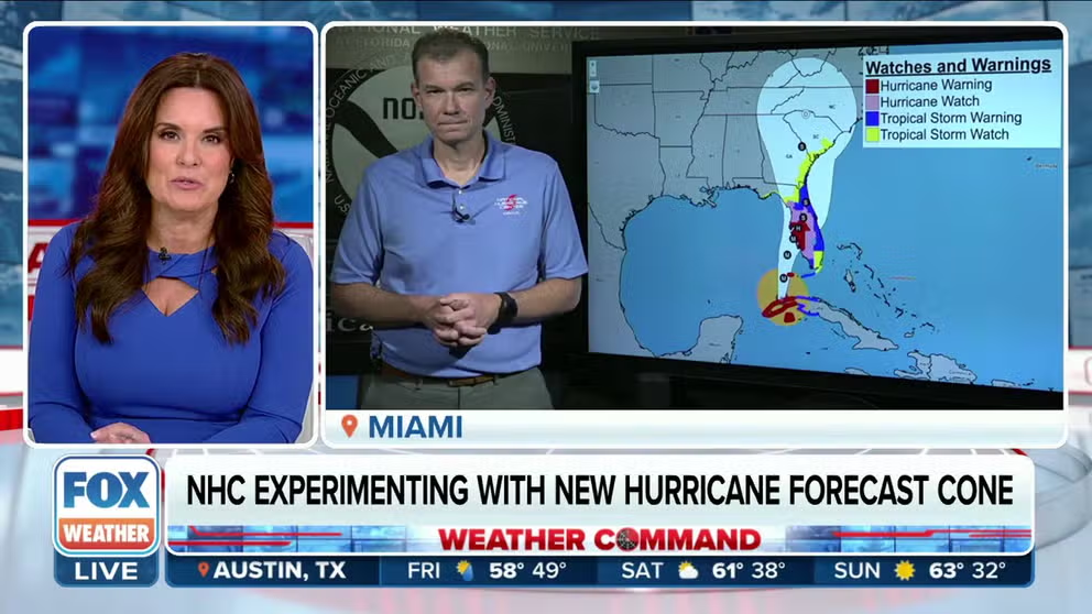
New forecast cone to be tested by National Hurricane Center during 2024 season
Jamie Rhome, deputy director of the NHC, says the goal is to help the public focus more on the impacts of a storm or hurricane instead of its track.
National Hurricane Center experimenting with new hurricane forecast cone
NHC Deputy Director Jamie Rhome joins Weather Command to discuss a potential change to the way the agency uses the "forecast cone" during threatening hurricanes and tropical storms.
MIAMI – One of the most prominent products used to show the future path of a tropical cyclone will get a face-lift in 2024, which the National Hurricane Center said is meant to better communicate how widespread hazards associated with a storm or hurricane will be.
Starting around Aug. 15, about a month before peak hurricane season, which runs from June to November, the agency plans to start releasing an experimental forecast cone that will show all related watches and warnings from local National Weather Services offices and the NHC.
The product will be in addition to the cone that has been used for decades that, up until this season, has only shown coastal alerts and not inland watches and warnings.
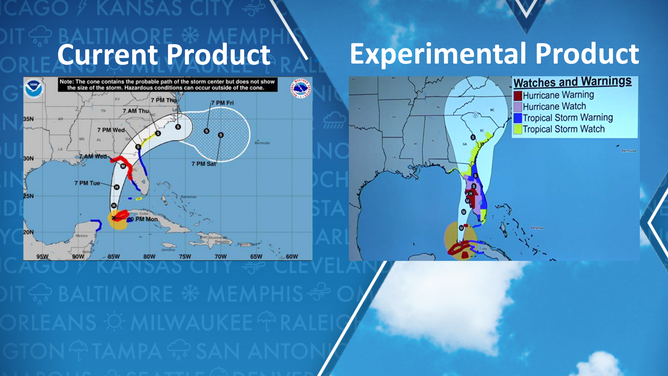
Current NHC product versus experimental product
The definitions and usage of the alert products will not change, just how they are displayed during NHC updates and advisories.
"I think all of us as risk communicators, need to evolve the way that we talk to the public to be a hazard-first approach," NHC Deputy Director Jamie Rhome told FOX Weather. "You know, we’ve been dealing with this track, and focusing on, where the center of the circulation might go for decades, and it’s going to be a hard habit to break. But I think with this new experimentation and hazard-first approach, it signals to the media that they, too, can start to evolve to a hazards-first approach."
7 FACTS TO KNOW ABOUT HURRICANES
Media organizations such as FOX Weather have sometimes shown the combined forecast track and alert products, but the NHC believes its usage will help further enhance storm messaging.
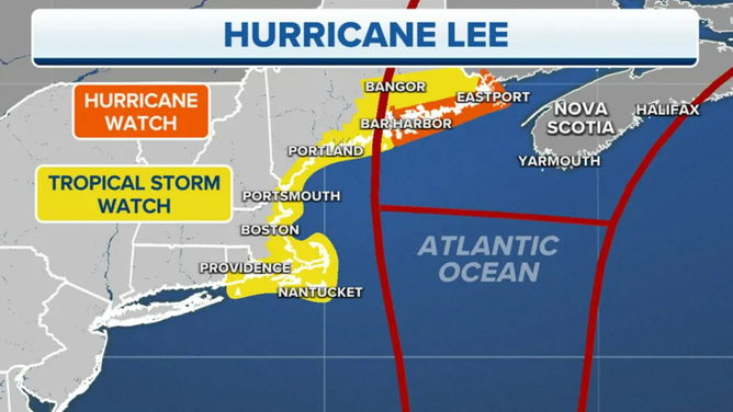
Hurricane Lee forecast cone
(FOX Weather)
Studies and hurricane experts have warned since the early 2000s that the cone is not doing its job as people often misinterpret the graphics.
Two of the common misconceptions are that a hurricane’s impact is confined to the coast and that those living outside the forecast cone are safe from the effects. Both are false and have led to fatalities, especially with stronger storms.
Tropical storm conditions (sustained winds of 39-73 mph) and hurricane conditions (sustained winds of at least 74 mph) regularly occur outside the cone and can extend hundreds of miles inland from the cyclone’s landfall location.
"The intent with all of our communication is to bring the hazards forward because they are the most important thing," Rhome said. "That’s where the rubber meets the road. That’s what determines what actions a given community or given individual might take. This cone is basically a table of contents for that hurricane story. We need people to read the chapters which are the actual hazards in these warnings. These tropical storm and hurricane warnings are the most important part of that book's narrative."
Not the only change
In addition to the release of the experimental product, the NHC annually adjusts the width of the cone, which accounts for forecast errors experienced over the last several seasons.
In preparation for the 2023 season, the biggest difference occurred at forecast hour 60, when the cone shrunk by 4% due to increased accuracy. Forecasters were least accurate at the 120-hour mark, where the cone saw a 3% increase.
HOW TO BEST COVER YOUR PROPERTY AGAINST FLOODS
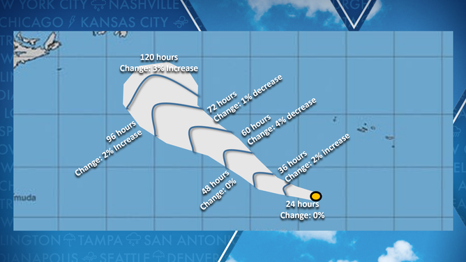
Hurricane forecast cone changes for the 2023 season.
(FOX Weather)
Additionally, the agency said the public should be on the lookout for more Spanish-language products during the 2024 season.
According to the Instituto Cervantes, a language school and cultural center, the U.S. is home to the fourth-largest population of Spanish speakers globally, with many living in hurricane-impact zones.
While the 2024 hurricane season officially begins on June 1, early-season development has happened every season during the past decade except for two.
A team of meteorologists at NOAA have reviewed the potential ramifications of adjusting the season’s annual start date, but that is not a change the agency plans to unveil any time soon.
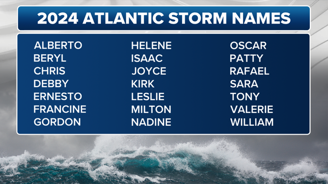
Hurricane season 2024 Atlantic Basin tropical cyclone names.
(FOX Weather)
