Hurricane John wreaks havoc in southern Mexico, leaving 2 dead from landslide
The powerful winds and torrential rains brought by Hurricane John — which has since weakened to a tropical storm — contributed to the deadly incident, which occurred shortly after the storm made landfall as a powerful Category 3 storm near Marquelia.
Hurricane John slams southern coast of Mexico with 120 mph winds
Hurricane John made landfall as a Category 3 hurricane along the southern coast of Mexico just to the south-southwest of Marquelia, Mexico in the state of Guerrero about 9:15 p.m. CT.
MARQUELIA, Mexico – Hurricane John swept through Mexico's southern Pacific coast overnight Monday, leaving a trail of destruction in its wake. The storm's devastating impact has resulted in at least two deaths and widespread damage across the region.
Governor Evelyn Salgado of the Mexican state of Guerrero confirmed Tuesday morning that two people lost their lives in a landslide that struck their home in the city of Tlacoachistlahuaca.
The powerful winds and torrential rains brought by John contributed to the deadly incident, which occurred shortly after the storm made landfall as a powerful Category 3 storm about 9:15 p.m. CT near Marquelia, with wind gusts reaching up to 120 mph.
Within 21 hours, the storm underwent a dramatic transformation, intensifying from a 40 mph tropical storm to a powerful 120 mph major hurricane, the FOX Forecast Center said.
WHAT'S THE DIFFERENCE BETWEEN A TROPICAL DEPRESSION, TROPICAL STORM AND HURRICANE?
Mexican President Andres Manuel Lopez Obrador urged residents on Monday to seek higher ground, emphasizing that the priority was to save lives.
The National Hurricane Center (NHC) warned of damaging winds, life-threatening storm surges and flash flooding associated with John. The storm's passage caused significant flooding, power outages and infrastructure damage throughout the region, forcing schools to close across the state of Guerrero.
The heavy rains brought by the hurricane made travel extremely hazardous in the city of Oaxaca. Local governor Salomon Jara Cruz reported that the highway between Barranca Larga and Ventanilla was closed due to flooding and mudslides.
DOWNLOAD THE FREE FOX WEATHER APP
Despite the challenging conditions, traveler Juan Carlos Sifuentes successfully navigated the flooded highway and reached Oaxaca safely. He described the conditions as "less than ideal" but expressed relief at arriving in the city.
Before John made landfall, lightning was seen flashing in the sky over Zihuatanejo on Monday evening. Footage captured by local resident Kuper Mendez showcases the dramatic scene.
John continues to pose a threat of life-threatening flash flooding across portions of southern and southwestern Mexico, the NHC warned.
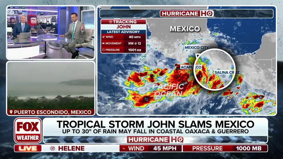
The storm is moving slowly northwest at approximately 12 mph, with little significant movement expected in the coming days. Maximum sustained winds have decreased to near 40 mph, with higher gusts. Further weakening is anticipated.
John is still expected to bring significant rainfall to southern Mexico through Thursday. Coastal areas of Chiapas could receive 6-12 inches of rain, with isolated totals reaching 15 inches. The Oaxaca coast to southeast Guerrero may experience 10 to 20 inches of rain, with isolated totals near 30 inches.
Dangerous surf and rip currents are also possible along the southern Mexican coast due to swells associated with the storm.


