

Kaua'i still without power amid devastation following rare direct hit of deadly Hurricane Lowell on Hawaii
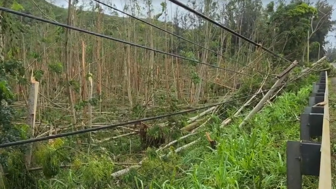
The storm damaged homes and downed trees across Kaua'i, where nearly 90% of customers are still without power.
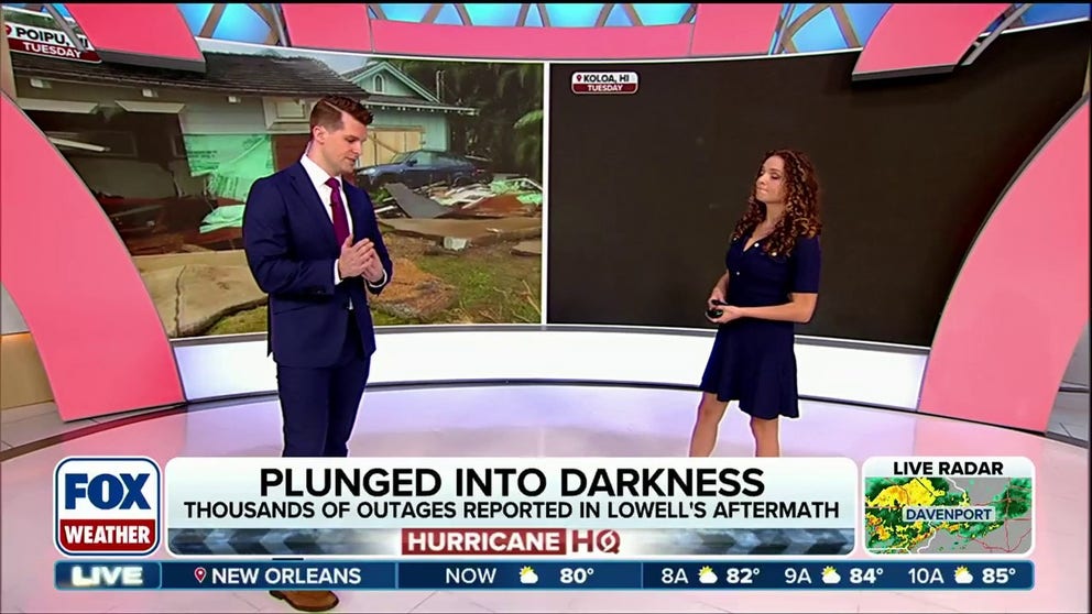
Nearly 90% of customers still without power on Kaua'i after Hurricane Lowell's direct hit on Hawaii
Powerful Hurricane Lowell damaged homes and downed trees across Kaua'i, where nearly 90% of customers are still without power. Crews are working to get the lights back on as a full cleanup gets underway later today.
THE TAKEAWAY
- Lowell made a rare direct hit on Hawaii as a Category 2 hurricane on Monday night Hawaii time.
- The storm damaged homes and downed trees across Kaua'i, where nearly 90% of customers are still without power.
- The eastern side of Kaua'i saw the worst of Lowell's impacts, with wind gusts over 80 mph, including a top gust of 92 in Puu Lua.
HONOLULU — Powerful Hurricane Lowell made a rare direct hit on Hawaii Monday night, blasting the state's western islands with intense wind, rain and storm surge. The storm damaged homes and downed trees across Kaua'i, where nearly 90% of customers are still without power.
Lowell was downgraded to a tropical storm late Tuesday night, according to the National Hurricane Center.
WHAT'S THE DIFFERENCE BETWEEN A HURRICANE MAKING A DIRECT HIT AND LANDFALL?
The storm turned deadly after a 74-year-old Kalāheo man was found dead Wednesday along the shoreline near Nōmilu Fishpond, a day after he was reported missing following Hurricane Lowell’s impact on Kauaʻi, police said.
Officials believe storm surge may have contributed to his death. An autopsy is pending, and foul play is not suspected.
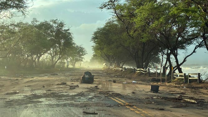
Damage reported on Maui as Hurricane Lowell impacts the Hawaiian Islands.
(Hawaii Department of Transportation / FOX Weather)
Calm conditions returned Tuesday afternoon following Lowell's departure but the National Hurricane Center (NHC) said Lowell will still generate life-threatening surf and rip currents
The first daylight revealed devastation across Kaua'i. FOX Weather Storm Specialist Mike Seidel and Correspondent Katie Byrne showed widespread debris strewn across the island.
WHAT DO HURRICANE AND TROPICAL STORM WARNINGS MEAN?
Several homes were ripped off their foundations and ocean-side roads were destroyed by storm surge.
More than 60,000 customers were without power across Kaua'i and Oahu at the height of the storm early Tuesday.
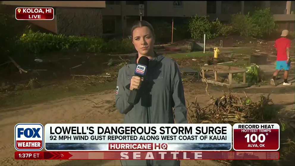
Damage left behind in Hawaii after Hurricane Lowell makes rare direct hit
🌀 THE AFTERMATH: FOX Weather Correspondent Katie Byrne continues her coverage from Koloa, Hawaii, where cleanup efforts are slowly underway after Hurricane Lowell impacted the state, and damage and debris litter communities.
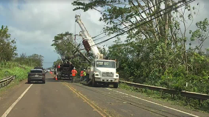
Hawaii Department of Trasportation and Department of Public Works crews are responding to widespread road closures that remain across Kaua'i, including large stretches of Kūhiō Highway.
Kaua'i County's Department of Water has asked people to conserve water as power is restored.
On Oahu, parts of Farrington and Kalanianaole highways that were closed due to debris and flash flooding have reopened.
WHAT'S THE DIFFERENCE BETWEEN A HURRICANE MAKING A DIRECT HIT AND LANDFALL?
Hawaii's Emergency Management issued a Brown Water Advisory, asking people to stay out of the water around Kauaʻi and Oahu and parts of Maui due to storm debris and other contaminants potentially in the water.
Meanwhile, Maui County government said there was significant coastal flooding and seawater pushed debris over roads on West and South Maui.
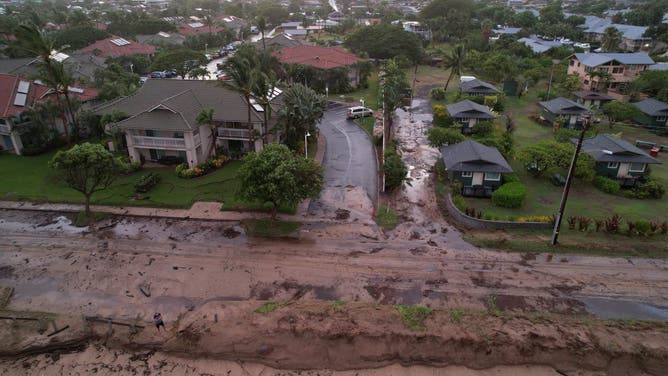
(County of Maui / Vernon Kalanikau / FOX Weather)
The eastern side of Kaua'i saw the worst of Lowell's impacts, with wind gusts over 80 mph, including a top gust of 92 in Puu Lua.
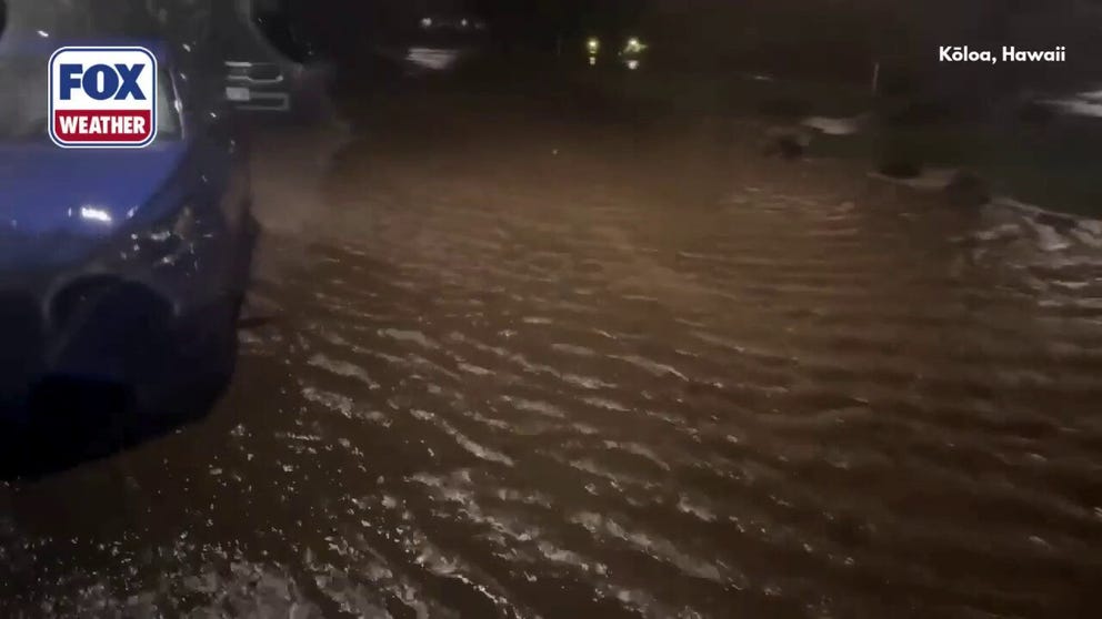
FOX Weather Correspondent Katie Byrne, reported strong wind gusts, flash flooding and several feet of storm surge in Kōloa on Kaua'i from late Monday night into early Tuesday morning.
LATEST FROM FOX WEATHER HURRICANE SPECIALIST BRYAN NORCROSS
Video from Byrne's crew showed debris that was pushed into the first floor of a Kōloa hotel near the beach. Seawater swept cars parked in beachside parking lots into one another.
![Damage in Poipu, Hawaii, from Hurricane Lowell on Tuesday, Sep. 8, 2026.]() Image 1 of 16
Image 1 of 16Damage in Poipu, Hawaii, from Hurricane Lowell on Tuesday, Sep. 8, 2026. (FOX Weather)
![Damage in Poipu, Hawaii, from Hurricane Lowell on Tuesday, Sep. 8, 2026.]() Image 2 of 16
Image 2 of 16Damage in Poipu, Hawaii, from Hurricane Lowell on Tuesday, Sep. 8, 2026. (FOX Weather)
![Damage in Poipu, Hawaii, from Hurricane Lowell on Tuesday, Sep. 8, 2026.]() Image 3 of 16
Image 3 of 16Damage in Poipu, Hawaii, from Hurricane Lowell on Tuesday, Sep. 8, 2026. (FOX Weather)
![Farrington Highway flooding on Oahu from Hurricane Lowell on Tuesday, Sep. 8, 2026.]() Image 4 of 16
Image 4 of 16Farrington Highway flooding on Oahu from Hurricane Lowell on Tuesday, Sep. 8, 2026. (Hawaii Department of Transportation/Facebook)
![Damage in Poipu, Hawaii, from Hurricane Lowell on Tuesday, Sep. 8, 2026.]() Image 5 of 16
Image 5 of 16Damage in Poipu, Hawaii, from Hurricane Lowell on Tuesday, Sep. 8, 2026. (FOX Weather)
![]() Image 6 of 16
Image 6 of 16Hurricane Lowell brings extensive damage to Kauai hotel ( )
![]() Image 7 of 16
Image 7 of 16Hurricane Lowell brings extensive damage to Kauai hotel ( )
![]() Image 8 of 16
Image 8 of 16Hurricane Lowell brings extensive damage to Kauai hotel ( )
![]() Image 9 of 16
Image 9 of 16Crew clearing Pali Highway Honolulu-bound. (Hawaii Department of Transportation)
![Large waves break off Diamond Head Beach Park in Honolulu, Hawaii, on September 6, 2026.]() Image 10 of 16
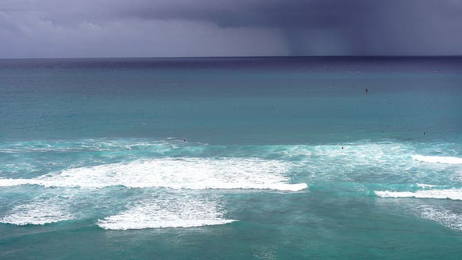
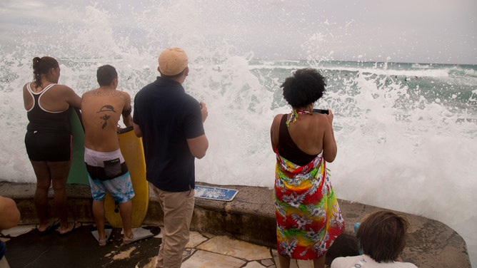
Image 10 of 16Large waves break off Diamond Head Beach Park in Honolulu, Hawaii, on September 6, 2026. ((Photo by Michelle Bir / AFP via Getty Images))
![Waiahole flooding on Oahu on Sep. 6, 2026.]() Image 11 of 16
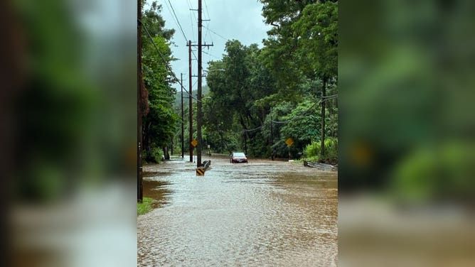
Image 11 of 16Waiahole flooding on Oahu on Sep. 6, 2026. (DOTHawaii/X)
![Keanae mudslide on Maui on Sep. 6, 2026.]() Image 12 of 16
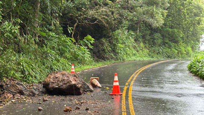
Image 12 of 16Keanae mudslide on Maui on Sep. 6, 2026. (DOTHawaii)
![]() Image 13 of 16
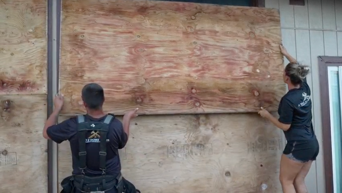
Image 13 of 16Locals boarding up their home ahead of Hurricane Lowell in Waimea, Hawaii. ( )
![]() Image 14 of 16
Image 14 of 16HONOLULU, HI - AUGUST 23: Onlookers get hit by large waves at the end of the Waikiki pier as Hurricane Lane approaches Waikiki Beach on August 23, 2018 in Honolulu, Hawaii. Hurricane Lane, which lashed the Big Island with nearly 20 inches of rain, has been downgraded to a Category 3 storm. (Photo by Kat Wade/Getty Images) ( )
![Damage from Hurricane Lowell in Lihue, Hawaii on Tuesday, Sep. 8, 2026.]() Image 15 of 16
Image 15 of 16Damage from Hurricane Lowell in Lihue, Hawaii on Tuesday, Sep. 8, 2026. (FOX Weather)
![Damage from Hurricane Lowell in Lihue, Hawaii on Tuesday, Sep. 8, 2026.]() Image 16 of 16
Image 16 of 16Damage from Hurricane Lowell in Lihue, Hawaii on Tuesday, Sep. 8, 2026. (FOX Weather)
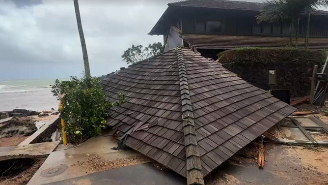
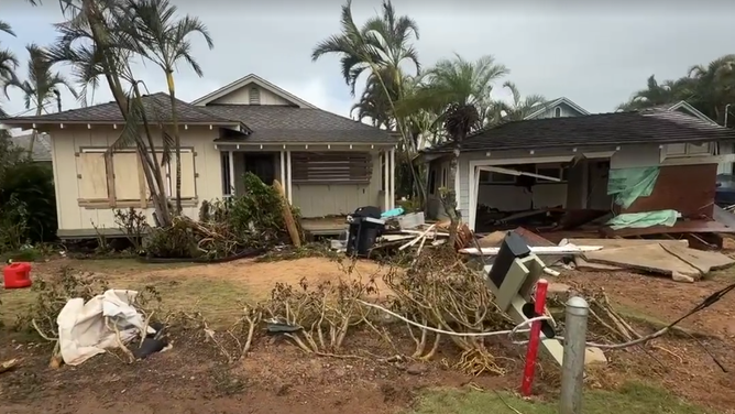
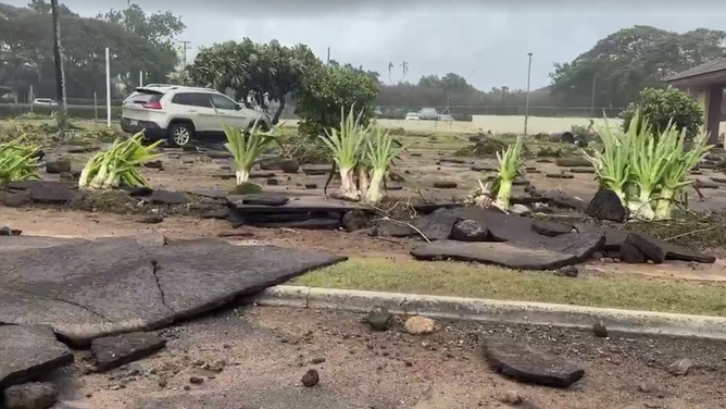

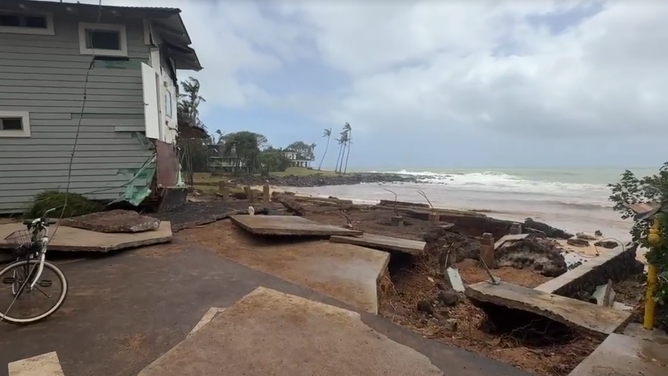
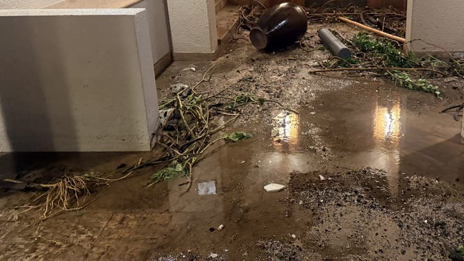
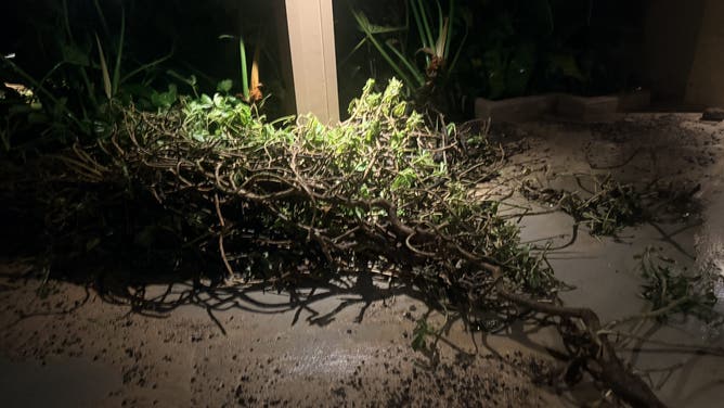
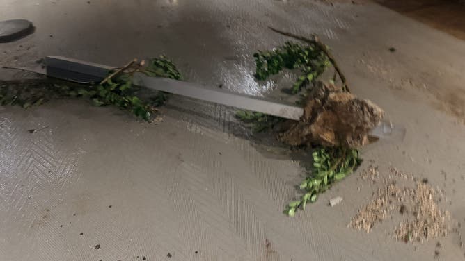
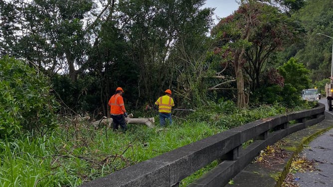
FOX Weather Storm Specialist Mike Seidel reported early Tuesday that storm surge and high tide from the Pacific Ocean destroyed parts of the coastal roadway in Kōloa.
Sustained winds between 65 and 95 mph were recorded on Ni'ihau, early Tuesday.
"There's no doubt that winds were near 100 mph on lightly populated Ni'ihau," FOX Weather Hurricane Specialist Bryan Norcross said.
WHAT’S THE DIFFERENCE BETWEEN A TROPICAL DEPRESSION, TROPICAL STORM AND HURRICANE?
The National Weather Service (NWS) issued a rare Tornado Watch for Kaua'i County as the storm bore down on the island. Officials said this was the first Tornado Watch issued in Hawaii's history.

Storm surge damage from Hurricane Lowell in Koloa on Kaua'i on Tuesday, Sep. 8, 2026.
(FOX Weather / FOX Weather)
A voluntary evacuation notice was sent to people on oceanfront properties and 275 people were staying in shelters early Tuesday. The administrator said one hotel on the eastern part of the island closed and evacuated guests.
On Monday, Byrne said people on Kaua'i were told by government officials to have at least three days' worth of food and supplies. Officials also asked people in low-lying areas to have an evacuation plan in place.
LOWELL IMPACTS 🌀: FOX Weather Storm Specialist Mike Seidel was about to go live on air when a powerful wave swept through, nearly knocking him and the camera operator to the ground. Mike will be live from Kaua'i, Hawaii throughout the day covering the impacts of powerful… pic.twitter.com/wiPz0pFE3f
— FOX Weather (@foxweather) September 8, 2026
Some people across the state boarded up their homes as a precaution.
Rain associated with Lowell triggered flash floods along the Kamehameha Highway north of Waikane in Oahu on Sunday afternoon.
Hawaii Gov. Josh Green declared a state of emergency last Thursday in preparation for the storm.
Watch: Hurricane Lowell Pounds Kaua'i With Intense Wind, Flash Flooding
🌀LOWELL BLASTS HAWAII: More than 60K customers are without power as the worst of Hurricane Lowell begins to bear down on Hawaii's western islands. FOX Weather is LIVE from Kaua'i with the latest hurricane coverage:
Hurricane Lowell's rare direct hit on Hawaii
While the storm's center did not make landfall, it still made a direct hit on Hawaii's western islands.
The definition of a direct hit is when a hurricane passes within a distance that is up to twice the length between the center of the storm and the maximum winds, which in Lowell's case was 60 miles.
HOW ARE HURRICANES RATED? THE SAFFIR-SIMPSON HURRICANE WIND SCALE EXPLAINED
Lowell's center came within 30 miles of Ni'ihau and 60 miles of Kaua'i, about 10 to 15 miles closer than the forecasts issued as late as Monday afternoon indicated, the FOX Forecast Center said.
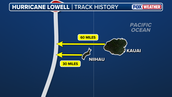
Distance of Hurricane Lowell's center to western Hawaiian Islands.
(FOX Weather)
Lowell was initially expected to pass farther west of Hawaii last week, but the storm's track continued to shift eastward through Monday morning, closer to Ni'ihau and Kaua'i, prompting the NHC to upgrade warnings on the western islands, as well as Oahu.
MAJOR HURRICANE LOWELL COULD FOLLOW EERILY SIMILAR TRACK TO THE WORST HURRICANE IN HAWAII'S HISTORY
"In the end, the storm tracked right over the edge of the Friday cone before Lowell made its turn to the north," Norcross said.
"When a storm slows down, the forecast tracks after that are subject to larger errors."
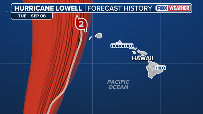
Hurricane Lowell followed the eastern edge to the forecast cone issued by the NHC on Friday, Sep. 4, 2026.
(FOX Weather)
"The lesson, of course, is that we should never focus on the center of the cone. The cone means what the cone means. Be ready for the range of possibilities," Norcross added.
More than 16 inches of rain fell across the higher elevations of Kauai, including a top rainfall total of 21.1 inches in Kilohana.
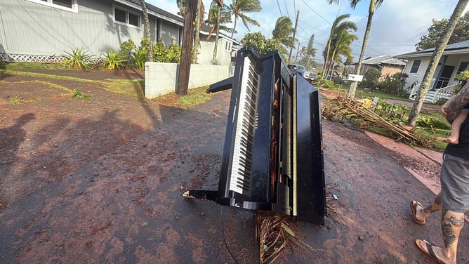
Damage from Hurricane Lowell Poipu, Hawaii, on Sep. 8. 2026.
(Jennifer Hill / FOX Weather)
Parts of the northeastern shores of Oahu received more than 7 inches.
Lowell followed an eerily similar track to 1992's Hurricane Iniki, which made actual landfall on Kaua'i, and was the last storm to make landfall on Hawaii.
MASSIVE SWELLS 🌊: Powerful waves crash along the coast of Kekaha, Hawaii, as Hurricane Lowell barrels toward the islands. The storm is producing dangerous, life-threatening surf, with waves expected to reach up to 25 feet across parts of Hawaii.#swells #surf #hurricane #lowell pic.twitter.com/4v7UoYugBt
— FOX Weather (@foxweather) September 8, 2026
Lowell peaked as a Category 5 hurricane last Wednesday with winds up to 160 mph.
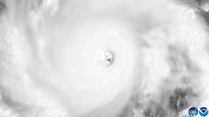
Satellite imagery of Hurricane Lowell as a Category 5 storm on Sep. 2, 2026.
((CSU/CIRA & NOAA) / NOAA)
Lowell was the first Category 5 storm in the Central Pacific Basin since Walaka in October 2018.