

Hurricane Nolo upgraded to Category 3 storm after bringing dangerous flooding to Hawaii
The storm is located 365 miles south-southwest of Honolulu, Hawaii, with maximum sustained winds of 115 mph, making the storm a Category 3 hurricane on the Saffir-Simpson wind scale.
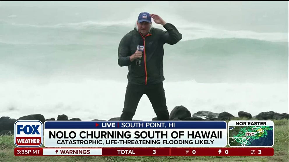
Hurricane Nolo moving just south of Hawaii, churning up strong winds and massive waves
Hurricane Nolo is making its closest approach to the Big Island on Saturday, stirring up massive waves and strong winds on South Point, Hawaii. FOX Weather Senior Correspondent Robert Ray gives us the latest update on conditions:
THE TAKEAWAY
- Hurricane Nolo made its closest approach to the Hawaiian Islands, coming within 140 miles of the island's southernmost point.
- Catastrophic and life-threatening flash flooding impacted parts of the Big Island.
- Hurricane Nolo has been upgraded to a Category 3 storm as the storm pulls away from Hawaii.
- Hawaii, which generally doesn't see much tropical activity, is seeing impacts from its fourth tropical threat this season.
Hurricane Nolo has been upgraded to a Category 3 storm as it continues to bring rounds of heavy rain and dangerous surg to Hawaii.
Nolo continues to produce dangerous flash flooding in parts of the Big Island as the storm pulls away from the Hawaiian Islands.
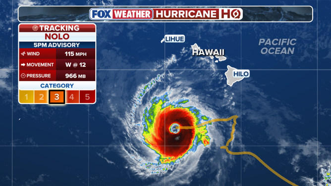
Hurricane Nolo latest stats as of Sunday night.
(FOX Weather)
The storm is located 365 miles south-southwest of Honolulu, Hawaii, with maximum sustained winds of 115 mph, making the storm a Category 3 hurricane on the Saffir-Simpson wind scale.
The storm was downgraded to a Category 1 storm on Saturday night before being upgraded yet again.
Due to the storm staying so far away from Hawaii, the original rain forecast did not come to fruition, but heavy precipitation continues nonetheless.
HURRICANE SWELLS REVEAL FORGOTTEN HISTORY BENEATH ICONIC CALIFORNIA BEACH
The Big Island is under a high wind and surf advisory for Sunday.
Nolo is moving at 12 mph, south of the Hawaiian Islands as the storm is expected to produce repeated rounds of rainfall, which will fuel a flood threat.
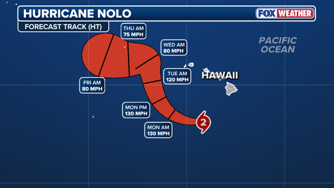
Hurricane Nolo forecast cone.
Nolo is moving west toward a pocket of deeper, warmer waters southwest of the Hawaiian Islands.
An additional 5 to 8 inches of rain is expected, putting storm totals between 10 and 20 inches, helping fuel the ongoing flood threat, but luckily not reaching catastrophic levels.
HURRICANE INIKI 30 YEARS LATER: HOW A MONSTER STORM IN HAWAII IMPACTED FILMING OF JURASSIC PARK
According to the FOX Forecast Center, the northeast side of the Big Island has already picked up about 18 inches of rain. This is the same area that saw 40 inches of rain from Lala.
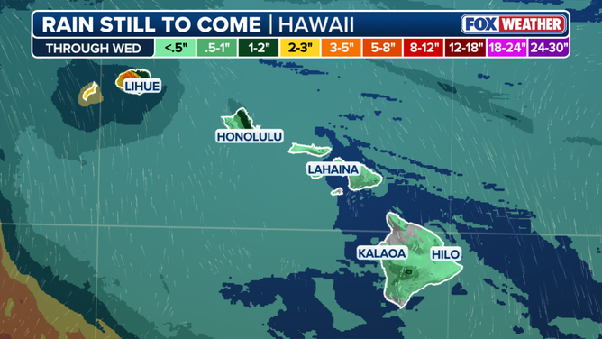
Rain still to come in the Hawaiian Islands.
A familiar threat from Hawaiian tropical systems is also present: mudslides.
Despite this, there have been no reports of catastrophic flooding, but roadways such as Highway 11 in Waiohinu were closed as a result of moderate flood conditions.
NOR’EASTER BATTERS EAST COAST WITH FLOODING AND DANGEROUS SURF — HERE’S WHERE IMPACTS ARE THE WORST
Hawaii, which generally doesn't see much tropical activity, is seeing impacts from its fourth tropical threat this season.
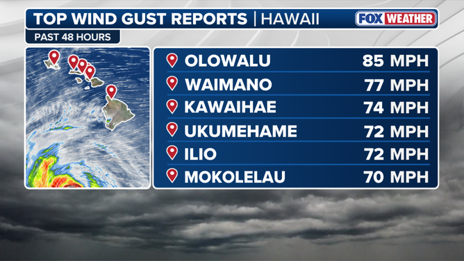
Top wind gusts reported in Hawaii.
Hurricane Lala and, more recently, Hurricane Lowell, have already impacted the islands, as a strengthening Super El Niño fuels what seems like a nonstop parade of tropical systems across the Pacific.
With Hawaii still reeling from previous storms, extreme rainfall — particularly in areas already affected by heavy rain this season — could trigger catastrophic flash flooding.
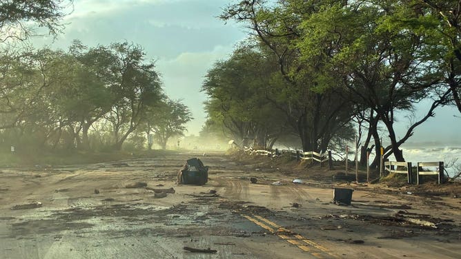
Damage reported on Maui as Hurricane Lowell impacts the Hawaiian Islands.
(Hawaii Department of Transportation / FOX Weather)
The wet weather will not slow down, as it is expected to continue for the state until Monday.