Kansas City, St. Louis get first accumulating snow of season as quick-hitting storm slickens roads
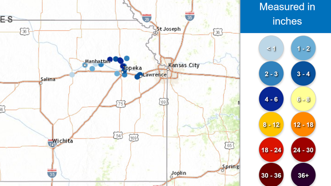
The storm system produced snowfall amounts of up to 6 inches, with both Kansas City and St. Louis seeing 1-3 inches on Saturday morning.
Quick-moving storm system produces snow for Kansas City, St. Louis
A weak area of low pressure that developed over the Plains had enough moisture and cold air to produce the first measurable snowfall of the season from communities in Kansas to the Ohio Valley.
KANSAS CITY, Mo. – A quick-moving storm system that originated over the Plains dropped the first measurable snowfall of the season across communities stretching from Kansas into the Appalachians.
The FOX Forecast Center said the weak area of low pressure had enough moisture and cold air to produce a narrow band of snow along the Intersate 70 corridor, which led to the issuance of Winter Weather Advisories.
The storm system produced snowfall amounts of up to 6 inches, with both Kansas City and St. Louis seeing 1-3 inches on Saturday morning.
"Be prepared for slippery roads. Slow down and use caution while driving," National Weather Service meteorologists warned residents. "If you are going outside, watch your first few steps on stairs, sidewalks, and driveways. These surfaces could be icy and slippery, increasing your risk of a fall and injury."

Estimated snowfall from Plains into Midwest
(FOX Weather)
RECORD LAKE-EFFECT SNOW PUMMELS GREAT LAKES WITH FEET OF SNOW THROUGH THE WEEKEND AMID ARCTIC BLAST
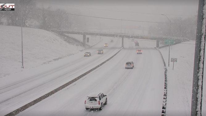
Photos and videos from the Kansas City metro area showed snow-covered roadways, but traffic was still flowing despite the wintry conditions.
Reported crashes along I-435, which serves as a beltway around Kansas City, made for slow travel during the start of the holiday weekend.
Troopers with the Missouri State Highway Patrol reported responding to a significant number of weather-related calls, which is typical during the first blast from Old Man Winter.
Department of Transportation crews were seen treating the main thoroughfares and bridges, but it appeared difficult for crews to keep up with quick precipitation rates.
The accumulating snowfall came earlier than usual, as Kansas City’s first significant snowfall doesn’t typically occur until Dec. 13, while St. Louis usually sees its first measurable snowfall around Dec. 4.

Snow along I-70 around the Kansas City metro
(KDOT / FOX Weather)
VIDEOS: ‘CHAPS’ ENSUES ALONG GREAT LAKES AS FEET OF SNOW PILES UP
The unseasonably early snow had residents bundling up as the region prepares for more cold weather in the coming days.
A flow out of the north, combined with the recent snowfall, was expected to allow temperatures to dip into the teens on Sunday morning.
A warming trend was not projected to begin before Tuesday, meaning the region was expected to see daytime temperatures remain below freezing for several days.
Fortunately, no additional snowfall accumulations are expected during the first week of December.

(FOX Weather)
