La Nina is over and El Nino could be on the way, forecasters say
The climate phenomenon is a by-product of a years-long cycle of water temperatures in the tropical Pacific Ocean known as the El Niño-Southern Oscillation (ENSO) and has been in its cool phase for the past three winters -- a rare feat for an event that typically lasts for one winter, maybe two.
'Triple dip' La Niña coming to an end, expected to transition to El Niño pattern
One of the most stubborn "Triple Dip" La Niña periods in recent history is finally over, NOAA declared Wednesday.
WASHINGTON – One of the most stubborn "Triple Dip" La Niña periods in recent history is finally over, NOAA declared Thursday.
The climate phenomenon is a by-product of a years-long cycle of water temperatures in the tropical Pacific Ocean known as the El Niño-Southern Oscillation (ENSO) and has been in its cool phase for the past three winters -- a rare feat for an event that typically lasts for one winter, maybe two.
The meaning of El Nino and La Nina
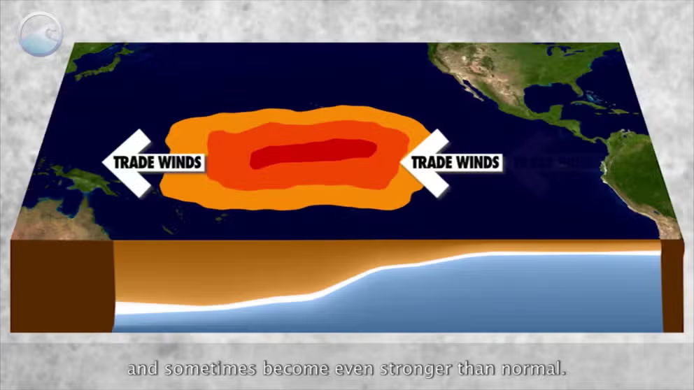
The status of whether the world is being impacted by an El Nino or a La Nina is determined by water temperatures in the central and eastern Pacific. (NOAA)
WHAT ARE EL NINO AND LA NINA CLIMATE PATTERNS?
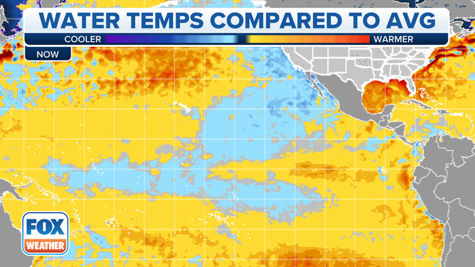
But ocean temperatures have finally warmed to the point where the La Niña threshold is no longer met, NOAA forecasters said in their monthly update on the La Nina/El Nino status. In fact, temperatures are now a little above average.

(FOX Weather)
Forecasters now say we've entered the "neutral" phase of the cycle, where tropical Pacific Ocean temperatures are within a half degree of the long-term average. Those conditions are likely to hold through the spring, which may be good news for the upcoming spring severe weather season.
Research completed by various private, government and educational groups has found that neutral-ENSO conditions tend to produce tornado and hail events that are more in line with average or slightly below-average historical tallies.
END OF TRIPLE-DIP LA NINA IN SIGHT: WHAT IT COULD MEAN FOR SPRING SEVERE WEATHER SEASON
El Niño favored by late summer
But forecasters don't expect the cycle to stay in that phase for long -- perhaps just through the beginning of summer. Indications now show about a 60% chance the cycle moves into the warmer El Niño phase by late summer into the autumn.
Warmer ocean waters lead to an increase in available moisture, and jet stream changes go along for the ride.
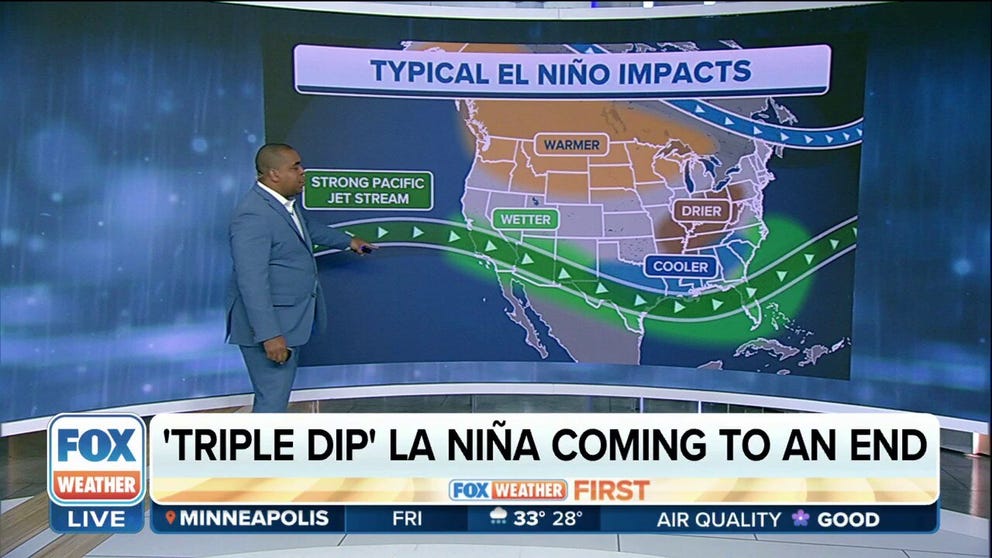
Typically, during an El Niño, the Pacific jet stream is more robust and provides more moisture for the southern U.S. This pattern can lead to flooding across the Gulf Coast and the Southeast. Drier conditions are usually experienced in the northern tier of the country, and warmer air can prevail.
The increased water temperatures and a decrease in upper-level winds in the eastern and central Pacific can lead to an increase in hurricanes, but as part of Mother Nature’s balancing act, the Atlantic basin can be hostile to tropical cyclone development and hurricane seasons have a higher probability of ending up at or below average.

